File:Creekwood Creek Stand Alabama.JPG
Jump to navigation
Jump to search

Size of this preview: 800 × 580 pixels. Other resolutions: 320 × 232 pixels | 640 × 464 pixels | 1,024 × 743 pixels | 1,280 × 928 pixels | 2,560 × 1,856 pixels | 3,434 × 2,490 pixels.
Original file (3,434 × 2,490 pixels, file size: 1.62 MB, MIME type: image/jpeg)
Captions
Captions
Add a one-line explanation of what this file represents
|
This is an image of a place or building that is listed on the National Register of Historic Places in the United States of America. Its reference number is 89000310. |
Summary[edit]
| Description |
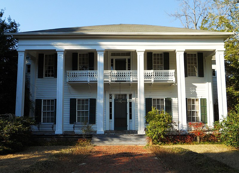
English: This is a photograph of Creekwood, a Greek Revival home near Creek Stand Alabama. The home was built around 1844 and it was placed on the National Register of Historic Places on April 13, 1989. |
||
| Date | |||
| Source | Own work | ||
| Author | Rivers A. Langley; SaveRivers | ||
| Permission (Reusing this file) |
I, the copyright holder of this work, hereby publish it under the following licenses: This file is licensed under the Creative Commons Attribution-Share Alike 3.0 Unported license.
You may select the license of your choice. |

| Object location | | View this and other nearby images on: OpenStreetMap |
|---|
File history
Click on a date/time to view the file as it appeared at that time.
| Date/Time | Thumbnail | Dimensions | User | Comment | |
|---|---|---|---|---|---|
| current | 18:02, 18 February 2011 | | 3,434 × 2,490 (1.62 MB) | SaveRivers (talk | contribs) | {{Information |Description ={{en|1=This is a photograph of Creekwood, a Greek Revival home near Creek Stand Alabama. The home was built around 1844 and it was placed on the National Register of Historic Places on April 13, 1989.}} |Source ={{ow |
You cannot overwrite this file.
File usage on Commons
The following page uses this file:
File usage on other wikis
The following other wikis use this file:
- Usage on de.wikipedia.org
- Usage on en.wikipedia.org
- Usage on www.wikidata.org
- Usage on zh.wikipedia.org