File:Coal power plants in France map-fr - 2016.svg
Jump to navigation
Jump to search

Size of this PNG preview of this SVG file: 632 × 600 pixels. Other resolutions: 253 × 240 pixels | 506 × 480 pixels | 809 × 768 pixels | 1,079 × 1,024 pixels | 2,158 × 2,048 pixels | 1,003 × 952 pixels.
Original file (SVG file, nominally 1,003 × 952 pixels, file size: 548 KB)
Captions
Captions
Add a one-line explanation of what this file represents
Summary
[edit]
| Description |
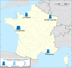
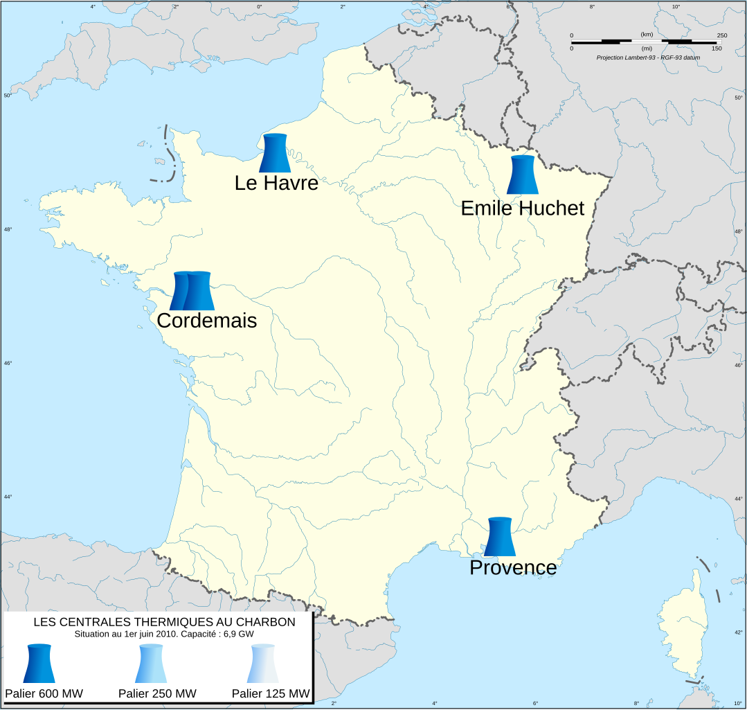
Français : Carte de France des centrales thermiques au charbon.
English: Coal power plants in France map. |
| Date | |
| Source | File:Coal power plants in France map-fr - 2011.svg |
| Author |
Historicair A.BourgeoisP |
Licensing
[edit]
This file is licensed under the Creative Commons Attribution-Share Alike 3.0 Unported license.
- You are free:
- to share – to copy, distribute and transmit the work
- to remix – to adapt the work
- Under the following conditions:
- attribution – You must give appropriate credit, provide a link to the license, and indicate if changes were made. You may do so in any reasonable manner, but not in any way that suggests the licensor endorses you or your use.
- share alike – If you remix, transform, or build upon the material, you must distribute your contributions under the same or compatible license as the original.
File history
Click on a date/time to view the file as it appeared at that time.
| Date/Time | Thumbnail | Dimensions | User | Comment | |
|---|---|---|---|---|---|
| current | 19:41, 14 April 2021 | | 1,003 × 952 (548 KB) | A.BourgeoisP (talk | contribs) | Carte 2016, on ne refait pas le passé ! |
| 19:24, 14 April 2021 |  | 1,003 × 952 (540 KB) | Ydecreux (talk | contribs) | Centrale du Havre et légende supprimées | |
| 11:22, 31 July 2016 |  | 1,003 × 952 (548 KB) | A.BourgeoisP (talk | contribs) | User created page with UploadWizard |
You cannot overwrite this file.
File usage on Commons
There are no pages that use this file.