Category:Maps of power plants
Jump to navigation
Jump to search
Subcategories
This category has the following 3 subcategories, out of 3 total.
Media in category "Maps of power plants"
The following 21 files are in this category, out of 21 total.
-
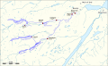 Affric-Beauly hydro-electric power scheme.svg 901 × 553; 1.95 MB
-
 Coal power plants in France map-fr - 2011.svg 1,003 × 952; 579 KB
-
 Coal power plants in France map-fr - 2016.svg 1,003 × 952; 548 KB
-
 Coal power plants in France map-fr - 2022.svg 1,003 × 952; 538 KB
-
 Fauske Lappland kraftstasjon.jpg 700 × 478; 170 KB
-
 Global power plants by generation sources.png 1,331 × 693; 439 KB
-
 HPP on Myitnge River.png 960 × 720; 1.54 MB
-
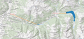 Lageplan Kraftwerksgruppe Gerlos.png 3,216 × 1,500; 5.13 MB
-
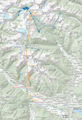 Lageplan Kraftwerksgruppe Malta.png 1,860 × 2,730; 5.42 MB
-
 Lageplan Kraftwerksgruppe Reißeck-Kreuzeck.png 1,868 × 2,730; 5.45 MB
-
 Lageplan Kraftwerksgruppe Sellrain-Silz (Detail HiDPI).png 3,664 × 2,676; 7.94 MB
-
 Lageplan Kraftwerksgruppe Sellrain-Silz (Detail).png 1,840 × 1,338; 2.03 MB
-
 Lageplan Kraftwerksgruppe Sellrain-Silz.png 1,974 × 2,812; 5.94 MB
-
 Lageplan Kraftwerksgruppe Zemm-Ziller.png 3,002 × 1,974; 5.19 MB
-
 Lageplan Speicherkraftwerk Kaunertal (Overpass Turbo).png 3,360 × 1,784; 2.04 MB
-
 Lageplan Speicherkraftwerk Kaunertal.png 2,088 × 1,564; 1.38 MB
-
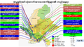
 Location of Hydropower and Solar Power Plants in Myanmar.png 924 × 668; 458 KB
-
 Location of Thermal Power Plants in Myanmar.png 1,270 × 712; 514 KB
-
 Power plants in Belarus.png 2,000 × 1,785; 652 KB
-
 Power Plants in Myanmar.svg 512 × 1,106; 1.2 MB
-


.png)
.png)


.png)


_map_of_hydroelectric_dams_and_transmission_lines.jpg)