File:City of Brampton - Map - 20240216.pdf
Jump to navigation
Jump to search

Size of this JPG preview of this PDF file: 800 × 600 pixels. Other resolutions: 320 × 240 pixels | 640 × 480 pixels | 1,024 × 768 pixels | 1,280 × 960 pixels | 2,560 × 1,920 pixels | 7,200 × 5,400 pixels.
Original file (7,200 × 5,400 pixels, file size: 3.5 MB, MIME type: application/pdf)
Captions
Captions
Add a one-line explanation of what this file represents
Summary
[edit]| Description |
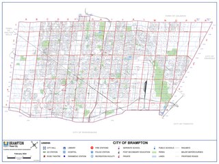
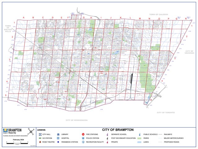
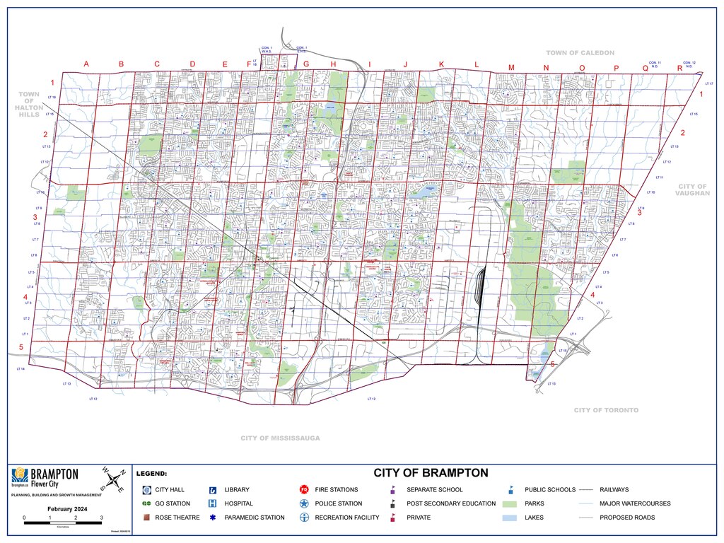
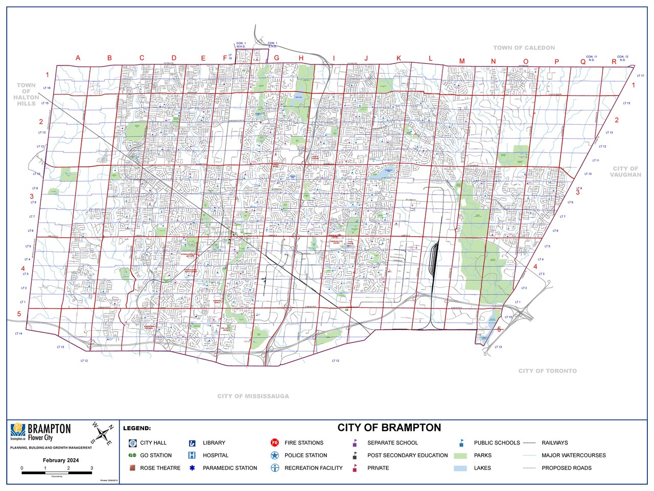
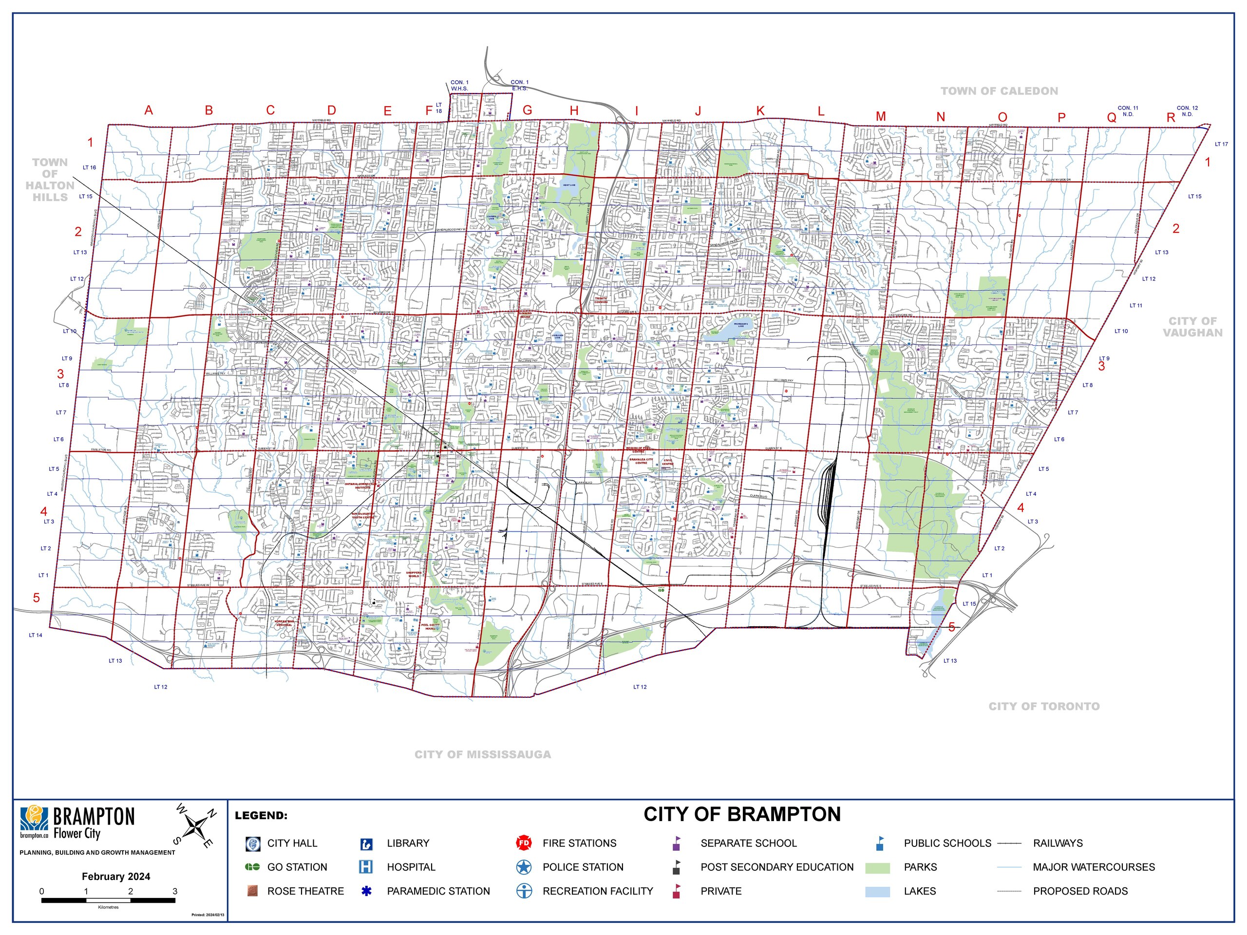
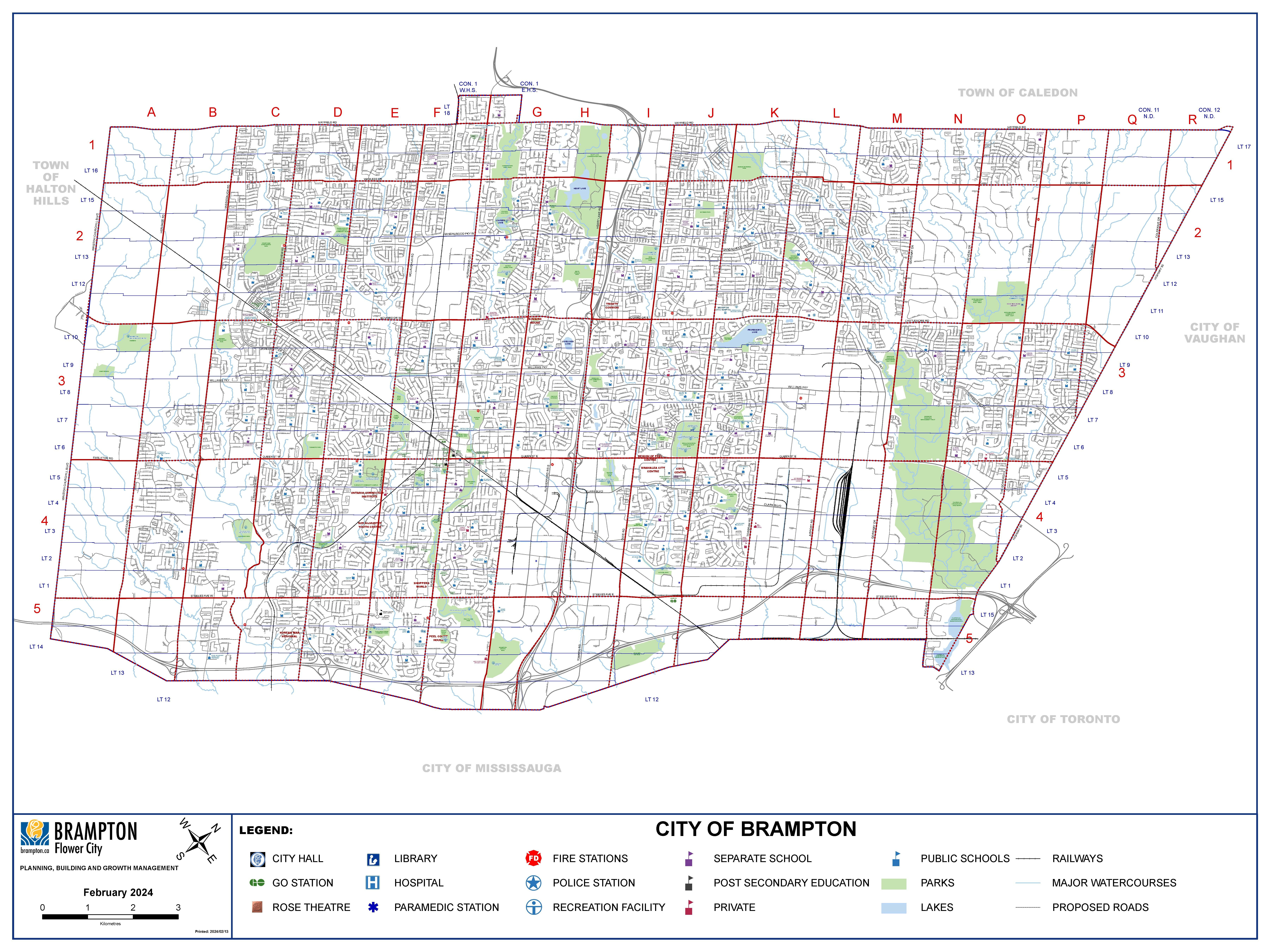
English: City of Brampton - Base Map |
| Date | |
| Source | https://geohub.brampton.ca/documents/6110be81714642db91ab10c713a7d682/explore (archive, archive) |
| Author | City of Brampton |
Licensing
[edit]This file is licensed under the Creative Commons Attribution 4.0 International license.
- You are free:
- to share – to copy, distribute and transmit the work
- to remix – to adapt the work
- Under the following conditions:
- attribution – You must give appropriate credit, provide a link to the license, and indicate if changes were made. You may do so in any reasonable manner, but not in any way that suggests the licensor endorses you or your use.
File history
Click on a date/time to view the file as it appeared at that time.
| Date/Time | Thumbnail | Dimensions | User | Comment | |
|---|---|---|---|---|---|
| current | 18:21, 10 March 2024 |  | 7,200 × 5,400 (3.5 MB) | Sikander (talk | contribs) | Uploaded a work by City of Brampton from https://geohub.brampton.ca/documents/6110be81714642db91ab10c713a7d682/explore with UploadWizard |
You cannot overwrite this file.
File usage on Commons
The following 3 pages use this file:
File usage on other wikis
The following other wikis use this file:
- Usage on ar.wikipedia.org
- Usage on arz.wikipedia.org
- Usage on ca.wikipedia.org
- Usage on diq.wikipedia.org
- Usage on el.wikipedia.org
- Usage on es.wikipedia.org
- Usage on ga.wikipedia.org
- Usage on tt.wikipedia.org
- Usage on vo.wikipedia.org
- Usage on www.wikidata.org