File:Cathedrale Tarbes 64 Archives nationales France.jpg
Jump to navigation
Jump to search
Size of this preview: 792 × 600 pixels. Other resolutions: 317 × 240 pixels | 634 × 480 pixels | 1,014 × 768 pixels | 1,280 × 969 pixels | 1,941 × 1,470 pixels.
Original file (1,941 × 1,470 pixels, file size: 287 KB, MIME type: image/jpeg)
Captions
Captions
Add a one-line explanation of what this file represents
Summary[edit]
| Q65643649
|
|||||||||||||||||||||
|---|---|---|---|---|---|---|---|---|---|---|---|---|---|---|---|---|---|---|---|---|---|
| Title |
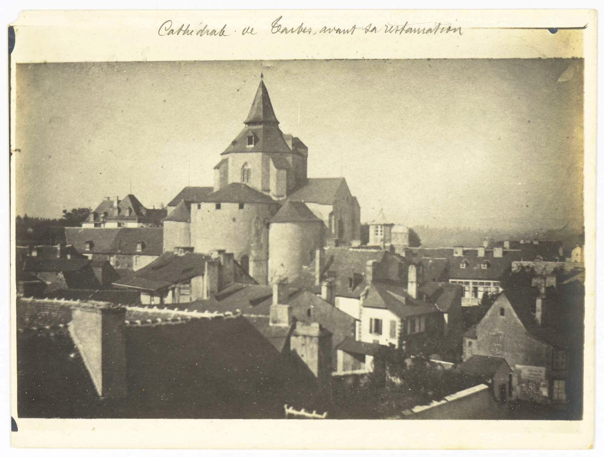
French: Photographie de la cathédrale de Tarbes avant restauration |
 | |||||||||||||||||||
| Part of |
Sub-series F/19 of the Archives nationales |
||||||||||||||||||||
| Object type |
photograph / drawing |
||||||||||||||||||||
| Genre |
architectural photography |
||||||||||||||||||||
| Description |
Français : Cathédrale de Tarbes, avant sa restauration. 1 plan, 1 élévation, 1 coupe, signé, approbation de l'évêque et du préfet. Échelle : 1 cm / 1 m. Photographie issue des dossiers de travaux de restauration des cathédrales (1802-1912, conservés aux Archives nationales (inventaire et documents numérisés consultables en ligne). |
||||||||||||||||||||
| Medium |
gelatin silver process |
||||||||||||||||||||
| Dimensions |
height: 13 cm (5.1 in) |
||||||||||||||||||||
| Collection |
|
||||||||||||||||||||
| Accession number |
F/19/7894/PHOTO, Photo 7 (Archives nationales) |
||||||||||||||||||||
| Object location |
|
||||||||||||||||||||
| Place of creation | Tarbes | ||||||||||||||||||||
| References |
http://www.siv.archives-nationales.culture.gouv.fr/siv/UD/FRAN_IR_054873/c-8oyrwqrse-11crp9ppnbww9 |
||||||||||||||||||||
| Source/Photographer |
|
||||||||||||||||||||
| Permission (Reusing this file) |
|
||||||||||||||||||||


| Object location | | View this and other nearby images on: OpenStreetMap |
|---|
File history
Click on a date/time to view the file as it appeared at that time.
| Date/Time | Thumbnail | Dimensions | User | Comment | |
|---|---|---|---|---|---|
| current | 09:22, 6 September 2019 | | 1,941 × 1,470 (287 KB) | Sokoljan (talk | contribs) | improved contrast |
| 14:49, 12 July 2017 |  | 1,941 × 1,470 (267 KB) | Archives nationales DJI (talk | contribs) | Téléversé avec ComeOn! 3.5.1 |
You cannot overwrite this file.
File usage on Commons
The following 3 pages use this file:
File usage on other wikis
The following other wikis use this file:
- Usage on www.wikidata.org