File:Bulgaria geographic map Western Stara Planina bg.svg
Jump to navigation
Jump to search

Size of this PNG preview of this SVG file: 654 × 599 pixels. Other resolutions: 262 × 240 pixels | 524 × 480 pixels | 838 × 768 pixels | 1,118 × 1,024 pixels | 2,235 × 2,048 pixels | 2,183 × 2,000 pixels.
Original file (SVG file, nominally 2,183 × 2,000 pixels, file size: 18.89 MB)
Captions
Captions
Add a one-line explanation of what this file represents
Summary[edit]
| Description |
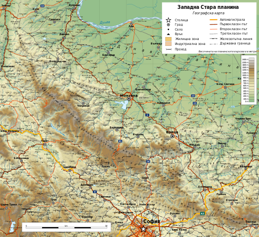
English: Geographic map of Western Stara Planina, Bulgaria in Bulgarian. Geographic limits of the map:
Български: Географска карта на Западна Стара планина и Западен Предбалкан. Карта на български. Граници на картата:
|
| Date | |
| Source |
Own work
|
| Author | Ikonact |
| Permission (Reusing this file) |
Any use of this map is subject of the license(s) stated below with the condition that you credit (Wikimedia Commons user: Ikonact) as the author . A message with a reply address would also be greatly appreciated. |

|
This SVG file contains embedded text that can be translated into your language, using any capable SVG editor, text editor or the SVG Translate tool. For more information see: About translating SVG files. |
Licensing[edit]
| This work contains information from OpenStreetMap, which is made available under the Open Database License (ODbL).
The ODbL does not require any particular license for maps produced from ODbL data. Prior to 1 August 2020, map tiles produced by the OpenStreetMap Foundation were licensed under the CC-BY-SA-2.0 license. Maps produced by other people may be subject to other licences. |
I, the copyright holder of this work, hereby publish it under the following license:
This file is licensed under the Creative Commons Attribution-Share Alike 4.0 International license.
- You are free:
- to share – to copy, distribute and transmit the work
- to remix – to adapt the work
- Under the following conditions:
- attribution – You must give appropriate credit, provide a link to the license, and indicate if changes were made. You may do so in any reasonable manner, but not in any way that suggests the licensor endorses you or your use.
- share alike – If you remix, transform, or build upon the material, you must distribute your contributions under the same or compatible license as the original.
File history
Click on a date/time to view the file as it appeared at that time.
| Date/Time | Thumbnail | Dimensions | User | Comment | |
|---|---|---|---|---|---|
| current | 11:47, 19 June 2019 | | 2,183 × 2,000 (18.89 MB) | Ikonact (talk | contribs) | Editing SVG source code using User:Rillke/SVGedit.js; upload handled by User:Rillke/MwJSBot.js |
| 21:34, 17 June 2019 |  | 2,183 × 2,000 (18.89 MB) | Ikonact (talk | contribs) | few more names | |
| 20:53, 17 June 2019 |  | 2,183 × 2,000 (19.01 MB) | Ikonact (talk | contribs) | pics added, font changes | |
| 19:33, 16 June 2019 |  | 2,183 × 2,000 (19.06 MB) | Ikonact (talk | contribs) | == {{int:filedesc}} == {{Information |description={{en|1=Geographic map of Western Stara Planina, Bulgaria in Bulgarian. Geographic limits of the map:}} {{bg|1=Географска карта на Западна Стара планина и Западен Предбалкан. Карта на български. Граници на картата:}} *N: 43.95° N *S: 42.65° N *W: 22.25° E *E: 24.20° E Projection: Equidistant Cylindrical |date=2019-06-16 |source={{own}} *Sources of data:<br/> **Topography: NASA SRTM3 v3; **Rivers: Produced... |
You cannot overwrite this file.
File usage on Commons
The following 4 pages use this file:
File usage on other wikis
The following other wikis use this file:
- Usage on bg.wikipedia.org
- Стара планина
- Драгойца
- Софийска планина
- Три уши
- Чепън
- Пъстрина
- Врачанска планина
- Видлич
- Мургаш
- Милин камък
- Врачанско
- Монтанско
- Бабин нос
- География на Стара планина
- Берковска планина
- Ржана планина
- Етрополска планина
- Козница (Стара планина)
- Връшка чука
- Борованска могила
- Ведерник
- Венеца (рид в област Видин)
- Венеца (рид в област Враца)
- Веренишко бърдо
- Веслец (рид)
- Владимировски рид
- Гола глава
- Дреновица (рид)
- Зъбера
- Каменополско плато
- Лакавица (рид)
- Широка планина (планина)
- Било (планина)
- Голема планина
- Мала планина
- Понор (планина)
- Светиниколска планина
- Чипровска планина
- Язова планина
- Уикипедия:Картография на България/Планини
- Белоградчишко
- Звездец (връх)
- Берковско
- Ботевградско
- Софийско
- Годечко
- Usage on hu.wikipedia.org
- Usage on www.wikidata.org
View more global usage of this file.