File:Bugio island.png
Jump to navigation
Jump to search
Size of this preview: 699 × 600 pixels. Other resolutions: 280 × 240 pixels | 560 × 480 pixels | 1,000 × 858 pixels.
Original file (1,000 × 858 pixels, file size: 64 KB, MIME type: image/png)
Captions
Captions
Add a one-line explanation of what this file represents
| Description |
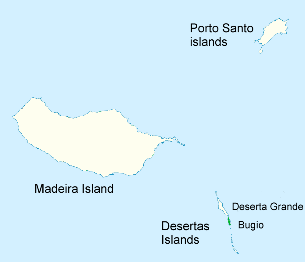
English: Map of the Portuguese Islands of Madeira Archipelago — in the Atlantic Macaronesia region.
|
| Date | (UTC) |
| Source | Portugal_Madeira_location_map.svg |
| Author |
- Geographische Begrenzung der Karte / Geographic limits of the map
- N: 33.16° N
- S: 32.38° N
- W: 17.31° W
- E: 16.23° W
| This is a retouched picture, which means that it has been digitally altered from its original version. Modifications: Boundaries removed, range added, text. The original can be viewed here: Portugal Madeira location map.svg:
|
I, the copyright holder of this work, hereby publish it under the following license:
This file is licensed under the Creative Commons Attribution-Share Alike 2.0 Generic license.
- You are free:
- to share – to copy, distribute and transmit the work
- to remix – to adapt the work
- Under the following conditions:
- attribution – You must give appropriate credit, provide a link to the license, and indicate if changes were made. You may do so in any reasonable manner, but not in any way that suggests the licensor endorses you or your use.
- share alike – If you remix, transform, or build upon the material, you must distribute your contributions under the same or compatible license as the original.
Original upload log
[edit]
This image is a derivative work of the following images:
- File:Portugal_Madeira_location_map.svg licensed with Cc-by-sa-2.0
- 2009-12-19T15:41:01Z NordNordWest 1590x1365 (105588 Bytes) == {{int:filedesc}} == {{Information |Description= {{de|Positionskarte von [[:de:Madeira|Madeira]], [[:de:Portugal|Portugal]]}} Geographische Begrenzung der Karte: * N: 33.16° N * S: 32.38° N * W: 17.31° W * O: 16.23° W {
Uploaded with derivativeFX
File history
Click on a date/time to view the file as it appeared at that time.
| Date/Time | Thumbnail | Dimensions | User | Comment | |
|---|---|---|---|---|---|
| current | 14:34, 10 August 2010 | | 1,000 × 858 (64 KB) | Jimfbleak (talk | contribs) | {{Information |Description=Range map for ''Pterodroma deserta'' (possible split from ''Pterodroma feae'' {{de|Positionskarte von Madeira, Portugal}} Geographische Begrenzung der Karte: * N: 33.16° N * S: 32.38° N * W: 17 |
You cannot overwrite this file.
File usage on Commons
The following page uses this file:
File usage on other wikis
The following other wikis use this file:
- Usage on da.wikipedia.org
- Usage on nl.wikipedia.org
- Usage on nn.wikipedia.org
- Usage on sv.wikipedia.org