Category:Maps of Porto Santo
Jump to navigation
Jump to search
Wikimedia category | |||||
| Upload media | |||||
| Instance of | |||||
|---|---|---|---|---|---|
| Category combines topics | |||||
| Porto Santo | |||||
municipality in Madeira, Portugal      | |||||
| Pronunciation audio | |||||
| Instance of | |||||
| Location | Madeira, Portugal | ||||
| Located in or next to body of water | |||||
| Capital | |||||
| Width |
| ||||
| Length |
| ||||
| Highest point |
| ||||
| Population |
| ||||
| Area |
| ||||
| Elevation above sea level |
| ||||
| official website | |||||
 | |||||
Media in category "Maps of Porto Santo"
The following 24 files are in this category, out of 24 total.
-
 PT Porto Santo.PNG 500 × 413; 6 KB
-
 Mapa Porto Santo.JPG 1,109 × 1,083; 104 KB
-
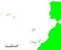
 Bugio island.png 1,000 × 858; 64 KB
-
 A New Chart of the Madeira and Canary Islands (8250888598).jpg 2,000 × 1,634; 2.83 MB
-

-
 Admiralty Chart No 1831 Madeira Porto Santo and Dezertas, Published 1847.jpg 9,886 × 8,610; 8.09 MB
-
 Anais do Município do Porto Santo.jpg 587 × 829; 69 KB
-
 Carta Geo-Hydrographica da Ilha De Porto Santo e dos Ilhéos E Baixos Adjacentes.jpg 9,794 × 14,510; 13.6 MB
-
 Ilhéu da Cal location map.svg 1,590 × 1,365; 21 KB
-
 Ilhéu da Fonte da Areia location map.svg 1,590 × 1,365; 21 KB
-
 Ilhéu das Cenouras location map.svg 1,590 × 1,365; 21 KB
-
 Ilhéu de Cima location map.svg 1,590 × 1,365; 21 KB
-
 Ilhéu de Ferro location map.svg 1,590 × 1,365; 21 KB
-
 Ilhéu de Fora location map.svg 1,590 × 1,365; 22 KB
-
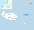 Kreis Porto Santo 2020.png 2,500 × 2,142; 489 KB
-
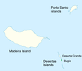
 LocalPortoSanto.png 182 × 140; 3 KB
-
 Mapa Porto Santo pt.JPG 1,109 × 1,083; 104 KB
-

-
 Porto Santo 1877 map.jpg 3,603 × 5,672; 2.34 MB
-
 Porto Santo freguesia-concelho.svg 1,652 × 1,600; 463 KB
-
 Porto Santo location map.svg 1,590 × 1,365; 24 KB
-
 Porto Santo Map.png 2,778 × 1,893; 1.84 MB
-

-
 Порту-Санту.png 408 × 259; 26 KB


.jpg)
_(14783455642).jpg)


