File:Bormio und Passo Del Tonale. NYPL1226748.tiff
Jump to navigation
Jump to search

Size of this JPG preview of this TIF file: 716 × 600 pixels. Other resolutions: 287 × 240 pixels | 573 × 480 pixels | 917 × 768 pixels | 1,223 × 1,024 pixels | 2,445 × 2,048 pixels | 5,195 × 4,351 pixels.
Original file (5,195 × 4,351 pixels, file size: 64.68 MB, MIME type: image/tiff)
Captions
Captions
Add a one-line explanation of what this file represents
Summary[edit]
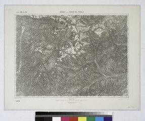
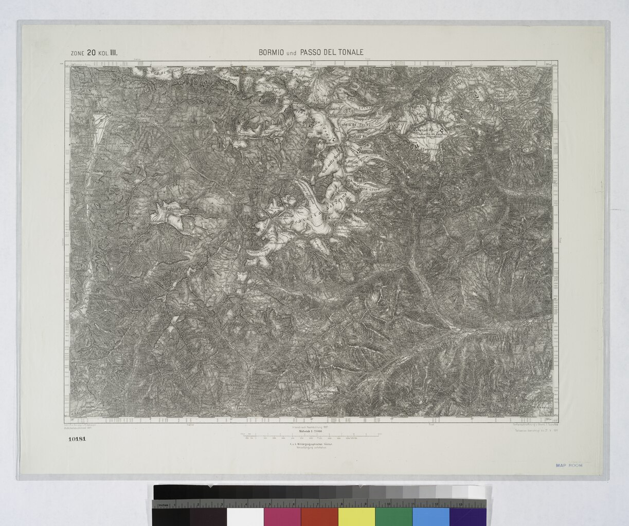
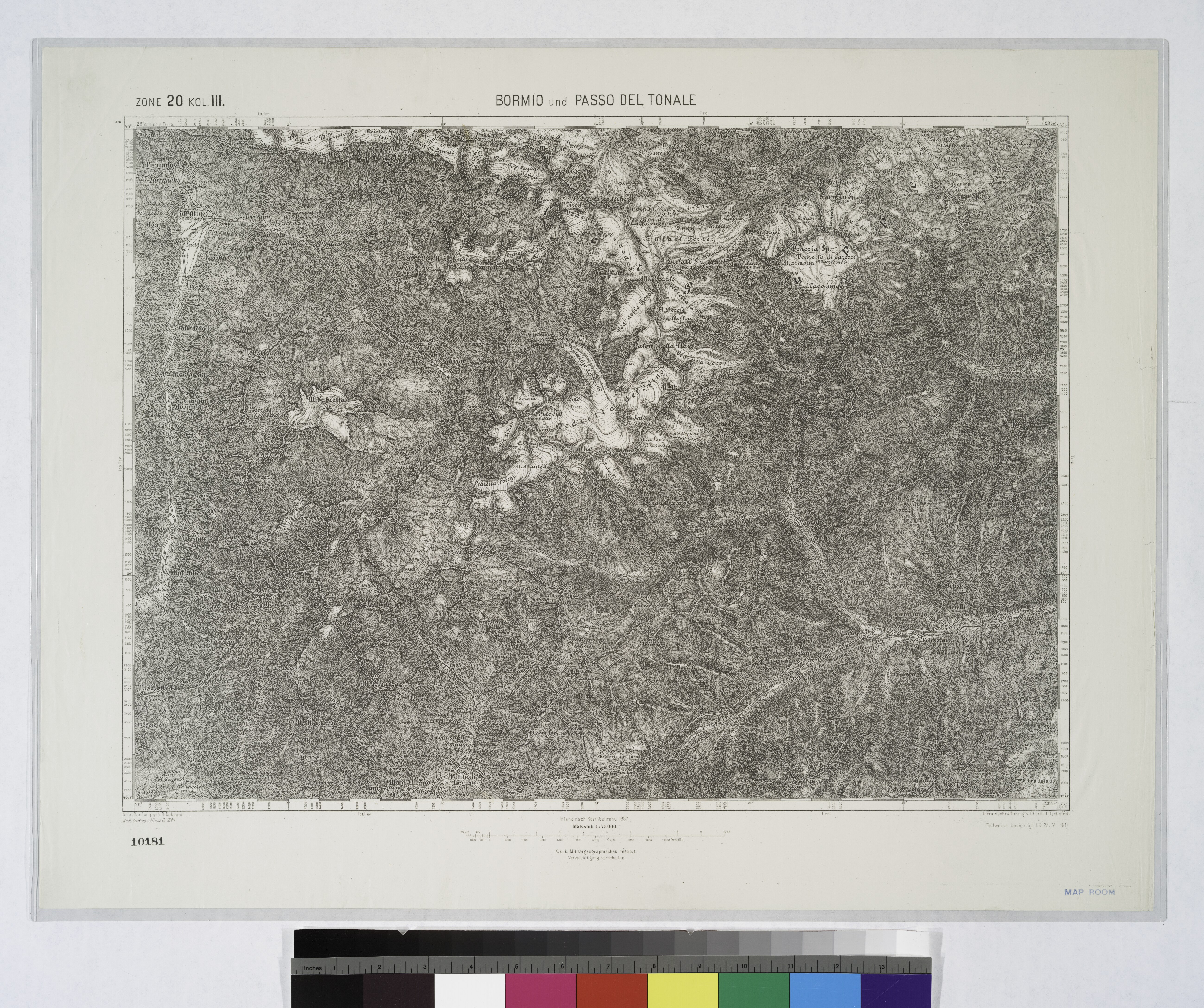
| Description | Bormio und Passo Del Tonale. | |||||||||||||||||||||||
| Item/Page/Plate | 20:III | |||||||||||||||||||||||
| Catalog Call Number | Map Div. 04-336 | |||||||||||||||||||||||
| Date | between 1877 and 1914 | |||||||||||||||||||||||
| Source |
http://digitalgallery.nypl.org/nypldigital/dgkeysearchdetail.cfm?imageID=1226748
|
|||||||||||||||||||||||
| Author | Austro-Hungarian Monarchy. Militärgeographisches Institut. -- Cartographer | |||||||||||||||||||||||
| Permission (Reusing this file) |
From The Lionel Pincus & Princess Firyal Map Division. Released on a CC0 license.[1] | |||||||||||||||||||||||
| Source Description | 776 maps ; 38 x 55 cm. or smaller. | |||||||||||||||||||||||
| Digital ID | 1226748 | |||||||||||||||||||||||
| Location | Stephen A. Schwarzman Building / The Lionel Pincus and Princess Firyal Map Division | |||||||||||||||||||||||
| NYPL digital item published | 6-23-2005; updated 2-17-2012 | |||||||||||||||||||||||

Licensing[edit]
| This file is made available under the Creative Commons CC0 1.0 Universal Public Domain Dedication. | |
| The person who associated a work with this deed has dedicated the work to the public domain by waiving all of their rights to the work worldwide under copyright law, including all related and neighboring rights, to the extent allowed by law. You can copy, modify, distribute and perform the work, even for commercial purposes, all without asking permission.
|
The making of this file was supported by Wikimedia UK.
To see other files made with the support of Wikimedia UK, please see the category Supported by Wikimedia UK.
|
File history
Click on a date/time to view the file as it appeared at that time.
| Date/Time | Thumbnail | Dimensions | User | Comment | |
|---|---|---|---|---|---|
| current | 20:33, 27 October 2023 |  | 5,195 × 4,351 (64.68 MB) | Sebastian Wallroth (talk | contribs) | Rotated 270° using CropTool with precise mode. |
| 13:51, 13 April 2014 |  | 4,352 × 5,195 (64.69 MB) | Fæ (talk | contribs) | =={{int:filedesc}}== {{NYPL_map |specific_material_type = maps |source_description = 776 maps ; 38 x 55 cm. or smaller. |medium = Engravings |record_id = 574478 |catalog_call_number = Map Div. 04-336 |creator = Austro-Hungarian Monarchy. Militärgeogra... |
You cannot overwrite this file.
File usage on Commons
The following page uses this file: