File:Big ten curve.png
Jump to navigation
Jump to search

Size of this preview: 474 × 599 pixels. Other resolutions: 190 × 240 pixels | 379 × 480 pixels | 607 × 768 pixels | 810 × 1,024 pixels | 2,000 × 2,529 pixels.
Original file (2,000 × 2,529 pixels, file size: 1.7 MB, MIME type: image/png)
Captions
Captions
Add a one-line explanation of what this file represents
Summary[edit]
| Description |
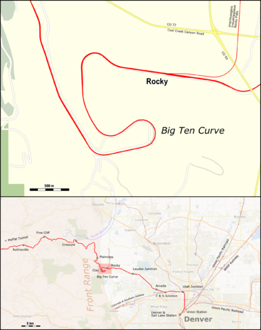
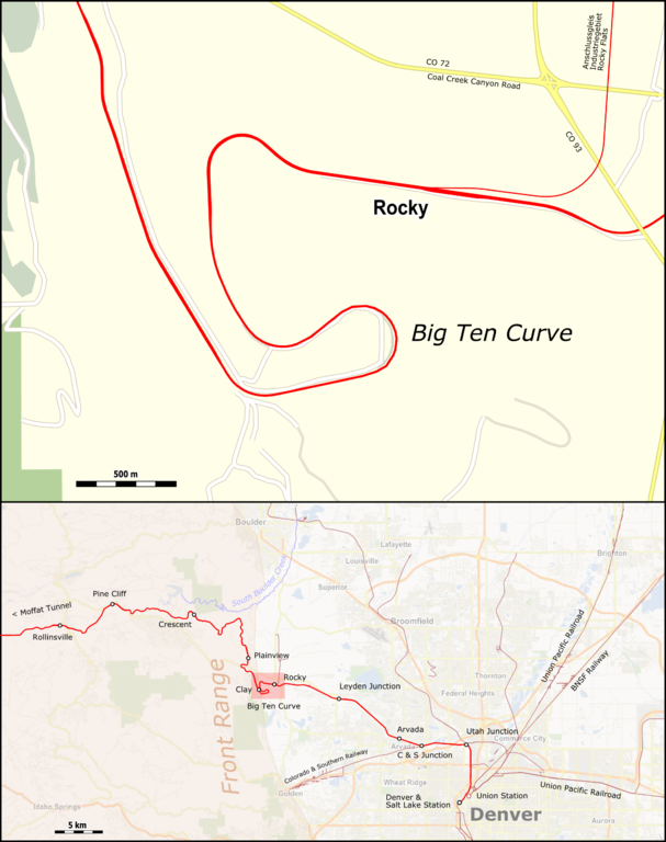
English: Map of the Big Ten Curve on the Moffat Route near Denver CO. |
| Date | |
| Source |
Map was created by using
|
| Author |
|
Licensing[edit]
I, the copyright holder of this work, hereby publish it under the following license:
This file is licensed under the Creative Commons Attribution 3.0 Unported license.
- You are free:
- to share – to copy, distribute and transmit the work
- to remix – to adapt the work
- Under the following conditions:
- attribution – You must give appropriate credit, provide a link to the license, and indicate if changes were made. You may do so in any reasonable manner, but not in any way that suggests the licensor endorses you or your use.
| This work is licensed under the Open Database License (summary). |
File history
Click on a date/time to view the file as it appeared at that time.
| Date/Time | Thumbnail | Dimensions | User | Comment | |
|---|---|---|---|---|---|
| current | 13:39, 21 August 2016 | | 2,000 × 2,529 (1.7 MB) | Pechristener (talk | contribs) | better resulution |
| 18:45, 2 March 2016 |  | 794 × 1,004 (469 KB) | Pechristener (talk | contribs) | Massstab etwas weniger freifliegend | |
| 18:43, 2 March 2016 |  | 794 × 1,004 (469 KB) | Pechristener (talk | contribs) | == {{int:filedesc}} == {{Information |Description={{en|1=Map of the Big Ten Curve on the Moffat Route near Denver CO. }} |Source=Map was created by using * [http://www.openstreetmap.org/ Open Street Map] Data |Author= * rendering with Maperitive, text... |
You cannot overwrite this file.
File usage on Commons
The following page uses this file:
File usage on other wikis
The following other wikis use this file:
- Usage on de.wikipedia.org