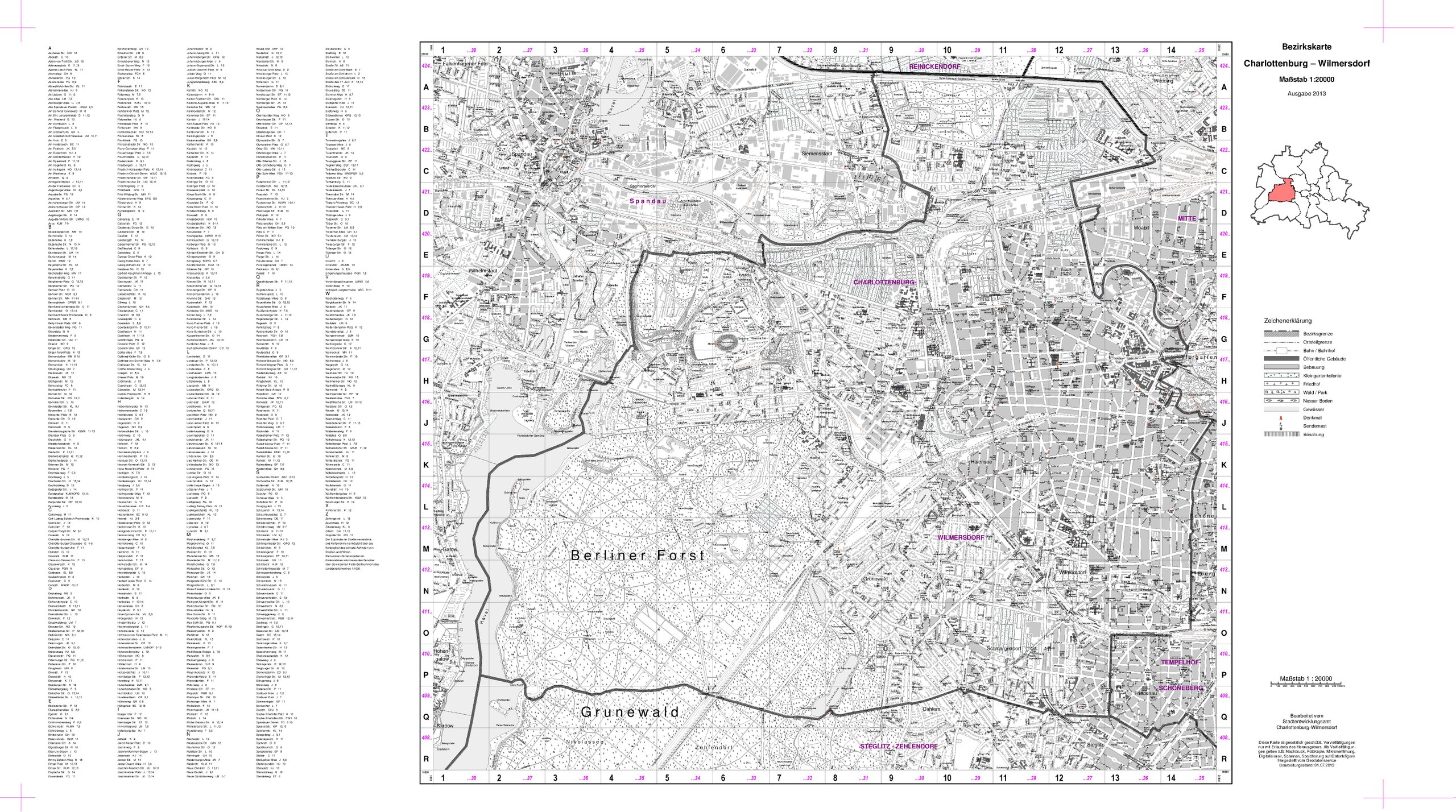
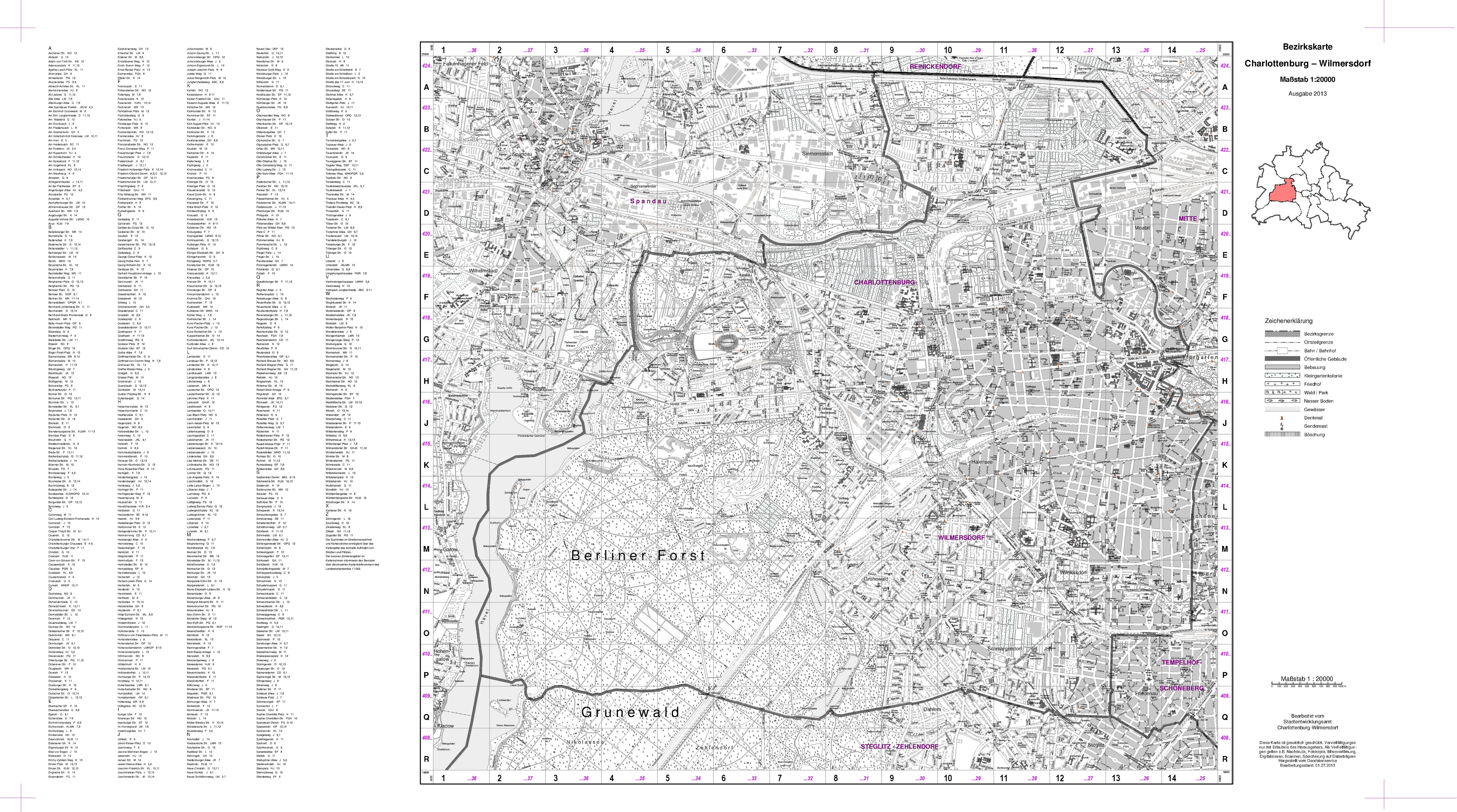
File:Bezirkskarte Charlottenburg-Wilmersdorf 20k sw 2013.pdf
Jump to navigation
Jump to search

Size of this JPG preview of this PDF file: 800 × 446 pixels. Other resolutions: 320 × 178 pixels | 640 × 357 pixels | 1,024 × 571 pixels | 1,280 × 714 pixels | 2,560 × 1,428 pixels | 6,141 × 3,425 pixels.
Original file (6,141 × 3,425 pixels, file size: 11.43 MB, MIME type: application/pdf)
Captions
Captions
Add a one-line explanation of what this file represents
Summary[edit]
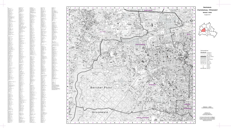
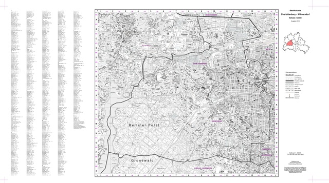
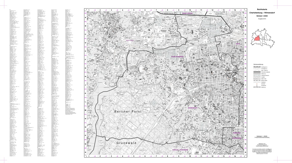
| Title |
Bezirkskarte Charlottenburg-Wilmersdorf |
| Description |
Schwarzweiß |
| Date | |
| Source | Bezirkskarte Charlottenburg-Wilmersdorf |
| Creator |
Stadtentwicklungsamt Charlottenburg-Wilmersdorf, Fachbereich Vermessung |
| Permission (Reusing this file) |
© Bezirkskarte Charlottenburg-Wilmerdorf, 1:20 000, herausgegeben vom Stadtentwicklungsamt Charlottenburg-Wilmersdorf, Fachbereich Vermessung |
| Geotemporal data | |
| Map location | Bezirk Charlottenburg-Wilmersdorf von Berlin |
| Map type | Stadtplan |
| Spatial reference system | DHDN / Soldner Berlin |
| Scale | 1:20,000 |
| Heading |
 |
| Georeferencing | If inappropriate please set warp_status = skip to hide. |
| Bibliographic data | |
| Language | German |
| Archival data | |
| Dimensions | height: 58 cm (22.8 in); width: 104 cm (40.9 in) |
Licensing[edit]

|
This file is licensed under the terms of the Nutzungsbedingungen of the Senatsverwaltung für Stadtentwicklung und Umwelt Berlin. |
|
You are free:
Under the following conditions:
The terms of the Nutzungsbedingungen have been archived in the OTRS system, see Ticket:2014052710020188. |
File history
Click on a date/time to view the file as it appeared at that time.
| Date/Time | Thumbnail | Dimensions | User | Comment | |
|---|---|---|---|---|---|
| current | 12:22, 18 October 2015 |  | 6,141 × 3,425 (11.43 MB) | Alexrk2 (talk | contribs) | == {{int:description}} == {{Map |title='''Bezirkskarte Charlottenburg-Wilmersdorf''' |description=Schwarzweiß |legend= |author=Stadtentwicklungsamt Charlottenburg-Wilmersdorf, Fachbereich Vermessung |date=2013 |source=[https://www.berlin.de/ba-charlo... |
You cannot overwrite this file.
File usage on Commons
There are no pages that use this file.