File:Atlas with Portolan Charts of the Old World and New World, 1580 WDL8918.pdf
Jump to navigation
Jump to search

Size of this JPG preview of this PDF file: 438 × 599 pixels. Other resolutions: 175 × 240 pixels | 351 × 480 pixels | 561 × 768 pixels | 749 × 1,024 pixels | 2,166 × 2,962 pixels.

Original file (2,166 × 2,962 pixels, file size: 57.96 MB, MIME type: application/pdf, 65 pages)
Captions
Captions
Add a one-line explanation of what this file represents
Summary
[edit]| Author |
Русский: Доураду, Фернан Ваш, XVI век
Français : Dourado, Fernão Vaz, XVIe siècle
English: Dourado, Fernando Vaz, 16th century
中文:费尔南·瓦斯·多拉多,16 世纪
Português: Dourado, Fernando Vaz, século XVI
العربية: فِرناو فاز دورادو، القرن السادس عشر
Español: Dourado, Fernão Vaz, siglo XVI |
| Title |
Русский: Атлас с картами-портуланами Старого и Нового Света, 1580 г.
Français : Atlas avec cartes-portulans de l'Ancien et du Nouveau Monde, 1580
English: Atlas with Portolan Charts of the Old World and New World, 1580
中文:描绘旧大陆和新大陆的波多兰航海地图册,1580 年
Português: Atlas com cartas portulanas do novo e velho mundo, 1580
العربية: أطلس مزود بخرائط بورتولان للعالم القديم والعالم الجديد، 1580
Español: Atlas con cartas portuláneas del Viejo Mundo y el Nuevo Mundo, 1580 |
| Description |
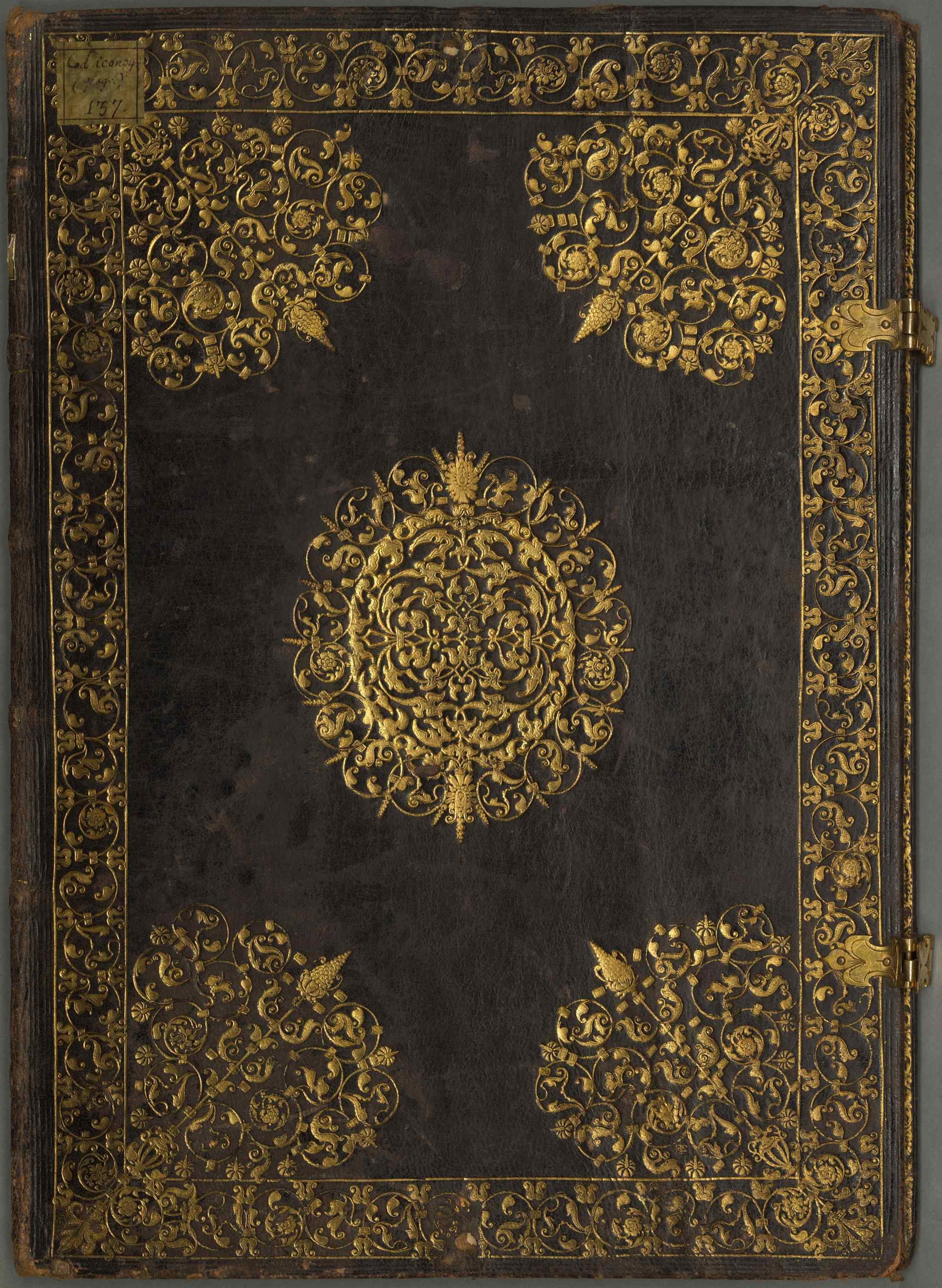
Русский: Этот атлас карт-портуланов Старого и Нового света состоит из 16 двойных листов, сделанных из тонкого белого пергамента, переплетенного дорогой красной сафьяновой кожей (из тонкого сафьяна) с золотыми орнаментами в восточном стиле. Предполагают, что выдающийся португальский мореплаватель, картограф и художник Фернан Ваш Доураду, создал атлас в 1580 г., ближе к концу своей жизни. Он относится к картографическим шедеврам конца XVI века, отражающим растущий спрос на картографические работы, которые были как визуально впечатляющими, так и полезными для практической навигации. Атлас был заказан португальской короной и сделан в Гоа, Западной Индии, где Доураду провел свои последние годы. Географический охват атласа простирается от Южной Америки до Персидской империи, от Китая (там, где написано Кантон) Явы, Новой Гвинеи и Северной Америки. Карты замечательны подробностями изложения. В изображаемых регионах местные жители показаны на основе типичных представлений, без одежды, занятыми охотой, сбором пищи или другой деятельностью, характерной для соответствующих стран, согласно описаниям в западных литературных произведениях. Завоеватели, напротив, представлены на лошадях, в шляпах и костюмах. Карта Африки содержит то, что, скорее всего, является живописным указанием на битву между португальцами и маврами у Ксар-эль-Кебира (Алькасаркевире, Марокко) в 1578 г. Два всадника, одетые в характерные костюмы и несущие знамя, возможно, олицетворяют главных героев битвы, короля Португалии Себастьяна I и султана Марокко Абд аль-Малика (нарисован в тюрбане). Атлас был передан из аббатства Поллинг (Верхняя Бавария), после его закрытия в 1803 г., в мюнхенскую придворную библиотеку, которая впоследствии стала Баварской государственной библиотекой, где он хранится с тех пор.
Карты-портуланы Français : Cet atlas de cartes-portulans de l'Ancien et du Nouveau Monde comporte 16 doubles feuillets élaborés à partir de fin parchemin blanc. Il est également relié de cuir (de peau de chèvre fine) marocain rouge de grande valeur avec des ornements dorés de style oriental. On attribue cet atlas au fameux marin, cartographe et peintre portugais Fernão Vaz Dourado, qui l'aurait réalisé en 1580, vers la fin de sa vie. Il appartient à une catégorie de chefs-d'œuvre cartographiques de la fin du XVIe siècle, reflétant la demande croissante d'ouvrages cartographiques de l'époque à la fois visuellement impressionnants et utiles pour la navigation. L'atlas fut commandé par la Couronne portugaise et réalisé à Goa, en Inde occidentale, où Dourado passa les dernières années de sa vie. La zone géographique couverte par l'atlas s'étend de l'Amérique du Sud à l'Empire persan, la Chine (où Canton est inscrit), Java et la Nouvelle-Guinée, et l'Amérique du Nord. Les cartes sont remarquables de par leur richesse narrative. Dans les régions illustrées, les autochtones sont représentés nus avec des attributs considérés comme typiques, pendant la chasse, la récolte de nourriture ou autres activités caractéristiques de leur pays respectif, comme généralement dépeints dans les ouvrages de la littérature occidentale. En revanche, les conquérants apparaissent à cheval, portant des chapeaux et des uniformes. La carte de l'Afrique comporte ce qui est vraisemblablement une allusion picturale à la bataille entre les Portugais et les Maures près de Ksar el-Kébir (également Alcazarquivir, au Maroc) en 1578. Les deux cavaliers portant des vêtements caractéristiques et arborant des bannières représentent peut-être les principaux protagonistes de la bataille, le roi Sébastien I er du Portugal et le sultan Abd Al-Malik du Maroc (coiffé d'un turban). L'atlas fut transféré de l'abbaye de Polling (en Haute-Bavière), lors de sa dissolution en 1803, à la bibliothèque de la cour de Munich, aujourd'hui la Bibliothèque d'État de Bavière, où il est conservé.
Cartes-portulans English: This atlas of portolan charts of the old and the new worlds consists of 16 double leaves made from fine white parchment, bound in costly red morocco leather (made from fine goatskin) with gold ornaments in oriental style. The important Portuguese mariner, cartographer, and painter Fernão Vaz Dourado is thought to have made the atlas in 1580, near the end of his life. It belongs to a class of late-16th-century cartographic masterpieces, which reflect the period’s rising demand for cartographic works that were both visually impressive and useful for practical navigation. The atlas was commissioned by the Portuguese crown and produced in Goa, western India, where Dourado spent his last years. The geographical scope of the atlas extends from South America to the Persian Empire, to China (where Canton is named), to Java and New Guinea, and to North America. The charts are remarkable for their narrative wealth. In the regions displayed, natives are portrayed wearing no clothes, with attributes thought to be typical, while busy hunting, gathering food, or carrying out other activities representative of their respective countries as portrayed in Western literary works. The conquerors, in contrast, appear on horseback, wearing hats and suits. The map of Africa contains what most likely is a pictorial allusion to the battle between the Portuguese and Moors near Ksar el-Kebir (Alcazarquivir, Morocco) in 1578. The two riders clad in characteristic costumes and carrying banners may represent the main protagonists in the battle, King Sebastião I of Portugal and Sultan Abd Al-Malik of Morocco (shown wearing a turban). The atlas was transferred from Polling Abbey (Upper Bavaria), when it was dissolved in 1803, to the Munich Court Library, which became the Bavarian State Library, where it has remained ever since.
Portolan charts 中文:这幅描绘旧大陆和新大陆的波多兰航海地图册包括 16 张由细白羊皮纸制作的双开页,装订在昂贵的红色摩洛哥皮革(由细羊皮制成)封面内,配有东方风格的金饰。据推断,这本地图册由葡萄牙重要的水手、制图师和画家费尔南·瓦斯·多拉多 (Fernão Vaz Dourado) 于 1580 年在其生命快要结束时才制作完成。它是 16 世纪后期制图的杰作,反映出这一时期大众对既给人视觉享受、又能用于实际导航的制图作品的需求不断上升。这本地图册是受葡萄牙王室委托,在印度西部的果阿制作的,多拉多在那里度过了他的最后岁月。地图册涵盖的地理范围包括南美洲、波斯帝国、中国(标示出了广州)、爪哇岛、新几内亚和北美。地图中的文字描述具有重要价值。在显示的区域,当地人的形象被描绘为:不穿衣服、带有被认为是典型的特征,同时忙着狩猎、采集食物或进行其它西方文学作品中描绘的各自国家的代表性活动。征服者则正好相反,他们骑在马背上,戴着帽子,着装整齐。非洲地图包含的很可能是一个图案典故,反映 1578 年葡萄牙人与摩尔人在凯比尔堡(摩洛哥凯比尔堡)附近的战斗。两个身着特色服装、举着旗帜的骑士可能代表战斗中的主角——葡萄牙国王塞巴斯蒂昂一世 (Sebastião I) 和摩洛哥苏丹阿布德·马立克(Abd Al-Malik,戴头巾)。1803 年珀灵修道院(上巴伐利亚行政区)解散后,地图册被转入慕尼黑宫廷图书馆(即后来的巴伐利亚州立图书馆)。至今这本地图册仍收藏在此图书馆。
波多兰航海图 Português: Este atlas de cartas portulanas do novo e velho mundo é composto por 16 folhas duplas feitas de pergaminho fino branco, encadernado em couro marroquino vermelho caro (feito de pele de bode) com ornamentos dourados em estilo oriental. Acredita-se que o importante marinheiro, cartógrafo e pintor português Fernão Vaz Dourado tenha feito o atlas em 1580, perto do fim de sua vida. Ele pertence a uma classe das obras primas cartográficas do século XVI, as quais refletem a crescente demanda da época por trabalhos que fossem tanto visualmente impressionantes quanto úteis para uma navegação prática. O atlas foi encomendado pela coroa portuguesa e produzido em Goa, oeste da Índia, onde Dourado passou seus últimos anos. A dimensão geográfica do atlas se extende da América do Sul ao Império Persa, até a China (onde Cantão recebeu seu nome), Java, Nova Guiné e América do Norte. Estas cartas são memoráveis por sua riqueza narrativa. Nas regiões mostradas, os nativos são retratados sem roupas, com atributos que se acreditavam típicos, enquanto caçavam, buscavam comida ou realizavam outras atividades representantes de seus respectivos países conforme retratados nos trabalhos literários ocidentais. Os conquistadores, em contraste, aparecem montados em cavalos, usando chapéu e trajes. O mapa da África contém o que provavelmente seja uma alusão ilustrativa à batalha entre os portugueses e os mouros próximo a Ksar el-Kebir (Alcazarquivir, Marrocos) em 1578. Os dois cavaleiros envoltos em trajes característicos e carregando bandeiras provavelmente representam os principais protagonistas da batalha, Rei Sebastião I de Portugal e sultão Abd Al-Malik do Marrocos (mostrado usando um turbante). O atlas foi transferido da abadia de Polling (Alta Baviera), após seu fechamento em 1803, para a biblioteca da corte de Munique, que tornou-se a Biblioteca Estatal da Baviera, onde permanece desde então.
Cartas portulanas العربية: إن هذا الأطلس المزود بخرائط بورتولان للعالمين القديم والجديد يتكون من 16 صفحة مزدوجة من المخطوطات الورقية البيضاء الفاخرة، مُجلد بغلاف أحمر ثمين من جلد الماعز المدبوغ، ومُزين بزخارف ذهبية ذات طابع شرقي. يُزعم أن البحار ورسام الخرائط والفنان البرتغالي المرموق، فِرناو فاز دورادو، قد أنتج هذا الأطلس عام 1580، أي قُبيل وفاته. ينتمي الأطلس لفئة من الأعمال الخرائطية المميزة التي يرجع تاريخها إلى أواخر القرن السادس عشر، الأمر الذي يعكس الطلب المتزايد في تلك الفترة على إنتاج الأعمال الخرائطية التي كانت مبهرة للعين ونافعة للملاحة العملية كذلك. بدأ العمل على الأطلس بأمر من البلاط الملكي البرتغالي، وأُنتِج في غوا، غرب الهند، حيث أمضى دورادو سنواته الأخيرة. يمتد النطاق الجغرافي للأطلس من أمريكا الجنوبية إلى الإمبراطورية الفارسية، إلى الصين (حتى كانتون)، ومنها إلى جاوا ونيو غينيا، وحتى أمريكا الشمالية. تتميز الخرائط بثرائها القصصي. ففي المناطق المعروضة، يظهر السكان الأصليون عُراة، بسمات تبدو تقليدية، أثناء انشغالهم بالصيد أو جمع الطعام أو انهماكهم في أنشطة أخرى تعكس صورة عن بلدانهم كما وصفتها أعمال الأدب الغربية. بينما يظهر الغزاة والمستعمرون على صهوة جيادهم مرتدين القبعات والأزياء الرسمية. تحتوي خريطة أفريقيا على ما هو على الأرجح إشارات تصويرية للمعركة التي نشبت بين البرتغاليين والمغاربة بالقرب من القصر الكبير (المغرب) عام 1578. يُعتقد أن الفارسين، المرتديين أزياء مميزة ويحملان الرايات، يمثلان بطلي المعركة الرئيسين، وهما ملك البرتغال سباستيان الأول وسلطان المغرب عبد الملك (يظهر مرتدياً عمامة). نُقِل الأطلس من دير بولينغ (بافاريا العليا)، عندما تفكك في 1803، إلى مكتبة بلاط ميونيخ، التي صارت مكتبة ولاية بافاريا، ولا يزال بها منذ ذلك الحين.
الرسوم البيانية البورتولانية Español: Este atlas de cartas portuláneas del Viejo y el Nuevo Mundo consta de 16 hojas dobles hechas de pergamino fino de color blanco, encuadernado en costoso cuero marroquí rojo (de piel de cabra fina), con adornos dorados en estilo oriental. Se cree que fue el importante marinero, cartógrafo y pintor portugués Fernão Vaz Dourado quien hizo este atlas en 1580, cerca del final de su vida. Pertenece a una clase de obras de arte cartográficas de finales del siglo XVI, que reflejan la creciente demanda de la época de obras cartográficas que fueran, a la vez, visualmente impresionantes y útiles para la navegación práctica. El atlas fue encargado por la corona portuguesa y producido en Goa, India occidental, donde Dourado pasó sus últimos años. El alcance geográfico del atlas se extiende desde América del Sur hasta el Imperio persa, China (donde se menciona Cantón), Java y Nueva Guinea, e incluso América del Norte. Las cartas son notables por su riqueza narrativa. Los nativos de las regiones que se muestran son retratados sin ropa y con los atributos que se creían típicos, y ocupados cazando, recolectando alimentos o haciendo otras actividades representativas de sus respectivos países, como se describen en las obras literarias occidentales. Los conquistadores, en cambio, aparecen a caballo, con sombreros y trajes. El mapa de África contiene lo que probablemente sea una alusión pictórica a la batalla entre los portugueses y los moros cerca de Ksar el-Kebir (Alcazarquivir, Marruecos) en 1578. Los dos jinetes vestidos con trajes característicos y portando estandartes pueden ser representaciones de los principales protagonistas de la batalla: el rey Sebastián I de Portugal y el sultán Abd al-Malik de Marruecos (que aparece con un turbante). El atlas fue trasladado de la abadía de Polling (Alta Baviera), cuando se disolvió en 1803, a la Biblioteca de la Corte de Múnich, que se convirtió en la Biblioteca Estatal de Baviera, donde ha permanecido desde entonces.
Cartas portulanas |
| Date | 1580 |
| Medium |
Русский: Карты
Français : Cartes
English: Maps
中文:地图
Português: Mapas
العربية: خرائط
Español: Mapas |
| Dimensions |
English: 38 sheets, parchment : illustrations ; 47 x 33.5 centimeters |
| Collection |
Русский: Государственная библиотека Баварии
Français : Bibliothèque d’État de Bavière
English: Bavarian State Library
中文:巴伐利亚州立图书馆
Português: Biblioteca Estatal da Baviera
العربية: مكتبة ولاية بافاريا
Español: Biblioteca Estatal de Baviera |
| Place of creation |
Русский: Мир
Français : Monde
English: World
中文:世界
Português: Mundo
العربية: العالم
Español: Mundo |
| Notes |
Original language title: Portulano Русский: Шифр по каталогу Баварской государственной библиотеки: Cod.icon. 137
Français : Cote de la Bibliothèque d’État de Bavière : Cod.icon. 137
English: BSB Shelfmark: Cod.icon. 137
中文:巴伐利亚州立图书馆排架号:Cod.icon. 137
Português: Código BSB: Cod.icon. 137
العربية: علامة الرف في مكتبة ولاية بافاريا: Cod.icon. 137
Español: Signatura BSB: Cod.icon. 137 |
| References | http://hdl.loc.gov/loc.wdl/demnbsb.8918 |
| Source/Photographer |
http://dl.wdl.org/8918/service/8918.pdf
|
Licensing
[edit]|
This is a faithful photographic reproduction of a two-dimensional, public domain work of art. The work of art itself is in the public domain for the following reason:
The official position taken by the Wikimedia Foundation is that "faithful reproductions of two-dimensional public domain works of art are public domain".
This photographic reproduction is therefore also considered to be in the public domain in the United States. In other jurisdictions, re-use of this content may be restricted; see Reuse of PD-Art photographs for details. | ||||
File history
Click on a date/time to view the file as it appeared at that time.
| Date/Time | Thumbnail | Dimensions | User | Comment | |
|---|---|---|---|---|---|
| current | 01:20, 12 March 2014 |  | 2,166 × 2,962, 65 pages (57.96 MB) | Fæ (talk | contribs) | =={{int:filedesc}}== {{Artwork |artist = |author ={{ru|1=Доураду, Фернан Ваш, XVI век}} {{fr|1=Dourado, Fernão Vaz, XVIe siècle}} {{en|1=Dourado, Fernando Vaz, 16th century}} {{zh|1=费尔南·瓦斯·多拉多,16 世纪}} {{pt|... |
You cannot overwrite this file.
File usage on Commons
The following page uses this file: