File:Atlas of Korea with a World Map WDL4460.pdf
Jump to navigation
Jump to search

Size of this JPG preview of this PDF file: 312 × 600 pixels. Other resolutions: 125 × 240 pixels | 249 × 480 pixels | 399 × 768 pixels | 533 × 1,024 pixels | 1,065 × 2,048 pixels | 3,750 × 7,208 pixels.

Original file (3,750 × 7,208 pixels, file size: 3.46 MB, MIME type: application/pdf, 15 pages)
Captions
Captions
Add a one-line explanation of what this file represents
Summary[edit]
| Title |
Русский: Атлас Кореи и карта мира
Français : Atlas de Corée avec une carte du monde
English: Atlas of Korea with a World Map
中文:朝鲜舆地图
Português: Atlas da Coréia com um Mapa-múndi
العربية: أطلس كوريا مع خريطة العالم
Español: Atlas de Corea con un mapa mundial |
| Description |
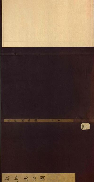
Русский: Данный атлас датируется периодом династии Мин (1368-1644 гг.). В нем содержится 13 карт, первая из которых является обзорной картой Кореи, а остальные — картами префектур. В нем содержится 13 карт, первая из которых является обзорной картой Кореи, а остальные — картами префектур. В конце атласа приводится карта мира под заголовком "Карта суши под Солнцем", на которой изображена 81 страна. Карты размещены в центре каждого двухстраничного разворота атласа, а по обеим сторонам карт приведены пояснительные тексты.
Историческая география; Корея; Карты мира Français : Il s'agit d'un atlas datant de la dynastie Ming (1368-1644). Il contient 13 cartes, la première étant un plan d'ensemble de la Corée, suivie par des cartes de ses préfectures. Vers la fin se trouve une carte du monde intitulée "Carte de la terre sous les cieux", qui montre 81 pays. L'atlas comprend également des cartes de la Chine, du Japon et des îles Ryukyu. Les cartes sont placées au centre de chaque double-page du volume, avec des textes explicatifs sur les côtés.
Géographie historique; Corée; Cartes du monde English: This is an atlas dating from the Ming Dynasty (1368–1644). It contains 13 maps, the first one being an overview map of Korea, followed by maps of its prefectures. Near the end is a world map entitled “Map of land under heaven,” which shows 81 countries. The atlas also includes maps for China, Japan, and the Ryukyu Islands. The maps are placed at the center of each double-page spread of the volume, with explanatory texts on the sides.
Historical geography; Korea; World maps 中文:这是一册明代(1368-1644年)地图集。 其中收集有13幅地图,第一幅为朝鲜概览图,之后为其各辖区地图。 地图集末尾处有一幅题为《天下地图》的世界地图,可以从中看到81个国家的疆域划分情况。 该图集还收有中国、日本和琉球群岛的地图。 地图位于卷册双页面的中心,侧边有解释文字。
历史地理学; 朝鲜; 世界地图 Português: Este é um atlas que data da Dinastia Ming (1368-1644). Contém 13 mapas, sendo o primeiro um mapa geral da Coréia, seguido por mapas de suas prefeituras. Perto do final, há um mapa-múndi intitulado "Mapa da terra debaixo do céu", que mostra 81 países. O atlas também inclui mapas da China, do Japão e das Ilhas Ryukyu. Os mapas estão colocados no centro de cada página dupla do volume, com textos explicativos nas laterais.
Geografia histórica; Coreia; Mapas-múndi العربية: هذا أطلس يرجع تاريخه إلى سلالة المينغ (1364-1644). وهو يحتوي على 13 خريطة، أولها خريطة شاملة لكوريا، وتتبعها خرائط لمقاطعاتها. وبالقرب من الجزء الأخير خريطة للعالم بعنوان "خريطة الأرض تحت السماء"، التي تظهر 81 بلدا. كما يشمل الأطلس أيضا خرائط للصين، واليابان وجزر ريوكيو. وقد وضعت الخرائط في وسط كل صفحتين للمجلد، مزودة بنصوص تفسيرية على الجانبين.
الجغرافيا التاريخية; كوريا; خرائط العالم Español: Se trata de un atlas que data de la dinastía Ming (1368-1644). Contiene 13 mapas, el primero es un mapa general de Corea, seguido por mapas de sus prefecturas. Cerca del final hay un mapa mundial titulado "Mapa de la tierra bajo el cielo", que muestra 81 países. El atlas también incluye mapas de las Islas Ryukyu, China y Japón. Los mapas se colocan en el centro de cada pliego de doble página del volumen, con textos explicativos en los lados.
Geografía histórica; Corea; Mapas del mundo |
| Date | between 1368 and 1644 |
| Medium |
Русский: Карты
Français : Cartes
English: Maps
中文:地图
Português: Mapas
العربية: خرائط
Español: Mapas |
| Dimensions |
English: 1 atlas, 13 maps |
| Collection |
Русский: Библиотека Конгресса
Français : Bibliothèque du Congrès
English: Library of Congress
中文:国会图书馆
Português: Biblioteca do Congresso
العربية: مكتبة الكونغرس
Español: Biblioteca del Congreso |
| Place of creation |
Русский: Китай
Français : Chine
English: China
中文:中国
Português: China
العربية: الصين
Español: China |
| Notes | Original language title: 朝鮮輿地圖 |
| Source/Photographer |
http://dl.wdl.org/4460/service/4460.pdf
|
Licensing[edit]
|
This is a faithful photographic reproduction of a two-dimensional, public domain work of art. The work of art itself is in the public domain for the following reason:
The official position taken by the Wikimedia Foundation is that "faithful reproductions of two-dimensional public domain works of art are public domain".
This photographic reproduction is therefore also considered to be in the public domain in the United States. In other jurisdictions, re-use of this content may be restricted; see Reuse of PD-Art photographs for details. | ||||
File history
Click on a date/time to view the file as it appeared at that time.
| Date/Time | Thumbnail | Dimensions | User | Comment | |
|---|---|---|---|---|---|
| current | 17:22, 11 March 2014 |  | 3,750 × 7,208, 15 pages (3.46 MB) | Fæ (talk | contribs) | =={{int:filedesc}}== {{Artwork |artist = |author = |title ={{ru|1=Атлас Кореи и карта мира}} {{fr|1=Atlas de Corée avec une carte du monde}} {{en|1=Atlas of Korea with a World Map}} {{zh|1=朝鲜舆地图}} {{pt|1=Atlas da Coréia... |
You cannot overwrite this file.
File usage on Commons
The following page uses this file: