File:Ambon 1943.jpg
Jump to navigation
Jump to search
Size of this preview: 750 × 600 pixels. Other resolutions: 300 × 240 pixels | 600 × 480 pixels | 961 × 768 pixels | 1,280 × 1,024 pixels | 2,426 × 1,940 pixels.
Original file (2,426 × 1,940 pixels, file size: 428 KB, MIME type: image/jpeg)
Captions
Captions
Add a one-line explanation of what this file represents
Summary[edit]
| Description |
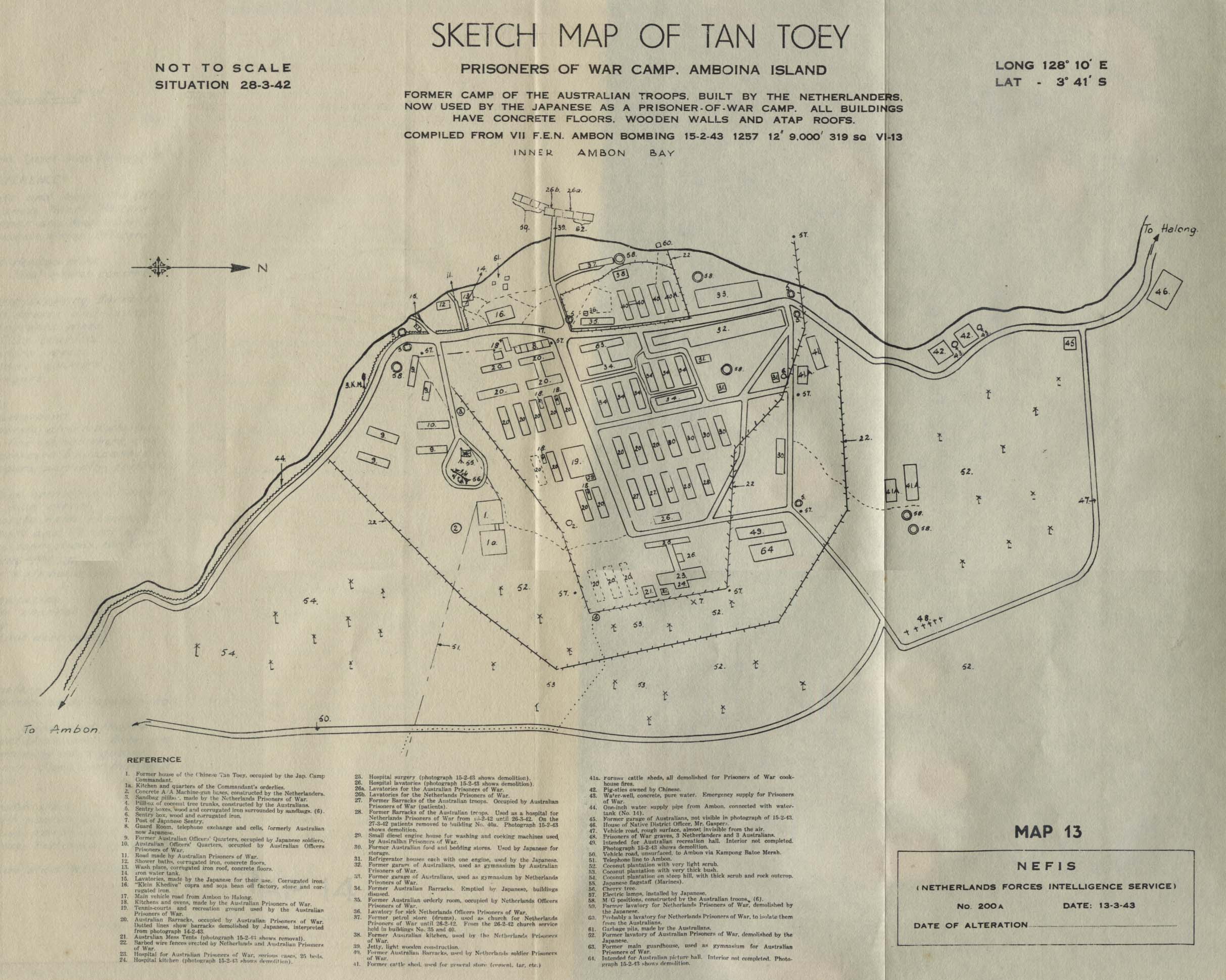
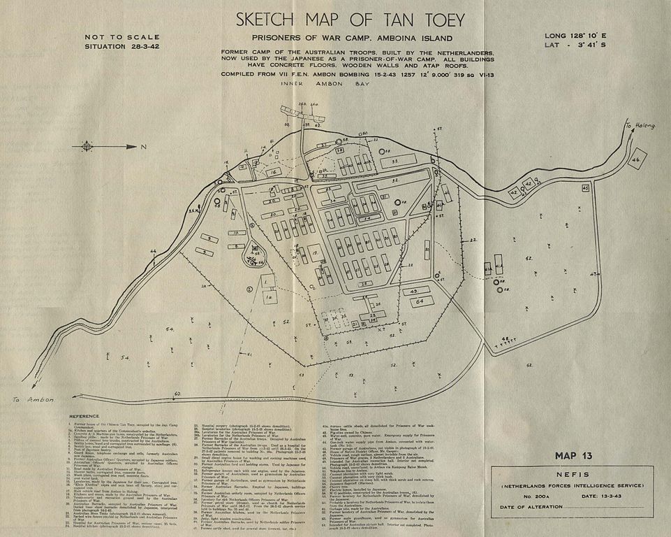
"Sketch Map of Tan Toey Prisoners of War Camp, Amboina Island, Former camp of the Australian troops, built by the Netherlanders, now used by the Japanese as a prisoner-of-war camp..." from Allied Geographical Section, Southwest Pacific Area. Area Study of Ambon Island, Terrain Study No. 45, Map 13 dated March 13, 1943 Courtesy of the University of Texas Libraries, The University of Texas at Austin. http://www.lib.utexas.edu/usage_statement.html?maps=yes http://www.lib.utexas.edu/maps/indonesia.html |
| Date | 13 April 2006 (original upload date) |
| Source | No machine-readable source provided. Own work assumed (based on copyright claims). |
| Author | No machine-readable author provided. Hullie assumed (based on copyright claims). |
Licensing[edit]
| I, the copyright holder of this work, release this work into the public domain. This applies worldwide. In some countries this may not be legally possible; if so: I grant anyone the right to use this work for any purpose, without any conditions, unless such conditions are required by law. |
File history
Click on a date/time to view the file as it appeared at that time.
| Date/Time | Thumbnail | Dimensions | User | Comment | |
|---|---|---|---|---|---|
| current | 22:20, 13 April 2006 | | 2,426 × 1,940 (428 KB) | Hullie (talk | contribs) | "Sketch Map of Tan Toey Prisoners of War Camp, Amboina Island, Former camp of the Australian troops, built by the Netherlanders, now used by the Japanese as a prisoner-of-war camp..." from Allied Geographical Section, Southwest Pacific Area. Area Study of |
You cannot overwrite this file.
File usage on Commons
There are no pages that use this file.
File usage on other wikis
The following other wikis use this file:
- Usage on id.wikipedia.org
- Usage on nl.wikipedia.org
- Usage on pt.wikipedia.org