Category:Old maps of Ambon
Jump to navigation
Jump to search
Media in category "Old maps of Ambon"
The following 32 files are in this category, out of 32 total.
-
 AMH-6403-NA Bird's eye view of the island of Ambon.jpg 1,566 × 2,400; 567 KB
-
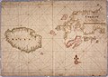
 AMH-6469-KB Map of the island of Amboina.jpg 2,400 × 1,656; 809 KB
-
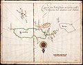
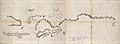 AMH-6172-NA Map of Ambon and environs.jpg 2,400 × 886; 298 KB
-
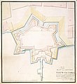
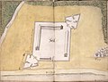 AMH-6429-NA Small map of the fort at Ceijt on Ambon.jpg 2,400 × 1,832; 515 KB
-

-
 AMH-4700-NA Bird's eye view map of Victoria Castle at Ambon.jpg 2,400 × 1,897; 672 KB
-
 AMH-4695-NA Bird's eye view map of Amboina.jpg 2,400 × 1,882; 1.03 MB
-
 AMH-5492-NA Map of Groot Ceram, that is, the Moluccas.jpg 2,400 × 1,897; 614 KB
-
 AMH-5594-NA Map of the Moluccas.jpg 2,400 × 1,102; 352 KB
-
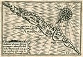
 AMH-5624-NA Map of the island of Ambon.jpg 2,400 × 1,690; 642 KB
-
 AMH-4696-NA Bird's eye view map of Amboina.jpg 2,400 × 1,701; 622 KB
-
 AMH-4707-NA Maps of the Hila, Larike, Pas Baguala and Ourien fortifications.jpg 2,400 × 1,675; 585 KB
-
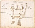
 AMH-5491-NA Map of the city and the castle of Amboina.jpg 2,400 × 1,819; 541 KB
-
 AMH-5540-NA Map of Boero, Ambon and part of Ceram.jpg 2,400 × 1,702; 654 KB
-
 AMH-4704-NA Map of Victoria Castle at Ambon.jpg 2,206 × 2,400; 652 KB
-
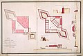 AMH-4705-NA Design for fortifications at Amboina.jpg 2,400 × 1,645; 508 KB
-
 AMH-4699-NA Map of Ambon and environs.jpg 2,400 × 1,729; 519 KB
-
 AMH-4698-NA Map of Ambon and environs.jpg 2,400 × 1,272; 283 KB
-
 AMH-7993-KB Map of Ceram, Ambon and the Banda islands.jpg 2,400 × 1,381; 616 KB
-
 AMH-7994-KB Map of the island of Ambon.jpg 2,400 × 1,826; 850 KB
-
 AMH-7995-KB Map of Amboina.jpg 2,400 × 1,897; 1.35 MB
-

-

-
 AMH-5595-NA Map of Amboina and South Ceram.jpg 2,400 × 1,701; 611 KB
-
 AMH-2531-NA Map of the bay of Ambon.jpg 2,400 × 1,014; 284 KB
-
 AMH-4697-NA Map of the area around Amboina.jpg 2,400 × 1,766; 873 KB
-

-
 Fort Amsterdam op het eiland Ambon.jpg 473 × 354; 32 KB
-

-
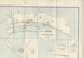 1899 Seram Earthquake map.jpg 5,100 × 3,510; 3.52 MB
-
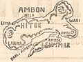
 Ambon-1942.jpg 738 × 624; 242 KB
-
 Ambon 1943.jpg 2,426 × 1,940; 428 KB


.jpg)


.jpg)
.jpg)


.jpg)

.jpg)


