File:Achensee Pertisau.JPG
Jump to navigation
Jump to search

Size of this preview: 800 × 525 pixels. Other resolutions: 320 × 210 pixels | 640 × 420 pixels | 1,024 × 672 pixels | 1,280 × 840 pixels | 2,560 × 1,679 pixels | 4,188 × 2,747 pixels.
Original file (4,188 × 2,747 pixels, file size: 2.25 MB, MIME type: image/jpeg)
Captions
Captions
Add a one-line explanation of what this file represents
This image has been assessed using the Quality image guidelines and is considered a Quality image.
|
| Description |
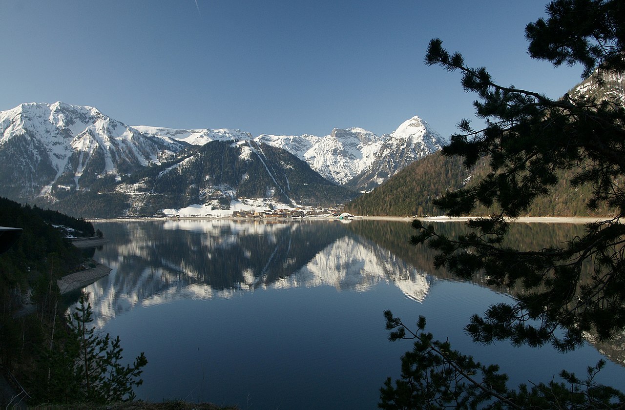
Deutsch: Pertisau ist ein Ortsteil der Gemeinde Eben am Achensee im österreichischen Bundesland Tirol. Zusammen mit Maurach konstituiert er das Zentrum des Tourismus am Achensee. Die Berge im Hintergrund gehören zum Karwendelgebirge, links der Bärenkopf 1.991m in der Mitte der bewaldete und durch eine Bergbahn eingeschnittene Hügel ist der Zwölferkopf 1.480m und rechts aussen ist der Dristenkopf 2.005m.
English: Pertisau is a district of the municipality Eben on Achensee in the Austrian state of Tyrol. Together with Maurach constitutes the center of tourism on the Achensee. The mountains in the background belong to the Karwendel Mountains, to the left of the Bärenkopf 1.991m in the middle of the forest and cut through a mountain hill is the Zwölferkopf 1.480m (Karwendel) and is right outside the Dristenkopf 2.005m. |
| Date | |
| Source | Own work |
| Author | --Böhringer |
| Permission (Reusing this file) |
I, the copyright holder of this work, hereby publish it under the following license: This file is licensed under the Creative Commons Attribution-Share Alike 2.5 Generic license.
|
| Camera location | | View this and other nearby images on: OpenStreetMap |
|---|
This Photo was taken by Böhringer Friedrich.
|
Feel free to use my photos, but please mention me as the author and if you want send me a message. or (rufre@lenz-nenning.at) |
| Annotations | This image is annotated: View the annotations at Commons |
File history
Click on a date/time to view the file as it appeared at that time.
| Date/Time | Thumbnail | Dimensions | User | Comment | |
|---|---|---|---|---|---|
| current | 21:42, 15 April 2009 | | 4,188 × 2,747 (2.25 MB) | Böhringer (talk | contribs) | {{Information |Description= {{de| Pertisau ist ein Ortsteil der Gemeinde Eben am Achensee im österreichischen Bundesland Tirol. Zusammen mit Maurach konstituiert er das Zentrum des Tourismus am Achensee.}} |Source= own work |Date= 200 |
You cannot overwrite this file.
File usage on Commons
The following 5 pages use this file:
File usage on other wikis
The following other wikis use this file:
- Usage on de.wikipedia.org
- Usage on en.wikipedia.org
- Usage on fa.wikipedia.org
- Usage on fr.wikipedia.org
- Usage on nl.wikipedia.org