File:Abruka OnEarth WMS.png
Jump to navigation
Jump to search
No higher resolution available.
Abruka_OnEarth_WMS.png (343 × 465 pixels, file size: 188 KB, MIME type: image/png)
Captions
Captions
Add a one-line explanation of what this file represents
Summary[edit]
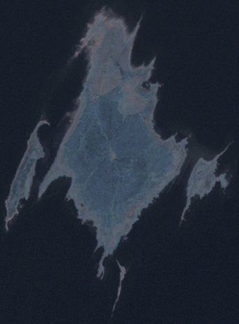
| Description | Satellite image of Abruka. Coordinates: worldwind://goto/world=Earth&lat=58.14961&lon=22.51000&alt=19306 |
| Source | Screenshot from NASA World Wind, OnEarth WMS global mosaic visual colour layer |
| Author | NASA World Wind |
Licensing[edit]
| This image is in the public domain because it is a screenshot from NASA’s globe software World Wind using a public domain layer, such as Blue Marble, MODIS, Landsat, SRTM, USGS or GLOBE.
|
 |
File history
Click on a date/time to view the file as it appeared at that time.
| Date/Time | Thumbnail | Dimensions | User | Comment | |
|---|---|---|---|---|---|
| current | 18:44, 7 June 2007 | | 343 × 465 (188 KB) | Hautala (talk | contribs) | {{PD-WorldWind}} Satellite image of Abruka. Screenshot from NASA World Wind, OnEarth WMS global mosaic visual colour layer. Coordinates: worldwind://goto/world=Earth&lat=58.14961&lon=22.51000&alt=19306 Category:Satellite pictures of Estonia [[Cate |
You cannot overwrite this file.
File usage on Commons
There are no pages that use this file.
File usage on other wikis
The following other wikis use this file:
- Usage on avk.wikipedia.org
- Usage on az.wikipedia.org
- Usage on en.wikipedia.org
- Usage on fa.wikipedia.org
- Usage on fr.wikipedia.org
- Usage on hr.wikipedia.org
- Usage on id.wikipedia.org
- Usage on it.wikipedia.org
- Usage on ml.wikipedia.org
- Usage on no.wikipedia.org
- Usage on ru.wikipedia.org
- Usage on sv.wikipedia.org
- Usage on tr.wikipedia.org