File:A PLAN of the HARBOUR and Parts of adjacent on the ISTHMUS of DARIEN where the SCOTCH COMPANY was settled - Justly Watson, 1743 - BL Maps K.Top.124.24.2 (BLL01018640966).jpg

Original file (6,011 × 4,385 pixels, file size: 3.92 MB, MIME type: image/jpeg)
Captions
Captions
| Title |
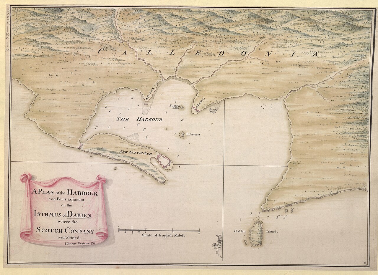
English: A PLAN of the HARBOUR and Parts of adjacent on the ISTHMUS of DARIEN where the SCOTCH COMPANY was settled. / I. Watson: Engineer: 1743. |
||||||||||||||
| Description |
English: A manuscript map of the Scottish settlement in Caledonia Bay (New Caledonia with New Edinburgh and Fort of St. Andrews), in use 1698-1700. The colony was abandoned in 1700 by remaining survivors of malaria (Encyclopædia Britannica). Includes pinpricks. Includes the bay, the settlement, the fort and batteries. Includes trompe-l'œil title vignette. Oriented with South at the top. Paper bears a watermark of a Roman numerical: "IV". Relief shown pictorially and with soundings. |
||||||||||||||
| Date | |||||||||||||||
| Source |
Part of King George III's Topographical Collection. Donated to the nation by George IV. Please do not overwrite this file. Any cropped or modified version should be uploaded with a new name and linked in the "
|
||||||||||||||
| Creator |
Draftsman:
|
||||||||||||||
| Permission (Reusing this file) |
|
||||||||||||||
| Geotemporal data | |||||||||||||||
| Map location |
Darien scheme |
||||||||||||||
| Scale | 1:45,500 | ||||||||||||||
| OpenStreetMap zoom level | 13 | ||||||||||||||
| Bounding box |
|
||||||||||||||
| Georeferencing | If inappropriate please set warp_status = skip to hide. | ||||||||||||||
| Bibliographic data | |||||||||||||||
| Language | English | ||||||||||||||
| Place of publication | [England?] : [Justly Watson] | ||||||||||||||
| Archival data | |||||||||||||||
| Collection | |||||||||||||||
| Accession number |
British Library Maps K.Top.124.24.2 |
||||||||||||||
| Dimensions | height: 34 cm (13.3 in); width: 49 cm (19.2 in) | ||||||||||||||
| Metadata note | Initial version of this page based on information from the BL catalogue entry, updated 2017-12-08. Used with permission. Accessed 2018-09-18. | ||||||||||||||


File history
Click on a date/time to view the file as it appeared at that time.
| Date/Time | Thumbnail | Dimensions | User | Comment | |
|---|---|---|---|---|---|
| current | 11:51, 22 September 2018 | | 6,011 × 4,385 (3.92 MB) | JhealdBot (talk | contribs) | JhealdBot(6): test upload |
You cannot overwrite this file.
File usage on Commons
The following page uses this file:
.jpg)
File usage on other wikis
The following other wikis use this file:
- Usage on en.wikipedia.org
- Usage on es.wikipedia.org
.jpg&oldid=776461755)