Category:Old maps of the Darien colony
Jump to navigation
Jump to search
Media in category "Old maps of the Darien colony"
The following 9 files are in this category, out of 9 total.
-

-

-

-
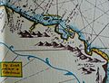 Caledonia, the Scots settlement on the gulf of Darien.jpg 913 × 697; 269 KB
-
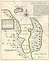 Darien colony.jpg 323 × 400; 45 KB
-
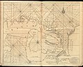 Darien Nautical Chart 1737.jpg 6,704 × 5,460; 8.08 MB
-
 New Caledonia in Darien.jpg 972 × 1,191; 939 KB
-
 New Caledonia in Darien2.jpg 582 × 533; 113 KB
-
 The Scots settlement in America called New Caledonia, A.D. 1699 (4579404788).jpg 3,744 × 5,244; 9.61 MB
.jpg)
.jpg)
.jpg)


.jpg)