File:39°S-Carta Preliminar 3973 Valdivia IGM 1953.pdf
Jump to navigation
Jump to search

Size of this JPG preview of this PDF file: 800 × 572 pixels. Other resolutions: 320 × 229 pixels | 640 × 457 pixels | 1,024 × 732 pixels | 1,280 × 915 pixels | 2,560 × 1,830 pixels | 4,491 × 3,210 pixels.
Original file (4,491 × 3,210 pixels, file size: 1.87 MB, MIME type: application/pdf)
Captions
Captions
Add a one-line explanation of what this file represents
Summary
[edit]| Description |
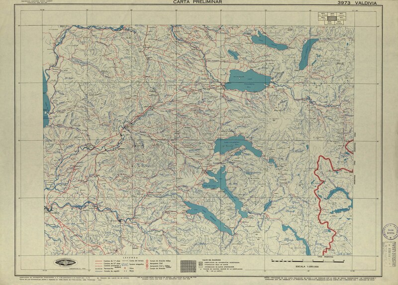
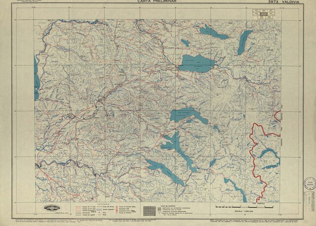
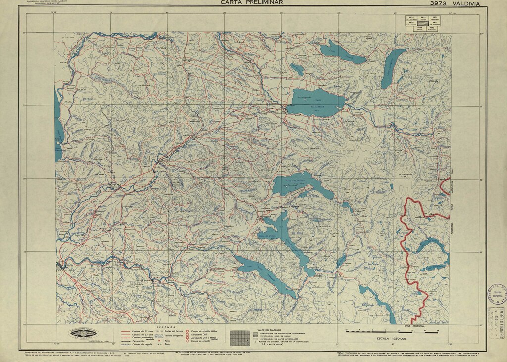
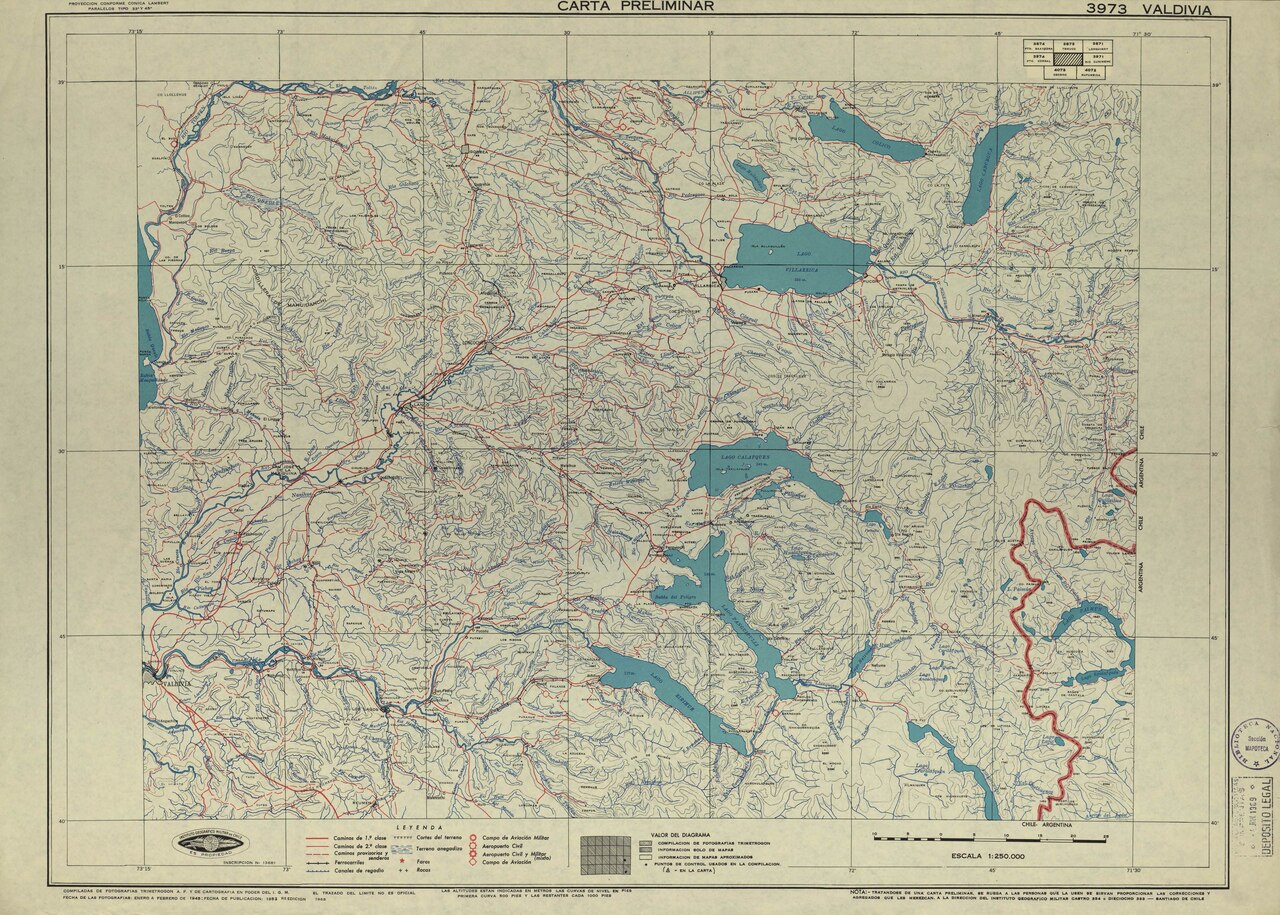
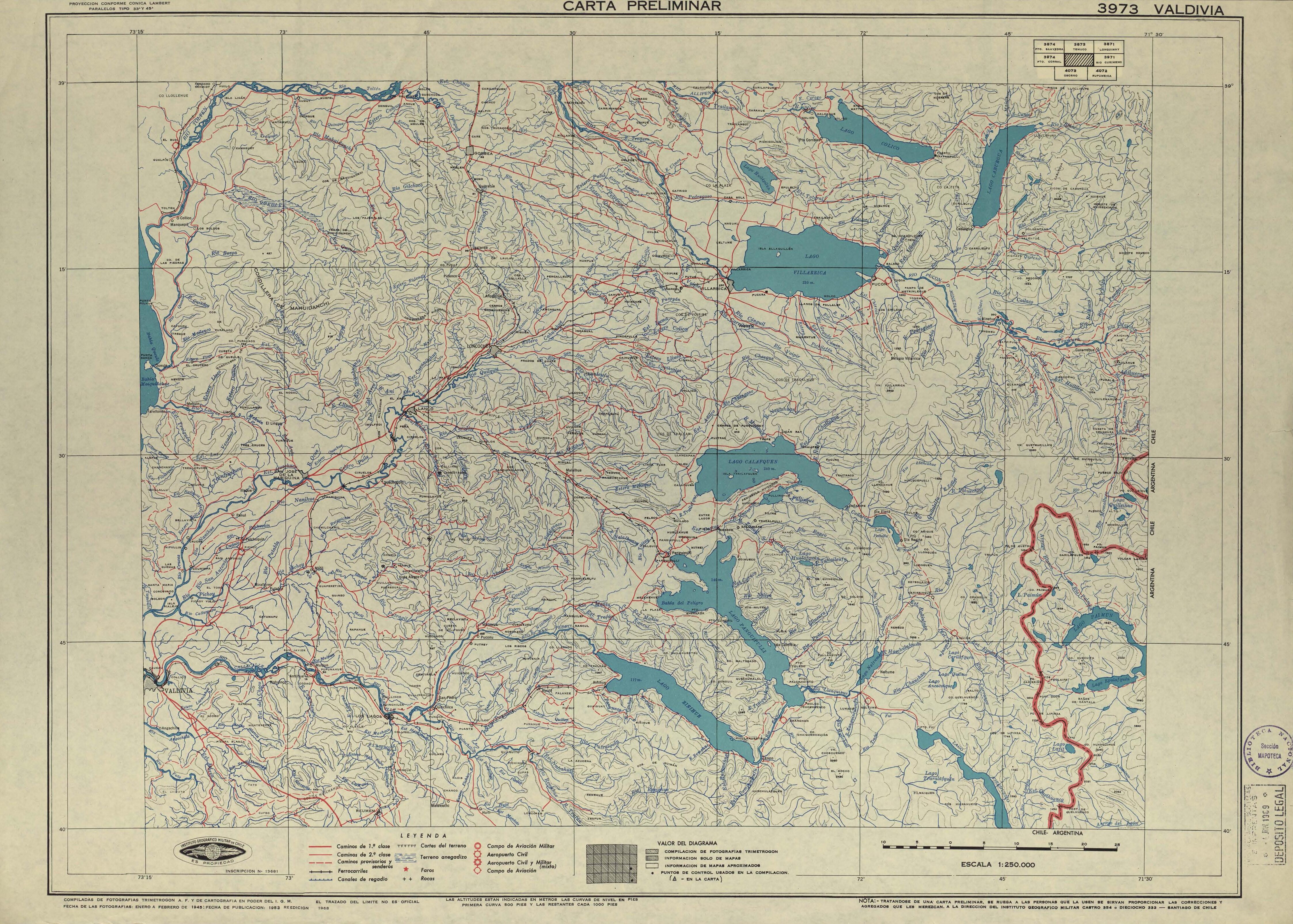
Español: Carta Preliminar elaborada por el Instituto Geográfico Militar en 1953, en base a fotografías aéreas de 1945, versión impresa en 1968 a escala 1:250.000 y corresponde a la actual Región de Los Ríos, la carta incluye por el norte el Lago Collico y Caburgua en la Region de Araucanía y por el sur el Lago Riñihue y Pirehueico. |
| Date | |
| Source | http://www.bibliotecanacionaldigital.gob.cl/bnd/631/w3-article-157120.html |
| Author | Instituto Geográfico Militar |
Licensing
[edit]| This file is made available under the Creative Commons CC0 1.0 Universal Public Domain Dedication. | |
| The person who associated a work with this deed has dedicated the work to the public domain by waiving all of their rights to the work worldwide under copyright law, including all related and neighboring rights, to the extent allowed by law. You can copy, modify, distribute and perform the work, even for commercial purposes, all without asking permission.
|
File history
Click on a date/time to view the file as it appeared at that time.
| Date/Time | Thumbnail | Dimensions | User | Comment | |
|---|---|---|---|---|---|
| current | 00:54, 12 May 2020 |  | 4,491 × 3,210 (1.87 MB) | Yastay (talk | contribs) | Uploaded a work by Instituto Geográfico Militar from http://www.bibliotecanacionaldigital.gob.cl/bnd/631/w3-article-157120.html with UploadWizard |
You cannot overwrite this file.
File usage on Commons
The following 2 pages use this file:
- IGM-Chile
- File:Carta Preliminar 3973 Valdivia IGM 1953.pdf (file redirect)
File usage on other wikis
The following other wikis use this file: