File:1968 The main townships of Fuzhou, Fubei, and Shangdongdu.tif
Jump to navigation
Jump to search

Size of this JPG preview of this TIF file: 697 × 599 pixels. Other resolutions: 279 × 240 pixels | 558 × 480 pixels | 893 × 768 pixels | 1,191 × 1,024 pixels | 2,382 × 2,048 pixels | 5,712 × 4,912 pixels.
Original file (5,712 × 4,912 pixels, file size: 26.76 MB, MIME type: image/tiff)
Captions
Captions
Add a one-line explanation of what this file represents
Summary[edit]
| Description |
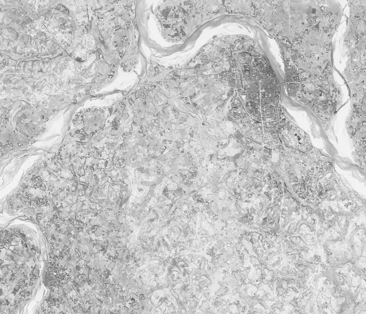
中文(中国大陆):一张同时包含抚州(地图东北部)、抚北(地图西北部)与上顿渡(地图西南部)的摄于1968年的卫星图。
如今,抚州成为了抚州市的主城区、抚北成为了工业园区、上顿渡成为了临川区的行政中心。
English: Satellite map from 1968 showing Fuzhou (north-eastern part of the map), Fubei (north-western part of the map) and Shangdongdu (south-western part of the map).
Today, Fuzhou is the main city of Fuzhou, Fubei is an industrial park, and Shangdongdu is the administrative centre of Linchuan District. |
| Date | |
| Source | https://earthexplorer.usgs.gov/ |
| Author | United States Geological Survey |
Licensing[edit]
This image is in the public domain in the United States because it only contains materials that originally came from the United States Geological Survey, an agency of the United States Department of the Interior. For more information, see the official USGS copyright policy.
|
File history
Click on a date/time to view the file as it appeared at that time.
| Date/Time | Thumbnail | Dimensions | User | Comment | |
|---|---|---|---|---|---|
| current | 15:29, 9 October 2023 |  | 5,712 × 4,912 (26.76 MB) | CandyDada (talk | contribs) | Uploaded a work by United States Geological Survey from https://earthexplorer.usgs.gov/ with UploadWizard |
You cannot overwrite this file.
File usage on Commons
There are no pages that use this file.
File usage on other wikis
The following other wikis use this file:
- Usage on zh.wikipedia.org