File:1853 - Map of the Ottoman Empire, the Black Sea and the frontiers of Russia and Persia.jpg
Jump to navigation
Jump to search

Size of this preview: 800 × 546 pixels. Other resolutions: 320 × 218 pixels | 640 × 437 pixels | 1,024 × 699 pixels | 1,280 × 873 pixels | 2,560 × 1,747 pixels | 15,482 × 10,565 pixels.
Original file (15,482 × 10,565 pixels, file size: 15.87 MB, MIME type: image/jpeg)
Captions
Captions
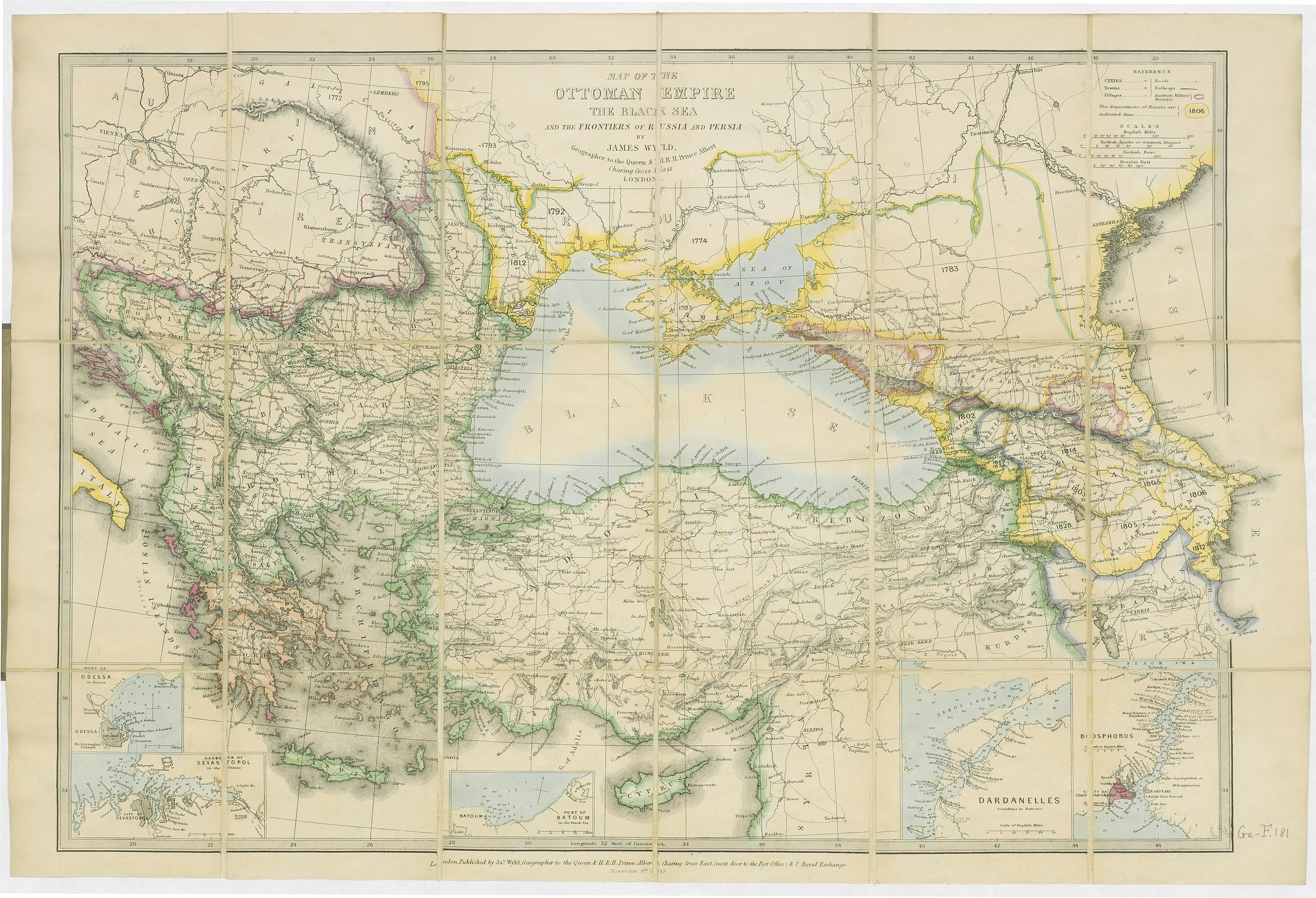
1853 - Map of the Ottoman Empire, the Black Sea and the frontiers of Russia and Persia
Summary
[edit]| Warning | The original file is very high-resolution. It might not load properly or could cause your browser to freeze when opened at full size. |
|---|
| Description |
English: 1853 - Map of the Ottoman Empire, the Black Sea and the frontiers of Russia and Persia |
|||||||||||||||||||||||
| Date | ||||||||||||||||||||||||
| Source |
|
|||||||||||||||||||||||
| Author |
|
|||||||||||||||||||||||

Licensing
[edit]
|
This work is in the public domain in its country of origin and other countries and areas where the copyright term is the author's life plus 70 years or fewer. This work is in the public domain in the United States because it was published (or registered with the U.S. Copyright Office) before January 1, 1929. | |
| This file has been identified as being free of known restrictions under copyright law, including all related and neighboring rights. | |
File history
Click on a date/time to view the file as it appeared at that time.
| Date/Time | Thumbnail | Dimensions | User | Comment | |
|---|---|---|---|---|---|
| current | 19:28, 10 March 2019 | | 15,482 × 10,565 (15.87 MB) | Balkanique (talk | contribs) | User created page with UploadWizard |
You cannot overwrite this file.
File usage on Commons
The following page uses this file: