File:1748 map - An Accurate Chart of the Mediterranean and Adriatic Seas; with the Archipelago & Part of the Black Sea.jpg
Jump to navigation
Jump to search

Size of this preview: 800 × 399 pixels. Other resolutions: 320 × 160 pixels | 640 × 319 pixels | 1,024 × 511 pixels | 1,280 × 639 pixels | 2,560 × 1,277 pixels | 14,020 × 6,996 pixels.
Original file (14,020 × 6,996 pixels, file size: 13.19 MB, MIME type: image/jpeg)
Captions
Captions
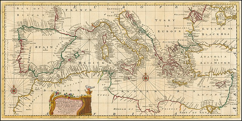
1748 map - An Accurate Chart of the Mediterranean and Adriatic Seas; with the Archipelago & Part of the Black Sea
Summary[edit]
| Warning | The original file is very high-resolution. It might not load properly or could cause your browser to freeze when opened at full size. |
|---|
| Description |
English: 1748 map - An Accurate Chart of the Mediterranean and Adriatic Seas; with the Archipelago & Part of the Black Sea |
|||||||||||||||||||||||
| Date | ||||||||||||||||||||||||
| Source | https://www.raremaps.com/gallery/detail/57309/an-accurate-chart-of-the-mediterranean-and-adriatic-seas-wi-bowen | |||||||||||||||||||||||
| Author |
|
|||||||||||||||||||||||

Licensing[edit]
|
This work is in the public domain in its country of origin and other countries and areas where the copyright term is the author's life plus 70 years or fewer. This work is in the public domain in the United States because it was published (or registered with the U.S. Copyright Office) before January 1, 1929. | |
| This file has been identified as being free of known restrictions under copyright law, including all related and neighboring rights. | |
File history
Click on a date/time to view the file as it appeared at that time.
| Date/Time | Thumbnail | Dimensions | User | Comment | |
|---|---|---|---|---|---|
| current | 20:12, 20 February 2020 | | 14,020 × 6,996 (13.19 MB) | Balkanique (talk | contribs) | User created page with UploadWizard |
You cannot overwrite this file.
File usage on Commons
The following 73 pages use this file:
- User:Magog the Ogre/Multilingual legend/2020 February 20-29
- File:1747 Baghdad detail New and Accurate Map of Persia by Emanuel Bowen.png
- File:1747 Bokara detail New and Accurate Map of Persia by Emanuel Bowen.png
- File:1747 Bowen Map of the North Atlantic Islands, Greenland, Iceland, Faroe Islands (Maelstrom) - Geographicus - OldGreenland-bowen-1747.jpg
- File:1747 Cabul detail New and Accurate Map of Persia by Emanuel Bowen.png
- File:1747 Candahar detail New and Accurate Map of Persia by Emanuel Bowen.png
- File:1747 Samarkand detail New and Accurate Map of Persia by Emanuel Bowen.png
- File:1748 map - An Accurate Chart of the Mediterranean and Adriatic Seas; with the Archipelago & Part of the Black Sea.jpg
- File:A New and Accurate Map of Africa. Drawn from the best & most approved Modern Maps and Charts and regulated by Astronomical Observations by Eman Bowen CTASC.jpg
- File:A SEQUEL of the Seat of WAR in the WEST INDIES, Containing - Emanuel Bowen, 1740 - BL Maps K.Top.124.21 (BLL01018640977).jpg
- File:A correct draught of the North Pole and of all the countries hitherto discovered intercepted between the pole and the parallel of 50 degrees.jpg
- File:A new & accurate map of the island of Cuba. A new & accurate map of the islands of Hispaniola or St. Domingo and Porto Rico. LOC 74693277.jpg
- File:An Accurate Map of Hereford Shire Divided into its Hundreds, Emanuel Bowen... 1755 pub. I. Tinney.jpg
- File:Bowen, Emanuel. Anatolia, Syria. 1747. (A).jpg
- File:Bowen, Emanuel. Anatolia, Syria. 1747. (B).jpg
- File:Bowen, Emanuel. Anatolia, Syria. 1747. (C).jpg
- File:Bowen, Emanuel. Anatolia, Syria. 1747.jpg
- File:Bowen, Emanuel. Anatolia, Syria. 1747 (D).jpg
- File:Bowen, Emanuel. Persia, adjacent countries. 1747.jpg
- File:Bowen, Emanuel. Persia, adjacent countries. 1747 (A).jpg
- File:Bowen, Emanuel. Persia, adjacent countries. 1747 (B).jpg
- File:Bowen, Emanuel. Persia, adjacent countries. 1747 (BA).jpg
- File:Bowen, Emanuel. Persia, adjacent countries. 1747 (BB).jpg
- File:Bowen, Emanuel. Persia, adjacent countries. 1747 (BC).jpg
- File:Bowen, Emanuel. Persia, adjacent countries. 1747 (C).jpg
- File:Bowen, Emanuel. Persia, adjacent countries. 1747 (D).jpg
- File:Bowen, Emanuel. Persia, adjacent countries. 1747 (DA).jpg
- File:Bowen, Emanuel. Persia, adjacent countries. 1747 (DB).jpg
- File:Bowen, Emanuel. Persia, adjacent countries. 1747 (DC).jpg
- File:Bowen, Emanuel. Persia, adjacent countries. 1747 (E).jpg
- File:Bowen, Emanuel; Orbeliani, Sulxan-Saba. A new and accurate map of the Caspian Sea. 1747. (A).jpg
- File:Bowen, Emanuel; Orbeliani, Sulxan-Saba. A new and accurate map of the Caspian Sea. 1747.jpg
- File:Bowen - Britannia Depicta (Berkshire).jpg
- File:Bowen - Britannia Depicta (The West Riding of Yorkshire).jpg
- File:Bowen - Britannica Depicta (Cardigan).jpg
- File:Bowen Mexico or New Spain 1752 UTA.jpg
- File:Broxash Hundred in An Accurate Map of Hereford Shire Divided into its Hundreds, Emanuel Bowen... 1755 pub. I. Tinney.jpg
- File:Emanuel Bowen, A MAP of TURKY, LITTLE TARTARY, and the Countries between the EUXINE and CASPIAN SEAS (FL36011262 2906444).jpg
- File:Emanuel Bowen, A New and accurate map of the Western parts of Barbary. containing Fez, Morocco, Algiers, Tunis & Biledulgerid (FL13726059 2495215).jpg
- File:Emanuel Bowen, A map of the journey in the wilderness and of the conquest and partition of the Land of Canaan by the Children of Israel (FL37121857 3897963).jpg
- File:Emanuel Bowen, A map of the kingdoms of Judah and Israel, according to this history (FL37121862 3897965).jpg
- File:Emanuel Bowen, A new & accurate map of the North Pole (FL37810584 3150547).jpg
- File:Emanuel Bowen, A new and accurate map of Anatolia or Asia Minor (FL35868071 2714634).jpg
- File:Emanuel Bowen, A new and accurate map of Nubia & Abissinia (FL13723585 2493169).jpg
- File:Emanuel Bowen, A new and accurate map of Turkey in Asia, Arabia &c (FL36010819 2716604).jpg
- File:Emanuel Bowen, A plan of the city of Jerusalem according to the description (FL36012270 3897952).jpg
- File:Emanuel Bowen, An accurate map of Turkey in Asia Arabia & c (FL35865298 2491810).jpg
- File:Emanuel Bowen, An accurate map of Turkey in Europe with Hungary, Transilvania and Little Tartary (FL35069274 2528013).jpg
- File:Emanuel Bowen, Nieuwe en naukeurige kaart van Arabien Asiatisch Turkyen enz (FL33131150 2490903).jpg
- File:Emanuel Bowen, Nieuwe kaart van China (FL25569918 2467595).jpg
- File:Ewias Lacy Hundred in An Accurate Map of Hereford Shire Divided into its Hundreds, Emanuel Bowen... 1755 pub I. Tinney.jpg
- File:From a map by Emanuel Bowen, 1744.jpg
- File:Greytree Hundred in An Accurate Map of Hereford Shire Divided into its Hundreds, Emanuel Bowen... 1755 pub. I. Tinney.jpg
- File:Grimsworth Hundred in An Accurate Map of Hereford Shire Divided into its Hundreds, Emanuel Bowen... 1755 pub. I. Tinney.jpg
- File:Huntington Hundred in An Accurate Map of Hereford Shire Divided into its Hundreds, Emanuel Bowen... 1755 pub. I. Tinney.jpg
- File:Little Birch in Wormlow Hundred in An Accurate Map of Hereford Shire Divided into its Hundreds, Emanuel Bowen... 1755 pub. I. Tinney.jpg
- File:Map of the Arctic, 1780s.jpeg
- File:Map of the Arctic, 1780s - B&W.jpeg
- File:New and accurate map of Persia.jpg
- File:Persian(IRAN) Empire 1747.jpg
- File:Radlow Hundred in An Accurate Map of Hereford Shire Divided into its Hundreds, Emanuel Bowen... 1755 pub. I. Tinney.jpg
- File:Safavid Persian Empire.jpg
- File:Safavid Persian Empire cropped - Caucasus.jpg
- File:Sayer Accurate Map of North America 1775 UTA (bottom).jpg
- File:Sayer Accurate Map of North America 1775 UTA (top).jpg
- File:Stretford Hundred in An Accurate Map of Hereford Shire Divided into its Hundreds, Emanuel Bowen... 1755 pub. I. Tinney.jpg
- File:Webtree Hundred in An Accurate Map of Hereford Shire Divided into its Hundreds, Emanuel Bowen... 1755 pub. I. Tinney.jpg
- File:Wigmore Hundred in An Accurate Map of Hereford Shire Divided into its Hundreds, Emanuel Bowen... 1755 pub. I. Tinney.jpg
- File:Wolphy Hundred in An Accurate Map of Hereford Shire Divided into its Hundreds, Emanuel Bowen... 1755 pub. I. Tinney.jpg
- File:Wormlow Hundred in An Accurate Map of Hereford Shire Divided into its Hundreds, Emanuel Bowen... 1755 pub. I. Tinney.jpg
- File:گیلان در نقشه امپراطوری افشاریه سال 1747 میادی.jpg
- Category:Emanuel Bowen
- Creator:Emanuel Bowen
_-_Geographicus_-_OldGreenland-bowen-1747.jpg)
.jpg)
.jpg)
.jpg)
.jpg)
.jpg)
.jpg)
.jpg)
.jpg)
.jpg)
.jpg)
.jpg)
.jpg)
.jpg)
.jpg)
.jpg)
.jpg)
.jpg)
.jpg)
.jpg)
.jpg)
.jpg)
.jpg)
.jpg)
.jpg)
.jpg)
.jpg)
.jpg)
.jpg)
.jpg)
.jpg)
.jpg)
.jpg)
.jpg)
_Empire_1747.jpg)
.jpg)
.jpg)
File usage on other wikis
The following other wikis use this file:
- Usage on ar.wikipedia.org
- Usage on fr.wikipedia.org
- Usage on sh.wikipedia.org
- Usage on uk.wikipedia.org
- Usage on www.wikidata.org