File:116 Inch Elevations from a Planting Plan Proposed to Provide a Setting for Washington Memorial Arch at Valley Forge Park, PA (96bc2cd375fa46548875fbebabd6a654).pdf
Jump to navigation
Jump to search

Size of this JPG preview of this PDF file: 800 × 427 pixels. Other resolutions: 320 × 171 pixels | 640 × 341 pixels | 1,024 × 546 pixels | 1,280 × 683 pixels | 2,560 × 1,365 pixels | 5,572 × 2,972 pixels.
Original file (5,572 × 2,972 pixels, file size: 8.83 MB, MIME type: application/pdf)
Captions
Captions
Add a one-line explanation of what this file represents

|
The categories of this image need checking. You can do so here.
|
Summary[edit]
| Description |
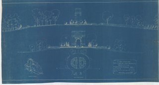
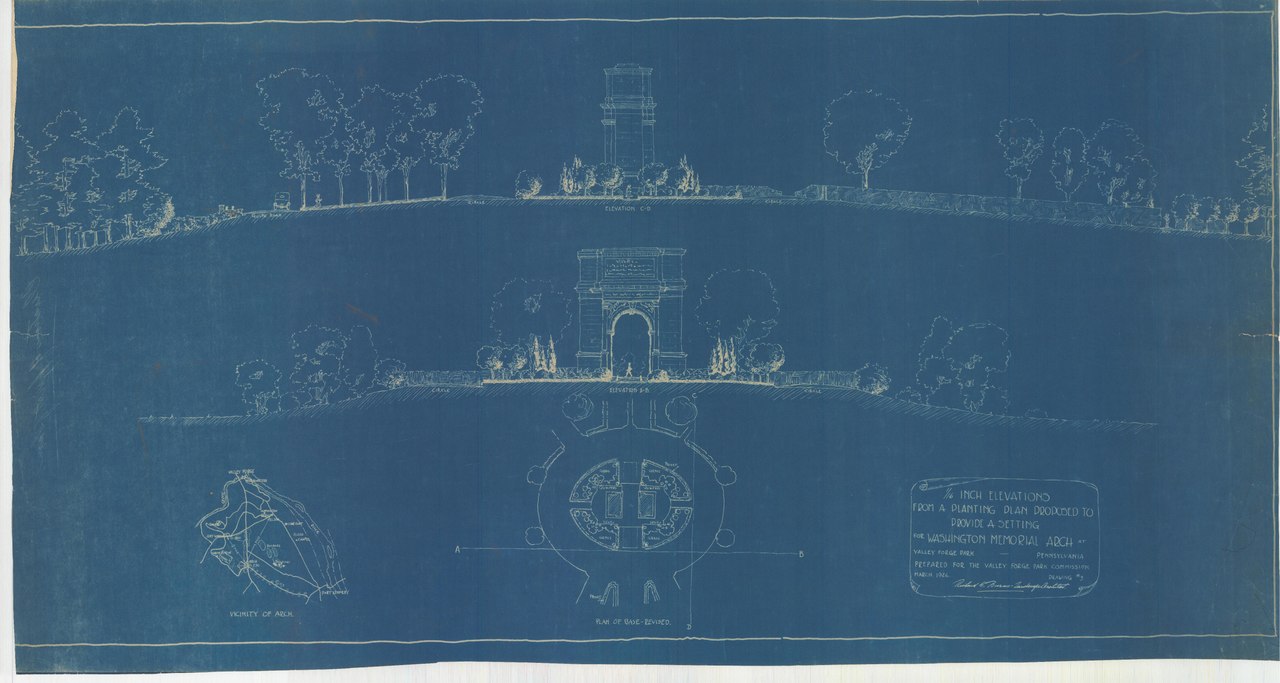
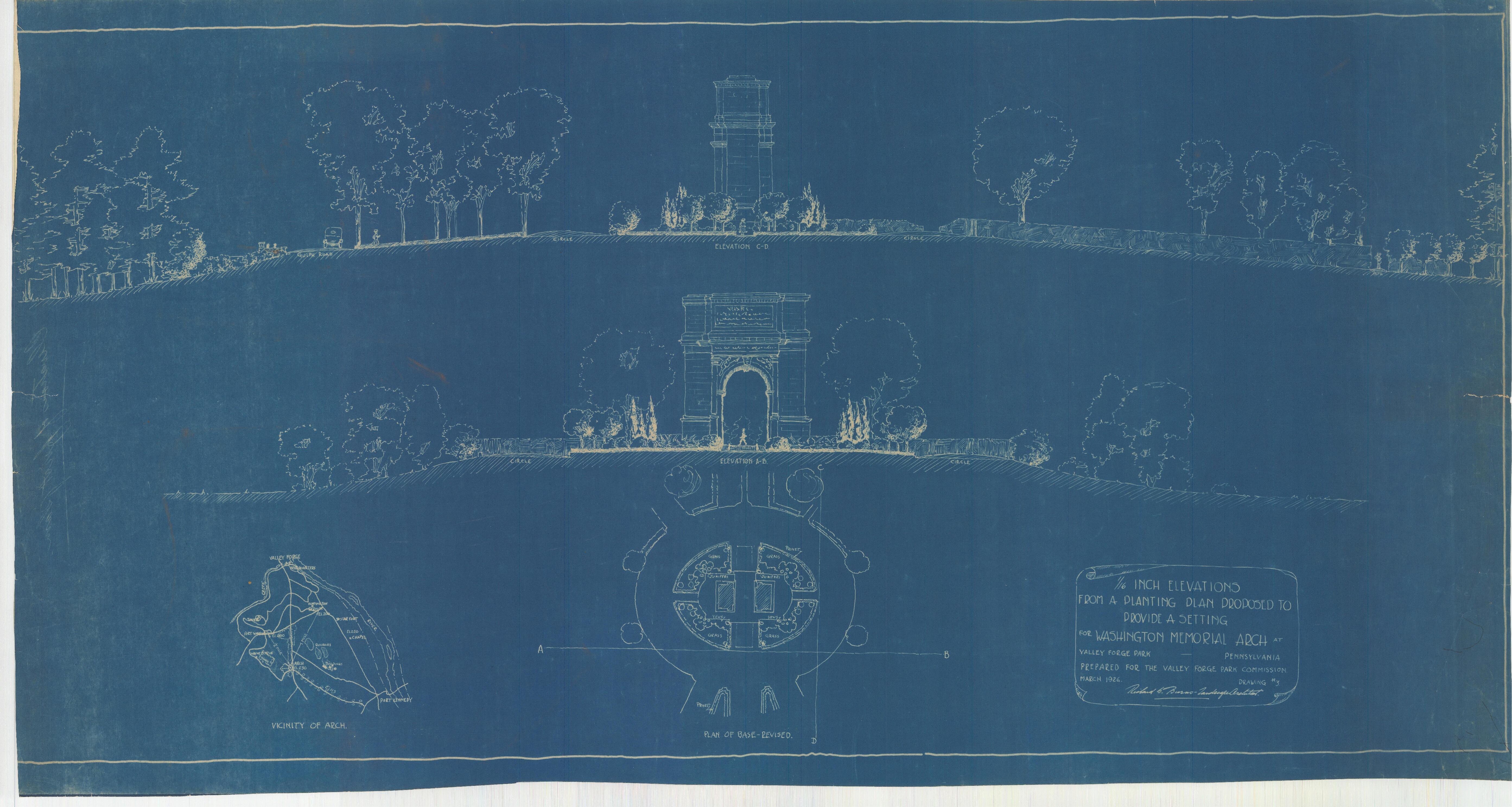
English: MapId: 5 MapNo: G5 Material:Blueprint of G4 Richard S Burns Collection, G Series: Memorial Arch
|
||
| Date | |||
| Source |
English: NPGallery |
||
| Author | Unknown author | ||
| Permission (Reusing this file) |
|
||
| Contacts | English: Person: Curator Organization: US National Park Service Address: Valley Forge National Historic Park, King of Prussia PA |
||
| NPS Unit Code | VAFO | ||
| Depicted Place | English: Valley Forge National Historical Park |
||
| Accession Number | 96bc2cd375fa46548875fbebabd6a654 | ||
| Publisher | English: U. S. National Park Service |
File history
Click on a date/time to view the file as it appeared at that time.
| Date/Time | Thumbnail | Dimensions | User | Comment | |
|---|---|---|---|---|---|
| current | 17:14, 15 January 2022 |  | 5,572 × 2,972 (8.83 MB) | BMacZeroBot (talk | contribs) | Batch upload (Commons:Batch uploading/NPGallery) |
You cannot overwrite this file.
File usage on Commons
There are no pages that use this file.