File:017 001.jpg
Jump to navigation
Jump to search
Size of this preview: 800 × 582 pixels. Other resolutions: 320 × 233 pixels | 640 × 466 pixels | 816 × 594 pixels.
Original file (816 × 594 pixels, file size: 102 KB, MIME type: image/jpeg)
Captions
Captions
Add a one-line explanation of what this file represents
Summary[edit]
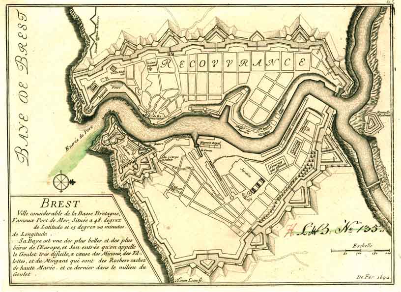
| Description | Carte de la ville de Brest (1692) |
| Date | |
| Source | Archives Militaires Suèdoises |
| Author | Nicolas de Fer (1646-1720) |
| Object location | | View this and other nearby images on: OpenStreetMap |
|---|
Licensing[edit]
|
This work is in the public domain in its country of origin and other countries and areas where the copyright term is the author's life plus 100 years or fewer. | |
| This file has been identified as being free of known restrictions under copyright law, including all related and neighboring rights. | |
File history
Click on a date/time to view the file as it appeared at that time.
| Date/Time | Thumbnail | Dimensions | User | Comment | |
|---|---|---|---|---|---|
| current | 14:40, 28 February 2007 | | 816 × 594 (102 KB) | S. DÉNIEL (talk | contribs) | {{Information |Description= Carte de la ville de Brest (1692) |Source= Archives Militaires Suèdoises [http://www.ra.se] |Date= 1692 |Author= |Permission= |other_versions= }} |
You cannot overwrite this file.
File usage on Commons
The following 3 pages use this file:
File usage on other wikis
The following other wikis use this file:
- Usage on fr.wikipedia.org