Edinburgh Trams: maps
Jump to navigation
Jump to search
English: Maps of the Edinburgh Trams system.
Proposal/planning maps[edit]
Proposed line maps[edit]
-
 Initial planned construction phase (with proposed Lines 1 & 2)
 -
 Proposed Line 1 (with Line 2)
 -
 Proposed Line 2 (with Line 1)
 -
 Proposed Line 3 (with Line 1 & 2)
 -
 Proposed Line 1 & 2 with phases

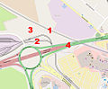
Edinburgh Gateway station[edit]
-
 general location map with tram line and railways
 -
 location map (blank)
 -
 location map (labelled)


.jpg)
As built maps[edit]
Whole route maps[edit]
-
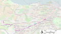 stop map till June 2023
 -
 stop map after June 2023
 -
 route diagram, w/ interchanges
 -
 track diagram


Stop to stop section maps (OSM zoom 16)[edit]
_(OSM_standard,_zoom_16).jpg)
_(OSM_standard,_zoom_16).jpg)
.jpg)
_(OSM_standard,_zoom_16).jpg)
_(OSM_standard,_zoom_16).jpg)
_(OSM_standard,_zoom_16).jpg)
_(OSM_standard,_zoom_16).jpg)
_(OSM_standard,_zoom_16).jpg)
_(OSM_standard,_zoom_16).jpg)
_(OSM_standard,_zoom_16).jpg)
_(OSM_standard,_zoom_16).jpg)
_(OSM_standard,_zoom_16).jpg)
_(OSM_standard,_zoom_16).jpg)
.jpg)
Other section maps[edit]
-
 street running section stop map, with mainline railway
 -
 street running section stop map, with mainline railway till June 2023
 -
 the section which was built using the former West Edinburgh Busway
 -
 Depot area
 -
 Depot site
 -


.jpg)
.jpg)
.jpg)
Stop maps[edit]
OSM zoom 16[edit]
.jpg)
.jpg)
.jpg)
.jpg)
.jpg)
.jpg)
.jpg)
.jpg)
.jpg)
.jpg)
.jpg)
.jpg)
.jpg)
.jpg)
OSM zoom 17[edit]
.jpg)
.jpg)
.jpg)
.jpg)
.jpg)
.jpg)
.jpg)
.jpg)
.jpg)
.jpg)
.jpg)
.jpg)
.jpg)
.jpg)
.jpg)
OSM zoom 18[edit]
(certain maps not created as they don't show anything not visible at level 17)
.jpg)

.jpg)
.jpg)
.jpg)
.jpg)
.jpg)
.jpg)
.jpg)