Commons:Wiki Loves Monuments in Switzerland/Graubünden/A-E

From Wikimedia Commons, the free media repository
Jump to navigation Jump to search

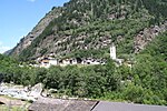
Albula/Alvra

Location Upload Photo Object Cat. Coordinates KGS-Nr
Albula/Alvra Upload a file
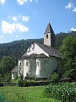
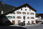
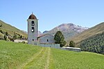
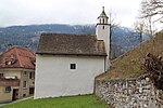
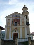
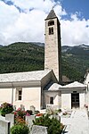
Baselgia catolica S. Franzestg e chasa pravenda A 46°39′01″N 9°33′54″E / 46.650416°N 9.565053°E / 46.650416; 9.565053 3115
Albula/Alvra Upload a file Baselgia catolica S. Stefan e conturn
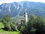
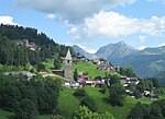
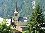
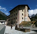
Baselgia catolica S. Stefan e conturn A 46°39′42″N 9°34′30″E / 46.66156°N 9.575007°E / 46.66156; 9.575007 3349
Albula/Alvra Upload a file
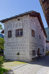
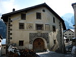
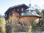
Tgesa Gronda A 46°40′13″N 9°34′34″E / 46.670402°N 9.576167°E / 46.670402; 9.576167 10035
Albula/Alvra Upload a file
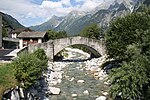
Alvaneu-Bad, Punt B 46°40′05″N 9°38′57″E / 46.66807°N 9.64912°E / 46.66807; 9.64912 2827
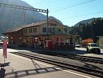
Albula/Alvra Upload a file Bahnhof mit Expressbuffet
Bahnhof mit Expressbuffet B 46°39′50″N 9°34′21″E / 46.66394°N 9.57262°E / 46.66394; 9.57262 10820
Albula/Alvra Upload a file Baselgia c.
Baselgia c. B 46°40′46″N 9°38′44″E / 46.67958°N 9.64563°E / 46.67958; 9.64563 2825
Albula/Alvra Upload a file Baselgia c. S. Madlaina
Baselgia c. S. Madlaina B 46°39′51″N 9°32′29″E / 46.66408°N 9.54125°E / 46.66408; 9.54125 3321
Albula/Alvra Upload a file
Baselgia c. Sogn Gieri B 46°39′55″N 9°36′42″E / 46.66528°N 9.61162°E / 46.66528; 9.61162 3326
Albula/Alvra Upload a file Baselgia catolic S. Calist
Baselgia catolic S. Calist B 46°40′07″N 9°35′42″E / 46.66865°N 9.5949°E / 46.66865; 9.5949 2885
Albula/Alvra Upload a file
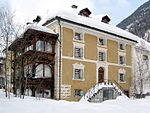
Chasa Christian Platz, Nr. 69 B 46°40′47″N 9°38′39″E / 46.67973°N 9.64429°E / 46.67973; 9.64429 2826
Albula/Alvra Upload a file
Kalkwerk B 46°40′04″N 9°37′21″E / 46.66768°N 9.62244°E / 46.66768; 9.62244 3327
Albula/Alvra Upload a file
La Tor B 46°39′50″N 9°32′27″E / 46.66386°N 9.54079°E / 46.66386; 9.54079 3322
Albula/Alvra Upload a file Ruina Belfort
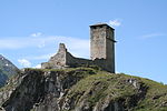
Ruina Belfort A 46°40′16″N 9°36′37″E / 46.671152777°N 9.610416666°E / 46.671152777; 9.610416666 2884
Albula/Alvra Upload a file
Tgav da geis (Gipsgrube) B 46°40′26″N 9°33′41″E / 46.67375°N 9.56141°E / 46.67375; 9.56141 2830
Albula/Alvra Upload a file
Tgesa Brancaleone B 46°39′53″N 9°36′36″E / 46.66486°N 9.60991°E / 46.66486; 9.60991 3328
Albula/Alvra Upload a file
Tgesa Gallin B 46°38′55″N 9°33′53″E / 46.64866°N 9.56476°E / 46.64866; 9.56476 3117
Albula/Alvra Upload a file
Tgesa Son Gieri B 46°40′31″N 9°33′05″E / 46.67523°N 9.55141°E / 46.67523; 9.55141 2831
Albula/Alvra Upload a file Alvagni
Alvagni ISOS 46°40′59″N 9°38′59″E / 46.683055555°N 9.649722222°E / 46.683055555; 9.649722222
Albula/Alvra Upload a file Alvaschagn
Alvaschagn ISOS 46°39′59″N 9°32′59″E / 46.666388888°N 9.549722222°E / 46.666388888; 9.549722222
Albula/Alvra Upload a file Brinzauls
Brinzauls ISOS 46°40′00″N 9°35′59″E / 46.666666666°N 9.599722222°E / 46.666666666; 9.599722222
Albula/Alvra Upload a file Stierva
Stierva ISOS 46°38′59″N 9°32′00″E / 46.649722222°N 9.533333333°E / 46.649722222; 9.533333333

Almens

Location Upload Photo Object Cat. Coordinates KGS-Nr
Almens Upload a file Reformierte Kirche
Reformierte Kirche B 46°44′16″N 9°27′18″E / 46.7379°N 9.45487°E / 46.7379; 9.45487 10030

Alvaschagn

Location Upload Photo Object Cat. Coordinates KGS-Nr
Alvaschagn Upload a file Son Peder Mistail
Son Peder Mistail A 46°40′00″N 9°33′40″E / 46.666666666°N 9.561111111°E / 46.666666666; 9.561111111 2828
Alvaschagn Upload a file Soliser Viadukt
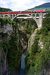
Soliser Viadukt B 46°40′44″N 9°31′51″E / 46.67889°N 9.53078°E / 46.67889; 9.53078 2829

Andeer

Location Upload Photo Object Cat. Coordinates KGS-Nr
Andeer Upload a file Reformierte Kirche Clugin
Reformierte Kirche Clugin B 46°37′01″N 9°25′38″E / 46.61684°N 9.42729°E / 46.61684; 9.42729 2962
Andeer Upload a file Chasa Padrun Nr. 64
Chasa Padrun Nr. 64 A 46°36′09″N 9°25′37″E / 46.602637°N 9.426882°E / 46.602637; 9.426882 2833
Andeer Upload a file
Clugin, Wohnhaus Demarmels B 46°37′02″N 9°25′34″E / 46.61724°N 9.42601°E / 46.61724; 9.42601 10734
Andeer Upload a file
Pferdewechselstation und Badhaus B 46°36′49″N 9°25′50″E / 46.61369°N 9.43065°E / 46.61369; 9.43065 3132
Andeer Upload a file
Tgea Conrad B 46°36′01″N 9°25′40″E / 46.60016°N 9.4278°E / 46.60016; 9.4278 2834
Andeer Upload a file Tgea Melchior
Tgea Melchior B 46°36′00″N 9°25′41″E / 46.60008°N 9.42795°E / 46.60008; 9.42795 12424
Andeer Upload a file Tgea Veia Granda
Tgea Veia Granda B 46°36′12″N 9°25′34″E / 46.6034°N 9.42615°E / 46.6034; 9.42615 10721
Andeer Upload a file Wohnhaus
Wohnhaus B 46°37′02″N 9°25′36″E / 46.61709°N 9.42655°E / 46.61709; 9.42655 10733
Andeer Upload a file
Andeer ISOS 46°36′10″N 9°25′36″E / 46.6029°N 9.4267°E / 46.6029; 9.4267
Andeer Upload a file Pignia
Pignia ISOS 46°35′59″N 9°25′59″E / 46.599722222°N 9.433055555°E / 46.599722222; 9.433055555

Ardez

Location Upload Photo Object Cat. Coordinates KGS-Nr
Ardez Upload a file Cha Isla
Cha Isla A 46°46′32″N 10°11′57″E / 46.775433°N 10.199246°E / 46.775433; 10.199246 10379
Ardez Upload a file Ruine Steinsberg
Ruine Steinsberg A 46°46′28″N 10°12′18″E / 46.774376°N 10.204983°E / 46.774376; 10.204983 9611
Ardez Upload a file Sur En
Sur En ISOS 46°45′59″N 10°10′33″E / 46.766389°N 10.175833°E / 46.766389; 10.175833
Ardez Upload a file Reformierte Kirche
Reformierte Kirche B 46°46′31″N 10°12′07″E / 46.77539°N 10.20202°E / 46.77539; 10.20202 2837
Ardez Upload a file Reformierte Kirche
Reformierte Kirche B 46°45′59″N 10°10′32″E / 46.76646°N 10.17568°E / 46.76646; 10.17568 12426

Arosa

Location Upload Photo Object Cat. Coordinates KGS-Nr
Arosa Upload a file Reformierte Kirche St. Peter
Reformierte Kirche St. Peter B 46°50′03″N 9°38′38″E / 46.834288°N 9.643888°E / 46.834288; 9.643888 10806
Arosa Upload a file Medergen
Medergen ISOS 46°48′15″N 9°44′22″E / 46.8043°N 9.73947°E / 46.8043; 9.73947
Arosa Upload a file Reformierte Kirche Castiel
Reformierte Kirche Castiel B 46°50′18″N 9°36′07″E / 46.8384215°N 9.601831°E / 46.8384215; 9.601831 12435
Arosa Upload a file Reformierte Kirche Langwies
Reformierte Kirche Langwies B 46°49′13″N 9°42′47″E / 46.820331°N 9.71319°E / 46.820331; 9.71319 3059
Arosa Upload a file Reformierte Kirche Lüen
Reformierte Kirche Lüen B 46°49′58″N 9°36′46″E / 46.8329025°N 9.612886°E / 46.8329025; 9.612886 3073
Arosa Upload a file
Sapün ISOS 46°48′53″N 9°45′48″E / 46.8147°N 9.76331°E / 46.8147; 9.76331
Arosa Upload a file Heimatmuseum Schanfigg-Arosa
Heimatmuseum Schanfigg-Arosa B 46°40′00″N 9°33′39″E / 46.666682°N 9.560961°E / 46.666682; 9.560961 2848
Arosa Upload a file Carschlingg, prähistorische/spätrömische-frühmittelalterliche Siedlung
Carschlingg, prähistorische/spätrömische-frühmittelalterliche Siedlung A 46°50′18″N 9°36′07″E / 46.838422°N 9.601831°E / 46.838422; 9.601831 9613
Arosa Upload a file
Wohnhaus Malisch B 46°50′15″N 9°38′24″E / 46.837511°N 9.640086°E / 46.837511; 9.640086 10752
Arosa Upload a file
Strassberg ISOS 46°50′42″N 9°45′01″E / 46.8451°N 9.7502°E / 46.8451; 9.7502
Arosa Upload a file Calfreisen
Calfreisen ISOS 46°49′59″N 9°35′00″E / 46.833055555°N 9.583333333°E / 46.833055555; 9.583333333

Aschera

Location Upload Photo Object Cat. Coordinates KGS-Nr
Aschera Upload a file Reformierte Kirche St. Johann
Reformierte Kirche St. Johann B 46°58′13″N 9°41′18″E / 46.97022°N 9.68827°E / 46.97022; 9.68827 10785
Aschera Upload a file Reformierte Kirche Schuders
Reformierte Kirche Schuders B 46°59′28″N 9°44′18″E / 46.99108°N 9.73832°E / 46.99108; 9.73832 3244
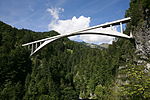
Aschera Upload a file Salginatobelbrücke
Salginatobelbrücke A 46°58′55″N 9°43′04″E / 46.981819444°N 9.717725°E / 46.981819444; 9.717725 3243

Avras

Location Upload Photo Object Cat. Coordinates KGS-Nr
Avras Upload a file Reformierte Kirche
Reformierte Kirche A 46°28′17″N 9°30′55″E / 46.471379°N 9.51524°E / 46.471379; 9.51524 2855
Avras Upload a file
Am Bach, Mittla-Hus B 46°27′31″N 9°32′13″E / 46.45871°N 9.53706°E / 46.45871; 9.53706 2857
Avras Upload a file
Camp sut, Armenhaus (Burdelski) B 46°29′14″N 9°28′41″E / 46.48728°N 9.47809°E / 46.48728; 9.47809 2858
Avras Upload a file
Averser Hofweiler ISOS 46°27′37″N 9°32′00″E / 46.4603°N 9.5332°E / 46.4603; 9.5332

Bergün Filisur

Location Upload Photo Object Cat. Coordinates KGS-Nr
Bergün Filisur Upload a file
Bravuogn ISOS 46°37′45″N 9°44′43″E / 46.62921°N 9.74537°E / 46.62921; 9.74537
Bergün Filisur Upload a file Latsch
Latsch ISOS 46°38′01″N 9°45′07″E / 46.6336°N 9.75194°E / 46.6336; 9.75194
Bergün Filisur Upload a file Stugl
Stugl ISOS 46°39′02″N 9°43′53″E / 46.6506°N 9.73139°E / 46.6506; 9.73139

Bever

Location Upload Photo Object Cat. Coordinates KGS-Nr
Bever Upload a file Reformierte Kirche Bever
Reformierte Kirche Bever B 46°33′08″N 9°53′21″E / 46.55229°N 9.88924°E / 46.55229; 9.88924 2872
Bever Upload a file
Chesa Guidon B 46°33′10″N 9°53′22″E / 46.55277°N 9.88955°E / 46.55277; 9.88955 10724
Bever Upload a file
Chesa Orlandi B 46°33′13″N 9°53′22″E / 46.55357°N 9.88956°E / 46.55357; 9.88956 12434
Bever Upload a file
Chesa Salis B 46°33′13″N 9°53′29″E / 46.55367°N 9.89139°E / 46.55367; 9.89139 10033
Bever Upload a file Hotel Chesa Salis
Hotel Chesa Salis B 46°33′14″N 9°53′30″E / 46.55375°N 9.89179°E / 46.55375; 9.89179 12433

Bondo

Location Upload Photo Object Cat. Coordinates KGS-Nr
Bondo Upload a file Palazzo Salis
Palazzo Salis A 46°20′08″N 9°33′14″E / 46.335486°N 9.5538°E / 46.335486; 9.5538 2878

Bravuogn

Location Upload Photo Object Cat. Coordinates KGS-Nr
Bravuogn Upload a file Reformierte Kirche Latsch
Reformierte Kirche Latsch B 46°38′01″N 9°45′08″E / 46.6335°N 9.752111111°E / 46.6335; 9.752111111 2866
Bravuogn Upload a file Reformierte Kirche Stugl
Reformierte Kirche Stugl A 46°39′01″N 9°43′54″E / 46.650361111°N 9.731611111°E / 46.650361111; 9.731611111 2860
Bravuogn Upload a file Kurhaus Bergün
Kurhaus Bergün B 46°37′45″N 9°44′54″E / 46.6292°N 9.74826°E / 46.6292; 9.74826 12431
Bravuogn Upload a file Reformierte Kirche Bergün
Reformierte Kirche Bergün B 46°37′36″N 9°44′58″E / 46.62655°N 9.74956°E / 46.62655; 9.74956 2862
Bravuogn Upload a file Chasa Jenatsch, Wohnhaus mit Stallscheune
Chasa Jenatsch, Wohnhaus mit Stallscheune A 46°37′47″N 9°44′43″E / 46.629595°N 9.745262°E / 46.629595; 9.745262 2864
Bravuogn Upload a file Chasa dubla
Chasa dubla B 46°37′44″N 9°44′43″E / 46.62887°N 9.74527°E / 46.62887; 9.74527 2863
Bravuogn Upload a file La Tuor cun archiv (Römerturm)
La Tuor cun archiv (Römerturm) B 46°37′45″N 9°44′41″E / 46.62921°N 9.74485°E / 46.62921; 9.74485 2865
Bravuogn Upload a file Ortsmuseum
Ortsmuseum B 46°37′41″N 9°44′50″E / 46.62798°N 9.74715°E / 46.62798; 9.74715 2868
Bravuogn Upload a file
Stugl, chasa Guidon B 46°39′00″N 9°43′55″E / 46.65002°N 9.73193°E / 46.65002; 9.73193 2869

Bregaglia

Location Upload Photo Object Cat. Coordinates KGS-Nr
Bregaglia Upload a file Burg Castelmur
Burg Castelmur A 46°20′28″N 9°33′38″E / 46.341112°N 9.560451°E / 46.341112; 9.560451 9612
Bregaglia Upload a file Borgonovo
Borgonovo ISOS 46°21′N 9°36′E / 46.35°N 9.6°E / 46.35; 9.6
Bregaglia Upload a file Reformierte Kirche San Pietro
Reformierte Kirche San Pietro B 46°20′31″N 9°34′43″E / 46.3419°N 9.57861°E / 46.3419; 9.57861 10809
Bregaglia Upload a file Reformierte Kirche Soglio
Reformierte Kirche Soglio B 46°20′28″N 9°32′22″E / 46.341°N 9.53931°E / 46.341; 9.53931 3291
Bregaglia Upload a file Casa Antonio
Casa Antonio A 46°20′32″N 9°32′25″E / 46.342187°N 9.540405°E / 46.342187; 9.540405 9269
Bregaglia Upload a file Casa Battista (Hotel Palazzo Salis)
Casa Battista (Hotel Palazzo Salis) A 46°20′32″N 9°32′23″E / 46.342184°N 9.539625°E / 46.342184; 9.539625 9270
Bregaglia Upload a file Nossa Donna Castelmur
Nossa Donna Castelmur A 46°20′21″N 9°33′42″E / 46.3393°N 9.56167°E / 46.3393; 9.56167 2879
Bregaglia Upload a file Palazzo Castelmur
Palazzo Castelmur A 46°20′33″N 9°34′57″E / 46.342563888°N 9.582555555°E / 46.342563888; 9.582555555 3312
Bregaglia Upload a file Reformierte Kirche S. Martino (Bondo)
Reformierte Kirche S. Martino (Bondo) B 46°20′03″N 9°33′16″E / 46.3343°N 9.55439°E / 46.3343; 9.55439 2881
Bregaglia Upload a file [[File:|150x150px|Reformierte Kirche S. Trinità (Vicosoprano)]]
Reformierte Kirche S. Trinità (Vicosoprano) B 46°21′03″N 9°37′20″E / 46.3507°N 9.62233°E / 46.3507; 9.62233 3404
Bregaglia Upload a file Casa di Mezzo, con stallazzo
Casa di Mezzo, con stallazzo A 46°20′32″N 9°32′24″E / 46.342184°N 9.540106°E / 46.342184; 9.540106 9271
Bregaglia Upload a file Cas'Alta
Cas'Alta A 46°20′31″N 9°32′22″E / 46.342071°N 9.539387°E / 46.342071; 9.539387 3289
Bregaglia Upload a file
Albergo Corona (già Castelmur) B 46°21′04″N 9°37′16″E / 46.35109°N 9.62121°E / 46.35109; 9.62121 3399
Bregaglia Upload a file Alte Brücke über die Maira
Alte Brücke über die Maira B 46°20′21″N 9°33′23″E / 46.33905°N 9.55628°E / 46.33905; 9.55628 2880
Bregaglia Upload a file Atelier Segantini
Atelier Segantini B 46°24′11″N 9°41′43″E / 46.40294°N 9.69529°E / 46.40294; 9.69529 10807
Bregaglia Upload a file
Casa «Cunvent» B 46°23′29″N 9°39′57″E / 46.39142°N 9.66585°E / 46.39142; 9.66585 10841
Bregaglia Upload a file
Casa Spargnapani B 46°20′03″N 9°31′01″E / 46.33418°N 9.51701°E / 46.33418; 9.51701 2898
Bregaglia Upload a file chiesa evangelica S. Giorgio con cimiterio
chiesa evangelica S. Giorgio con cimiterio B 46°20′47″N 9°36′00″E / 46.34648°N 9.60003°E / 46.34648; 9.60003 10808
Bregaglia Upload a file Ciäsa Granda (Museo di Bregaglia)
Ciäsa Granda (Museo di Bregaglia) B 46°20′35″N 9°35′25″E / 46.34294°N 9.59015°E / 46.34294; 9.59015 3316
Bregaglia Upload a file
Ehemaliger Kursaal B 46°20′37″N 9°35′27″E / 46.34355°N 9.59095°E / 46.34355; 9.59095 10060
Bregaglia Upload a file La Torr (Salis)
La Torr (Salis) B 46°21′02″N 9°37′15″E / 46.35059°N 9.62073°E / 46.35059; 9.62073 3406
Bregaglia Upload a file Maloja, Isola, Casa Perico
Maloja, Isola, Casa Perico B 46°24′46″N 9°44′20″E / 46.41264°N 9.73902°E / 46.41264; 9.73902 3317
Bregaglia Upload a file
Palazzo Cortini B 46°20′04″N 9°33′17″E / 46.33452°N 9.55467°E / 46.33452; 9.55467 2882
Bregaglia Upload a file Ponte di San Cassiano sulla Maira
Ponte di San Cassiano sulla Maira B 46°21′06″N 9°37′14″E / 46.35158°N 9.62064°E / 46.35158; 9.62064 3408
Bregaglia Upload a file Ponte sulla Maira
Ponte sulla Maira B 46°20′37″N 9°35′25″E / 46.3437°N 9.59031°E / 46.3437; 9.59031 3320
Bregaglia Upload a file Pretorio e torre rotonda con archivio
Pretorio e torre rotonda con archivio B 46°21′04″N 9°37′17″E / 46.3512°N 9.62141°E / 46.3512; 9.62141 3409
Bregaglia Upload a file Ruderi della chiesa e ospizio di S. Gaudenzio
Ruderi della chiesa e ospizio di S. Gaudenzio B 46°23′41″N 9°40′23″E / 46.39474°N 9.6731°E / 46.39474; 9.6731 3398
Bregaglia Upload a file Schweizerhau
Schweizerhau B 46°24′10″N 9°41′45″E / 46.40284°N 9.69581°E / 46.40284; 9.69581 3319
Bregaglia Upload a file
Coltura ISOS 46°21′00″N 9°34′00″E / 46.35°N 9.56666667°E / 46.35; 9.56666667
Bregaglia Upload a file
Promotogno ISOS 46°20′20″N 9°33′27″E / 46.3389°N 9.5575°E / 46.3389; 9.5575
Bregaglia Upload a file
Stampa ISOS 46°20′35″N 9°35′26″E / 46.343°N 9.5905°E / 46.343; 9.5905
Bregaglia Upload a file Vicosoprano
Vicosoprano ISOS 46°21′10″N 9°37′20″E / 46.352777777°N 9.622222222°E / 46.352777777; 9.622222222
Bregaglia Upload a file Bondo
Bondo ISOS 46°20′00″N 9°33′00″E / 46.333333333°N 9.55°E / 46.333333333; 9.55
Bregaglia Upload a file Castasegna
Castasegna ISOS 46°19′59″N 9°30′59″E / 46.333055555°N 9.516388888°E / 46.333055555; 9.516388888
Bregaglia Upload a file Soglio
Soglio ISOS 46°19′59″N 9°31′59″E / 46.333055555°N 9.533055555°E / 46.333055555; 9.533055555

Breil

Location Upload Photo Object Cat. Coordinates KGS-Nr
Breil Upload a file Caplutta da Sontgaclau
Caplutta da Sontgaclau B 46°45′34″N 9°01′56″E / 46.759502777°N 9.032252777°E / 46.759502777; 9.032252777 10726
Breil Upload a file Kapelle St. Eusebius
Kapelle St. Eusebius A 46°46′29″N 9°03′43″E / 46.774586111°N 9.062077777°E / 46.774586111; 9.062077777 2883
Breil Upload a file Caplutta S. Giacun
Caplutta S. Giacun B 46°46′07″N 9°03′20″E / 46.76873°N 9.0555°E / 46.76873; 9.0555 10725
Breil Upload a file Caplutta S. Martin
Caplutta S. Martin B 46°46′20″N 9°03′43″E / 46.77219°N 9.06189°E / 46.77219; 9.06189 10034

Brüsch

Location Upload Photo Object Cat. Coordinates KGS-Nr
Brüsch Upload a file Kraftwerk Campocologno
Kraftwerk Campocologno B 46°23′33″N 10°01′50″E / 46.39258°N 10.03044°E / 46.39258; 10.03044 2892
Brüsch Upload a file Chiesa rifurmada con casa parrocchiale
Chiesa rifurmada con casa parrocchiale B 46°15′31″N 10°07′30″E / 46.25865°N 10.12501°E / 46.25865; 10.12501 2890
Brüsch Upload a file San Romerio
San Romerio A 46°16′55″N 10°07′00″E / 46.281886111°N 10.116633333°E / 46.281886111; 10.116633333 2887
Brüsch Upload a file
Casa di Risch A 46°14′40″N 10°07′52″E / 46.244354°N 10.131102°E / 46.244354; 10.131102 10380
Brüsch Upload a file Gruppo di 9 «Crot»
Gruppo di 9 «Crot» A 46°15′23″N 10°07′41″E / 46.256522°N 10.12811°E / 46.256522; 10.12811 2886
Brüsch Upload a file
Cappella San Gottardo B 46°16′23″N 10°06′04″E / 46.27307°N 10.10119°E / 46.27307; 10.10119 10036
Brüsch Upload a file Casa Besta / Marlianico
Casa Besta / Marlianico B 46°15′20″N 10°07′37″E / 46.25554°N 10.12687°E / 46.25554; 10.12687 2888
Brüsch Upload a file chiesa catolic di S. Carlo Borromeo
chiesa catolic di S. Carlo Borromeo B 46°15′28″N 10°07′33″E / 46.25777°N 10.12588°E / 46.25777; 10.12588 2889
Brüsch Upload a file Kehrviadukt der Rhätischen Bahn
Kehrviadukt der Rhätischen Bahn B 46°15′13″N 10°07′41″E / 46.25354°N 10.128°E / 46.25354; 10.128 2891
Brüsch Upload a file
Cavaione ISOS 46°14′54″N 10°07′03″E / 46.2482°N 10.1175°E / 46.2482; 10.1175

Calanca

Location Upload Photo Object Cat. Coordinates KGS-Nr
Calanca Upload a file
Bodio, Ca d'el Pin B 46°19′52″N 9°07′09″E / 46.330995°N 9.119265°E / 46.330995; 9.119265 2903
Calanca Upload a file
Bodio, Casa No. 12 B 46°19′52″N 9°07′08″E / 46.331063°N 9.118929°E / 46.331063; 9.118929 12437
Calanca Upload a file
Bodio, Casa No. 15 B 46°19′51″N 9°07′10″E / 46.330939°N 9.119354°E / 46.330939; 9.119354 12436
Calanca Upload a file Brücke und Umgebung
Brücke und Umgebung B 46°18′02″N 9°06′54″E / 46.30053°N 9.11512°E / 46.30053; 9.11512 12432
Calanca Upload a file Cappella Madonna di Loreto e di Sant' Anna
Cappella Madonna di Loreto e di Sant' Anna B 46°19′52″N 9°07′09″E / 46.331166°N 9.119231°E / 46.331166; 9.119231 2904
Calanca Upload a file
Chiesa c. S. Antonio Abate B 46°20′06″N 9°07′17″E / 46.335058°N 9.121365°E / 46.335058; 9.121365 2902
Calanca Upload a file
Chiesa cattolica SS. Giacomo e Pietro B 46°19′10″N 9°07′18″E / 46.31933°N 9.12154°E / 46.31933; 9.12154 10793
Calanca Upload a file
Laschiallo, Cappell S. Antonio di Padova B 46°20′02″N 9°07′32″E / 46.333935°N 9.125448°E / 46.333935; 9.125448 2905
Calanca Upload a file
Ossario B 46°20′06″N 9°07′16″E / 46.334916°N 9.121205°E / 46.334916; 9.121205 12438
Calanca Upload a file Cauco
Cauco ISOS 46°20′07″N 9°07′15″E / 46.3354°N 9.1208°E / 46.3354; 9.1208
Calanca Upload a file
Braggio ISOS 46°18′11″N 9°07′27″E / 46.30295°N 9.12406°E / 46.30295; 9.12406
Calanca Upload a file Landarenca
Landarenca ISOS 46°19′04″N 9°06′39″E / 46.317777777°N 9.110833333°E / 46.317777777; 9.110833333

Cama

Location Upload Photo Object Cat. Coordinates KGS-Nr
Cama Upload a file Castello di Norantola
Castello di Norantola B 46°17′00″N 9°10′35″E / 46.28323°N 9.17649°E / 46.28323; 9.17649 2894
Cama Upload a file
Chiesa cattolica di S. Maurizio B 46°16′14″N 9°10′02″E / 46.27046°N 9.1672°E / 46.27046; 9.1672 2893
Cama Upload a file
I Grotti B 46°16′24″N 9°10′05″E / 46.27331°N 9.16818°E / 46.27331; 9.16818 10727

Castaneda

Location Upload Photo Object Cat. Coordinates KGS-Nr
Castaneda Upload a file
Insediamento preistorico e tombe B 46°15′23″N 9°08′25″E / 46.256422317°N 9.140232082°E / 46.256422317; 9.140232082 2895
Castaneda Upload a file
Scuola elementare della Valle Calanca (Kasper 1972) B 46°15′28″N 9°08′27″E / 46.257761611°N 9.140922577°E / 46.257761611; 9.140922577 2896

Castasegna

Location Upload Photo Object Cat. Coordinates KGS-Nr
Castasegna Upload a file Villa Garbald (1862, Semper) con giardino
Villa Garbald (1862, Semper) con giardino B 46°20′01″N 9°30′53″E / 46.33359°N 9.51475°E / 46.33359; 9.51475 2899

Casti-Vargistagn

Location Upload Photo Object Cat. Coordinates KGS-Nr
Casti-Vargistagn Upload a file Reformierte Kirche Casti
Reformierte Kirche Casti B 46°37′26″N 9°25′22″E / 46.6239°N 9.42289°E / 46.6239; 9.42289 2901
Casti-Vargistagn Upload a file
Casti, Tgea Gredinger B 46°36′53″N 9°26′08″E / 46.61472°N 9.43563°E / 46.61472; 9.43563 10729

Cazas

Location Upload Photo Object Cat. Coordinates KGS-Nr
Cazas Upload a file Kloster Cazis
Kloster Cazis B 46°43′16″N 9°25′47″E / 46.721111111°N 9.429722222°E / 46.721111111; 9.429722222 2910
Cazas Upload a file Reformierte Kirche Sarn
Reformierte Kirche Sarn B 46°43′11″N 9°24′35″E / 46.7196°N 9.40983°E / 46.7196; 9.40983 3218
Cazas Upload a file Cresta-Siedlung
Cresta-Siedlung A 46°42′36″N 9°25′54″E / 46.71005°N 9.43153°E / 46.71005; 9.43153 2907
Cazas Upload a file Kapelle St. Wendelin
Kapelle St. Wendelin A 46°43′14″N 9°25′44″E / 46.720627°N 9.428838°E / 46.720627; 9.428838 2911
Cazas Upload a file Katholische Begräbniskirche St. Martin
Katholische Begräbniskirche St. Martin A 46°43′10″N 9°26′11″E / 46.719504°N 9.436464°E / 46.719504; 9.436464 2908
Cazas Upload a file
Stecherhaus B 46°43′09″N 9°25′06″E / 46.7191°N 9.41838°E / 46.7191; 9.41838 10817
Cazas Upload a file
Tgea cun passadi (Lanica) B 46°43′14″N 9°24′34″E / 46.72048°N 9.40957°E / 46.72048; 9.40957 3219
Cazas Upload a file Sarn
Sarn ISOS 46°42′59″N 9°24′00″E / 46.716388888°N 9.4°E / 46.716388888; 9.4
Cazas Upload a file Preaz
Preaz ISOS 46°43′59″N 9°24′00″E / 46.733055555°N 9.4°E / 46.733055555; 9.4

Circul da Belfort

Location Upload Photo Object Cat. Coordinates KGS-Nr
Circul da Belfort Upload a file Ferrera
Ferrera ISOS 46°41′14″N 9°40′20″E / 46.6871°N 9.6723°E / 46.6871; 9.6723

Circul da Bravuogn

Location Upload Photo Object Cat. Coordinates KGS-Nr
Circul da Bravuogn Upload a file Filisur
Filisur ISOS 46°40′20″N 9°41′15″E / 46.672222222°N 9.6875°E / 46.672222222; 9.6875

Circul da Cuira

Location Upload Photo Object Cat. Coordinates KGS-Nr
Circul da Cuira Upload a file Cuira
Cuira ISOS 46°51′08″N 9°31′47″E / 46.85212°N 9.52965°E / 46.85212; 9.52965

Circul da la Cadi

Location Upload Photo Object Cat. Coordinates KGS-Nr
Circul da la Cadi Upload a file Sumvitg
Sumvitg ISOS 46°42′59″N 8°55′59″E / 46.716388888°N 8.933055555°E / 46.716388888; 8.933055555
Circul da la Cadi Upload a file Trun
Trun ISOS 46°44′36″N 8°58′59″E / 46.74332°N 8.9831°E / 46.74332; 8.9831

Claustra-Serneus

Location Upload Photo Object Cat. Coordinates KGS-Nr
Claustra-Serneus Upload a file Heimatmuseum Nutli-Hüschi
Heimatmuseum Nutli-Hüschi B 46°52′11″N 9°53′06″E / 46.86961°N 9.88501°E / 46.86961; 9.88501 3054
Claustra-Serneus Upload a file Reformierte Kirche Klosters
Reformierte Kirche Klosters A 46°52′13″N 9°52′56″E / 46.870302°N 9.88209°E / 46.870302; 9.88209 3053
Claustra-Serneus Upload a file
Chesa Grischuna B 46°52′04″N 9°52′57″E / 46.86785°N 9.8825°E / 46.86785; 9.8825 12397
Claustra-Serneus Upload a file
Serneus, Haus Florin B 46°53′24″N 9°50′21″E / 46.89008°N 9.83904°E / 46.89008; 9.83904 3056
Claustra-Serneus Upload a file
Serneus, Haus Jann B 46°53′24″N 9°50′21″E / 46.89001°N 9.83927°E / 46.89001; 9.83927 12396
Claustra-Serneus Upload a file
Wohnhaus B 46°53′24″N 9°50′15″E / 46.88996°N 9.83756°E / 46.88996; 9.83756 12395
Claustra-Serneus Upload a file
Wohnhaus B 46°53′24″N 9°50′19″E / 46.88989°N 9.83874°E / 46.88989; 9.83874 13011
Claustra-Serneus Upload a file
Wohnhaus B 46°53′23″N 9°50′17″E / 46.88986°N 9.83808°E / 46.88986; 9.83808 13010

Cuira

Location Upload Photo Object Cat. Coordinates KGS-Nr
Cuira Upload a file Museum d'art dal Grischun
Museum d'art dal Grischun A 46°51′05″N 9°31′56″E / 46.851332°N 9.53236°E / 46.851332; 9.53236 8479
Cuira Upload a file Bündner Naturmuseum
Bündner Naturmuseum A 46°51′15″N 9°32′03″E / 46.854223°N 9.534217°E / 46.854223; 9.534217 8481
Cuira Upload a file [[File:|150x150px|Theater Chur]]
Theater Chur B 46°51′06″N 9°31′59″E / 46.8516°N 9.53303°E / 46.8516; 9.53303 2940
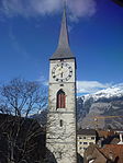
Cuira Upload a file Martinskirche
Martinskirche A 46°50′54″N 9°31′59″E / 46.848217°N 9.532921°E / 46.848217; 9.532921 2928
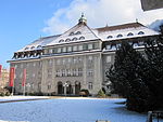
Cuira Upload a file Verwaltungsgebäude der Rhätischen Bahn
Verwaltungsgebäude der Rhätischen Bahn A 46°51′06″N 9°31′57″E / 46.851778°N 9.532587°E / 46.851778; 9.532587 2932
Cuira Upload a file St. Luziuskirche
St. Luziuskirche A 46°50′52″N 9°32′14″E / 46.847735°N 9.537138°E / 46.847735; 9.537138 2923
Cuira Upload a file Archiv dal stadi dal Grischun
Archiv dal stadi dal Grischun A 46°51′00″N 9°32′03″E / 46.84999°N 9.53418°E / 46.84999; 9.53418 8782
Cuira Upload a file Regulakirche
Regulakirche B 46°51′03″N 9°32′03″E / 46.85084°N 9.53412°E / 46.85084; 9.53412 2952
Cuira Upload a file Grossratsgebäude
Grossratsgebäude B 46°51′08″N 9°32′02″E / 46.8523°N 9.53401°E / 46.8523; 9.53401 2940
Cuira Upload a file
St. Stephanskirche B 46°50′48″N 9°32′19″E / 46.8467°N 9.53857°E / 46.8467; 9.53857 2919
Cuira Upload a file Bischöflicher Hof
Bischöflicher Hof A 46°50′54″N 9°32′07″E / 46.848213°N 9.53515°E / 46.848213; 9.53515 2917
Cuira Upload a file Martinsbrunnen
Martinsbrunnen B 46°50′53″N 9°31′58″E / 46.8481°N 9.53289°E / 46.8481; 9.53289 2950
Cuira Upload a file Kantonsbibliothek Graubünden
Kantonsbibliothek Graubünden A 46°50′58″N 9°32′02″E / 46.849522222°N 9.533855555°E / 46.849522222; 9.533855555 9333
Cuira Upload a file Krematorium Totengut
Krematorium Totengut A 46°50′33″N 9°32′23″E / 46.84237°N 9.539696°E / 46.84237; 9.539696 2949
Cuira Upload a file Neues Gebäu
Neues Gebäu A 46°51′00″N 9°32′01″E / 46.850102°N 9.533716°E / 46.850102; 9.533716 2926
Cuira Upload a file Oberer Spaniöl
Oberer Spaniöl A 46°50′53″N 9°32′04″E / 46.848086111°N 9.534438888°E / 46.848086111; 9.534438888 9103
Cuira Upload a file Postgebäude Chur
Postgebäude Chur A 46°51′02″N 9°31′52″E / 46.850626°N 9.531126°E / 46.850626; 9.531126 2941
Cuira Upload a file Rathaus
Rathaus A 46°50′56″N 9°31′57″E / 46.84899°N 9.532518°E / 46.84899; 9.532518 2929
Cuira Upload a file Museum retic
Museum retic A 46°50′53″N 9°32′01″E / 46.848151°N 9.533627°E / 46.848151; 9.533627 2930
Cuira Upload a file Schutzbauten Welschdörfli
Schutzbauten Welschdörfli A 46°50′47″N 9°31′36″E / 46.84625°N 9.526627777°E / 46.84625; 9.526627777 2934
Cuira Upload a file Stadtgarten
Stadtgarten B 46°50′59″N 9°31′47″E / 46.84962°N 9.52976°E / 46.84962; 9.52976 10719
Cuira Upload a file
Frauenkulturarchiv Graubünden B 46°50′55″N 9°31′49″E / 46.84857°N 9.53036°E / 46.84857; 9.53036 8820
Cuira Upload a file Alte Kaserne (Zeughaus 3)
Alte Kaserne (Zeughaus 3) A 46°50′56″N 9°29′57″E / 46.848992°N 9.49923°E / 46.848992; 9.49923 9082
Cuira Upload a file Altstadt, frühmittelalterliche Kirche/mittelalterliche/neuzeitliche Stadt
Altstadt, frühmittelalterliche Kirche/mittelalterliche/neuzeitliche Stadt A 46°50′57″N 9°31′55″E / 46.849171°N 9.531974°E / 46.849171; 9.531974 9614
Cuira Upload a file
Bischöfliche Bibliothek A 46°50′54″N 9°32′07″E / 46.84822°N 9.53526°E / 46.84822; 9.53526 9332
Cuira Upload a file
Bischöfliches Archiv Chur A 46°50′54″N 9°32′07″E / 46.84824°N 9.53536°E / 46.84824; 9.53536 8901
Cuira Upload a file
Dommuseum (Churer Domschatz) A 46°50′52″N 9°32′07″E / 46.84769°N 9.53541°E / 46.84769; 9.53541 8480
Cuira Upload a file Eidgenössische Pulvermühle
Eidgenössische Pulvermühle A+ISOS 46°51′14″N 9°30′31″E / 46.853989°N 9.508538°E / 46.853989; 9.508538 2927
Cuira Upload a file Gabentempel (Eidgenössisches Schützenfest 1863)
Gabentempel (Eidgenössisches Schützenfest 1863) A 46°51′14″N 9°30′09″E / 46.85391°N 9.502409°E / 46.85391; 9.502409 2920
Cuira Upload a file Haus Schwartz mit Garten
Haus Schwartz mit Garten A 46°50′51″N 9°31′58″E / 46.847481°N 9.532853°E / 46.847481; 9.532853 2921
Cuira Upload a file
Stadtarchiv Chur A 46°50′56″N 9°31′57″E / 46.84892°N 9.53258°E / 46.84892; 9.53258 8867
Cuira Upload a file Villa Planta und Sulserbau
Villa Planta und Sulserbau A 46°51′05″N 9°31′56″E / 46.851332°N 9.53236°E / 46.851332; 9.53236 2933
Cuira Upload a file Bündner Natur-Museum
Bündner Natur-Museum B 46°51′15″N 9°32′04″E / 46.8542°N 9.53433°E / 46.8542; 9.53433 2937
Cuira Upload a file
Grabenschulhaus B 46°50′58″N 9°31′50″E / 46.84933°N 9.53052°E / 46.84933; 9.53052 2938
Cuira Upload a file
Grosser Türligarten mit Garten B 46°50′49″N 9°31′56″E / 46.84705°N 9.53221°E / 46.84705; 9.53221 2939
Cuira Upload a file
Haus Pestalozza B 46°50′55″N 9°31′25″E / 46.84869°N 9.52355°E / 46.84869; 9.52355 2942
Cuira Upload a file
Haus Planaterra B 46°51′02″N 9°32′02″E / 46.85045°N 9.53389°E / 46.85045; 9.53389 2943
Cuira Upload a file
Haus zum Brunnengarten B 46°50′55″N 9°31′44″E / 46.84851°N 9.52892°E / 46.84851; 9.52892 2944
Cuira Upload a file
Haus zum Raben B 46°50′54″N 9°31′59″E / 46.84845°N 9.53298°E / 46.84845; 9.53298 2945
Cuira Upload a file
Heiligkreuzkirche B 46°51′51″N 9°32′04″E / 46.86424°N 9.53452°E / 46.86424; 9.53452 2946
Cuira Upload a file Kantonalbank
Kantonalbank B 46°51′34″N 9°31′56″E / 46.85942°N 9.53223°E / 46.85942; 9.53223 2947
Cuira Upload a file Kantonsbibliothek und Staatsarchiv Graubünden
Kantonsbibliothek und Staatsarchiv Graubünden B 46°50′59″N 9°32′02″E / 46.8496°N 9.53401°E / 46.8496; 9.53401 2924
Cuira Upload a file Konviktsgebäude
Konviktsgebäude B 46°50′48″N 9°32′23″E / 46.8466°N 9.5396°E / 46.8466; 9.5396 2948
Cuira Upload a file
Quaderschulhaus (1914) mit Eingangstor an der Masanserstrasse B 46°51′13″N 9°32′12″E / 46.85359°N 9.53659°E / 46.85359; 9.53659 2951
Cuira Upload a file
Salishaus (1818) B 46°51′17″N 9°32′04″E / 46.8547°N 9.53454°E / 46.8547; 9.53454 2953
Cuira Upload a file
Salishaus auf dem Sand (kleiner Türligarten), mit Garten B 46°50′49″N 9°31′55″E / 46.84706°N 9.53188°E / 46.84706; 9.53188 2954
Cuira Upload a file
Staatsgebäude B 46°51′00″N 9°31′50″E / 46.85001°N 9.53042°E / 46.85001; 9.53042 2955
Cuira Upload a file
Stuppishaus B 46°51′19″N 9°32′04″E / 46.85539°N 9.53458°E / 46.85539; 9.53458 10731
Cuira Upload a file
Villa Brunnengarten B 46°50′55″N 9°31′43″E / 46.84869°N 9.52853°E / 46.84869; 9.52853 2956
Cuira Upload a file
Villa Coaz mit ehem. Ökonomiegebäude (Villetta) B 46°51′26″N 9°32′01″E / 46.85733°N 9.53372°E / 46.85733; 9.53372 2959
Cuira Upload a file
Villa Dr. Barth B 46°51′08″N 9°31′50″E / 46.85227°N 9.53064°E / 46.85227; 9.53064 2957
Cuira Upload a file
Villa La Nicca B 46°50′56″N 9°31′44″E / 46.84889°N 9.52897°E / 46.84889; 9.52897 2958
Cuira Upload a file
Villa Svea B 46°51′33″N 9°32′06″E / 46.8592°N 9.53511°E / 46.8592; 9.53511 10732
Cuira Upload a file
Villa Zambail (1863, Hotel Duc de Rohan) B 46°51′18″N 9°32′07″E / 46.85487°N 9.5352°E / 46.85487; 9.5352 2960
Cuira Upload a file Altes Gebäu
Altes Gebäu A 46°50′59″N 9°31′55″E / 46.849827°N 9.532°E / 46.849827; 9.532 2915
Cuira Upload a file
Museo retico (collezione) A 46°50′53″N 9°32′01″E / 46.848055555°N 9.533611111°E / 46.848055555; 9.533611111 8478
Cuira Upload a file Antistitium
Antistitium A 46°50′53″N 9°31′59″E / 46.847929°N 9.532975°E / 46.847929; 9.532975 10037
Cuira Upload a file Bahnhof Chur
Bahnhof Chur B 46°51′11″N 9°31′42″E / 46.85292°N 9.52843°E / 46.85292; 9.52843 2935
Cuira Upload a file Kathedrale St. Mariä Himmelfahrt
Kathedrale St. Mariä Himmelfahrt A 46°50′52″N 9°32′08″E / 46.847665°N 9.535575°E / 46.847665; 9.535575 2925

Curvalda

Location Upload Photo Object Cat. Coordinates KGS-Nr
Curvalda Upload a file Abtgebäude
Abtgebäude A 46°47′19″N 9°32′10″E / 46.788713°N 9.536162°E / 46.788713; 9.536162 10457
Curvalda Upload a file Reformierte Kirche Parpan
Reformierte Kirche Parpan B 46°45′40″N 9°33′27″E / 46.7611°N 9.55759°E / 46.7611; 9.55759 12459
Curvalda Upload a file Schlössli Parpan
Schlössli Parpan A 46°45′38″N 9°33′29″E / 46.760502777°N 9.558116666°E / 46.760502777; 9.558116666 3123
Curvalda Upload a file Kirche St. Maria und Michael
Kirche St. Maria und Michael A 46°47′22″N 9°32′09″E / 46.78935°N 9.535794°E / 46.78935; 9.535794 2961
Curvalda Upload a file
Ehemalige St. Peterskirche B 46°45′39″N 9°33′29″E / 46.76095°N 9.55813°E / 46.76095; 9.55813 3124

Domat

Location Upload Photo Object Cat. Coordinates KGS-Nr
Domat Upload a file Kirche Sogn Gion
Kirche Sogn Gion A 46°50′14″N 9°27′02″E / 46.837316°N 9.450462°E / 46.837316; 9.450462 2993
Domat Upload a file Kirche Sogn Pieder
Kirche Sogn Pieder A 46°50′07″N 9°26′55″E / 46.83528°N 9.448551°E / 46.83528; 9.448551 2994

Domleschg

Location Upload Photo Object Cat. Coordinates KGS-Nr
Domleschg Upload a file Tumegl
Tumegl ISOS 46°45′00″N 9°25′59″E / 46.75°N 9.433055555°E / 46.75; 9.433055555
Domleschg Upload a file Baselgia cattolica S. Maria e Maurezzi
Baselgia cattolica S. Maria e Maurezzi A 46°45′48″N 9°26′20″E / 46.763465°N 9.438801°E / 46.763465; 9.438801 3368
Domleschg Upload a file
Dusch, Haus Buol mit Hofanlage (Haus Albertini) B 46°45′19″N 9°27′06″E / 46.755232°N 9.451719°E / 46.755232; 9.451719 12468
Domleschg Upload a file
Feldis/Veulden, Wohnhaus B 46°47′38″N 9°25′57″E / 46.793859°N 9.432396°E / 46.793859; 9.432396 12464
Domleschg Upload a file
Haus Blumenthal B 46°44′09″N 9°26′36″E / 46.735897°N 9.443406°E / 46.735897; 9.443406 3175
Domleschg Upload a file
Haus Castelmur B 46°45′43″N 9°26′31″E / 46.762036°N 9.441943°E / 46.762036; 9.441943 10821
Domleschg Upload a file
Haus Jecklin B 46°44′06″N 9°26′40″E / 46.735112°N 9.444555°E / 46.735112; 9.444555 12450
Domleschg Upload a file
Haus Keller B 46°44′15″N 9°27′21″E / 46.73743°N 9.45573°E / 46.73743; 9.45573 2823
Domleschg Upload a file
Kath. Kirche St. Christophorus B 46°44′07″N 9°26′42″E / 46.735372°N 9.445088°E / 46.735372; 9.445088 3176
Domleschg Upload a file Katholische Kirche St. Andreas
Katholische Kirche St. Andreas B 46°44′13″N 9°27′22″E / 46.73705°N 9.4561°E / 46.73705; 9.4561 2824
Domleschg Upload a file
Wohnhaus B 46°46′40″N 9°26′34″E / 46.77775°N 9.442802°E / 46.77775; 9.442802 10784
Domleschg Upload a file Almens
Almens ISOS 46°44′20″N 9°27′19″E / 46.73886°N 9.45528°E / 46.73886; 9.45528
Domleschg Upload a file Pasqual
Pasqual ISOS 46°43′59″N 9°26′00″E / 46.733055555°N 9.433333333°E / 46.733055555; 9.433333333

Donat

Location Upload Photo Object Cat. Coordinates KGS-Nr
Donat Upload a file
Champ da fossas preistoric (Bronzezeit) B 46°37′41″N 9°25′25″E / 46.62795°N 9.42362°E / 46.62795; 9.42362 2997
Donat Upload a file Patzen-Fardün, Baselgia refurmada
Patzen-Fardün, Baselgia refurmada B 46°37′58″N 9°25′33″E / 46.63267°N 9.42586°E / 46.63267; 9.42586 10753
Donat Upload a file
Patzen-Fardün, Tgea Nr. 8 «La Caplutta» B 46°38′08″N 9°25′45″E / 46.63545°N 9.42923°E / 46.63545; 9.42923 10754