namma ID
ligger i administrativ enhet sajádat geokoordinater govva
Q30142064 (gilli cultural environment
1309
. . Puolanka
65°03′12″N 27°46′04″E / 65.053258°N 27.767799°E / 65.053258; 27.767799 Upload an image of this heritage site
Hoikankangas (quarter
4540
. . Kajaani
64°11′54″N 27°42′42″E / 64.19833333333334°N 27.711666666666662°E / 64.19833333333334; 27.711666666666662 Upload an image of this heritage site
Q11863932 (girku )
1374
. . Hyrynsalmi
64°40′52″N 28°30′31″E / 64.68104238°N 28.50870243°E / 64.68104238; 28.50870243 64°40′52″N 28°30′31″E / 64.6810388°N 28.5086825°E / 64.6810388; 28.5086825
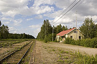
Hyrynsalmi railway station (togastašuvdna )
4198
. Hyrynsalmi parish village Hyrynsalmi
64°41′02″N 28°27′47″E / 64.68379424°N 28.46306755°E / 64.68379424; 28.46306755
Kainuu Rapid Mills (čáhcemillu )
1293
. . Sotkamo Hyrynsalmi Ristijärvi Paltamo Suomussalmi Puolanka Kuhmo
Upload an image of this heritage site
Kainuun seitsemäs Kekkostie (historic road
4295
. . Kuhmo
64°23′34″N 30°06′03″E / 64.392886344°N 30.100904652°E / 64.392886344; 30.100904652 Upload an image of this heritage site
Kainuun vienalaiskylät (rural environment
3947
. . Suomussalmi Kuhmo
Upload an image of this heritage site
Q3098265 (togastašuvdna rail yard station located on surface
1442
. . Kajaani
64°13′12″N 27°44′19″E / 64.22°N 27.738611111111°E / 64.22; 27.738611111111
Kajaani river historical surroundings (Category:Urban landscapes )
1290
. . Kajaani
64°13′50″N 27°43′30″E / 64.230687°N 27.724882°E / 64.230687; 27.724882 Upload an image of this heritage site
Kajaanin Kauppakadun funkistalot ja Raatihuoneentori (Category:Urban landscapes )
1296
. . Kajaani
64°13′38″N 27°43′42″E / 64.227202777778°N 27.728344444444°E / 64.227202777778; 27.728344444444
Kajaanin keskustan kirkot (landscape of religious buildings
1375
. . Kajaani
Upload an image of this heritage site
Karelianismin kohteet Kainuussa (kultureanadat
4296
. . Suomussalmi Kuhmo
Upload an image of this heritage site
Q29974165 (olgomusea báikkálaš musea
1289
89 Vanhatie Hyrynsalmi
64°37′26″N 28°22′30″E / 64.623867°N 28.374873°E / 64.623867; 28.374873
Kivesjärvi railway station (togastašuvdna )
1448
Category:National road 22 (Finland) . Kivesjärvi Paltamo
64°28′07″N 27°28′18″E / 64.468611111111°N 27.471666666667°E / 64.468611111111; 27.471666666667
Q11872399 (togastašuvdna junction station
1449
. Category:Kontiomäki . Paltamo
64°20′19″N 28°06′48″E / 64.338611111111°N 28.113333333333°E / 64.338611111111; 28.113333333333
Korvanniemen kylä (gilli
2028
. . Sotkamo
64°12′00″N 27°58′28″E / 64.199890041°N 27.974362157°E / 64.199890041; 27.974362157 Upload an image of this heritage site
Murtomäki railway station (togastašuvdna )
4197
. Murtomäki Kajaani
64°03′53″N 27°34′45″E / 64.064722222222°N 27.579166666667°E / 64.064722222222; 27.579166666667
Q30690314 (gilli
3943
. . Sotkamo
Upload an image of this heritage site
Otanmäki mine (iron mine
1455
. Category:Otanmäki . Kajaani
64°06′59″N 27°06′04″E / 64.116389°N 27.101111°E / 64.116389; 27.101111 Upload an image of this heritage site
Oulujoen ja Sotkamon reitin voimalaitokset (industrial landscape
1292
. Montta Kajaani Ristijärvi Paltamo Suomussalmi Sotkamo Kuhmo
Upload an image of this heritage site
Paltaniemen kirkkotie ja kylä (gilli
1291
. . Kajaani
64°17′34″N 27°39′26″E / 64.292858333333°N 27.657180555556°E / 64.292858333333; 27.657180555556 Upload an image of this heritage site
Q164333 (historical military facility fortified line
2021
. . Suomussalmi Kuhmo
Q19758642 (girku )
2013
. Suomussalmi village Suomussalmi
64°54′13″N 29°00′10″E / 64.90369415°N 29.00280571°E / 64.90369415; 29.00280571 64°54′14″N 29°00′10″E / 64.90375903°N 29.00278733°E / 64.90375903; 29.00278733
Särkän kämppäkartano (huksejuvvon kulturbiras
4855
. . Kuhmo
64°12′12″N 29°56′55″E / 64.203218572°N 29.948724231°E / 64.203218572; 29.948724231 Upload an image of this heritage site
Talvisodan taistelupaikat (battlefield
1299
. . Suomussalmi Kuhmo
Upload an image of this heritage site
Tervanpolton muistomerkit (kultureanadat
1302
. . Ristijärvi Sotkamo Kuhmo
Upload an image of this heritage site
Tiaisen kruununmetsätorppa (agricultural environment
1297
. . Puolanka
65°01′18″N 27°23′51″E / 65.021539247°N 27.397551337°E / 65.021539247; 27.397551337 Upload an image of this heritage site
Täyssinän rauhan rajakivet (boundary point
4287
. . Suomussalmi Kuhmo
Upload an image of this heritage site
Q11901962 (togastašuvdna rail yard
1447
. . Sotkamo
64°08′51″N 28°16′24″E / 64.1475°N 28.2733°E / 64.1475; 28.2733
museum bridge ()
4845
. . Ristijärvi Kuhmo


