Commons:Wiki4Alps/Veveyse
Jump to navigation
Jump to search
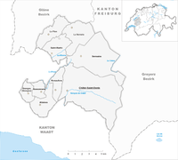
Map of Sense

List of the cultural heritage of the district of Sense in the Canton Fribourg
[edit]
List of Monuments in the district of Sense in the Canton Fribourg.
Update: 15 April 2014
List
[edit]| KGS-Nr | Upload | Foto | Object | Other | Cov. | Cat. | Type | Address | Town | Coordinates | |||
|---|---|---|---|---|---|---|---|---|---|---|---|---|---|
| 1985 | 
|
Église Saint-Denis | A | G | Chemin de l’Église 31 | Châtel-Saint-Denis |
| ||||||
| 12408 | Ferme | B | G | Chemin de la Planière 21 | Châtel-Saint-Denis |
| |||||||
| 12411 | Ferme Pilloud aux Granges de Belmont | B | G | Chemin des Granges 19 | Châtel-Saint-Denis |
| |||||||
| 12409 | Ferme de Catherine Chillier | B | G | Chemin de la Planière 80 | Châtel-Saint-Denis |
| |||||||
| 1987 | Maison double 339 | B | G | Route de Fruence 29, Fruence | Châtel-Saint-Denis |
| |||||||
| 12410 | Ferme domaniale La Rota | B | G | Route de Bulle 45 | Châtel-Saint-Denis |
| |||||||
| 12407 | 
|
Cure | B | G | Chemin de l’Église 21 | Châtel-Saint-Denis |
| ||||||
| 1984 | Château baillivial | B | G | Chemin du Château 11 | Châtel-Saint-Denis |
| |||||||
| 2312 | 
|
Église Saint-Nicolas | B | G | Grand-Rue | Semsales |
|