Commons:Wiki4Alps/Uri (district)

From Wikimedia Commons, the free media repository
Jump to navigation Jump to search

<< Wiki4Alps << Uri

List of the cultural heritage of the Canton Uri

[edit]
Map of Uri
Map of Uri

List of Monuments in the Canton Uri.

Update: 15 April 2014

List

[edit]
KGS-Nr Upload Foto   Object Other Cov. Cat. Type Address Town Coordinates
5772 Upload a file Beinhauskapelle St. Anna Beinhauskapelle St. Anna No images A G Kirchplatz 2 Altdorf
46° 52′ 58.98″ N, 8° 38′ 31.81″ E Kartographer map based on OpenStreetMap.View all coordinates using: OpenStreetMapinfo


8582 Upload a file Dätwyler-Stiftung No images A S Gotthardstrasse 31 Altdorf
46° 52′ 40.2″ N, 8° 38′ 48.59″ E Kartographer map based on OpenStreetMap.View all coordinates using: OpenStreetMapinfo


5786 Upload a file Eidgenössisches Getreidesilo Eidgenössisches Getreidesilo No images A G Eyschachen Altdorf
46° 52′ 12.43″ N, 8° 37′ 57.91″ E Kartographer map based on OpenStreetMap.View all coordinates using: OpenStreetMapinfo


9057 Upload a file Eidgenössisches Sackmagazin Eidgenössisches Sackmagazin No images A G Eyschachen Altdorf
46° 52′ 15.13″ N, 8° 37′ 56.69″ E Kartographer map based on OpenStreetMap.View all coordinates using: OpenStreetMapinfo


5775 Upload a file Fremdenspital mit Kapelle Fremdenspital mit Kapelle No images A G Gemeindehausplatz 2 Altdorf
46° 52′ 58.8″ N, 8° 38′ 29.17″ E Kartographer map based on OpenStreetMap.View all coordinates using: OpenStreetMapinfo


5789 Upload a file Haus im Eselmätteli Haus im Eselmätteli No images A G Herrengasse 1 Altdorf
46° 52′ 57.56″ N, 8° 38′ 24.37″ E Kartographer map based on OpenStreetMap.View all coordinates using: OpenStreetMapinfo


5776 Upload a file Haus Jauch, sogenanntes Suworow-Haus Haus Jauch, sogenanntes Suworow-Haus No images A G Hellgasse 9 Altdorf
46° 52′ 50.29″ N, 8° 38′ 47.17″ E Kartographer map based on OpenStreetMap.View all coordinates using: OpenStreetMapinfo


8579 Upload a file Historisches Museum Uri No images A S Gotthardstrasse 18 Altdorf
46° 52′ 40.21″ N, 8° 38′ 41.88″ E Kartographer map based on OpenStreetMap.View all coordinates using: OpenStreetMapinfo


5778 Upload a file Katholische Kirche St. Martin Katholische Kirche St. Martin No images A G Kirchplatz Altdorf
46° 52′ 59.88″ N, 8° 38′ 31.7″ E Kartographer map based on OpenStreetMap.View all coordinates using: OpenStreetMapinfo


8791 Upload a file Staatsarchiv Uri No images A S Bahnhofstrasse 13 Altdorf
46° 52′ 51.46″ N, 8° 38′ 28.61″ E Kartographer map based on OpenStreetMap.View all coordinates using: OpenStreetMapinfo


5783 Upload a file Telldenkmal und Türmli Telldenkmal und Türmli No images A K Rathausplatz Altdorf
46° 52′ 54.33″ N, 8° 38′ 38.28″ E Kartographer map based on OpenStreetMap.View all coordinates using: OpenStreetMapinfo


5784 Upload a file Ankenwaage mit Hexenturm No images B G Tellsgasse 5 Altdorf
46° 52′ 55.37″ N, 8° 38′ 34.9″ E Kartographer map based on OpenStreetMap.View all coordinates using: OpenStreetMapinfo


11991 Upload a file Bannersammlung im Rathaus Bannersammlung im Rathaus No images B S Rathausplatz 1 Altdorf
46° 52′ 55.3″ N, 8° 38′ 38.71″ E Kartographer map based on OpenStreetMap.View all coordinates using: OpenStreetMapinfo


5773 Upload a file Besslerbrunnen No images B K Rathausplatz Altdorf
46° 52′ 54.37″ N, 8° 38′ 38.19″ E Kartographer map based on OpenStreetMap.View all coordinates using: OpenStreetMapinfo


5785 Upload a file Besslerhaus (Dr.Christen) Besslerhaus (Dr.Christen) No images B G Herrengasse 16 Altdorf
46° 53′ 00.32″ N, 8° 38′ 17.63″ E Kartographer map based on OpenStreetMap.View all coordinates using: OpenStreetMapinfo


11331 Upload a file Crivellihaus No images B G Herrengasse 12 Altdorf
46° 52′ 59.8″ N, 8° 38′ 20.12″ E Kartographer map based on OpenStreetMap.View all coordinates using: OpenStreetMapinfo


5787 Upload a file Fabrikgebäude Dätwyler No images B G Gotthardstrasse 31 Altdorf
46° 52′ 39.65″ N, 8° 38′ 46.14″ E Kartographer map based on OpenStreetMap.View all coordinates using: OpenStreetMapinfo


11296 Upload a file Grabmäler auf dem Friedhof gemäss Verzeichnis der Kirchgemeinde Grabmäler auf dem Friedhof gemäss Verzeichnis der Kirchgemeinde No images B K Kirchplatz 1 Altdorf
46° 52′ 59.4″ N, 8° 38′ 31.07″ E Kartographer map based on OpenStreetMap.View all coordinates using: OpenStreetMapinfo


11338 Upload a file Haus Blumenfeld mit Granitbrunnen No images B K Blumenfeldgasse 19 Altdorf
46° 52′ 26.76″ N, 8° 38′ 55″ E Kartographer map based on OpenStreetMap.View all coordinates using: OpenStreetMapinfo


5788 Upload a file Haus Dr. F.Schmid (Korporationsarchiv Uri) No images B G Gotthardstrasse 3 Altdorf
46° 52′ 47.96″ N, 8° 38′ 37.39″ E Kartographer map based on OpenStreetMap.View all coordinates using: OpenStreetMapinfo


11333 Upload a file Haus Dr.Hirzel No images B G Herrengasse 16a Altdorf
46° 53′ 00.32″ N, 8° 38′ 17.63″ E Kartographer map based on OpenStreetMap.View all coordinates using: OpenStreetMapinfo


11336 Upload a file Haus Huon No images B G Attinghauserstrasse 37 Altdorf
46° 52′ 35.85″ N, 8° 38′ 23.02″ E Kartographer map based on OpenStreetMap.View all coordinates using: OpenStreetMapinfo


5790 Upload a file Haus in der Stoffelmatte No images B G Gotthardstrasse 14a Altdorf
46° 52′ 41.76″ N, 8° 38′ 35.55″ E Kartographer map based on OpenStreetMap.View all coordinates using: OpenStreetMapinfo


5791 Upload a file Haus Lusser No images B G Gotthardstrasse 9 Altdorf
46° 52′ 45.94″ N, 8° 38′ 38.94″ E Kartographer map based on OpenStreetMap.View all coordinates using: OpenStreetMapinfo


5792 Upload a file Haus Martin Gamma mit Ökonomiegebäude No images B G Gemeindehausplatz 1 Altdorf
46° 52′ 58.37″ N, 8° 38′ 27.41″ E Kartographer map based on OpenStreetMap.View all coordinates using: OpenStreetMapinfo


11341 Upload a file Haus oberer Vogelsang (mit Baumbestand) No images B G Vogelsanggasse 20 Altdorf
46° 53′ 05.14″ N, 8° 38′ 27.33″ E Kartographer map based on OpenStreetMap.View all coordinates using: OpenStreetMapinfo


5793 Upload a file Haus von Roll (früher Urner Kantonalbank) Haus von Roll (früher Urner Kantonalbank) No images B G Tellsgasse 1 Altdorf
46° 52′ 54.39″ N, 8° 38′ 35.83″ E Kartographer map based on OpenStreetMap.View all coordinates using: OpenStreetMapinfo


11339 Upload a file Haus Waldegg (mit Baumbestand) Haus Waldegg (mit Baumbestand) No images B G Kapuzinerweg 24 Altdorf
46° 53′ 04.35″ N, 8° 38′ 34.07″ E Kartographer map based on OpenStreetMap.View all coordinates using: OpenStreetMapinfo


5794 Upload a file Haus Walker-Kesselbach No images B G Gotthardstrasse 2 Altdorf
46° 52′ 48.56″ N, 8° 38′ 36.17″ E Kartographer map based on OpenStreetMap.View all coordinates using: OpenStreetMapinfo


11334 Upload a file Haus Winterberg No images B G Winterberggasse 29 Altdorf
46° 52′ 56.04″ N, 8° 38′ 27.55″ E Kartographer map based on OpenStreetMap.View all coordinates using: OpenStreetMapinfo


11297 Upload a file Haus Zieri Haus Zieri No images B G Rathausplatz 2 Altdorf
46° 52′ 56.24″ N, 8° 38′ 38.32″ E Kartographer map based on OpenStreetMap.View all coordinates using: OpenStreetMapinfo


5795 Upload a file Historisches Museum Uri No images B G Gotthardstrasse 18 Altdorf
46° 52′ 40.21″ N, 8° 38′ 41.88″ E Kartographer map based on OpenStreetMap.View all coordinates using: OpenStreetMapinfo


5777 Upload a file Josefsbrunnen beim Fremdenspital Josefsbrunnen beim Fremdenspital No images B K Gemeindehausplatz Altdorf
46° 52′ 58.99″ N, 8° 38′ 29.32″ E Kartographer map based on OpenStreetMap.View all coordinates using: OpenStreetMapinfo


8463 Upload a file Kantonale Kunst- und Kulturgutsammlung Uri No images B S Bahnhofstrasse 13 Altdorf
46° 52′ 50.61″ N, 8° 38′ 25.82″ E Kartographer map based on OpenStreetMap.View all coordinates using: OpenStreetMapinfo


5796 Upload a file Kantonales Zeughaus mit Lehn-Brunnen Kantonales Zeughaus mit Lehn-Brunnen No images B G Lehnplatz 22 Altdorf
46° 52′ 50.13″ N, 8° 38′ 40.46″ E Kartographer map based on OpenStreetMap.View all coordinates using: OpenStreetMapinfo


11299 Upload a file Kapelle beim Suworowhaus Kapelle beim Suworowhaus No images B G Hellgasse 9 Altdorf
46° 52′ 49.63″ N, 8° 38′ 48.14″ E Kartographer map based on OpenStreetMap.View all coordinates using: OpenStreetMapinfo


5797 Upload a file Kapelle Unter-Heiligkreuz mit ehemaligem Schützenhaus und Haus Muheim beim Spital Kapelle Unter-Heiligkreuz mit ehemaligem Schützenhaus und Haus Muheim beim Spital No images B G Spitalstrasse 1 Altdorf
46° 53′ 00.45″ N, 8° 38′ 14.7″ E Kartographer map based on OpenStreetMap.View all coordinates using: OpenStreetMapinfo


5798 Upload a file Kapuzinerinnenkloster St.Karl No images B G Gotthardstrasse 12 Altdorf
46° 52′ 44.35″ N, 8° 38′ 36.55″ E Kartographer map based on OpenStreetMap.View all coordinates using: OpenStreetMapinfo


5779 Upload a file Kapuzinerkloster Kapuzinerkloster No images B G Kapuzinerweg 22 Altdorf
46° 53′ 03.44″ N, 8° 38′ 37.45″ E Kartographer map based on OpenStreetMap.View all coordinates using: OpenStreetMapinfo


8562 Upload a file Kirchenschatz-Museum No images B S Kirchplatz 7 Altdorf
46° 52′ 58.34″ N, 8° 38′ 30.25″ E Kartographer map based on OpenStreetMap.View all coordinates using: OpenStreetMapinfo


5799 Upload a file Kollegium St.Karl Borromäus No images B G Gotthardstrasse 59 Altdorf
46° 52′ 28.85″ N, 8° 39′ 02.65″ E Kartographer map based on OpenStreetMap.View all coordinates using: OpenStreetMapinfo


5781 Upload a file Ölbergkapelle bei der Pfarrkirche St.Martin No images B G Kapuzinergasse 5–7 Altdorf
46° 53′ 00.82″ N, 8° 38′ 30.66″ E Kartographer map based on OpenStreetMap.View all coordinates using: OpenStreetMapinfo


9058 Upload a file Personalhaus der ehemaligen Draht- und Gummiwerke AG No images B G Gotthardstrasse 31 Altdorf
46° 52′ 40.2″ N, 8° 38′ 48.59″ E Kartographer map based on OpenStreetMap.View all coordinates using: OpenStreetMapinfo


5800 Upload a file Postgebäude No images B G Bahnhofstrasse 11 Altdorf
46° 52′ 51.4″ N, 8° 38′ 31.25″ E Kartographer map based on OpenStreetMap.View all coordinates using: OpenStreetMapinfo


5782 Upload a file Rathaus Rathaus No images B G Rathausplatz 1 Altdorf
46° 52′ 55.33″ N, 8° 38′ 38.68″ E Kartographer map based on OpenStreetMap.View all coordinates using: OpenStreetMapinfo


5803 Upload a file Tellspielhaus Tellspielhaus No images B G Lehnplatz 1 Altdorf
46° 52′ 51.43″ N, 8° 38′ 40.48″ E Kartographer map based on OpenStreetMap.View all coordinates using: OpenStreetMapinfo


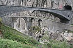
5804 Upload a file Alte und neue Teufelsbrücke Alte und neue Teufelsbrücke No images A G Schöllenen Andermatt
46° 38′ 50.53″ N, 8° 35′ 25.12″ E Kartographer map based on OpenStreetMap.View all coordinates using: OpenStreetMapinfo


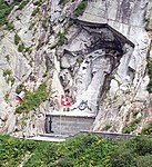
5807 Upload a file General-Suworow-Denkmal General-Suworow-Denkmal No images A K Schöllenen Andermatt
46° 38′ 49.52″ N, 8° 35′ 27.67″ E Kartographer map based on OpenStreetMap.View all coordinates using: OpenStreetMapinfo


9748 Upload a file Wohnhaus (Talmuseum) Wohnhaus (Talmuseum) No images A Gotthardstrasse 113 Andermatt
46° 37′ 57.82″ N, 8° 35′ 42.76″ E Kartographer map based on OpenStreetMap.View all coordinates using: OpenStreetMapinfo


5806 Upload a file Alte Kirche St.Kolumban Alte Kirche St.Kolumban No images B G Gotthardstrasse Andermatt
46° 38′ 25.65″ N, 8° 35′ 39.4″ E Kartographer map based on OpenStreetMap.View all coordinates using: OpenStreetMapinfo


11347 Upload a file Friedhof mit Grabmälern und Totenkapelle St.Michael Friedhof mit Grabmälern und Totenkapelle St.Michael No images B G Friedhof Andermatt
46° 38′ 02.78″ N, 8° 35′ 39.2″ E Kartographer map based on OpenStreetMap.View all coordinates using: OpenStreetMapinfo


5808 Upload a file Haus Babylon Haus Babylon No images B G Gotthardstrasse 145 Andermatt
46° 37′ 57.57″ N, 8° 35′ 39.36″ E Kartographer map based on OpenStreetMap.View all coordinates using: OpenStreetMapinfo


5811 Upload a file Kapelle Maria-Hilf Kapelle Maria-Hilf No images B G Mariahilfgasse Andermatt
46° 37′ 59.91″ N, 8° 35′ 53.9″ E Kartographer map based on OpenStreetMap.View all coordinates using: OpenStreetMapinfo


11353 Upload a file Kapelle St.Wendelin, genannt Eiskapelle Kapelle St.Wendelin, genannt Eiskapelle No images B G Oberalpstrasse Andermatt
46° 38′ 07.31″ N, 8° 35′ 59.46″ E Kartographer map based on OpenStreetMap.View all coordinates using: OpenStreetMapinfo


5810 Upload a file Katholische Kirche St.Peter und Paul Katholische Kirche St.Peter und Paul No images B G Kirchgasse Andermatt
46° 38′ 02.31″ N, 8° 35′ 40.78″ E Kartographer map based on OpenStreetMap.View all coordinates using: OpenStreetMapinfo


11354 Upload a file Kriegskaserne Büel Kriegskaserne Büel No images B G Büel Andermatt
46° 38′ 37.82″ N, 8° 35′ 24.68″ E Kartographer map based on OpenStreetMap.View all coordinates using: OpenStreetMapinfo


11352 Upload a file Nosenhaus Nosenhaus No images B G Gotthardstrasse 44 Andermatt
46° 38′ 02.75″ N, 8° 35′ 49.35″ E Kartographer map based on OpenStreetMap.View all coordinates using: OpenStreetMapinfo


5812 Upload a file Rathaus mit Talarchiv und Dorfbrunnen Rathaus mit Talarchiv und Dorfbrunnen No images B G Gotthardstrasse 74 Andermatt
46° 37′ 59.22″ N, 8° 35′ 43.09″ E Kartographer map based on OpenStreetMap.View all coordinates using: OpenStreetMapinfo


5813 Upload a file Burgruine Attinghausen Burgruine Attinghausen No images A F/G Schulhausweg Attinghausen
46° 51′ 43.84″ N, 8° 37′ 47.22″ E Kartographer map based on OpenStreetMap.View all coordinates using: OpenStreetMapinfo


5814 Upload a file Haus Schweinsberg Haus Schweinsberg No images A G Schweinsberggasse 6 Attinghausen
46° 51′ 51.07″ N, 8° 37′ 34.49″ E Kartographer map based on OpenStreetMap.View all coordinates using: OpenStreetMapinfo


5815 Upload a file Katholische Kirche St.Andreas, Friedhofkapelle, Pfarrhaus und Beinhaus St.Ottilien Katholische Kirche St.Andreas, Friedhofkapelle, Pfarrhaus und Beinhaus St.Ottilien No images B Kirchweg Attinghausen
46° 51′ 49.16″ N, 8° 37′ 47.15″ E Kartographer map based on OpenStreetMap.View all coordinates using: OpenStreetMapinfo


11357 Upload a file Überreste des Kapuzinerinnenklosters Maria zu allen Engeln inkl. Kaplanenhaus No images B F Klosterweg 30 Attinghausen
46° 51′ 47.16″ N, 8° 37′ 30.53″ E Kartographer map based on OpenStreetMap.View all coordinates using: OpenStreetMapinfo


5818 Upload a file Haus im oberen Baumgarten No images B G Baumgartenstrasse Bauen
46° 56′ 04.65″ N, 8° 34′ 39.43″ E Kartographer map based on OpenStreetMap.View all coordinates using: OpenStreetMapinfo


5819 Upload a file Katholische Kirche St.Ida Katholische Kirche St.Ida No images B G Walchring Bauen
46° 56′ 11.06″ N, 8° 34′ 47.16″ E Kartographer map based on OpenStreetMap.View all coordinates using: OpenStreetMapinfo


5821 Upload a file Haus in der Spielmatt (Planzerhaus) Haus in der Spielmatt (Planzerhaus) No images A G Klausenstrasse 144 Bürglen
46° 52′ 31.52″ N, 8° 38′ 15.36″ E Kartographer map based on OpenStreetMap.View all coordinates using: OpenStreetMapinfo


5822 Upload a file Katholische Pfarrkirche St.Peter und Paul mit Beinhaus und Ölbergkapelle Katholische Pfarrkirche St.Peter und Paul mit Beinhaus und Ölbergkapelle No images A G Kirchplatz Bürglen
46° 52′ 30.41″ N, 8° 39′ 44.86″ E Kartographer map based on OpenStreetMap.View all coordinates using: OpenStreetMapinfo


5825 Upload a file Brücke am alten Klausenweg Brücke am alten Klausenweg No images B G Brügg Bürglen
46° 52′ 36.76″ N, 8° 40′ 50.51″ E Kartographer map based on OpenStreetMap.View all coordinates using: OpenStreetMapinfo


10304 Upload a file Gasthaus zum Adler Gasthaus zum Adler No images B G Klausenstrasse 137 Bürglen
46° 52′ 31.09″ N, 8° 39′ 47.04″ E Kartographer map based on OpenStreetMap.View all coordinates using: OpenStreetMapinfo


11363 Upload a file Haus in der Balmermatte ob St.Josef No images B G Balmermatte Bürglen
46° 52′ 29.7″ N, 8° 39′ 26″ E Kartographer map based on OpenStreetMap.View all coordinates using: OpenStreetMapinfo


11366 Upload a file Haus Sebastian samt altem Kornspeicher im Resämätteli No images B G St. Sebastiangasse 4 Bürglen
46° 52′ 37.23″ N, 8° 40′ 22.23″ E Kartographer map based on OpenStreetMap.View all coordinates using: OpenStreetMapinfo


11360 Upload a file Haus zur Stiege Haus zur Stiege No images B G Feldgasse 4 Bürglen
46° 52′ 28.06″ N, 8° 39′ 46.13″ E Kartographer map based on OpenStreetMap.View all coordinates using: OpenStreetMapinfo


5826 Upload a file Loretokapelle St.Simon und Juda Loretokapelle St.Simon und Juda No images B G Klausenstrasse Bürglen
46° 52′ 36.86″ N, 8° 40′ 41.07″ E Kartographer map based on OpenStreetMap.View all coordinates using: OpenStreetMapinfo


5827 Upload a file Meierturm Meierturm No images B G Klausenstrasse Bürglen
46° 52′ 32.92″ N, 8° 39′ 46.19″ E Kartographer map based on OpenStreetMap.View all coordinates using: OpenStreetMapinfo


11359 Upload a file Pfarrhaus mit Resten eines ehemaligen Turmes No images B G Klausenstrasse 141 Bürglen
46° 52′ 31.93″ N, 8° 39′ 47.49″ E Kartographer map based on OpenStreetMap.View all coordinates using: OpenStreetMapinfo


8580 Upload a file Tell-Museum No images B S Postplatz Bürglen
46° 52′ 31.19″ N, 8° 39′ 47.74″ E Kartographer map based on OpenStreetMap.View all coordinates using: OpenStreetMapinfo


5823 Upload a file Tellskapelle Tellskapelle No images B G Bürglen
46° 52′ 31.31″ N, 8° 39′ 44.74″ E Kartographer map based on OpenStreetMap.View all coordinates using: OpenStreetMapinfo


5824 Upload a file Wattigwilerturm (Tellmuseum) Wattigwilerturm (Tellmuseum) No images B G Postplatz Bürglen
46° 52′ 31.28″ N, 8° 39′ 48.04″ E Kartographer map based on OpenStreetMap.View all coordinates using: OpenStreetMapinfo


5825 Upload a file Wallfahrtskapelle Unserer Lieben Frau Wallfahrtskapelle Unserer Lieben Frau No images B G Riedertal Bürglen
46° 52′ 01.65″ N, 8° 41′ 31.73″ E Kartographer map based on OpenStreetMap.View all coordinates using: OpenStreetMapinfo


10306 Upload a file Wohnhaus, Hof No images B G Belimatt Bürglen
46° 52′ 21.42″ N, 8° 39′ 30.82″ E Kartographer map based on OpenStreetMap.View all coordinates using: OpenStreetMapinfo


10309 Upload a file Stallscheune Hinterwiler No images A G Wilerstrasse Erstfeld
46° 48′ 02.89″ N, 8° 39′ 35.01″ E Kartographer map based on OpenStreetMap.View all coordinates using: OpenStreetMapinfo


5830 Upload a file Wallfahrtskapelle Jagdmatt Wallfahrtskapelle Jagdmatt No images A G Kapellweg Erstfeld
46° 49′ 03.24″ N, 8° 38′ 51.75″ E Kartographer map based on OpenStreetMap.View all coordinates using: OpenStreetMapinfo


10310 Upload a file Wohnhaus No images A G Talweg 14 Erstfeld
46° 49′ 11.21″ N, 8° 38′ 35.98″ E Kartographer map based on OpenStreetMap.View all coordinates using: OpenStreetMapinfo


5829 Upload a file Bahnhof und Werkstätte SBB No images B G Gotthardstrasse Erstfeld
46° 49′ 12.32″ N, 8° 39′ 02.56″ E Kartographer map based on OpenStreetMap.View all coordinates using: OpenStreetMapinfo


10307 Upload a file Lokremise No images B G Lindenstrasse Erstfeld
46° 49′ 07.28″ N, 8° 39′ 02.77″ E Kartographer map based on OpenStreetMap.View all coordinates using: OpenStreetMapinfo


11372 Upload a file Wohnhaus im Püntenermätteli No images B G Kirchgasse 3 Erstfeld
46° 49′ 15.24″ N, 8° 38′ 38.15″ E Kartographer map based on OpenStreetMap.View all coordinates using: OpenStreetMapinfo


11369 Upload a file Wohnhaus unterer Spätach mit Dörrraum No images B G Spätach 3 Erstfeld
46° 49′ 05.21″ N, 8° 38′ 39.43″ E Kartographer map based on OpenStreetMap.View all coordinates using: OpenStreetMapinfo


9063 Upload a file Stationsgebäude SBB Stationsgebäude SBB No images A G Bahnhofstrasse 1 Flüelen
46° 54′ 05.94″ N, 8° 37′ 27.26″ E Kartographer map based on OpenStreetMap.View all coordinates using: OpenStreetMapinfo


5834 Upload a file Ziegelhütte Ziegelhütte No images A G Seemattstrasse 4 Flüelen
46° 54′ 04.76″ N, 8° 37′ 21.85″ E Kartographer map based on OpenStreetMap.View all coordinates using: OpenStreetMapinfo


5831 Upload a file Alte Kirche St.Georg und Nikolaus Alte Kirche St.Georg und Nikolaus No images B G Dorfstrasse Flüelen
46° 54′ 09.58″ N, 8° 37′ 29.47″ E Kartographer map based on OpenStreetMap.View all coordinates using: OpenStreetMapinfo


11374 Upload a file Pfarrkirche Herz Jesu samt Friedhof, Beinhaus und Pfarrhaus Pfarrkirche Herz Jesu samt Friedhof, Beinhaus und Pfarrhaus No images B G Kirchstrasse 39 (Pfarrhaus) Flüelen
46° 54′ 19.91″ N, 8° 37′ 34.14″ E Kartographer map based on OpenStreetMap.View all coordinates using: OpenStreetMapinfo


5833 Upload a file Schlösschen Rudenz Schlösschen Rudenz No images B G Axenstrasse Flüelen
46° 54′ 06.66″ N, 8° 37′ 29.6″ E Kartographer map based on OpenStreetMap.View all coordinates using: OpenStreetMapinfo


5836 Upload a file Bahnhof mit Gleisareal Bahnhof mit Gleisareal No images B G Gotthardstrasse Göschenen
46° 39′ 55.25″ N, 8° 35′ 17.8″ E Kartographer map based on OpenStreetMap.View all coordinates using: OpenStreetMapinfo


5837 Upload a file Ehemalige katholische Kirche Ehemalige katholische Kirche No images B G Unterdorf Göschenen
46° 40′ 04.4″ N, 8° 35′ 09.99″ E Kartographer map based on OpenStreetMap.View all coordinates using: OpenStreetMapinfo


11376 Upload a file Fachwerkbrücke, ehemalige Bahnbrücke Fachwerkbrücke, ehemalige Bahnbrücke No images B G Bahnhofstrasse Göschenen
46° 40′ 02.34″ N, 8° 35′ 21.71″ E Kartographer map based on OpenStreetMap.View all coordinates using: OpenStreetMapinfo


11443 Upload a file Gotthardtunnel mit Portal Gotthardtunnel mit Portal No images B G Bahnhof Göschenen
46° 39′ 45.85″ N, 8° 35′ 19.01″ E Kartographer map based on OpenStreetMap.View all coordinates using: OpenStreetMapinfo


11375 Upload a file Katholische Pfarrkirche Maria Himmelfahrt Katholische Pfarrkirche Maria Himmelfahrt No images B G Kirchmatt (Winterhalten) Göschenen
46° 40′ 06.84″ N, 8° 35′ 18.79″ E Kartographer map based on OpenStreetMap.View all coordinates using: OpenStreetMapinfo


5835 Upload a file Reste der Häderlisbrücke (Sprenggibrücke) Reste der Häderlisbrücke (Sprenggibrücke) No images B G Schöllenen Göschenen
46° 39′ 30.79″ N, 8° 35′ 03.16″ E Kartographer map based on OpenStreetMap.View all coordinates using: OpenStreetMapinfo


5838 Upload a file Zollbrücke mit Zolltor Zollbrücke mit Zolltor No images B G Göschenen
46° 40′ 03.14″ N, 8° 35′ 07.96″ E Kartographer map based on OpenStreetMap.View all coordinates using: OpenStreetMapinfo


5841 Upload a file Altes Schulhaus No images B G Talstrasse, Wiler Gurtnellen
46° 43′ 42.98″ N, 8° 37′ 20.4″ E Kartographer map based on OpenStreetMap.View all coordinates using: OpenStreetMapinfo


11295 Upload a file Bergheimatschule (Grosshus) No images B G Bitzi Gurtnellen
46° 44′ 18.99″ N, 8° 37′ 33.39″ E Kartographer map based on OpenStreetMap.View all coordinates using: OpenStreetMapinfo


5839 Upload a file Kapelle St. Anna (mit Durchgang des Gotthardweges) No images B G Gotthardstrasse, Wiler Gurtnellen
46° 43′ 35.23″ N, 8° 37′ 18.35″ E Kartographer map based on OpenStreetMap.View all coordinates using: OpenStreetMapinfo


10245 Upload a file Galgen No images A G Hospental
46° 37′ 22.95″ N, 8° 34′ 34.13″ E Kartographer map based on OpenStreetMap.View all coordinates using: OpenStreetMapinfo


5844 Upload a file Langobardenturm, Turmmatte Langobardenturm, Turmmatte No images A G Turmmatte Hospental
46° 37′ 07.26″ N, 8° 34′ 00.43″ E Kartographer map based on OpenStreetMap.View all coordinates using: OpenStreetMapinfo


10246 Upload a file Ökonomiegebäude / Stallscheune No images A Steg Hospental
46° 37′ 29.24″ N, 8° 34′ 37.32″ E Kartographer map based on OpenStreetMap.View all coordinates using: OpenStreetMapinfo


10244 Upload a file Brücke über die Gotthardreuss (Dorfbrücke) Brücke über die Gotthardreuss (Dorfbrücke) No images B G Gotthardstrasse Hospental
46° 37′ 07.62″ N, 8° 33′ 59.97″ E Kartographer map based on OpenStreetMap.View all coordinates using: OpenStreetMapinfo


11466 Upload a file Gasthaus St.Gotthard Gasthaus St.Gotthard No images B G Gotthardstrasse Hospental
46° 37′ 09.56″ N, 8° 34′ 09.55″ E Kartographer map based on OpenStreetMap.View all coordinates using: OpenStreetMapinfo


5848 Upload a file Kapelle St.Nikolaus No images B G Zumdorf 6 Hospental
46° 36′ 35.87″ N, 8° 32′ 19.71″ E Kartographer map based on OpenStreetMap.View all coordinates using: OpenStreetMapinfo


5846 Upload a file Kapelle und Pfrundhaus St.Karl Kapelle und Pfrundhaus St.Karl No images B G St. Karl 5 Hospental
46° 37′ 04.05″ N, 8° 33′ 59.89″ E Kartographer map based on OpenStreetMap.View all coordinates using: OpenStreetMapinfo


5845 Upload a file Katholische Kirche Mariä Himmelfahrt Katholische Kirche Mariä Himmelfahrt No images B G Kirchgasse Hospental
46° 37′ 10.48″ N, 8° 34′ 04.72″ E Kartographer map based on OpenStreetMap.View all coordinates using: OpenStreetMapinfo


11456 Upload a file Müllerhaus samt Ausstattung Müllerhaus samt Ausstattung No images B G Gotthardstrasse 106 Hospental
46° 37′ 06.66″ N, 8° 34′ 01.83″ E Kartographer map based on OpenStreetMap.View all coordinates using: OpenStreetMapinfo


9684 Upload a file Rossplatten, prähistorische Bergkristall-Schlagplätze No images B F Büel Hospental
46° 38′ 08.09″ N, 8° 33′ 17.06″ E Kartographer map based on OpenStreetMap.View all coordinates using: OpenStreetMapinfo


11468 Upload a file Tennlenbrücke über die Furkareuss Tennlenbrücke über die Furkareuss No images B G Tennlen Hospental
46° 37′ 39.27″ N, 8° 34′ 47.4″ E Kartographer map based on OpenStreetMap.View all coordinates using: OpenStreetMapinfo


10247 Upload a file Wohnhaus Wohnhaus No images A G Ringli Isenthal
46° 54′ 39.41″ N, 8° 34′ 10.69″ E Kartographer map based on OpenStreetMap.View all coordinates using: OpenStreetMapinfo


5849 Upload a file Altes Pfarrhaus Altes Pfarrhaus No images B G Pfarrhof Isenthal
46° 54′ 37.74″ N, 8° 33′ 46.08″ E Kartographer map based on OpenStreetMap.View all coordinates using: OpenStreetMapinfo


11473 Upload a file Haus Luss No images B G Luss Isenthal
46° 54′ 42.31″ N, 8° 33′ 25.14″ E Kartographer map based on OpenStreetMap.View all coordinates using: OpenStreetMapinfo


11475 Upload a file Kapelle St.Jakob Kapelle St.Jakob No images B G St. Jakob Isenthal
46° 54′ 14.86″ N, 8° 31′ 19.11″ E Kartographer map based on OpenStreetMap.View all coordinates using: OpenStreetMapinfo


5850 Upload a file Katholische Kirche St.Theodul und Agatha Katholische Kirche St.Theodul und Agatha No images B G Kirchenhofstatt Isenthal
46° 54′ 38.05″ N, 8° 33′ 47.5″ E Kartographer map based on OpenStreetMap.View all coordinates using: OpenStreetMapinfo


11479 Upload a file Florentinihaus Florentinihaus No images B G Furkastrasse (Dorfgartenweg) Realp
46° 35′ 55.13″ N, 8° 30′ 08.46″ E Kartographer map based on OpenStreetMap.View all coordinates using: OpenStreetMapinfo


9686 Upload a file Frühmittelalterlicher Schlagplatz, Biel No images B F Realp
46° 35′ 32.71″ N, 8° 29′ 54.67″ E Kartographer map based on OpenStreetMap.View all coordinates using: OpenStreetMapinfo


11485 Upload a file Hotel Furkablick No images B G Furkapassstrasse Realp
46° 34′ 22.56″ N, 8° 24′ 55.08″ E Kartographer map based on OpenStreetMap.View all coordinates using: OpenStreetMapinfo


11477 Upload a file Pfarrkirche Heilig Kreuz Pfarrkirche Heilig Kreuz No images B G Kirchplatz Realp
46° 35′ 55.28″ N, 8° 30′ 06.25″ E Kartographer map based on OpenStreetMap.View all coordinates using: OpenStreetMapinfo


11483 Upload a file Schirmhaus No images B G Furkapassstrasse, Tiefenbach Realp
46° 35′ 35.19″ N, 8° 27′ 38.52″ E Kartographer map based on OpenStreetMap.View all coordinates using: OpenStreetMapinfo


10248 Upload a file Tanzhaus No images A G Kirchgasse Schattdorf
46° 51′ 51.54″ N, 8° 39′ 20.22″ E Kartographer map based on OpenStreetMap.View all coordinates using: OpenStreetMapinfo


5852 Upload a file Crivelli-Kapelle No images B G Gotthardstrasse Schattdorf
46° 52′ 11.33″ N, 8° 39′ 05.09″ E Kartographer map based on OpenStreetMap.View all coordinates using: OpenStreetMapinfo


11294 Upload a file Haus Hof No images B G Hofgasse 50 Schattdorf
46° 51′ 54.38″ N, 8° 39′ 12.5″ E Kartographer map based on OpenStreetMap.View all coordinates using: OpenStreetMapinfo


5853 Upload a file Haus Schmid-Gerig (ehemalige Schleife) No images B G Rüttistrasse 2 Schattdorf
46° 51′ 52.35″ N, 8° 38′ 52.85″ E Kartographer map based on OpenStreetMap.View all coordinates using: OpenStreetMapinfo


5854 Upload a file Katholische Kirche Heilige Dreifaltigkeit und St.Nikolaus mit Friedhofkapelle No images B G Kirchgasse Schattdorf
46° 51′ 49.18″ N, 8° 39′ 23.26″ E Kartographer map based on OpenStreetMap.View all coordinates using: OpenStreetMapinfo


5855 Upload a file Pulverturm No images B G Landsgemeindeplatz Schattdorf
46° 52′ 07.18″ N, 8° 38′ 59.33″ E Kartographer map based on OpenStreetMap.View all coordinates using: OpenStreetMapinfo


5856 Upload a file Benediktinerinnenkloster St.Lazarus No images A G Klosterweg 4 Seedorf
46° 52′ 56.49″ N, 8° 36′ 47.85″ E Kartographer map based on OpenStreetMap.View all coordinates using: OpenStreetMapinfo


5858 Upload a file Schlösschen A Pro Schlösschen A Pro No images A G A Pro-Strasse Seedorf
46° 53′ 11.64″ N, 8° 36′ 22.91″ E Kartographer map based on OpenStreetMap.View all coordinates using: OpenStreetMapinfo


5857 Upload a file Katholische Kirche St.Ulrich mit Friedhofkapelle No images B G Unterdorf Seedorf
46° 53′ 07.75″ N, 8° 36′ 22.91″ E Kartographer map based on OpenStreetMap.View all coordinates using: OpenStreetMapinfo


11537 Upload a file Restaurant Waldheim am Plätzli No images B G Bodenwaldstrasse 2 Seedorf
46° 52′ 51.77″ N, 8° 36′ 46.89″ E Kartographer map based on OpenStreetMap.View all coordinates using: OpenStreetMapinfo


5860 Upload a file Rütlihaus auf der Rütliwiese Rütlihaus auf der Rütliwiese No images A G Rütli Seelisberg
46° 58′ 06.41″ N, 8° 35′ 32.68″ E Kartographer map based on OpenStreetMap.View all coordinates using: OpenStreetMapinfo


9746 Upload a file Schillerstein Schillerstein No images A K Seelisberg
46° 58′ 58.53″ N, 8° 35′ 48.24″ E Kartographer map based on OpenStreetMap.View all coordinates using: OpenStreetMapinfo


5859 Upload a file Wirtshaus zur Treib Wirtshaus zur Treib No images A G Treib Seelisberg
46° 59′ 13.91″ N, 8° 35′ 10″ E Kartographer map based on OpenStreetMap.View all coordinates using: OpenStreetMapinfo


10249 Upload a file Wohnhaus No images A G Buchholz Seelisberg
46° 58′ 49.57″ N, 8° 34′ 25.47″ E Kartographer map based on OpenStreetMap.View all coordinates using: OpenStreetMapinfo


11562 Upload a file Aebnet, altes Haus No images B G Hoch Flue Seelisberg
46° 58′ 30.73″ N, 8° 34′ 05.15″ E Kartographer map based on OpenStreetMap.View all coordinates using: OpenStreetMapinfo


11563 Upload a file Gadenhaus No images B G Stöck (mittlere Rüti) Seelisberg
46° 58′ 41.6″ N, 8° 35′ 27.76″ E Kartographer map based on OpenStreetMap.View all coordinates using: OpenStreetMapinfo


11561 Upload a file Hotelanlage Sonnenberg Hotelanlage Sonnenberg No images B G Dorfstrasse 63 Seelisberg
46° 58′ 13.12″ N, 8° 35′ 09.78″ E Kartographer map based on OpenStreetMap.View all coordinates using: OpenStreetMapinfo


5862 Upload a file Schiffsstation No images B G Rütli Seelisberg
46° 58′ 12.67″ N, 8° 35′ 35.13″ E Kartographer map based on OpenStreetMap.View all coordinates using: OpenStreetMapinfo


5863 Upload a file Schlösschen Beroldingen mit Kapelle No images B S Beroldingen 1 Seelisberg
46° 57′ 15.72″ N, 8° 34′ 57.96″ E Kartographer map based on OpenStreetMap.View all coordinates using: OpenStreetMapinfo


5864 Upload a file Wallfahrtskapelle Maria Sonnenberg mit Kaplaneihaus Wallfahrtskapelle Maria Sonnenberg mit Kaplaneihaus No images B G Dorfstrasse Seelisberg
46° 58′ 15.49″ N, 8° 35′ 12.01″ E Kartographer map based on OpenStreetMap.View all coordinates using: OpenStreetMapinfo


10250 Upload a file Bauernhaus Bauernhaus No images A G Kirchstrasse 49 Silenen
46° 47′ 32.2″ N, 8° 40′ 22.5″ E Kartographer map based on OpenStreetMap.View all coordinates using: OpenStreetMapinfo


10312 Upload a file Ehemalige Sust mit Gasthof Ehemalige Sust mit Gasthof No images A G Dörfli 15 Silenen
46° 46′ 43.44″ N, 8° 40′ 21.2″ E Kartographer map based on OpenStreetMap.View all coordinates using: OpenStreetMapinfo


5869 Upload a file Eisenschmelzofen Eisenschmelzofen No images A G Bristen Silenen
46° 45′ 59.89″ N, 8° 42′ 47.31″ E Kartographer map based on OpenStreetMap.View all coordinates using: OpenStreetMapinfo


5868 Upload a file Kraftwerk SBB Kraftwerk SBB No images A G Gotthardstrasse 115 Silenen
46° 46′ 03.44″ N, 8° 40′ 15.19″ E Kartographer map based on OpenStreetMap.View all coordinates using: OpenStreetMapinfo


10449 Upload a file Meierturm Meierturm No images A G Sustenweg Silenen
46° 46′ 44.97″ N, 8° 40′ 20.06″ E Kartographer map based on OpenStreetMap.View all coordinates using: OpenStreetMapinfo


10313 Upload a file Wohnhaus Burghofstatt Wohnhaus Burghofstatt No images A G Dörfli 1 Silenen
46° 46′ 46.31″ N, 8° 40′ 19″ E Kartographer map based on OpenStreetMap.View all coordinates using: OpenStreetMapinfo


5867 Upload a file Zwing Uri (prähistorische / mittelalterliche Siedlung / Burg) Zwing Uri (prähistorische / mittelalterliche Siedlung / Burg) No images A F Gotthardstrasse Silenen
46° 46′ 27.52″ N, 8° 40′ 13.72″ E Kartographer map based on OpenStreetMap.View all coordinates using: OpenStreetMapinfo


11571 Upload a file Altes Pfarrhaus an der vorderen Kirchstrasse Altes Pfarrhaus an der vorderen Kirchstrasse No images B G Kirchstrasse 31 Silenen
46° 47′ 31.27″ N, 8° 40′ 14.02″ E Kartographer map based on OpenStreetMap.View all coordinates using: OpenStreetMapinfo


11569 Upload a file Altes Pfarrhelferhaus an der hinteren Kirchgasse Altes Pfarrhelferhaus an der hinteren Kirchgasse No images B G Kirchstrasse 55 Silenen
46° 47′ 28.24″ N, 8° 40′ 23.22″ E Kartographer map based on OpenStreetMap.View all coordinates using: OpenStreetMapinfo


11559 Upload a file Ellbogenkapelle St.Ursula auf der Stetten No images B G Gotthardstrasse Silenen
46° 48′ 07.9″ N, 8° 39′ 48.75″ E Kartographer map based on OpenStreetMap.View all coordinates using: OpenStreetMapinfo


11568 Upload a file Hotel Stern und Post Hotel Stern und Post No images B G Gotthardstrasse 88, Amsteg Silenen
46° 46′ 10.28″ N, 8° 40′ 15.11″ E Kartographer map based on OpenStreetMap.View all coordinates using: OpenStreetMapinfo


11556 Upload a file Kapelle 14-Nothelfer im Dörfli Kapelle 14-Nothelfer im Dörfli No images B G Sustenweg, Dörfli Silenen
46° 46′ 44.87″ N, 8° 40′ 20.95″ E Kartographer map based on OpenStreetMap.View all coordinates using: OpenStreetMapinfo


5870 Upload a file Katholische Kirche St.Albin mit Beinhaus Katholische Kirche St.Albin mit Beinhaus No images B G Kirchstrasse Silenen
46° 47′ 30.69″ N, 8° 40′ 21.29″ E Kartographer map based on OpenStreetMap.View all coordinates using: OpenStreetMapinfo


11560 Upload a file Landjägerhaus im Buechholz No images B G Buechholz 27 Silenen
46° 48′ 08.46″ N, 8° 40′ 02.82″ E Kartographer map based on OpenStreetMap.View all coordinates using: OpenStreetMapinfo


11567 Upload a file Pfarrhaus No images B G Gotthardstrasse 79, Amsteg Silenen
46° 46′ 12.96″ N, 8° 40′ 15.51″ E Kartographer map based on OpenStreetMap.View all coordinates using: OpenStreetMapinfo


11565 Upload a file Pfarrkirche Maria zum Guten Rat Pfarrkirche Maria zum Guten Rat No images B G Bristen Silenen
46° 46′ 10.02″ N, 8° 41′ 28.86″ E Kartographer map based on OpenStreetMap.View all coordinates using: OpenStreetMapinfo


11564 Upload a file Reussbrücke bei Amsteg (Plattibrücke) Reussbrücke bei Amsteg (Plattibrücke) No images B G Gotthardstrasse Silenen
46° 46′ 03.7″ N, 8° 40′ 09.4″ E Kartographer map based on OpenStreetMap.View all coordinates using: OpenStreetMapinfo


5872 Upload a file Steinhaus nordöstlich der Kirche Steinhaus nordöstlich der Kirche No images B G Kirchstrasse Silenen
46° 47′ 32.29″ N, 8° 40′ 22.74″ E Kartographer map based on OpenStreetMap.View all coordinates using: OpenStreetMapinfo


11570 Upload a file Wohnhaus zur Aschart No images B G Gotthardstrasse 177 Silenen
46° 47′ 22.29″ N, 8° 40′ 13.6″ E Kartographer map based on OpenStreetMap.View all coordinates using: OpenStreetMapinfo


5873 Upload a file Tellskapelle bei der Tellsplatte Tellskapelle bei der Tellsplatte No images A G Sisikon
46° 55′ 57.48″ N, 8° 36′ 42.68″ E Kartographer map based on OpenStreetMap.View all coordinates using: OpenStreetMapinfo


10314 Upload a file Wohnhaus No images A G Oberdorf Spiringen
46° 52′ 18.46″ N, 8° 44′ 14.77″ E Kartographer map based on OpenStreetMap.View all coordinates using: OpenStreetMapinfo


11574 Upload a file Haus im Tal No images B G Talstrasse Spiringen
46° 52′ 28.52″ N, 8° 43′ 29.95″ E Kartographer map based on OpenStreetMap.View all coordinates using: OpenStreetMapinfo


5875 Upload a file Kapelle Sieben Schmerzen Mariä No images B G Getschwiler Spiringen
46° 52′ 20.02″ N, 8° 45′ 02.79″ E Kartographer map based on OpenStreetMap.View all coordinates using: OpenStreetMapinfo


11575 Upload a file Kirche St.Verena samt Friedhof Kirche St.Verena samt Friedhof No images B G Auf dem Kapellenport Spiringen
46° 53′ 20.45″ N, 8° 54′ 08.03″ E Kartographer map based on OpenStreetMap.View all coordinates using: OpenStreetMapinfo


5876 Upload a file Pfarrhaus No images B G Dorf Spiringen
46° 52′ 21.31″ N, 8° 43′ 37.34″ E Kartographer map based on OpenStreetMap.View all coordinates using: OpenStreetMapinfo


5878 Upload a file Sägerei No images A G Bielen Unterschächen
46° 51′ 30.3″ N, 8° 46′ 16.13″ E Kartographer map based on OpenStreetMap.View all coordinates using: OpenStreetMapinfo


11580 Upload a file Hof Bodenbergli No images B G Bodenbergli Unterschächen
46° 52′ 28.52″ N, 8° 45′ 40.31″ E Kartographer map based on OpenStreetMap.View all coordinates using: OpenStreetMapinfo


11579 Upload a file Hotel Posthaus Hotel Posthaus No images B Klausenstrasse, Urigen Unterschächen
46° 52′ 17.57″ N, 8° 45′ 29.98″ E Kartographer map based on OpenStreetMap.View all coordinates using: OpenStreetMapinfo


5880 Upload a file Kapelle St.Anna No images B G Schwanden Unterschächen
46° 51′ 51.86″ N, 8° 47′ 19.99″ E Kartographer map based on OpenStreetMap.View all coordinates using: OpenStreetMapinfo


5879 Upload a file Katholische Kirche St.Theodul mit Beinhauskapelle Katholische Kirche St.Theodul mit Beinhauskapelle No images B G Kirchenstrasse Unterschächen
46° 51′ 50.44″ N, 8° 46′ 07.7″ E Kartographer map based on OpenStreetMap.View all coordinates using: OpenStreetMapinfo


11576 Upload a file Wohnhaus Stüssihofstatt No images B G Stüssihofstatt, Mätteli Unterschächen
46° 51′ 44.7″ N, 8° 46′ 16.35″ E Kartographer map based on OpenStreetMap.View all coordinates using: OpenStreetMapinfo


5883 Upload a file Katholische Pfarrkirche St.Gallus Katholische Pfarrkirche St.Gallus No images A G Kirchgasse Wassen
46° 42′ 25.35″ N, 8° 36′ 03.84″ E Kartographer map based on OpenStreetMap.View all coordinates using: OpenStreetMapinfo


11581 Upload a file Beinhauskapelle No images B G Kirchgasse Wassen
46° 42′ 25.4″ N, 8° 36′ 02.85″ E Kartographer map based on OpenStreetMap.View all coordinates using: OpenStreetMapinfo


11583 Upload a file Kapelle St.Josef No images B G Wattingen Wassen
46° 41′ 43.98″ N, 8° 35′ 43.18″ E Kartographer map based on OpenStreetMap.View all coordinates using: OpenStreetMapinfo


5884 Upload a file Meienschanze am alten Sustenweg No images B F Alter Sustenweg Wassen
46° 42′ 37.16″ N, 8° 35′ 20.77″ E Kartographer map based on OpenStreetMap.View all coordinates using: OpenStreetMapinfo


11582 Upload a file Russenhaus No images B G Gotthardstrasse Wassen
46° 42′ 25.08″ N, 8° 35′ 58.84″ E Kartographer map based on OpenStreetMap.View all coordinates using: OpenStreetMapinfo