Commons:Wiki4Alps/Toggenburg
Jump to navigation
Jump to search
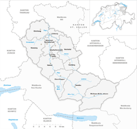
Map of Toggenburg

<< Wiki4Alps << St. Gallen
List of the cultural heritage of the district of Toggenburg in the Canton St. Gallen
[edit]
List of Monuments in the district of Toggenburg in the Canton St. Gallen.
Update: 15 April 2014
List
[edit]| KGS-Nr | Upload | Foto | Object | Other | Cov. | Cat. | Type | Address | Town | Coordinates | |||
|---|---|---|---|---|---|---|---|---|---|---|---|---|---|
| 14013 | Dreifaltigkeitskapelle | B | G | Egerten, Dietfurt | Bütschwil-Ganterschwil |
| |||||||
| 8138 | Holzbrücke Anzenwil (1862) | B | G | Anzenwil | Bütschwil-Ganterschwil |
| |||||||
| 8139 | Letzibrücke (Mitte 19. Jh.) | B | G | Letzistrasse, Ganterschwil | Bütschwil-Ganterschwil |
| |||||||
| 8141 | _111.JPG)
|
Reformierte Kirche (15. Jh.) | B | G | Neckertalstrasse, Ganterschwil | Bütschwil-Ganterschwil |
| ||||||
| 14106 | Villa Sonnenbühl | B | G | Schieb, Dietfurt | Bütschwil-Ganterschwil |
| |||||||
| 8111 | Weisses Haus (17. Jh.) | B | G | Landstrasse 31, Bütschwil | Bütschwil-Ganterschwil |
| |||||||
| 8117 | Haus Felsenstein (1624) | B | Felsensteinstrasse 15 | Ebnat-Kappel |
| ||||||||
| 8116 | Heimatmuseum Albert Edelmann-Stiftung | B | Ackerhusweg 16 | Ebnat-Kappel |
| ||||||||
| 14018 | 
|
Reformierte Kirche Ebnat | B | Ebnaterstrasse 21 | Ebnat-Kappel |
| |||||||
| 14019 | Weberei Trempel | B | Trempel | Ebnat-Kappel |
| ||||||||
| 8157 | 
|
Rotes Haus | A | Bruggstrasse 9, Bächli | Hemberg |
| |||||||
| 8156 | 
|
Katholische Kirche St. Johannes der Täufer | B | Oberdorf | Hemberg |
| |||||||
| 8178 | 
|
Altes Rathaus | A | Hintergasse 22 | Lichtensteig |
| |||||||
| 14035 | 
|
Bezirksgebäude | B | Hauptgasse 21 | Lichtensteig |
| |||||||
| 8179 | Haus zur Glocke | B | Hauptgasse 19 | Lichtensteig |
| ||||||||
| 14036 | Katholische Kirche St. Gallus | B | Schwendiweg | Lichtensteig |
| ||||||||
| 8180 | 
|
Loretokapelle (1680) | B | Loretostrasse | Lichtensteig |
| |||||||
| 8181 | 
|
Rathaus (1687) | B | Hintergasse 22 | Lichtensteig |
| |||||||
| 14037 | Spinnerei Stadtbrücke | B | Stadtbrücke 3 | Lichtensteig |
| ||||||||
| 8876 | Stadtarchiv Lichtensteig | B | Hauptgasse 10 | Lichtensteig |
| ||||||||
| 8182 | 
|
Toggenburger Museum (1804) | B | Hauptgasse 1 | Lichtensteig |
| |||||||
| 8200 | Bauernhaus Spilhusen (18. Jh.) | B | G | Spilhusen 10 | Mosnang |
| |||||||
| 8201 | _057.JPG)
|
Katholische Kirche St. Georg mit Friedhofskapelle | B | G | Bütschwilerstrasse | Mosnang |
| ||||||
| 8202 | -Preghejo_258a.jpg)
|
Katholische Kirche St. Josef | B | G | Mühlrüti | Mosnang |
| ||||||
| 8194 | 
|
Haus Näf | A | Furt 520, St. Peterzell | Neckertal |
| |||||||
| 8195 | 
|
Oberes Türmlihaus | A | Furtstrasse 93, Peterzell | Neckertal |
| |||||||
| 10141 | 
|
Unteres Türmlihaus | A | Furtstrasse 95, Peterzell | Neckertal |
| |||||||
| 8362 | 
|
Ehemalige Propstei St. Peter und Paul | B | Dorf 9, St. Peterzell | Neckertal |
| |||||||
| 8108 | Furth, Alter Hirschen | B | Hofstettenstrasse 8, Brunnadern | Neckertal |
| ||||||||
| 14044 | Gasthaus Rössli | B | Dorfstrasse 16, Mogelsberg | Neckertal |
| ||||||||
| 8361 | Haus Bädli (um 1720, Fassadenmalerei) | B | Bädli 93, St. Peterzell | Neckertal |
| ||||||||
| 8197 | Holzbrücke Anzenwil (1862) | B | Mettlen - Anzenwil, Mogelsberg | Neckertal |
| ||||||||
| 14043 | 
|
Paritätische Kirche St. Jakobus | B | Sandbüelstrasse, Mogelsberg | Neckertal |
| |||||||
| 14042 | Reformierte Kirche | B | Dorfstrasse 29, Brunnadern | Neckertal |
| ||||||||
| 8364 | Rotes Haus | B | Dorf 28, St. Peterzell | Neckertal |
| ||||||||
| 8109 | Spreitenbach, Fabrikantenhaus | B | Flurstrasse 40, Brunnadern | Neckertal |
| ||||||||
| 8363 | Wald, Fabrikantenhaus (1770/71) | B | Hauptstrasse 53, Schönengrund | Neckertal |
| ||||||||
| 8176 | 
|
Ehemaliges Benediktinerkloster | A | Johanneumstrasse 1–3 | Nesslau |
| |||||||
| 10142 | Haus | A | Sidwaldstrasse 6 | Nesslau |
| ||||||||
| 14094 | Bahnhof Lichtensteig | B | Freudenau | Wattwil |
| ||||||||
| 14093 | 
|
Bahnhof Wattwil | B | Bahnhofplatz | Wattwil |
| |||||||
| 8404 | 
|
Burgruine Iberg (Mitte 13. Jh.) | B | Am Iberg | Wattwil |
| |||||||
| 8403 | Fabrikantenhaus (ehemaliges Altersheim Bunt) | B | Wilerstrasse 77 | Wattwil |
| ||||||||
| 8405 | 
|
Geburtshaus Ulrich Bräker, Nr. 1219 | B | Näppis-Ueli-Strasse | Wattwil |
| |||||||
| 8407 | Haus Steiner (1692) | B | Scheftenauerstrasse 1246 | Wattwil |
| ||||||||
| 14092 | Kantonsschule Wattwil | B | Näppis-Ueli-Strasse 11 | Wattwil |
| ||||||||
| 8406 | 
|
Kapuzinerinnenkloster Maria der Engel (17./18. Jh., Baugruppe) | B | Wenkenrüti | Wattwil |
| |||||||
| 14034 | Reformierte Kirche Krinau | B | Krinaustrasse, Krinau | Wattwil |
| ||||||||
| 14091 | 
|
Reformierte Kirche Wattwil | B | Kirchenrain | Wattwil |
| |||||||
| 10130 | Wohnhaus Quelle | B | Mühle 65, Krinau | Wattwil |
| ||||||||
| 8071 | 
|
Wildenmannlisloch (paläolithische Wohnhöhle) | A | Alt St. Johann | Wildhaus-Alt St. Johann |
| |||||||
| 8422 | 
|
Geburtshaus von Ulrich Zwingli | A | Lisighus 167, Wildhaus | Wildhaus-Alt St. Johann |
| |||||||
| 8423 | 
|
Burgruine Wildenburg | B | Wildhaus | Wildhaus-Alt St. Johann |
| |||||||
| 8424 | Katholische Kirche St. Bartholomäus (1776) | B | Wisstrasse, Wildhaus | Wildhaus-Alt St. Johann |
| ||||||||
| 8072 | 
|
Propstei / ehemaliges Benediktinerkloster | B | Dorf 401-404, Alt St. Johann | Wildhaus-Alt St. Johann |
|