Commons:Wiki4Alps/Raron (West)

From Wikimedia Commons, the free media repository
Jump to navigation Jump to search

<< Wiki4Alps << Valais

List of the cultural heritage of the district of Raron in the Canton Valais

[edit]
Map of Raron
Map of Raron

List of Monuments in the district of Raron in the Canton Valais.

Update: 15 April 2014

List

[edit]
KGS-Nr Upload Foto   Object Other Cov. Cat. Type Address Town Coordinates
6595 Upload a file Kirche St. Josef (spätgotischer Flügelaltar) No images B G Dorfstrasse Ausserberg
46° 18′ 51.41″ N, 7° 51′ 04.36″ E Kartographer map based on OpenStreetMap.View all coordinates using: OpenStreetMapinfo


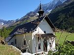
6641 Upload a file Kapelle St.Bernhard Kapelle St.Bernhard No images B G Fafleralp Blatten
46° 26′ 05.86″ N, 7° 51′ 32.51″ E Kartographer map based on OpenStreetMap.View all coordinates using: OpenStreetMapinfo


6642 Upload a file Kapelle Mariä Heimsuchung Kapelle Mariä Heimsuchung No images B G Kühmatt Blatten
46° 25′ 44.36″ N, 7° 50′ 35.99″ E Kartographer map based on OpenStreetMap.View all coordinates using: OpenStreetMapinfo


6673 Upload a file Eisenzeitliche Höhensiedlung Eisenzeitliche Höhensiedlung No images B F Hochastler Bürchen
46° 17′ 27.28″ N, 7° 48′ 41.69″ E Kartographer map based on OpenStreetMap.View all coordinates using: OpenStreetMapinfo


6675 Upload a file Kapelle No images B G Mauracker Bürchen
46° 17′ 00.38″ N, 7° 48′ 48.71″ E Kartographer map based on OpenStreetMap.View all coordinates using: OpenStreetMapinfo


6674 Upload a file Muttergotteskapelle (Ende 17. Jh.) Muttergotteskapelle (Ende 17. Jh.) No images B G Ibrich Bürchen
46° 16′ 46.42″ N, 7° 49′ 05.16″ E Kartographer map based on OpenStreetMap.View all coordinates using: OpenStreetMapinfo


6676 Upload a file Wallfahrtskapelle der Schmerzhaften Muttergottes mit Kapellenweg (Originalfiguren in der Taufkapelle) No images B G Wandfluh Bürchen
46° 18′ 00.86″ N, 7° 48′ 06.88″ E Kartographer map based on OpenStreetMap.View all coordinates using: OpenStreetMapinfo


6705 Upload a file Kirche Mariä Himmelfahrt (1886) No images B G Dorfstrasse Eischoll
46° 17′ 41.06″ N, 7° 46′ 45.05″ E Kartographer map based on OpenStreetMap.View all coordinates using: OpenStreetMapinfo


10360 Upload a file Rotigostadel No images A G Ferden
46° 23′ 36.74″ N, 7° 45′ 30.49″ E Kartographer map based on OpenStreetMap.View all coordinates using: OpenStreetMapinfo


6736 Upload a file Ehemaliges Bleibergwerk mit Aufbereitungsanlage No images B G Goppenstein Ferden
46° 21′ 48.28″ N, 7° 45′ 33.41″ E Kartographer map based on OpenStreetMap.View all coordinates using: OpenStreetMapinfo


6735 Upload a file Faldumalp mit Kapelle Faldumalp mit Kapelle No images B G Ferden
46° 22′ 39.61″ N, 7° 44′ 19.97″ E Kartographer map based on OpenStreetMap.View all coordinates using: OpenStreetMapinfo


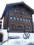
6791 Upload a file Haus Murmann No images B G Kippel
46° 23′ 56.9″ N, 7° 46′ 20.21″ E Kartographer map based on OpenStreetMap.View all coordinates using: OpenStreetMapinfo


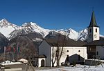
6792 Upload a file Kirche St.Martin mit Beinhaus Kirche St.Martin mit Beinhaus No images B G Kippel
46° 23′ 56.29″ N, 7° 46′ 23.74″ E Kartographer map based on OpenStreetMap.View all coordinates using: OpenStreetMapinfo


6793 Upload a file Lötschentaler Museum (Gebäude) No images B G Museumsweg Kippel
46° 23′ 57.62″ N, 7° 46′ 23.02″ E Kartographer map based on OpenStreetMap.View all coordinates using: OpenStreetMapinfo


10699 Upload a file Lötschentaler Museum (Sammlung) No images B S Museumsweg Kippel
46° 23′ 57.8″ N, 7° 46′ 23.16″ E Kartographer map based on OpenStreetMap.View all coordinates using: OpenStreetMapinfo


13915 Upload a file Stafel mit Kapelle No images B G Hockenalp Kippel
46° 24′ 37.55″ N, 7° 45′ 54.25″ E Kartographer map based on OpenStreetMap.View all coordinates using: OpenStreetMapinfo


6903 Upload a file Gestelnburg Gestelnburg No images A F/G Ritterweg Niedergesteln
46° 18′ 47.99″ N, 7° 46′ 59.16″ E Kartographer map based on OpenStreetMap.View all coordinates using: OpenStreetMapinfo


6904 Upload a file Häuserzeile Eischler-Haus No images B G Niedergesteln
46° 18′ 51.84″ N, 7° 46′ 56.17″ E Kartographer map based on OpenStreetMap.View all coordinates using: OpenStreetMapinfo


6905 Upload a file Kirche St.Maria mit Beinhaus No images B G Kirchgasse Niedergesteln
46° 18′ 49.28″ N, 7° 46′ 57.14″ E Kartographer map based on OpenStreetMap.View all coordinates using: OpenStreetMapinfo


6906 Upload a file Pfarrhaus No images B G Pfarreigasse 8 Niedergesteln
46° 18′ 48.31″ N, 7° 46′ 56.6″ E Kartographer map based on OpenStreetMap.View all coordinates using: OpenStreetMapinfo


6940 Upload a file Prähistorische Stätte No images A S Heidnischbühl Raron
46° 18′ 35.96″ N, 7° 48′ 35.64″ E Kartographer map based on OpenStreetMap.View all coordinates using: OpenStreetMapinfo


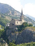
6936 Upload a file Kirche St.Roman mit altem Pfarrhaus Kirche St.Roman mit altem Pfarrhaus No images A G Burghügel Raron
46° 18′ 38.41″ N, 7° 48′ 11.84″ E Kartographer map based on OpenStreetMap.View all coordinates using: OpenStreetMapinfo


6939 Upload a file Wohnturm der Viztume No images A G Burghügel Raron
46° 18′ 39.1″ N, 7° 48′ 13.68″ E Kartographer map based on OpenStreetMap.View all coordinates using: OpenStreetMapinfo


9073 Upload a file Bietschtal-Viadukt BLS No images B G Raron
46° 19′ 23.27″ N, 7° 48′ 50″ E Kartographer map based on OpenStreetMap.View all coordinates using: OpenStreetMapinfo


6938 Upload a file Haus von Ulrich Ruffiner (Haus Imboden) No images B G Ulrich-Ruffiner-Weg 2 Raron
46° 18′ 33.59″ N, 7° 48′ 11.2″ E Kartographer map based on OpenStreetMap.View all coordinates using: OpenStreetMapinfo


6937 Upload a file Kapelle Maria vom Guten Rat No images B G Rarnerchumma Raron
46° 19′ 02.57″ N, 7° 48′ 13.86″ E Kartographer map based on OpenStreetMap.View all coordinates using: OpenStreetMapinfo


6943 Upload a file St.German, Kirche St.German No images B G Dorfstrasse 9 Raron
46° 18′ 44.42″ N, 7° 49′ 15.17″ E Kartographer map based on OpenStreetMap.View all coordinates using: OpenStreetMapinfo


6941 Upload a file Maxenhaus Maxenhaus No images B G Dorfplatz 9 Raron
46° 18′ 42.66″ N, 7° 48′ 00.79″ E Kartographer map based on OpenStreetMap.View all coordinates using: OpenStreetMapinfo


10702 Upload a file Museum auf der Burg No images B S Stalde Raron
46° 18′ 39.1″ N, 7° 48′ 12.1″ E Kartographer map based on OpenStreetMap.View all coordinates using: OpenStreetMapinfo


6944 Upload a file St.German, Tscherggenhaus No images B G Tscherggen Raron
46° 18′ 42.91″ N, 7° 48′ 52.13″ E Kartographer map based on OpenStreetMap.View all coordinates using: OpenStreetMapinfo


6945 Upload a file St.German, Vogelhaus No images B G Tscherggen Raron
46° 18′ 43.2″ N, 7° 48′ 52.6″ E Kartographer map based on OpenStreetMap.View all coordinates using: OpenStreetMapinfo


6946 Upload a file Zentriegenhaus No images B G Oberdorfgasse 11 Raron
46° 18′ 43.49″ N, 7° 48′ 03.13″ E Kartographer map based on OpenStreetMap.View all coordinates using: OpenStreetMapinfo


7094 Upload a file Kirche Heilige Familie (1914) No images B G Kirchstrasse, Steg Steg-Hohtenn
46° 18′ 54.07″ N, 7° 44′ 48.66″ E Kartographer map based on OpenStreetMap.View all coordinates using: OpenStreetMapinfo


6783 Upload a file Kirche St.Barbara (Glasmalereien) No images B G Bahnhofstrasse 20, Hohtenn Steg-Hohtenn
46° 19′ 07.18″ N, 7° 45′ 23.36″ E Kartographer map based on OpenStreetMap.View all coordinates using: OpenStreetMapinfo


7153 Upload a file Altes Gemeindehaus Altes Gemeindehaus No images B G Dorfstrasse Unterbäch
46° 17′ 05.6″ N, 7° 47′ 55″ E Kartographer map based on OpenStreetMap.View all coordinates using: OpenStreetMapinfo


7154 Upload a file Burgruine Steinhaus und Zwingherrenschloss Burgruine Steinhaus und Zwingherrenschloss No images B F Unterbäch
46° 17′ 24.9″ N, 7° 47′ 46.1″ E Kartographer map based on OpenStreetMap.View all coordinates using: OpenStreetMapinfo


7156 Upload a file Kirche Heilige Dreifaltigkeit Kirche Heilige Dreifaltigkeit No images B G Bei der Kirche Unterbäch
46° 17′ 05.71″ N, 7° 48′ 00.43″ E Kartographer map based on OpenStreetMap.View all coordinates using: OpenStreetMapinfo


7218 Upload a file Friedhof No images B G Oberdorf Wiler (Lötschen)
46° 24′ 14.72″ N, 7° 46′ 59.99″ E Kartographer map based on OpenStreetMap.View all coordinates using: OpenStreetMapinfo


7219 Upload a file Zwei Wüstungen im Giätrich (abgegangene Weiler) No images B F Wiler (Lötschen)
46° 24′ 08.1″ N, 7° 47′ 38.47″ E Kartographer map based on OpenStreetMap.View all coordinates using: OpenStreetMapinfo