Commons:Wiki4Alps/Hinterrhein

From Wikimedia Commons, the free media repository
Jump to navigation Jump to search

<< Wiki4Alps << Graubünden

List of the cultural heritage of the district of Hinterrhein in the Canton Graubünden[edit]

Map of Hinterrhein
Map of Hinterrhein

List of Monuments in the district of Hinterrhein in the Canton Graubünden.

Update: 15 April 2014

List[edit]

KGS-Nr Upload Foto   Object Other Cov. Cat. Type Address Town Coordinates
2823 Upload a file Haus Keller No images B G Dorfstrasse 31 Almens
46° 44′ 14.75″ N, 9° 27′ 20.63″ E Kartographer map based on OpenStreetMap.View all coordinates using: OpenStreetMapinfo


2824 Upload a file Katholische Kirche St. Andreas Katholische Kirche St. Andreas Less or equal to 10 images B G Dorfstrasse 40 Almens
46° 44′ 13.38″ N, 9° 27′ 21.96″ E Kartographer map based on OpenStreetMap.View all coordinates using: OpenStreetMapinfo


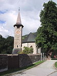
10030 Upload a file Reformierte Kirche Reformierte Kirche DE Less or equal to 10 images B G Dorfstrasse Almens
46° 44′ 16.44″ N, 9° 27′ 17.53″ E Kartographer map based on OpenStreetMap.View all coordinates using: OpenStreetMapinfo


2833 Upload a file Chasa Padrun (Giassa dad asens) Chasa Padrun (Giassa dad asens) Less or equal to 10 images A G Veia Sgraffito 64 Andeer
46° 36′ 09.49″ N, 9° 25′ 36.78″ E Kartographer map based on OpenStreetMap.View all coordinates using: OpenStreetMapinfo


2834 Upload a file Tgea Conrad Tgea Conrad Less or equal to 10 images B G Vea Granda Andeer
46° 36′ 00.58″ N, 9° 25′ 40.08″ E Kartographer map based on OpenStreetMap.View all coordinates using: OpenStreetMapinfo


12424 Upload a file Tgea Melchior Tgea Melchior Less or equal to 10 images B G Vea Granda Andeer
46° 36′ 00.29″ N, 9° 25′ 40.62″ E Kartographer map based on OpenStreetMap.View all coordinates using: OpenStreetMapinfo


10721 Upload a file Tgea Veia Granda Tgea Veia Granda Less or equal to 10 images B G Veia Granda 26 Andeer
46° 36′ 12.24″ N, 9° 25′ 34.14″ E Kartographer map based on OpenStreetMap.View all coordinates using: OpenStreetMapinfo


3132 Upload a file Pferdewechselstation und Badhaus No images B G Bogn 65/66, Pignia Andeer
46° 36′ 49.28″ N, 9° 25′ 50.34″ E Kartographer map based on OpenStreetMap.View all coordinates using: OpenStreetMapinfo


2962 Upload a file Baselgia refurmada Baselgia refurmada DE Less or equal to 10 images B G Clugin Andeer
46° 37′ 00.62″ N, 9° 25′ 38.24″ E Kartographer map based on OpenStreetMap.View all coordinates using: OpenStreetMapinfo


10734 Upload a file Wohnhaus Demarmels No images B G Lavatér 23, Clugin Andeer
46° 37′ 02.06″ N, 9° 25′ 33.64″ E Kartographer map based on OpenStreetMap.View all coordinates using: OpenStreetMapinfo


10733 Upload a file Wohnhaus Wohnhaus Less or equal to 10 images B G Lavatér 31, Clugin Andeer
46° 37′ 01.52″ N, 9° 25′ 35.58″ E Kartographer map based on OpenStreetMap.View all coordinates using: OpenStreetMapinfo


2855 Upload a file Reformierte Kirche Reformierte Kirche DE Less or equal to 30 images A G Cresta 105 (Chilchawäg) Avers
46° 28′ 16.96″ N, 9° 30′ 54.86″ E Kartographer map based on OpenStreetMap.View all coordinates using: OpenStreetMapinfo


2858 Upload a file Armenhaus (Burdelski) No images B G Campsut 226 Avers
46° 29′ 14.21″ N, 9° 28′ 41.12″ E Kartographer map based on OpenStreetMap.View all coordinates using: OpenStreetMapinfo


2857 Upload a file Mittla-Hus No images B G Am Bach 77 Avers
46° 27′ 31.36″ N, 9° 32′ 13.42″ E Kartographer map based on OpenStreetMap.View all coordinates using: OpenStreetMapinfo


10729 Upload a file Tgea Gredinger No images B G Curtgegns 210 Casti-Wergenstein
46° 36′ 52.99″ N, 9° 26′ 08.27″ E Kartographer map based on OpenStreetMap.View all coordinates using: OpenStreetMapinfo


2901 Upload a file Baselgia reformada Baselgia reformada DE Less or equal to 10 images B G Casti Casti-Wergenstein
46° 37′ 27.73″ N, 9° 25′ 19.52″ E Kartographer map based on OpenStreetMap.View all coordinates using: OpenStreetMapinfo


2907 Upload a file Prähistorische Siedlung Prähistorische Siedlung DE Less or equal to 10 images A G Cresta Cazis
46° 42′ 36.18″ N, 9° 25′ 53.51″ E Kartographer map based on OpenStreetMap.View all coordinates using: OpenStreetMapinfo


2911 Upload a file Kapelle St. Wendelin Kapelle St. Wendelin Less or equal to 10 images A G Am Dorfplatz 17 Cazis
46° 43′ 14.26″ N, 9° 25′ 43.82″ E Kartographer map based on OpenStreetMap.View all coordinates using: OpenStreetMapinfo


2908 Upload a file Katholische Begräbniskirche St. Martin Katholische Begräbniskirche St. Martin Less or equal to 10 images A G St. Martinsstrasse Cazis
46° 43′ 10.21″ N, 9° 26′ 11.27″ E Kartographer map based on OpenStreetMap.View all coordinates using: OpenStreetMapinfo


2910 Upload a file Ehemalige Klosterkirche St. Peter und Paul Ehemalige Klosterkirche St. Peter und Paul DE FR Less or equal to 10 images B G Hauptstrasse Cazis
46° 43′ 16.32″ N, 9° 25′ 46.96″ E Kartographer map based on OpenStreetMap.View all coordinates using: OpenStreetMapinfo


3219 Upload a file Tgea cun passadi (Lanica) No images B G Dorfplatz 77, Sarn Cazis
46° 43′ 13.73″ N, 9° 24′ 34.45″ E Kartographer map based on OpenStreetMap.View all coordinates using: OpenStreetMapinfo


2909 Upload a file Petrushügel, jungsteinzeitliche Höhensiedlung Petrushügel, jungsteinzeitliche Höhensiedlung Less or equal to 10 images B G Ratitscherstrasse Cazis
46° 44′ 00.96″ N, 9° 25′ 21.04″ E Kartographer map based on OpenStreetMap.View all coordinates using: OpenStreetMapinfo


3218 Upload a file Baselgia refurmada Baselgia refurmada DE Less or equal to 10 images B G Sarn Cazis
46° 43′ 10.6″ N, 9° 24′ 35.39″ E Kartographer map based on OpenStreetMap.View all coordinates using: OpenStreetMapinfo


10817 Upload a file Stecherhaus No images B G Curtgegns 14, Tartar Cazis
46° 43′ 08.76″ N, 9° 25′ 06.17″ E Kartographer map based on OpenStreetMap.View all coordinates using: OpenStreetMapinfo


10754 Upload a file Tgea Nr. 8 "La Caplutta" No images B G Patzen 8, Patzen-Fardün Donat
46° 38′ 07.62″ N, 9° 25′ 45.23″ E Kartographer map based on OpenStreetMap.View all coordinates using: OpenStreetMapinfo


2997 Upload a file Champ da fossas preistoric No images B F Donat
46° 37′ 40.62″ N, 9° 25′ 25.03″ E Kartographer map based on OpenStreetMap.View all coordinates using: OpenStreetMapinfo


10753 Upload a file Baselgia refurmada Baselgia refurmada DE Less or equal to 10 images B G Patzen-Fardün Donat
46° 37′ 57.61″ N, 9° 25′ 33.1″ E Kartographer map based on OpenStreetMap.View all coordinates using: OpenStreetMapinfo


12445 Upload a file Ausserferrera, Cresta, evangelische Kirche Ausserferrera, Cresta, evangelische Kirche DE Less or equal to 10 images B G Ferrera
46° 33′ 42.77″ N, 9° 26′ 51.6″ E Kartographer map based on OpenStreetMap.View all coordinates using: OpenStreetMapinfo


2852 Upload a file Ruinen der Bergbausiedlung (19. Jh.) am Averser Rhein No images B F Ferrera
46° 33′ 39.38″ N, 9° 26′ 14.33″ E Kartographer map based on OpenStreetMap.View all coordinates using: OpenStreetMapinfo


3020 Upload a file Haus Stoffel Haus Stoffel Less or equal to 10 images A G Schlossgass 65 Fürstenau
46° 43′ 15.38″ N, 9° 26′ 47.03″ E Kartographer map based on OpenStreetMap.View all coordinates using: OpenStreetMapinfo


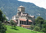
10044 Upload a file Oberes Schloss Oberes Schloss EN DE Less or equal to 30 images A G Schlossgass 71 Fürstenau
46° 43′ 16.76″ N, 9° 26′ 45.9″ E Kartographer map based on OpenStreetMap.View all coordinates using: OpenStreetMapinfo


3019 Upload a file Unteres Schloss Unteres Schloss EN DE Less or equal to 10 images A G Schlossgass 70 Fürstenau
46° 43′ 15.95″ N, 9° 26′ 42.24″ E Kartographer map based on OpenStreetMap.View all coordinates using: OpenStreetMapinfo


10045 Upload a file Umfassungsmauer No images B G Fürstenau
46° 43′ 16.81″ N, 9° 26′ 41.85″ E Kartographer map based on OpenStreetMap.View all coordinates using: OpenStreetMapinfo


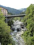
3035 Upload a file Alte Landbrücke Alte Landbrücke DE FR Less or equal to 30 images A G Hinterrhein
46° 31′ 43.78″ N, 9° 12′ 07.11″ E Kartographer map based on OpenStreetMap.View all coordinates using: OpenStreetMapinfo


3037 Upload a file Rotes Haus, mit Garten No images B G Hauptstrasse 6 Hinterrhein
46° 31′ 51.26″ N, 9° 11′ 59.85″ E Kartographer map based on OpenStreetMap.View all coordinates using: OpenStreetMapinfo


3070 Upload a file Baselgia refurmada cun chasa pravenda Baselgia refurmada cun chasa pravenda DE Less or equal to 30 images B G Dorf 23 Lohn
46° 39′ 03″ N, 9° 25′ 37″ E Kartographer map based on OpenStreetMap.View all coordinates using: OpenStreetMapinfo


3100 Upload a file Evangelische Kirche Evangelische Kirche DE Less or equal to 10 images B G Ausserdorf Masein
46° 42′ 17.79″ N, 9° 25′ 37.03″ E Kartographer map based on OpenStreetMap.View all coordinates using: OpenStreetMapinfo


3101 Upload a file Schloss Tagstein mit Umgebung Schloss Tagstein mit Umgebung Less or equal to 10 images B G Masagn Masein
46° 42′ 16.35″ N, 9° 25′ 58.63″ E Kartographer map based on OpenStreetMap.View all coordinates using: OpenStreetMapinfo


3103 Upload a file Baselgia veglia S. Antonius Baselgia veglia S. Antonius DE Less or equal to 30 images B G Sutgea Mathon
46° 38′ 09.52″ N, 9° 25′ 01.55″ E Kartographer map based on OpenStreetMap.View all coordinates using: OpenStreetMapinfo


3102 Upload a file Baselgia refurmada Baselgia refurmada DE Less or equal to 10 images B G Zulada Mathon
46° 38′ 10.28″ N, 9° 24′ 55.47″ E Kartographer map based on OpenStreetMap.View all coordinates using: OpenStreetMapinfo


3125 Upload a file Kapelle St. Lorenz Kapelle St. Lorenz DE Less or equal to 30 images A G Paspels
46° 45′ 24.29″ N, 9° 26′ 13.13″ E Kartographer map based on OpenStreetMap.View all coordinates using: OpenStreetMapinfo


3126 Upload a file Kapelle St. Maria Magdalena Kapelle St. Maria Magdalena DE Less or equal to 30 images A G Dusch Paspels
46° 45′ 23.47″ N, 9° 26′ 59.76″ E Kartographer map based on OpenStreetMap.View all coordinates using: OpenStreetMapinfo


3127 Upload a file Burgruine Alt-Sins Burgruine Alt-Sins DE Less or equal to 10 images B G Alt-Sins Paspels
46° 44′ 58.26″ N, 9° 26′ 20.65″ E Kartographer map based on OpenStreetMap.View all coordinates using: OpenStreetMapinfo


3128 Upload a file Burgruine Canova (Neu-Sins) Burgruine Canova (Neu-Sins) DE Less or equal to 10 images B G Canova Paspels
46° 44′ 38.93″ N, 9° 26′ 51.5″ E Kartographer map based on OpenStreetMap.View all coordinates using: OpenStreetMapinfo


12468 Upload a file Haus Buol mit Hofanlage (Haus Albertini) No images B G Dusch 103 Paspels
46° 45′ 18.84″ N, 9° 27′ 06.19″ E Kartographer map based on OpenStreetMap.View all coordinates using: OpenStreetMapinfo


3130 Upload a file Schloss Sins mit Gartenanlage Schloss Sins mit Gartenanlage DE Less or equal to 30 images B G Vitg 60 Paspels
46° 45′ 00.12″ N, 9° 26′ 25.43″ E Kartographer map based on OpenStreetMap.View all coordinates using: OpenStreetMapinfo


3157 Upload a file Schloss Rietberg Schloss Rietberg Less or equal to 30 images A G Rietberg Pratval
46° 44′ 08.86″ N, 9° 26′ 52.93″ E Kartographer map based on OpenStreetMap.View all coordinates using: OpenStreetMapinfo


3175 Upload a file Haus Blumenthal No images B G Bahnhofstrasse 20 Rodels
46° 44′ 09.23″ N, 9° 26′ 36.26″ E Kartographer map based on OpenStreetMap.View all coordinates using: OpenStreetMapinfo


12450 Upload a file Haus Jecklin No images B G Im Feld 25 Rodels
46° 44′ 06.4″ N, 9° 26′ 40.4″ E Kartographer map based on OpenStreetMap.View all coordinates using: OpenStreetMapinfo


3176 Upload a file Katholische Kirche St. Christophorus No images B G Oberdorf Rodels
46° 44′ 07.34″ N, 9° 26′ 42.32″ E Kartographer map based on OpenStreetMap.View all coordinates using: OpenStreetMapinfo


10479 Upload a file Burg Hochjuvalt, Talsperre Burg Hochjuvalt, Talsperre EN DE Less or equal to 30 images A F Vigna Rothenbrunnen
46° 46′ 39.97″ N, 9° 25′ 15.01″ E Kartographer map based on OpenStreetMap.View all coordinates using: OpenStreetMapinfo


10762 Upload a file Ehemaliges Kurhaus Ehemaliges Kurhaus Less or equal to 10 images B G Dorfstrasse 2 Rothenbrunnen
46° 46′ 12.27″ N, 9° 25′ 34.36″ E Kartographer map based on OpenStreetMap.View all coordinates using: OpenStreetMapinfo


3183 Upload a file Haus Tscharner Haus Tscharner Less or equal to 10 images B G Dorfstrasse 10 Rothenbrunnen
46° 46′ 08.36″ N, 9° 25′ 35.68″ E Kartographer map based on OpenStreetMap.View all coordinates using: OpenStreetMapinfo


3239 Upload a file Haus Bardill (ehemaliges Haus Gees) Haus Bardill (ehemaliges Haus Gees) Less or equal to 10 images A G Davos Cresta 37 Scharans
46° 42′ 58.86″ N, 9° 27′ 33.22″ E Kartographer map based on OpenStreetMap.View all coordinates using: OpenStreetMapinfo


3240 Upload a file Haus Buchli-Balzer No images B G Sumvitg 48 Scharans
46° 42′ 57.24″ N, 9° 27′ 35.38″ E Kartographer map based on OpenStreetMap.View all coordinates using: OpenStreetMapinfo


3241 Upload a file Häuser Nr. 36 und 38 No images B G Davos Cresta 36, Sumvitg 38 Scharans
46° 42′ 58.74″ N, 9° 27′ 33.22″ E Kartographer map based on OpenStreetMap.View all coordinates using: OpenStreetMapinfo


3242 Upload a file Reformierte Kirche Reformierte Kirche DE Less or equal to 10 images B G Cadiepel Scharans
46° 43′ 05.04″ N, 9° 27′ 33.93″ E Kartographer map based on OpenStreetMap.View all coordinates using: OpenStreetMapinfo


10781 Upload a file Wohnhaus Joos No images B G Cadiepel 88a Scharans
46° 43′ 05.43″ N, 9° 27′ 32.3″ E Kartographer map based on OpenStreetMap.View all coordinates using: OpenStreetMapinfo


10782 Upload a file Wohnhaus Patzen Kohler No images B G Linda 77 Scharans
46° 43′ 03.62″ N, 9° 27′ 32.23″ E Kartographer map based on OpenStreetMap.View all coordinates using: OpenStreetMapinfo


10058 Upload a file Burg Ehrenfels Burg Ehrenfels EN DE Less or equal to 10 images A F/G Ehrenfels Sils im Domleschg
46° 41′ 48.26″ N, 9° 27′ 06.34″ E Kartographer map based on OpenStreetMap.View all coordinates using: OpenStreetMapinfo


3270 Upload a file Carschenna (prähistorische Felszeichnungen) Carschenna (prähistorische Felszeichnungen) DE Less or equal to 10 images A F Sils im Domleschg
46° 41′ 38.1″ N, 9° 27′ 31.38″ E Kartographer map based on OpenStreetMap.View all coordinates using: OpenStreetMapinfo


3271 Upload a file Hohen Rätien, Burgruine Hohen Rätien, Burgruine EN DE Less or equal to 30 images A F/G Sils im Domleschg
46° 41′ 30.57″ N, 9° 26′ 40.72″ E Kartographer map based on OpenStreetMap.View all coordinates using: OpenStreetMapinfo


3269 Upload a file Ruine Campi Ruine Campi EN DE Less or equal to 30 images A F/G Campi Sils im Domleschg
46° 42′ 02.56″ N, 9° 28′ 16.55″ E Kartographer map based on OpenStreetMap.View all coordinates using: OpenStreetMapinfo


3274 Upload a file Evangelische Kirche St. Cassian Evangelische Kirche St. Cassian DE Less or equal to 10 images B G Quadra Sils im Domleschg
46° 42′ 15.38″ N, 9° 27′ 35.98″ E Kartographer map based on OpenStreetMap.View all coordinates using: OpenStreetMapinfo


3272 Upload a file Haus Künzler mit Garten No images B G Dorfplatz 1 Sils im Domleschg
46° 42′ 01.85″ N, 9° 27′ 15.32″ E Kartographer map based on OpenStreetMap.View all coordinates using: OpenStreetMapinfo


3273 Upload a file Palazzo Donatz mit Gartenanlage Palazzo Donatz mit Gartenanlage Less or equal to 10 images B G Ausserdorf 9 Sils im Domleschg
46° 42′ 00.25″ N, 9° 27′ 06.78″ E Kartographer map based on OpenStreetMap.View all coordinates using: OpenStreetMapinfo


3275 Upload a file Schloss Baldenstein mit Gartenanlage Schloss Baldenstein mit Gartenanlage Less or equal to 10 images B G Baldenstein 1 Sils im Domleschg
46° 42′ 23.85″ N, 9° 27′ 36.63″ E Kartographer map based on OpenStreetMap.View all coordinates using: OpenStreetMapinfo


10555 Upload a file Ehemalige Säumerherberge Weiss Kreuz Ehemalige Säumerherberge Weiss Kreuz Less or equal to 10 images A G Oberdorf 66 Splügen
46° 33′ 13.1″ N, 9° 19′ 20.56″ E Kartographer map based on OpenStreetMap.View all coordinates using: OpenStreetMapinfo


3295 Upload a file Burg Burg EN DE IT Less or equal to 30 images B G Splügen
46° 33′ 26.51″ N, 9° 20′ 03.95″ E Kartographer map based on OpenStreetMap.View all coordinates using: OpenStreetMapinfo


10802 Upload a file Evangelische Kirche Evangelische Kirche DE Less or equal to 30 images B G Splügen
46° 33′ 15.02″ N, 9° 19′ 26.64″ E Kartographer map based on OpenStreetMap.View all coordinates using: OpenStreetMapinfo


3300 Upload a file Gemeindehaus (altes Schulhaus) Gemeindehaus (altes Schulhaus) Less or equal to 30 images B G Oberdorf 65 Splügen
46° 33′ 13.9″ N, 9° 19′ 19.93″ E Kartographer map based on OpenStreetMap.View all coordinates using: OpenStreetMapinfo


3294 Upload a file Haus Albertini Haus Albertini Less or equal to 10 images B G Oberdorf 59 Splügen
46° 33′ 15.4″ N, 9° 19′ 19.14″ E Kartographer map based on OpenStreetMap.View all coordinates using: OpenStreetMapinfo


3297 Upload a file Haus Camastral Haus Camastral Less or equal to 30 images B G Susta 34 Splügen
46° 33′ 14.04″ N, 9° 19′ 21.11″ E Kartographer map based on OpenStreetMap.View all coordinates using: OpenStreetMapinfo


10801 Upload a file Hotel Bodenhaus Hotel Bodenhaus Less or equal to 30 images B G Bodenplatz 6a Splügen
46° 33′ 12.81″ N, 9° 19′ 27.26″ E Kartographer map based on OpenStreetMap.View all coordinates using: OpenStreetMapinfo


3299 Upload a file Schorsch-Haus Schorsch-Haus Less or equal to 10 images B G Oberdorf 58, 58A Splügen
46° 33′ 15.36″ N, 9° 19′ 19.75″ E Kartographer map based on OpenStreetMap.View all coordinates using: OpenStreetMapinfo


3343 Upload a file Burgruine Obertagstein Burgruine Obertagstein DE Less or equal to 30 images B G Thusis
46° 41′ 06.06″ N, 9° 25′ 39.56″ E Kartographer map based on OpenStreetMap.View all coordinates using: OpenStreetMapinfo


10819 Upload a file Ehemaliges Hotel Viamala No images B G Neudorfstrasse 6 Thusis
46° 41′ 40.61″ N, 9° 26′ 22.83″ E Kartographer map based on OpenStreetMap.View all coordinates using: OpenStreetMapinfo


3344 Upload a file Haus Krone (Haus Rosenroll) No images B G Altdorfstrasse 13 Thusis
46° 41′ 38.43″ N, 9° 26′ 17.95″ E Kartographer map based on OpenStreetMap.View all coordinates using: OpenStreetMapinfo


3345 Upload a file Nolla-Fassung der Rheinkorrektion Nolla-Fassung der Rheinkorrektion Less or equal to 10 images B G Thusis
46° 41′ 34.79″ N, 9° 26′ 22.52″ E Kartographer map based on OpenStreetMap.View all coordinates using: OpenStreetMapinfo


3346 Upload a file Reformierte Kirche Reformierte Kirche DE Less or equal to 30 images B G Thusis
46° 41′ 39.69″ N, 9° 26′ 19.88″ E Kartographer map based on OpenStreetMap.View all coordinates using: OpenStreetMapinfo


3347 Upload a file Schlösschen Rosenroll (Veragut) Schlösschen Rosenroll (Veragut) Less or equal to 10 images B G Feldstrasse 1 Thusis
46° 41′ 41.32″ N, 9° 26′ 15.8″ E Kartographer map based on OpenStreetMap.View all coordinates using: OpenStreetMapinfo


3369 Upload a file Burg Ortenstein Burg Ortenstein EN DE Less or equal to 30 images A F/G Ortenstein 71 Tomils
46° 45′ 35.15″ N, 9° 26′ 07.03″ E Kartographer map based on OpenStreetMap.View all coordinates using: OpenStreetMapinfo


3368 Upload a file Katholische Kirche St. Maria e Maurezzi Katholische Kirche St. Maria e Maurezzi Less or equal to 10 images A G Hauptstrasse Tomils
46° 45′ 48.47″ N, 9° 26′ 19.68″ E Kartographer map based on OpenStreetMap.View all coordinates using: OpenStreetMapinfo


9617 Upload a file Sogn Murezi (frühmittelalterliche Kirchengebäude) Sogn Murezi (frühmittelalterliche Kirchengebäude) Less or equal to 10 images A F Tomils
46° 45′ 46.94″ N, 9° 26′ 33.3″ E Kartographer map based on OpenStreetMap.View all coordinates using: OpenStreetMapinfo


10821 Upload a file Haus Castelmur No images B G Tumegl/Tomils Tomils
46° 45′ 43.33″ N, 9° 26′ 30.99″ E Kartographer map based on OpenStreetMap.View all coordinates using: OpenStreetMapinfo


2999 Upload a file Baselgia refurmada Baselgia refurmada DE Less or equal to 10 images B G Feldis/Veulden Tomils
46° 47′ 36.79″ N, 9° 25′ 54.89″ E Kartographer map based on OpenStreetMap.View all coordinates using: OpenStreetMapinfo


10783 Upload a file Baselgia refurmada Baselgia refurmada DE Less or equal to 30 images B G Scheid, Neras 32 Tomils
46° 46′ 38.4″ N, 9° 26′ 40.54″ E Kartographer map based on OpenStreetMap.View all coordinates using: OpenStreetMapinfo


12464 Upload a file Wohnhaus No images B G Feldis/Veulden, Canteun 11 Tomils
46° 47′ 37.89″ N, 9° 25′ 56.63″ E Kartographer map based on OpenStreetMap.View all coordinates using: OpenStreetMapinfo


10784 Upload a file Wohnhaus No images B G Scheid, Turera 42 Tomils
46° 46′ 39.9″ N, 9° 26′ 34.09″ E Kartographer map based on OpenStreetMap.View all coordinates using: OpenStreetMapinfo


9619 Upload a file Cuvel sut Hasenstein, cuvel da cult roman Cuvel sut Hasenstein, cuvel da cult roman Less or equal to 10 images A F Zillis-Reischen
46° 37′ 51.19″ N, 9° 26′ 26.46″ E Kartographer map based on OpenStreetMap.View all coordinates using: OpenStreetMapinfo


3430 Upload a file Baselgia refurmada S. Martegn Baselgia refurmada S. Martegn DE IT Less or equal to 30 images A G Zillis-Reischen
46° 38′ 03.37″ N, 9° 26′ 29.92″ E Kartographer map based on OpenStreetMap.View all coordinates using: OpenStreetMapinfo


9516 Upload a file Punts da Wildener e Premoli No images A G Zillis-Reischen
46° 39′ 43.27″ N, 9° 26′ 54.19″ E Kartographer map based on OpenStreetMap.View all coordinates using: OpenStreetMapinfo


3431 Upload a file Cuort da Cajafas No images B G Reschen 31, 33, 35 Zillis-Reischen
46° 38′ 27.49″ N, 9° 27′ 02.52″ E Kartographer map based on OpenStreetMap.View all coordinates using: OpenStreetMapinfo


3432 Upload a file Tgea Hofer Tgea Hofer Less or equal to 10 images B G Reschen 13 Zillis-Reischen
46° 38′ 24.24″ N, 9° 27′ 02.97″ E Kartographer map based on OpenStreetMap.View all coordinates using: OpenStreetMapinfo


3433 Upload a file Tgea cumegn cun plaz No images B G Vischnanca Sura 27 Zillis-Reischen
46° 38′ 05.65″ N, 9° 26′ 40.83″ E Kartographer map based on OpenStreetMap.View all coordinates using: OpenStreetMapinfo