Charta Principateloru Unite ale României
Jump to navigation
Jump to search
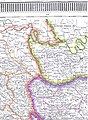
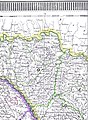
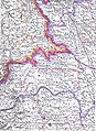
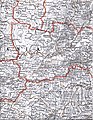
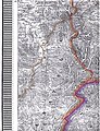
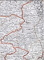
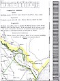
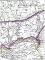
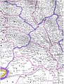
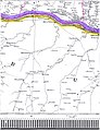
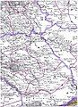
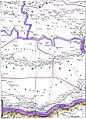
The geographic and statistic map Chartei Principateloru Unite ale României published under Alexander John Cuza's reign, by the cartographers de George Filipescu-Dubău & Anton Parteni-Antoninu, shows the United Principalities of [Moldavia & Wallachia, from this time called] Romania. This map (size 2m x 2m) consists of 54 pages, distributed in 9 groups of 6 pages each. It is cited as "published 1864 since the 1859-1860 census" here: Marin Popescu-Spineni, România în izvoare geografice și cartografice, p. 231 - [1] archive copy at the Wayback Machine.
Gallery[edit]
-
 The 54 files of the Charta Principateloru Unite ale României
 -
 "Charta Principateloru Unite ale României" -file 1
 -
 idem -file 2- Oaş (Ugocea)
 -
 idem -file 3- Maramureş
 -
 idem -file 4- Bihor/Sălaj
 -
 idem -file 5- Șimleu/Zalău
 -
 idem -file 6- Dej/Bistriţa
 -
 idem -file 7- North-Western Bucovina
 -
 idem -file 8- North-Eastern Bucovina
 -
 idem -file 9- Northern Bessarabia
 -
 idem -file 10- South-Western Bucovina
 -
 idem -file 11- South-Eastern Bucovina
 -
 idem -file 12- Iaşi and around
 -
 idem -file 13- Soroca and around
 -
 idem -file 14- Statistics and Legend
 -
 idem -file 15- Legend
 -
 idem -file 16- Bălţi/Orhei
 -
 idem -file 17- Chişinău/Dubăsari and Statistics
 -
 idem -file 18- Statistics
 -
 idem -file 19- Eastern Bihor
 -
 idem -file 20- Cluj/Moţs county/Alba-Iulia
 -
 idem -file 21- Country of the Târnave rivers
 -
 idem -file 22- Caransebeş/Mehadia
 -
 idem -file 23- Hunedoara/Haţeg country/Târgu-Jiu
 -
 idem -file 24- Sibiu/Râmnicu-Vâlcea
 -
 idem -file 25- Western Székely county
 -
 idem -file 26- Eastern Székely & Csángó counties/Piatra-Neamţ
 -
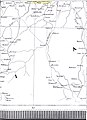
 idem -file 27- Roman/Vaslui/Bârlad
 -
 idem -file 28- Braşov/Câmpulung/Câmpina
 -
 idem -file 29- Covasna/Vrancea/Buzău
 -
 idem -file 30- Tecuci/Focşani/Râmnicu-Sărat
 -
 idem -file 31- Hânceşti/Huşi/Leova/Comrat
 -
 idem -file 32- Chişinău/Tighina-Bender/Căuşeni
 -
 idem -file 33- Mouths of the Dniestr
 -
 idem -file 34- Galaţi/Reni/Bolgrad
 -
 idem -file 35- Izmail/Chilia/Chilia & Sulina branchs
 -
 idem -file 36- Tuzla in Budzak/Snakes Is.
 -
 idem -file 37- Orşova/Turnu-Severin/Vidin/Iron Gates
 -
 idem -file 38- Central Oltenia/Craiova
 -
 idem -file 39- Piteşti/Slatina/Caracal
 -
 idem -file 40- North-Western Bulgaria in the Ottoman Empire
 -
 idem -file 41- North-Western Bulgaria/Danube
 -
 idem -file 42- Islaz/Turnu-Măgurele/Danube/Northern Bulgaria
 -
 idem -file 43- Central Muntenia/Târgovişte/Vlaşca county
 -
 idem -file 44- Bucharest/Ploieşti/Olteniţa
 -
 idem -file 45- Slobozia/Călăraşi/Bărăgan
 -
 idem -file 46- Alexandria/Zimnicea/Giurgiu
 -
 idem -file 47- Northern Bulgaria between Ruse/Tutrakan/Razgrad
 -
 idem -file 48- North-Eastern Bulgaria around Silistra
 -
 idem -file 49- Central Dobrudja
 -
 idem -file 50- North-Eastern Dobrudja/St-George branch and Statistics
 -
 idem -file 51- Statistics
 -
 idem -file 52- Southern Dobrudja around Mangalia
 -
 idem -file 53- Statistics
 -
 idem -file 54- Statistics


See also[edit]
- Keith M. Hitchins, The Romanians, 1774–1866 (1996) online archive copy at the Wayback Machine
- 2004 Romanian Statistical Yearbook - Geography, Meteorology and Environment