Category:Yoke, Cumbria
Jump to navigation
Jump to search
English: Yoke is a fell in the Lake District in Cumbria, England. It has a height of 706 m (2,316 ft) and is situated in the far eastern sector of the national park, 6½ kilometres (4 miles) ENE of the town of Ambleside. Yoke is the southern extremity of the long ridge that runs southwards from the fell of High Street. Yoke’s name is believed to be derived from the Old English language word geoc which is similar to the German word joch meaning mountain ridge.
mountain  | |||||
| Upload media | |||||
| Instance of | |||||
|---|---|---|---|---|---|
| Location | Cumbria, North West England, England | ||||
| Mountain range | |||||
| Topographic prominence |
| ||||
| Elevation above sea level |
| ||||
| Parent peak | |||||
 | |||||
Media in category "Yoke, Cumbria"
The following 34 files are in this category, out of 34 total.
-
 Approaching Yoke Summit - geograph.org.uk - 960321.jpg 640 × 480; 73 KB
-
 Ascending Yoke - geograph.org.uk - 145684.jpg 640 × 480; 81 KB
-
 Big Hagg, Yoke - geograph.org.uk - 960302.jpg 640 × 480; 76 KB
-
 Contouring Around Yoke - geograph.org.uk - 1981702.jpg 640 × 427; 243 KB
-
 Descending Yoke - geograph.org.uk - 3296973.jpg 2,560 × 1,920; 2.06 MB
-
 Descending Yoke - geograph.org.uk - 3296986.jpg 2,560 × 1,920; 671 KB
-
 From Yoke summit looking north - geograph.org.uk - 1723305.jpg 2,272 × 1,712; 908 KB
-
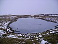 Frozen Tarn, Yoke - geograph.org.uk - 645800.jpg 640 × 480; 74 KB
-
 Heading to Yoke - geograph.org.uk - 1526923.jpg 640 × 480; 104 KB
-
 Low Clouds on Yoke - geograph.org.uk - 960316.jpg 640 × 480; 55 KB
-
 Old Quarry Yoke - geograph.org.uk - 96042.jpg 640 × 480; 109 KB
-
 On the summit ridge of Yoke - geograph.org.uk - 1723298.jpg 2,272 × 1,712; 1.02 MB
-
 On Yoke - geograph.org.uk - 3296964.jpg 2,560 × 1,920; 567 KB
-
 On Yoke - geograph.org.uk - 3734386.jpg 2,560 × 1,920; 2.05 MB
-
 Path descending Yoke - geograph.org.uk - 4408440.jpg 2,048 × 1,536; 1.26 MB
-
 Path on the south side of Yoke - geograph.org.uk - 4408448.jpg 2,048 × 1,536; 1.17 MB
-
 Path, Yoke - geograph.org.uk - 645795.jpg 640 × 480; 60 KB
-
 Rock outcrop and sheep on Yoke - geograph.org.uk - 4408450.jpg 2,048 × 1,536; 1.31 MB
-
 Snowed slope north of summit of Yoke - geograph.org.uk - 2790264.jpg 1,500 × 843; 997 KB
-
 South West Flank of Yoke - geograph.org.uk - 96179.jpg 640 × 480; 78 KB
-
 Southern slopes of Yoke - geograph.org.uk - 2199364.jpg 640 × 480; 48 KB
-
 Summit Cairn on Yoke - geograph.org.uk - 4295860.jpg 3,748 × 2,147; 3.75 MB
-
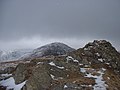 Summit Cairn Yoke - geograph.org.uk - 96025.jpg 640 × 480; 88 KB
-
 Summit of Yoke - geograph.org.uk - 1526927.jpg 640 × 480; 90 KB
-
 The grassy western side of Yoke - geograph.org.uk - 4387673.jpg 2,048 × 1,536; 1.24 MB
-
 The southern slopes of Yoke - geograph.org.uk - 1723280.jpg 2,272 × 1,712; 812 KB
-
 The summit of Yoke - geograph.org.uk - 4387668.jpg 2,048 × 1,536; 1.08 MB
-
 Unnamed beck on Yoke - geograph.org.uk - 3296997.jpg 2,560 × 1,920; 850 KB
-
 Unnamed Beck on Yoke - geograph.org.uk - 3297001.jpg 2,560 × 1,920; 2.13 MB
-
 Windermere from Yoke.jpg 1,848 × 1,386; 111 KB
-
 Yoke and Windermere - geograph.org.uk - 567964.jpg 640 × 427; 77 KB
-
 YOKE ETC FROM GARBURN PASS.jpg 2,040 × 1,530; 134 KB
-
 Yoke Summit - geograph.org.uk - 2217307.jpg 640 × 480; 82 KB
-
 Yoke summit cairn - geograph.org.uk - 2199366.jpg 640 × 402; 38 KB


