Category:Wroxall, Isle of Wight
Jump to navigation
Jump to search
village and civil parish in the central south of the Isle of Wight  | |||||
| Upload media | |||||
| Instance of | |||||
|---|---|---|---|---|---|
| Location | Isle of Wight, South East England, England | ||||
 | |||||
Subcategories
This category has the following 8 subcategories, out of 8 total.
Media in category "Wroxall, Isle of Wight"
The following 200 files are in this category, out of 223 total.
(previous page) (next page)-

-
 A3020 towards Godshill - geograph.org.uk - 5129824.jpg 640 × 480; 109 KB
-
 Amongst the cow parsley - geograph.org.uk - 2007187.jpg 640 × 426; 237 KB
-
 An OS Trig Point - geograph.org.uk - 5972978.jpg 1,024 × 768; 219 KB
-
 Approaching Freemantle Gate - geograph.org.uk - 3279474.jpg 640 × 424; 224 KB
-
 Appuldurcombe Farm - geograph.org.uk - 5689556.jpg 1,000 × 665; 828 KB
-
 Appuldurcombe Park gate - geograph.org.uk - 5539453.jpg 574 × 370; 75 KB
-
 Appuldurcombe Park IOW - geograph.org.uk - 5539457.jpg 828 × 561; 137 KB
-
 Archery Practice at Appuldurcombe, Isle of Wight - geograph.org.uk - 1983902.jpg 3,872 × 2,592; 5.65 MB
-
 B3327 heading to Wroxall - geograph.org.uk - 1034033.jpg 640 × 480; 58 KB
-
 B3327 heads south out of Wroxall - geograph.org.uk - 1034077.jpg 640 × 480; 63 KB
-
 Bachelors Farm - geograph.org.uk - 508705.jpg 640 × 479; 139 KB
-
 Baycroft Farm - geograph.org.uk - 4107591.jpg 1,024 × 680; 333 KB
-
 Being watched - geograph.org.uk - 5972991.jpg 1,024 × 768; 211 KB
-
 Blasted Tree - geograph.org.uk - 4073303.jpg 427 × 640; 307 KB
-
 Bluebells, Wroxall Down, Isle of Wight - geograph.org.uk - 5491114.jpg 3,836 × 2,985; 3.52 MB
-
 Bonchurch Down - geograph.org.uk - 5381827.jpg 3,456 × 2,592; 4.3 MB
-
 Bridge at Wroxall, Isle of Wight - geograph.org.uk - 1982392.jpg 3,872 × 2,592; 4.39 MB
-

-
 Bridge over the old railway line, Wroxall, Isle of Wight, England.jpg 2,226 × 1,642; 2.08 MB
-
 Bridleway at Wroxall, Isle of Wight - geograph.org.uk - 1982398.jpg 2,592 × 3,872; 4.83 MB
-
 Bridleway sign on Wroxall Down - geograph.org.uk - 4031607.jpg 1,024 × 680; 238 KB
-
 Bridleway to Wroxall covered in snow.JPG 4,592 × 3,056; 3.61 MB
-
 Bridleway, Wroxall Copse - geograph.org.uk - 508525.jpg 479 × 640; 224 KB
-
 But Basher, those are horses^ - geograph.org.uk - 3857872.jpg 640 × 480; 80 KB
-
 Byway V60 covered in snow.JPG 4,592 × 3,056; 5.73 MB
-
 Camp Site - geograph.org.uk - 1578971.jpg 640 × 480; 64 KB
-
 Colourful day over Shanklin - geograph.org.uk - 3727871.jpg 640 × 429; 67 KB
-
 Converted Farm Buildings - geograph.org.uk - 2691443.jpg 3,264 × 2,448; 3.51 MB
-
 Cook's Castle stone - geograph.org.uk - 2007159.jpg 640 × 427; 229 KB
-
 Cottage at Whiteley Bank - geograph.org.uk - 4637076.jpg 1,600 × 1,065; 973 KB
-
 Cottages - geograph.org.uk - 2691477.jpg 3,264 × 2,448; 4.06 MB
-
 Derelict buildings, Wroxall, Isle of Wight, England.jpg 3,584 × 2,689; 4.4 MB
-
 Diamond Jubilee Memorial 1837 - 1897, Wroxall - geograph.org.uk - 6254453.jpg 1,024 × 684; 239 KB
-
 Dismantled railway - geograph.org.uk - 1034066.jpg 640 × 480; 80 KB
-
 Disused Warehouse at Wroxall, Isle of Wight - geograph.org.uk - 1984526.jpg 3,872 × 2,592; 5.07 MB
-
 Disused Warehouse at Wroxall, Isle of Wight - geograph.org.uk - 1984540.jpg 3,872 × 2,592; 3.17 MB
-
 Donkey Paddocks - geograph.org.uk - 2691416.jpg 1,451 × 1,088; 958 KB
-
 Drive at Appuldurcombe, looking east - geograph.org.uk - 2156432.jpg 480 × 640; 274 KB
-
 Driveway to Appuldurcombe, Isle of Wight - geograph.org.uk - 1979161.jpg 3,872 × 2,592; 4.7 MB
-
 Edge of field beside dismantled railway - geograph.org.uk - 4460530.jpg 640 × 427; 107 KB
-
 Farmland near Wroxall - geograph.org.uk - 4107085.jpg 800 × 531; 142 KB
-
 Field as seen from Rew Lane - geograph.org.uk - 3104179.jpg 640 × 480; 104 KB
-
 Field near Appuldurcombe - geograph.org.uk - 4073294.jpg 640 × 427; 396 KB
-
 Fields south of Rew Lane - geograph.org.uk - 6255813.jpg 1,024 × 768; 178 KB
-
 First house in Wroxall - geograph.org.uk - 6254503.jpg 1,024 × 768; 234 KB
-
 Footpath going down to Wroxall Cemetery - geograph.org.uk - 3702078.jpg 2,432 × 4,320; 4.79 MB
-
 Footpath Junction, Whiteley Bank, Isle of Wight - geograph.org.uk - 1979439.jpg 2,592 × 3,872; 4.96 MB
-
 Footpath Sign at Ventnor Down - geograph.org.uk - 4547461.jpg 4,896 × 3,672; 6.65 MB
-
 Footpath to Shanklin - geograph.org.uk - 508235.jpg 640 × 479; 181 KB
-
 Footpath towards St. Martin's Down - geograph.org.uk - 2007148.jpg 640 × 426; 253 KB
-
 Footpath up St Martins Down - geograph.org.uk - 3702072.jpg 4,320 × 2,432; 2.64 MB
-
 Former site of Cook's Castle now a grassy field - geograph.org.uk - 3702107.jpg 4,320 × 2,432; 2.59 MB
-
 Freemantle Gate and Appuldurcombe Park from Wroxall Down - geograph.org.uk - 5491156.jpg 3,965 × 2,468; 1.46 MB
-
 Freemantle Gates and Lodge, Appuldurcombe Park - geograph.org.uk - 6253067.jpg 1,024 × 768; 280 KB
-
 From Shanklin Down - geograph.org.uk - 2007991.jpg 640 × 427; 230 KB
-
 Frozen lake.JPG 4,592 × 3,056; 6.03 MB
-
 Gate and path on St. Martin's Down - geograph.org.uk - 4460442.jpg 640 × 427; 77 KB
-
 Gate at Appuldurcombe - geograph.org.uk - 2007129.jpg 640 × 426; 252 KB
-
 Gate at Appuldurcombe - geograph.org.uk - 2156434.jpg 640 × 480; 316 KB
-
 Gate on Luccombe Down - geograph.org.uk - 4031622.jpg 1,024 × 680; 266 KB
-
 Godshill Park gate - geograph.org.uk - 2007069.jpg 426 × 640; 197 KB
-
 Grassland below St. Martin's Down - geograph.org.uk - 2007174.jpg 640 × 427; 179 KB
-
 Grassland near Freemantle Gate - geograph.org.uk - 2007119.jpg 640 × 426; 189 KB
-
 Grazing sheep on Week Down - geograph.org.uk - 581357.jpg 640 × 480; 81 KB
-
 Harvesting the Hay, Whiteley Bank, Isle of Wight - geograph.org.uk - 1984569.jpg 3,872 × 2,592; 4.23 MB
-
 High security^ - geograph.org.uk - 5973013.jpg 1,024 × 768; 199 KB
-
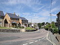
 High Street, Wroxall - geograph.org.uk - 6254484.jpg 1,024 × 768; 189 KB
-
 Houses on Station Road, Wroxall - geograph.org.uk - 6254497.jpg 1,024 × 684; 153 KB
-
 Houses on West Street, Wroxall - geograph.org.uk - 6253336.jpg 1,024 × 768; 234 KB
-
 IOW Donkey Sanctuary - geograph.org.uk - 2689866.jpg 3,264 × 2,448; 4.42 MB
-
 Japanese Rose, Rosa rugosa - geograph.org.uk - 6253701.jpg 1,024 × 1,024; 330 KB
-

-
 Lane down from Stenbury Down towards Wroxall - geograph.org.uk - 6256156.jpg 1,024 × 768; 222 KB
-
 Lane down from Stenbury Down towards Wroxall - geograph.org.uk - 6256232.jpg 1,024 × 768; 309 KB
-
 Lane down from Stenbury Down towards Wroxall - geograph.org.uk - 6256422.jpg 1,024 × 768; 274 KB
-
 Lane down from Stenbury Down towards Wroxall - geograph.org.uk - 6256427.jpg 1,024 × 768; 359 KB
-
 Leaving Wroxall - geograph.org.uk - 2007135.jpg 640 × 426; 249 KB
-
 Livestock drinking tanks - geograph.org.uk - 4031632.jpg 1,024 × 680; 294 KB
-
 Lower Winstone Farm - geograph.org.uk - 2690825.jpg 3,264 × 2,448; 5.09 MB
-
 Luccombe Down - geograph.org.uk - 2008002.jpg 640 × 427; 240 KB
-
 Luccombe Down - geograph.org.uk - 2008006.jpg 640 × 426; 229 KB
-
 Luccombe Down - geograph.org.uk - 4086456.jpg 640 × 427; 386 KB
-
 Luccombe Down - geograph.org.uk - 4086464.jpg 640 × 427; 379 KB
-
 Luccombe Down - geograph.org.uk - 5381820.jpg 3,456 × 2,592; 4.29 MB
-
 Methodist Church for sale, Wroxall - geograph.org.uk - 6254196.jpg 1,024 × 768; 198 KB
-
 Methodist Church Hall, Wroxall - geograph.org.uk - 6254177.jpg 1,024 × 768; 208 KB
-
 Middle Barn - geograph.org.uk - 508255.jpg 640 × 479; 153 KB
-
 Middle Barn, Wroxall - geograph.org.uk - 5502761.jpg 3,952 × 2,964; 2.52 MB
-
 On St. Martin's Down - geograph.org.uk - 2007178.jpg 640 × 427; 164 KB
-
 On St. Martin's Down - geograph.org.uk - 2007183.jpg 640 × 427; 164 KB
-
 Part of Appeldurcombe House estate - geograph.org.uk - 146368.jpg 640 × 480; 70 KB
-

-

-
 Path on St Martin's Down - geograph.org.uk - 4631107.jpg 1,200 × 799; 450 KB
-
 Pathway to Appuldurcombe House - geograph.org.uk - 1578987.jpg 640 × 480; 76 KB
-
 Pavement in Wroxall, Isle of Wight - geograph.org.uk - 1982092.jpg 3,872 × 2,592; 4.91 MB
-
 Pillbox on St Boniface Down - geograph.org.uk - 4031590.jpg 800 × 531; 161 KB
-

-
 Public footpath NT1 covered in snow.JPG 4,592 × 3,056; 6.53 MB
-
 Public footpaths, Luccombe Down - geograph.org.uk - 5512819.jpg 3,958 × 2,968; 1.81 MB
-
 Railway Embankment, Whiteley Bank, Isle of Wight - geograph.org.uk - 1979430.jpg 3,872 × 2,592; 4.69 MB
-
 Redhill Lane - geograph.org.uk - 2689786.jpg 3,264 × 2,448; 1.83 MB
-
 Rew Lane - geograph.org.uk - 4107084.jpg 1,024 × 680; 318 KB
-
 Rew Lane at junction with way up Stenbury Down - geograph.org.uk - 6256045.jpg 1,024 × 768; 198 KB
-
 Rew Lane descending towards Wroxall - geograph.org.uk - 6255884.jpg 1,024 × 768; 221 KB
-
 Rew Lane, Wroxall - geograph.org.uk - 4107596.jpg 800 × 531; 127 KB
-
 Rew Lane, Wroxall - geograph.org.uk - 4258193.jpg 800 × 531; 107 KB
-
 Road leading to Cooks Castle Farm, Wroxall - geograph.org.uk - 4637079.jpg 1,600 × 1,122; 885 KB
-
 Ruined building at foot of St. Martin's Down, Wroxall 01.jpg 4,128 × 3,096; 7.62 MB
-
 Ruined building at foot of St. Martin's Down, Wroxall 02.jpg 4,128 × 3,096; 7.55 MB
-
 Ruined building at foot of St. Martin's Down, Wroxall 03.jpg 4,128 × 3,096; 8.04 MB
-
 Ruined building at foot of St. Martin's Down, Wroxall 04.jpg 4,128 × 3,096; 8.74 MB
-
 Ruined building at foot of St. Martin's Down, Wroxall 05.jpg 4,128 × 3,096; 8.13 MB
-
 Safely Gathered in - geograph.org.uk - 1984467.jpg 3,872 × 2,592; 4.73 MB
-
 Scenic view on Isle of Wight - geograph.org.uk - 3727892.jpg 640 × 429; 61 KB
-
 Shanklin Down - geograph.org.uk - 2007987.jpg 640 × 427; 244 KB
-
 Shanklin to Ventnor road, Luccombe - geograph.org.uk - 5491216.jpg 2,952 × 3,936; 2.45 MB
-
 Sheep in Appuldurcombe Park - geograph.org.uk - 6289130.jpg 2,630 × 3,300; 1.72 MB
-
 Sheep in field north of Rew Lane - geograph.org.uk - 6255818.jpg 1,024 × 768; 175 KB
-
 Sheep, east slopes of Stenbury Down - geograph.org.uk - 6256250.jpg 1,024 × 768; 242 KB
-
 Span Farm - geograph.org.uk - 6256163.jpg 1,024 × 768; 179 KB
-
 Span Lodge, Wroxall 01.jpg 4,128 × 3,096; 6.59 MB
-
 Span Lodge, Wroxall 02.jpg 4,128 × 3,096; 8.46 MB
-
 Span Lodge, Wroxall 03.jpg 3,096 × 4,128; 7.57 MB
-
 Span Lodge, Wroxall 04.jpg 3,096 × 4,128; 4.37 MB
-
 Span Lodge, Wroxall 05.jpg 4,128 × 3,096; 6.92 MB
-
 Span Lodge, Wroxall 06.jpg 5,152 × 3,864; 7.64 MB
-
 Span Lodge, Wroxall 09.jpg 5,152 × 3,864; 7.46 MB
-
 Spectacular views from site of Cook's Castle - geograph.org.uk - 3702121.jpg 4,320 × 2,432; 2.2 MB
-
 St Boniface Down - geograph.org.uk - 3336892.jpg 2,592 × 1,944; 1.61 MB
-
 St Boniface Down - geograph.org.uk - 5167338.jpg 640 × 480; 57 KB
-

-
 St John's Road - geograph.org.uk - 2689882.jpg 3,264 × 2,448; 4.31 MB
-
 St Martin's Down - geograph.org.uk - 146439.jpg 640 × 482; 78 KB
-
 St Martins Down path from Wroxall - geograph.org.uk - 5539465.jpg 842 × 564; 191 KB
-
 St.John's Road, Wroxall, Isle of Wight - geograph.org.uk - 1982060.jpg 3,872 × 2,592; 4.69 MB
-
 Starlings on church weather vane, Wroxall - geograph.org.uk - 6254250.jpg 768 × 1,024; 110 KB
-
 Stenbury Trail leaving Wroxall - geograph.org.uk - 2007127.jpg 640 × 428; 198 KB
-
 Steps, Homelands Pit Farm - geograph.org.uk - 508516.jpg 479 × 640; 243 KB
-
 Thatched Cottage (geograph 6650794).jpg 1,024 × 684; 224 KB
-
 Thatched Cottages, High Street, Wroxall - geograph.org.uk - 6254469.jpg 1,024 × 684; 221 KB
-
 The Eagle Will not Take off - geograph.org.uk - 1981692.jpg 3,872 × 2,592; 3.35 MB
-
 The Post Office on West Street, Wroxall - geograph.org.uk - 4631126.jpg 1,200 × 799; 400 KB
-
 The road into Wroxall - geograph.org.uk - 2689843.jpg 3,264 × 2,448; 949 KB
-
 The Star Inn, Wroxall - geograph.org.uk - 4631116.jpg 1,200 × 799; 346 KB
-
 The Star Inn, Wroxall - geograph.org.uk - 4631120.jpg 1,200 × 799; 204 KB
-
 The Star Inn, Wroxall - geograph.org.uk - 6253744.jpg 1,024 × 768; 173 KB
-
 The village of Wroxall - geograph.org.uk - 4056118.jpg 1,024 × 680; 300 KB
-
 The Worsley (derelict pub), Wroxall, Isle of Wight, England.jpg 1,955 × 1,454; 1.24 MB
-
 The Worsley Trail in Appuldurcombe Park - geograph.org.uk - 4631148.jpg 1,200 × 799; 401 KB
-
 The Worsley, Wroxall (closed) - geograph.org.uk - 6253352.jpg 1,024 × 684; 171 KB
-
 The Worsley, Wroxall - geograph.org.uk - 4631135.jpg 1,200 × 799; 390 KB
-

-
 Track and tree - geograph.org.uk - 4038196.jpg 1,024 × 680; 301 KB
-

-
 Track on Luccombe Down - geograph.org.uk - 4031615.jpg 1,024 × 680; 270 KB
-
 Track to Baycroft Farm - geograph.org.uk - 6255806.jpg 1,024 × 768; 204 KB
-
 Track to Span Lodge - geograph.org.uk - 6255900.jpg 1,024 × 768; 314 KB
-
 View from a pillbox - geograph.org.uk - 4031595.jpg 1,024 × 680; 150 KB
-
 View From Appuldurcombe, Isle of Wight - geograph.org.uk - 1984338.jpg 3,872 × 2,592; 4 MB
-
 View From Appuldurcombe, Isle of Wight - geograph.org.uk - 1984350.jpg 3,872 × 2,592; 5.31 MB
-
 View From Appuldurcombe, Isle of Wight - geograph.org.uk - 1984368.jpg 3,872 × 2,592; 4.42 MB
-
 View from Luccombe Down - geograph.org.uk - 2008011.jpg 640 × 427; 190 KB
-
 View from Shanklin Down - geograph.org.uk - 2007997.jpg 640 × 428; 217 KB
-
 View From the Sunshine Trail, Isle of Wight - geograph.org.uk - 1984616.jpg 3,872 × 2,592; 4.86 MB
-
 View From the Sunshine Trail, Isle of Wight - geograph.org.uk - 1985303.jpg 3,872 × 2,592; 4.37 MB
-
 View From the Sunshine Trail, Isle of Wight - geograph.org.uk - 1985315.jpg 3,872 × 2,592; 3.85 MB
-

-
 View of hay bales from footpath near Cook's Castle - geograph.org.uk - 3702084.jpg 4,320 × 2,432; 3.21 MB
-
 View to Shanklin Down - geograph.org.uk - 4038201.jpg 1,024 × 680; 316 KB
-
 View to Wroxall - geograph.org.uk - 4258197.jpg 800 × 531; 127 KB
-
 View towards Luccombe Down from Middle Barn, Wroxall - geograph.org.uk - 5502763.jpg 3,942 × 2,818; 3.07 MB
-
 Wall at Appuldurcombe, Isle of Wight - geograph.org.uk - 1984378.jpg 3,872 × 2,592; 4.5 MB
-
 We Have Lift-off - geograph.org.uk - 1981697.jpg 3,872 × 2,592; 2.42 MB
-
 West Street - geograph.org.uk - 1578963.jpg 640 × 480; 62 KB
-

-
 West Wight - geograph.org.uk - 5490377.jpg 3,966 × 2,974; 1.86 MB
-
 Whiteley Bank - geograph.org.uk - 3760125.jpg 640 × 480; 373 KB
-
 Wroxall - geograph.org.uk - 1578958.jpg 640 × 480; 55 KB
-
 Wroxall church - geograph.org.uk - 6254283.jpg 1,024 × 768; 153 KB
-
 Wroxall Community Centre 01.jpg 4,128 × 3,096; 4.84 MB
-
 Wroxall Community Centre 02.jpg 4,128 × 3,096; 4.4 MB
-
 Wroxall Community Centre 03.jpg 4,128 × 3,096; 5.65 MB
-
 Wroxall Diamond Jubilee Memorial.JPG 3,072 × 2,304; 2.38 MB
-
 Wroxall Down - geograph.org.uk - 1045348.jpg 640 × 480; 60 KB
-
 Wroxall Farm Barn (geograph 6656863).jpg 1,024 × 684; 180 KB
-
 Wroxall Football Ground - geograph.org.uk - 1579010.jpg 640 × 480; 43 KB
-
 Wroxall from Rew Down.JPG 4,592 × 3,056; 3.85 MB
-
 Wroxall from Stenbury Down during snow December 2010 2.JPG 4,592 × 3,056; 3.17 MB
-
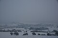 Wroxall from Stenbury Down during snow December 2010.JPG 4,592 × 3,056; 3.24 MB
-
 Wroxall Grove Road old public toilets.JPG 4,000 × 3,000; 4.84 MB
-
 Wroxall Grove Road public toilets closure notice.JPG 3,000 × 4,000; 3.7 MB
-
 Wroxall High Street 2.JPG 4,000 × 3,000; 4.97 MB
-
 Wroxall High Street during snow December 2010.JPG 4,000 × 3,000; 4.59 MB
-
 Wroxall High Street.JPG 4,000 × 3,000; 4.75 MB
-
 Wroxall Post Office - geograph.org.uk - 4056121.jpg 680 × 1,024; 242 KB
-
 Wroxall Post Office, Isle of Wight - geograph.org.uk - 1980487.jpg 2,592 × 3,872; 3.88 MB
-
 Wroxall Post Office.JPG 2,304 × 3,072; 2.35 MB
-
 Wroxall Primary School.JPG 4,000 × 3,000; 4.52 MB


.jpg)


,_Wroxall,_Isle_of_Wight,_England.jpg)

_-_geograph.org.uk_-_6253352.jpg)


.jpg)


