Category:Wotton-under-Edge
Jump to navigation
Jump to search
market town in Gloucestershire, England  Eglwys Santes Fair y Forwyn, Wotton-under-Edge | |||||
| Upload media | |||||
| Instance of | |||||
|---|---|---|---|---|---|
| Location | Stroud, Gloucestershire, South West England, England | ||||
| Population |
| ||||
| Elevation above sea level |
| ||||
| official website | |||||
 | |||||
Subcategories
This category has the following 9 subcategories, out of 9 total.
C
- Coombe Hill, Stroud (6 F)
F
G
- Giles Grendey (1 P, 21 F)
R
- Ram Inn, Wotton-under-Edge (10 F)
- Renishaw plc (7 F)
W
- Wotton-under-Edge Town Hall (2 F)
Media in category "Wotton-under-Edge"
The following 200 files are in this category, out of 664 total.
(previous page) (next page)-
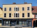 1 High Street, Wotton-under-Edge, Gloucestershire.jpg 2,532 × 1,899; 1.31 MB
-

-
 2 Bradley Street, Wotton-under-Edge.jpg 1,878 × 2,504; 686 KB
-

-
 33 Long Street, Wotton-under-Edge, Gloucestershire.jpg 1,940 × 4,096; 1.99 MB
-
 35 Long Street, Wotton-under-Edge, Gloucestershire.jpg 1,940 × 3,187; 1.66 MB
-
 37 Long Street, Wotton-under-Edge, Gloucestershire.jpg 1,940 × 2,587; 1.34 MB
-
 47, Long Street.jpg 2,584 × 4,592; 6.31 MB
-
 49, Long Street.jpg 2,584 × 4,592; 6.39 MB
-
 57 Bradley Street, Wotton-under-Edge, Gloucestershire.jpg 3,460 × 1,940; 2.28 MB
-
 7 High Street, Wotton-under-Edge, Gloucestershire.jpg 1,940 × 2,587; 1.16 MB
-

-
 A floral door - geograph.org.uk - 4155199.jpg 1,704 × 2,304; 1.66 MB
-
 A footpath to Waterley Bottom - geograph.org.uk - 5173738.jpg 1,024 × 768; 405 KB
-
 A new kingdom - geograph.org.uk - 4159456.jpg 1,704 × 2,304; 1.38 MB
-
 A room with a balcony - geograph.org.uk - 4147775.jpg 1,704 × 2,304; 1.48 MB
-
 Above Corner Farm - geograph.org.uk - 1653229.jpg 640 × 409; 79 KB
-
 Access road to Symonds Hall Farm near Uley - geograph.org.uk - 3379062.jpg 1,600 × 1,228; 417 KB
-
 Adey's Lane - geograph.org.uk - 4147802.jpg 2,304 × 1,704; 1.63 MB
-
 Adey's Lane, Wotton-under-Edge - geograph.org.uk - 3811155.jpg 800 × 600; 166 KB
-
 Agriculture House, Wotton-under-Edge - geograph.org.uk - 3716808.jpg 600 × 800; 106 KB
-
 Albert YOUNG.jpg 1,435 × 2,183; 1.17 MB
-
 Alderley Farm - geograph.org.uk - 5363117.jpg 1,024 × 768; 259 KB
-
 Alderley Farm - geograph.org.uk - 5363483.jpg 1,024 × 768; 208 KB
-
 Alderley Farm from Hillmill Lane - geograph.org.uk - 2837912.jpg 1,024 × 769; 163 KB
-
 Alderley, Winterspring Lane - geograph.org.uk - 5627364.jpg 1,600 × 899; 666 KB
-
 An old falcon - geograph.org.uk - 4157338.jpg 1,704 × 2,304; 1.57 MB
-

-
 Approaching a junction on the A4135 - geograph.org.uk - 2837843.jpg 1,024 × 648; 98 KB
-
 At the corner of Church Street - geograph.org.uk - 4157327.jpg 2,304 × 1,704; 1.62 MB
-

-
 B4058 - geograph.org.uk - 2837644.jpg 640 × 480; 666 KB
-
 B4058 approaches Wotton-Under-Edge - geograph.org.uk - 3142235.jpg 4,752 × 3,168; 2.82 MB
-
 B4058 near Symonds Hall Farm - geograph.org.uk - 2990022.jpg 1,024 × 763; 181 KB
-
 B4058 near The Ridge - geograph.org.uk - 2990019.jpg 1,024 × 766; 227 KB
-
 B4058 passes the Golf Course - geograph.org.uk - 2354234.jpg 640 × 480; 146 KB
-
 B4058 south of Uley, Gloucestershire - geograph.org.uk - 4153221.jpg 640 × 480; 131 KB
-

-
 Bagging a winner - geograph.org.uk - 4147791.jpg 1,704 × 2,304; 1.51 MB
-
 Bank Yard Garage, Wotton-under-Edge - geograph.org.uk - 3817499.jpg 800 × 489; 81 KB
-
 Baptist church - geograph.org.uk - 4155144.jpg 2,304 × 1,704; 1.76 MB
-
 Baptist graveyard - geograph.org.uk - 4155165.jpg 2,304 × 1,704; 1.8 MB
-

-

-
 Bear Street, Wotton-under-Edge - geograph.org.uk - 3716838.jpg 800 × 627; 97 KB
-
 Bearlands, Wotton-under-edge - geograph.org.uk - 343145.jpg 640 × 454; 56 KB
-
 Bearlands, Wotton-under-edge - geograph.org.uk - 343148.jpg 640 × 457; 78 KB
-
 Beaumont Row, Wotton-under-Edge - geograph.org.uk - 3732125.jpg 800 × 696; 114 KB
-
 Beaumont Square, Wotton-under-Edge - geograph.org.uk - 3750975.jpg 800 × 652; 111 KB
-
 Bend near Coombe Hill - geograph.org.uk - 2989975.jpg 1,024 × 767; 228 KB
-
 Blackquarries Hill - geograph.org.uk - 5483282.jpg 3,776 × 2,520; 3.95 MB
-

-
 Bombed in the car park - geograph.org.uk - 4145776.jpg 1,704 × 2,304; 1.73 MB
-
 Bowcott Farm - geograph.org.uk - 1656159.jpg 640 × 445; 91 KB
-
 Bowcott Farm - geograph.org.uk - 5877054.jpg 1,600 × 889; 553 KB
-
 Boxed in - geograph.org.uk - 4155215.jpg 2,304 × 1,704; 1.51 MB
-
 Bradley Court - geograph.org.uk - 343267.jpg 640 × 480; 73 KB
-
 Bradley Green - geograph.org.uk - 1652798.jpg 640 × 440; 97 KB
-
 Bradley Green - geograph.org.uk - 1653074.jpg 640 × 458; 105 KB
-
 Bradley Green - geograph.org.uk - 1653140.jpg 640 × 464; 103 KB
-
 Bradley Green, the castellated tollhouse - geograph.org.uk - 3060021.jpg 1,000 × 749; 542 KB
-
 Bradley Green, tollhouse - geograph.org.uk - 1811180.jpg 1,024 × 768; 144 KB
-

-

-
 Bradley Street, Wotton-Under-Edge - geograph.org.uk - 1652737.jpg 640 × 411; 63 KB
-
 Brickfields, Wotton-Under-Edge - geograph.org.uk - 1651281.jpg 640 × 480; 60 KB
-
 Buttercups Forever - geograph.org.uk - 5421903.jpg 3,264 × 2,448; 3.24 MB
-
 Carlton House - geograph.org.uk - 4101235.jpg 2,304 × 1,704; 1.72 MB
-
 Cars parked at Newark Park - geograph.org.uk - 3060130.jpg 750 × 1,000; 577 KB
-

-

-
 Cattle at Newark park - geograph.org.uk - 3275052.jpg 1,600 × 1,089; 575 KB
-
 Charles Meredith PENLY.jpg 1,435 × 2,183; 1.1 MB
-
 Chipping Gardens and car park - geograph.org.uk - 1003188.jpg 640 × 428; 71 KB
-
 Chipping Hall - geograph.org.uk - 2837543.jpg 640 × 480; 358 KB
-
-
 Church of St Mary the Virgin, Wotton-under-Edge - geograph.org.uk - 5483314.jpg 3,776 × 2,520; 4.26 MB
-
 Church Street at The Cloud (road) - geograph.org.uk - 3448860.jpg 800 × 600; 142 KB
-
 Citroen Dyane in Old Town, Wotton-Under-Edge - geograph.org.uk - 3277399.jpg 1,600 × 1,430; 440 KB
-
 Climbing up Wotton Hill - geograph.org.uk - 5485273.jpg 3,776 × 2,520; 4.32 MB
-

-

-
 Combe above Bradley - geograph.org.uk - 1653284.jpg 640 × 461; 120 KB
-
 Commanding location - geograph.org.uk - 4101219.jpg 1,704 × 2,304; 1.37 MB
-
 Communications mast and line of trees - geograph.org.uk - 3936116.jpg 4,320 × 3,240; 2.91 MB
-
 Communications mast by the A4135 - geograph.org.uk - 2354298.jpg 640 × 480; 67 KB
-
 Communications mast, Wotton-Under-Edge - geograph.org.uk - 5876157.jpg 1,600 × 1,142; 662 KB
-

-
 Community Fire Station, Symm Lane, Wotton-under-Edge, Gloucestershire.jpg 2,794 × 1,863; 992 KB
-
 Coombe Hill - geograph.org.uk - 4895098.jpg 3,264 × 2,448; 3.69 MB
-
 Coombe Road - geograph.org.uk - 2989969.jpg 1,024 × 780; 222 KB
-

-
 Coombehall Farm - geograph.org.uk - 1651675.jpg 640 × 477; 67 KB
-

-

-

-

-
 Cotswold Edge Golf Club - geograph.org.uk - 2837638.jpg 640 × 480; 441 KB
-
 Cotswold farmland - geograph.org.uk - 5173748.jpg 800 × 600; 107 KB
-
 Cotswold House, Wotton-under-Edge - geograph.org.uk - 3716941.jpg 800 × 778; 114 KB
-
 Cotswold scenery near Kingscote - geograph.org.uk - 3275044.jpg 1,600 × 1,162; 417 KB
-
 Cotswold Way - geograph.org.uk - 5071800.jpg 2,340 × 3,121; 1.83 MB
-
 Cotswold Way above Wotton-Under-Edge - geograph.org.uk - 4231450.jpg 1,024 × 768; 347 KB
-
 Cotswold Way above Wotton-Under-Edge - geograph.org.uk - 4231468.jpg 1,920 × 2,377; 1.86 MB
-
 Cotswold Way by Tyley Stream - geograph.org.uk - 4895104.jpg 2,448 × 3,264; 2.81 MB
-
 Cotswold Way climbing Wotton Hill (2) - geograph.org.uk - 1653348.jpg 640 × 480; 124 KB
-
 Cotswold Way climbing Wotton Hill - geograph.org.uk - 1653332.jpg 640 × 498; 144 KB
-
 Cotswold Way leaving Wotton-Under-Edge - geograph.org.uk - 4231422.jpg 1,920 × 2,447; 1.24 MB
-
 Cotswold Way on Wotton Hill - geograph.org.uk - 42729.jpg 426 × 640; 198 KB
-
 Cottages, Wotton-Under-Edge - geograph.org.uk - 1652155.jpg 480 × 640; 97 KB
-
 Culverhay (B4058) - geograph.org.uk - 2837630.jpg 640 × 480; 434 KB
-
 Culverhay Surgery, Wotton-under-Edge - geograph.org.uk - 3811235.jpg 800 × 600; 97 KB
-
 Cyclists in the Cotswolds near Uley - geograph.org.uk - 3379064.jpg 1,600 × 1,133; 378 KB
-
 Daniel SHIPTON.jpg 1,430 × 2,075; 1,010 KB
-

-

-
 Down into the valley - geograph.org.uk - 4155354.jpg 2,304 × 1,704; 1.8 MB
-
 Drive on Wotton Hill - geograph.org.uk - 1653376.jpg 640 × 460; 142 KB
-
 Drive to Symonds' Hall Farm - geograph.org.uk - 5173752.jpg 800 × 600; 88 KB
-
 Dyers Brook House, Wotton-under-edge - geograph.org.uk - 343163.jpg 640 × 467; 54 KB
-
 Dyers Brook, Wotton-under-Edge - geograph.org.uk - 3732024.jpg 800 × 679; 200 KB
-
 Edbrooke House, Wotton-under-Edge - geograph.org.uk - 3790449.jpg 800 × 543; 93 KB
-
 Edbrooke Spring - geograph.org.uk - 4155388.jpg 1,704 × 2,304; 2.04 MB
-
 Edward Sylvester MAUNDERS.jpg 1,613 × 2,197; 1.07 MB
-
 Eight to Yate from Wotton-under-Edge - geograph.org.uk - 3728793.jpg 795 × 800; 126 KB
-

-
 Empty building plot, 13 and 15 Bradley Street, Wotton-under-Edge, Gloucestershire.jpg 3,887 × 1,936; 2.46 MB
-

-
 Entrance to house near Monkcombe Wood - geograph.org.uk - 3936123.jpg 4,320 × 3,240; 2.91 MB
-
 Ernest JONES.jpg 1,518 × 2,184; 1.29 MB
-

-
 Farm access road near Kingscote - geograph.org.uk - 3275041.jpg 1,600 × 1,165; 568 KB
-
 Farmland above Tyley Bottom - geograph.org.uk - 5173727.jpg 800 × 600; 156 KB
-
 Farmland near Symonds' Hall Farm - geograph.org.uk - 5174368.jpg 1,024 × 768; 263 KB
-
 Farmland near Wotton-under-Edge - geograph.org.uk - 5362270.jpg 1,024 × 768; 212 KB
-
 Farmland on Blackquarries Hill - geograph.org.uk - 5087742.jpg 6,000 × 4,000; 4.23 MB
-
 Field above Tyley Bottom - geograph.org.uk - 5173691.jpg 800 × 600; 151 KB
-
 Field and Hedge - geograph.org.uk - 5466982.jpg 3,264 × 2,448; 2.65 MB
-
 Field below Tyndale Monument - geograph.org.uk - 5372320.jpg 3,264 × 2,448; 2.42 MB
-
 Field boundary, Spuncombe Bottom - geograph.org.uk - 4232835.jpg 1,920 × 1,345; 958 KB
-
 Field by the A4135 - geograph.org.uk - 2354290.jpg 640 × 480; 80 KB
-
 Field entrance and lone tree on road to Ozleworth - geograph.org.uk - 5876190.jpg 1,600 × 1,198; 747 KB
-
 Field gateway - geograph.org.uk - 5363500.jpg 1,024 × 768; 237 KB
-
 Field of maize on Blackquarries Hill - geograph.org.uk - 5087751.jpg 6,000 × 4,000; 4.59 MB
-
 Field on Wotton Hill - geograph.org.uk - 1653716.jpg 640 × 474; 110 KB
-
 Field Surrounded by Woodland - geograph.org.uk - 5376662.jpg 3,264 × 2,448; 3.8 MB
-
 Field with sheep on the top of Wortley Hill - geograph.org.uk - 5089605.jpg 6,000 × 4,000; 5.43 MB
-
 Fields north of Wotton-under-Edge - geograph.org.uk - 5087717.jpg 6,000 × 4,000; 4.18 MB
-
 Filling station in Wotton-under-Edge - geograph.org.uk - 3060035.jpg 1,000 × 750; 496 KB
-
 Fish, chips and mushy peas - geograph.org.uk - 4155288.jpg 2,304 × 1,704; 1.56 MB
-

-

-
 Footbridge at Tyley Bottom - geograph.org.uk - 5376689.jpg 3,264 × 2,448; 3.05 MB
-
 Footpath through the buttercups - geograph.org.uk - 4935919.jpg 3,264 × 2,448; 3.91 MB
-
-
 Footpath to Wortley - geograph.org.uk - 5362257.jpg 1,024 × 768; 247 KB
-
 Footpath to Wotton-under-Edge - geograph.org.uk - 5362235.jpg 1,024 × 768; 201 KB
-
 For the church fête^ - geograph.org.uk - 4155347.jpg 2,304 × 1,704; 1.64 MB
-
 Former Falcon Inn, Wotton-under-Edge - geograph.org.uk - 3780177.jpg 800 × 703; 108 KB
-
 Former Mill Building At New Mills,west Of Bushford Bridge.jpg 4,000 × 3,000; 4.28 MB
-

-

-

-

-

-
 Frederick CHAPPELL.jpg 1,326 × 1,898; 973 KB
-
 Frederick JACKSON.jpg 1,523 × 2,144; 1.11 MB
-
 Frederick MARSH.jpg 1,447 × 2,105; 1.14 MB
-
 Frosty grass near Bradley Green - geograph.org.uk - 1653052.jpg 640 × 480; 132 KB
-
 Frozen track above Tumbleyhill Wood - geograph.org.uk - 1656022.jpg 640 × 480; 98 KB
-

-
 Gap through woodland, Tyley Bottom - geograph.org.uk - 1656242.jpg 640 × 480; 101 KB
-
 Garage, Bear St, Wotton Under Edge, Gloucestershire 2014 - geograph.org.uk - 5807400.jpg 3,373 × 2,110; 1.18 MB
-
 Garden Path - geograph.org.uk - 5071801.jpg 2,448 × 3,264; 2.75 MB
-
 Gate and golf - geograph.org.uk - 632149.jpg 640 × 344; 103 KB
-
 Gate and Path, Newark Park Estate - geograph.org.uk - 2837668.jpg 640 × 480; 516 KB
-
 Going around the post - geograph.org.uk - 4157079.jpg 2,304 × 1,704; 1.64 MB
-

-

-

-

-
 Haw Street, Wotton-Under-Edge - geograph.org.uk - 1002917.jpg 640 × 428; 96 KB
-
 Haw Street, Wotton-under-Edge - geograph.org.uk - 1672306.jpg 640 × 480; 204 KB
-
 Heading towards Wotton-under-Edge - geograph.org.uk - 3448706.jpg 800 × 600; 148 KB
-
 High Street in Wotton-Under-Edge - geograph.org.uk - 3142216.jpg 4,752 × 3,168; 2.49 MB
-

-
 High Street-Long Street, Wotton Under Edge, Gloucestershire 2015 - geograph.org.uk - 5800677.jpg 2,743 × 1,833; 1,013 KB
-
 Hillmill Lane - geograph.org.uk - 5363121.jpg 1,024 × 768; 238 KB
-

-
 Hilltop above Warren Farm - geograph.org.uk - 5087757.jpg 6,000 × 4,000; 4.99 MB
-
 Holywell heifers - geograph.org.uk - 4155424.jpg 2,304 × 1,704; 1.29 MB
-
-
 House Behind Trees - geograph.org.uk - 5437923.jpg 3,264 × 2,448; 2.33 MB
-
 House on a hill - geograph.org.uk - 4851252.jpg 1,024 × 768; 161 KB
-
 House on Gloucester Street, Wotton-Under-Edge - geograph.org.uk - 4231380.jpg 4,000 × 3,000; 1.07 MB
-
 Houses at Bradley Green - geograph.org.uk - 1653179.jpg 640 × 480; 75 KB
-

-
 How many repairs^ - geograph.org.uk - 1003316.jpg 640 × 443; 131 KB
-

-


_chats_to_some_of_the_twenty-two_Special_Constables_who_have_joined_the_three_regualrs_in_keeping_law_and_order_in_the_town,_1944._D22047.jpg)


_-_geograph.org.uk_-_3448860.jpg)


_-_geograph.org.uk_-_1653348.jpg)


_-_geograph.org.uk_-_2837630.jpg)


