Category:Worcester and Birmingham Canal
Jump to navigation
Jump to search
Main Wikipedia article: Worcester and Birmingham Canal.

canal in the United Kingdom  | |||||
| Upload media | |||||
| Instance of | |||||
|---|---|---|---|---|---|
| Location |
| ||||
| Has part(s) |
| ||||
 | |||||
Subcategories
This category has the following 12 subcategories, out of 12 total.
B
C
D
- Canal at Dunhampstead (16 F)
- Dunhampstead Tunnel (15 F)
E
- Edgbaston Canal Tunnel (11 F)
G
H
K
T
- Tardebigge Engine House (10 F)
W
- Wast Hill Tunnel (6 F)
Media in category "Worcester and Birmingham Canal"
The following 200 files are in this category, out of 220 total.
(previous page) (next page)-
 2022 Commonwealth Games final Worcester and Birmingham Canal (52326893851).jpg 3,269 × 3,176; 5.83 MB
-
 70A (45550229035).jpg 5,184 × 3,456; 6.92 MB
-
 Alvechurch, canal - geograph.org.uk - 1345773.jpg 640 × 480; 115 KB
-
 Alvechurch, marina - geograph.org.uk - 1345815.jpg 640 × 480; 111 KB
-
 Angler adjacent a canal bridge - geograph.org.uk - 1373812.jpg 640 × 425; 116 KB
-
 Astwood Bridge - geograph.org.uk - 1354207.jpg 640 × 455; 123 KB
-
 Astwood Bridge. - geograph.org.uk - 10688.jpg 640 × 480; 92 KB
-
 Astwood Lock - geograph.org.uk - 503497.jpg 640 × 480; 133 KB
-
 Astwood lock cottage - geograph.org.uk - 189592.jpg 640 × 436; 94 KB
-

-
 Birmingham and Worcester Canal - geograph.org.uk - 1753126.jpg 640 × 480; 91 KB
-
 Birmingham Canal - panoramio (25).jpg 2,816 × 2,112; 2.09 MB
-
 Birmingham Canal - panoramio (26).jpg 2,816 × 2,112; 2.58 MB
-
 Birmingham Canals 200721 3451 (51335560897).jpg 4,161 × 3,129; 8.34 MB
-
 Birmingham MMB 13 Cross-City Line 43366.jpg 3,795 × 2,412; 2.67 MB
-
 Birmingham MMB 27 University of Birmingham and A38.jpg 3,369 × 1,566; 2.02 MB
-
 BirminghamCanal.JPG 2,816 × 2,112; 1.11 MB
-
 Blackpole Lock - geograph.org.uk - 1349461.jpg 640 × 455; 89 KB
-
 Blackpole Road Bridge - geograph.org.uk - 1349453.jpg 640 × 455; 86 KB
-
 Boat St near by Scarfield Hill Rd - panoramio.jpg 1,408 × 1,056; 550 KB
-
 Boat Worcester ^ Birmingham Canal - panoramio.jpg 1,408 × 1,056; 766 KB
-
 Boatyard at Tardebigge - 2 - geograph.org.uk - 1352132.jpg 640 × 480; 77 KB
-
 Boatyard at Tardebigge - geograph.org.uk - 1352128.jpg 640 × 480; 81 KB
-
 Bournville - panoramio.jpg 2,816 × 2,112; 2.83 MB
-
 Bournville railway station and Worcester and Birmingham Canal.jpg 1,495 × 1,087; 392 KB
-
 Bournville railway station, Birmingham, geograph-3963695-by-Nigel-Thompson.jpg 1,024 × 697; 202 KB
-

-
 Bridge No 80 near Selly Oak, Birmingham - geograph.org.uk - 1729415.jpg 640 × 475; 148 KB
-
 Broad Street Tunnel (24494250932).jpg 3,607 × 2,681; 5.09 MB
-
 Canal along Hanbury Rd - panoramio (1).jpg 2,816 × 2,112; 2.71 MB
-
 Canal along Hanbury Rd - panoramio (2).jpg 2,816 × 2,112; 2.65 MB
-
 Canal along Hanbury Rd - panoramio (3).jpg 2,816 × 2,112; 3.06 MB
-
 Canal along Hanbury Rd - panoramio (4).jpg 2,816 × 2,112; 2.77 MB
-
 Canal along Hanbury Rd - panoramio (5).jpg 2,816 × 2,112; 2.52 MB
-
 Canal along Hanbury Rd - panoramio (6).jpg 2,816 × 2,112; 2.76 MB
-
 Canal along Hanbury Rd - panoramio (7).jpg 2,816 × 2,112; 2.57 MB
-
 Canal along Hanbury Rd - panoramio (8).jpg 2,816 × 2,112; 2.46 MB
-
 Canal along Hanbury Rd - panoramio.jpg 2,816 × 2,112; 2.63 MB
-
 Canal at Hopwood - geograph.org.uk - 7645.jpg 640 × 480; 116 KB
-
 Canal bend near the Whitford Bridge - geograph.org.uk - 1347821.jpg 640 × 480; 100 KB
-
 Canal bridge at Bittel Farm - geograph.org.uk - 1373883.jpg 640 × 425; 124 KB
-
 Canal diversion under the M42 - geograph.org.uk - 154584.jpg 640 × 480; 329 KB
-
 Canal in Worcestershire countryside - geograph.org.uk - 189598.jpg 640 × 394; 68 KB
-
 Canal Junction at "The Malt House". - geograph.org.uk - 127455.jpg 640 × 437; 167 KB
-

-
 Canal, Hopwood.JPG 3,648 × 2,736; 3.55 MB
-
 Coming towards a canal tunnel.jpg 800 × 600; 94 KB
-
 Cottage, Stoke Works - geograph.org.uk - 1354251.jpg 640 × 455; 109 KB
-
 Day 30 - West Midlands Police - View from Above 1 (8428681775).jpg 4,288 × 2,848; 7.7 MB
-
 Entrance to Droitwich Canal - geograph.org.uk - 1353610.jpg 640 × 455; 130 KB
-
 Exit to Parsons Hill - geograph.org.uk - 1374683.jpg 640 × 425; 103 KB
-

-

-
 Gas street canal sign.jpg 2,048 × 1,536; 712 KB
-
 Granville Street trackbed 14.jpg 6,000 × 4,000; 14.64 MB
-
 Granville Street trackbed 24.jpg 6,000 × 4,000; 12.01 MB
-
 Granville Street trackbed 25.jpg 6,000 × 4,000; 12.93 MB
-
 Granville Street trackbed 26.jpg 3,777 × 5,584; 12.14 MB
-
 Granville Street trackbed at Five Ways station 35.jpg 5,800 × 3,307; 11.09 MB
-
 Granville Street trackbed south of Five Ways station 38.jpg 4,986 × 3,669; 11.34 MB
-
 Hanbury Wharf - geograph.org.uk - 1353596.jpg 640 × 455; 81 KB
-
 IM1308 Night view from 15th floor Jurys Inn C.JPG 2,136 × 1,424; 1.5 MB
-
 IWA plaque 1981.jpg 1,774 × 1,639; 621 KB
-
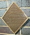 IWA plaque 2005.jpg 1,793 × 2,089; 1.14 MB
-
 IWA plaques at Tardebigge top lock.jpg 1,944 × 2,592; 1.17 MB
-
 King's Norton, Birmingham, UK - panoramio (10).jpg 5,472 × 3,648; 4.81 MB
-
 Lock 1, Worcester ^ Birmingham Canal. - panoramio.jpg 2,112 × 2,816; 1.53 MB
-
 Lock-keepers cottage - geograph.org.uk - 1350378.jpg 640 × 480; 83 KB
-
 Moorings near 'The Crown Inn' - geograph.org.uk - 1373819.jpg 640 × 425; 109 KB
-
 Motor Museum Bridge, Worcester and Birmingham Canal - geograph.org.uk - 3108961.jpg 2,088 × 1,408; 619 KB
-
 Narrowboat moored at Oddingley - geograph.org.uk - 1707171.jpg 640 × 426; 69 KB
-
 Narrowboats at Tibberton - geograph.org.uk - 84440.jpg 640 × 479; 102 KB
-
 Narrowboats-at-tardebigge.jpg 1,844 × 732; 275 KB
-

-

-
 Passing Stoke Wharf - geograph.org.uk - 1373502.jpg 640 × 425; 115 KB
-

-
 Pirate boat at Tardebigge - geograph.org.uk - 1352204.jpg 640 × 480; 81 KB
-
 Premier Inn near Gas Street Basin - geograph.org.uk - 869790.jpg 640 × 475; 228 KB
-

-
 Rad Meadow Bridge - geograph.org.uk - 1349576.jpg 640 × 455; 112 KB
-

-
 Salt Way Bridge - geograph.org.uk - 1353603.jpg 640 × 455; 113 KB
-
 Selly Oak - geograph.org.uk - 2545.jpg 640 × 480; 63 KB
-
 Selly Oak, Birmingham B29, UK - panoramio (1).jpg 5,472 × 3,648; 5.36 MB
-
 Selly Oak, Birmingham B29, UK - panoramio (2).jpg 5,472 × 3,648; 4.34 MB
-
 Selly Oak, Birmingham B29, UK - panoramio (3).jpg 5,472 × 3,648; 4.82 MB
-
 Selly Oak, Birmingham B29, UK - panoramio (4).jpg 5,472 × 3,648; 6.81 MB
-
 Selly Oak, Birmingham B29, UK - panoramio (5).jpg 5,472 × 3,648; 4.89 MB
-
 Selly Oak, Birmingham B29, UK - panoramio.jpg 5,472 × 3,648; 9.16 MB
-
 Signpost (46463118511).jpg 3,456 × 5,184; 5.36 MB
-
 Site of University Station in 1968.jpg 2,700 × 1,790; 685 KB
-
 Slow traffic - geograph.org.uk - 1340512.jpg 640 × 425; 115 KB
-
 South portal of Tardebigge Tunnel - geograph.org.uk - 824631.jpg 640 × 480; 277 KB
-
 Spring & boats - panoramio.jpg 1,408 × 1,056; 725 KB
-

-
 Steam boat near Hopwood - panoramio.jpg 1,408 × 1,056; 695 KB
-
 Steps (46462744881).jpg 3,456 × 5,184; 5.02 MB
-
 Stoke Bottom Lock - geograph.org.uk - 522927.jpg 640 × 428; 116 KB
-

-
 Tardebigge Basin - geograph.org.uk - 1351613.jpg 640 × 480; 84 KB
-
 Tardebigge canal tunnel - geograph.org.uk - 1352216.jpg 640 × 480; 108 KB
-
 Tardebigge New Wharf - geograph.org.uk - 522939.jpg 640 × 428; 110 KB
-
 Tardebigge Wharf - geograph.org.uk - 1352198.jpg 640 × 480; 99 KB
-

-
 The first bridge after long tunnel - panoramio.jpg 1,408 × 1,056; 842 KB
-

-

-

-

-

-
 Towpath and canal - geograph.org.uk - 1373829.jpg 640 × 425; 128 KB
-
 Trees reflected in a canal - geograph.org.uk - 1708982.jpg 426 × 640; 68 KB
-
 Urban jungle (32590368248).jpg 5,184 × 3,456; 9.61 MB
-
 View from hotel towards Gas Street Basin 005 C.jpg 2,272 × 1,712; 1.1 MB
-
 WandB Lock No 18 at Astwood - geograph.org.uk - 1373475.jpg 640 × 425; 120 KB
-
 Waterfront Walk - Worcester & Birmingham Canal - diving sculpture opposite The Cube.jpg 3,216 × 4,288; 3.4 MB
-
 Wcn canal near broad street.jpg 1,536 × 2,048; 717 KB
-
 Winding hole on the Worcester and Birmingham Canal.jpg 640 × 430; 93 KB
-

-

-

-

-

-

-
 Worcester & Birmingham Canal C IM1234.JPG 2,563 × 1,709; 1.85 MB
-
 Worcester & Birmingham Canal IM1233 P C.JPG 2,563 × 1,709; 2 MB
-
 Worcester & Birmingham, & Droitwich Canal map.png 1,156 × 1,558; 2.13 MB
-
 Worcester and Birmingham Canal - geograph.org.uk - 1348443.jpg 640 × 455; 86 KB
-
 Worcester and Birmingham Canal - geograph.org.uk - 1348620.jpg 640 × 455; 102 KB
-
 Worcester and Birmingham Canal - geograph.org.uk - 1349444.jpg 640 × 455; 83 KB
-
 Worcester and Birmingham Canal - geograph.org.uk - 1349458.jpg 640 × 455; 67 KB
-
 Worcester and Birmingham Canal - geograph.org.uk - 1349568.jpg 640 × 455; 92 KB
-
 Worcester and Birmingham Canal - geograph.org.uk - 1349582.jpg 640 × 455; 104 KB
-
 Worcester and Birmingham Canal - geograph.org.uk - 1349588.jpg 640 × 455; 84 KB
-
 Worcester and Birmingham Canal - geograph.org.uk - 1349595.jpg 640 × 455; 88 KB
-
 Worcester and Birmingham Canal - geograph.org.uk - 1349707.jpg 640 × 455; 98 KB
-
 Worcester and Birmingham Canal - geograph.org.uk - 1349714.jpg 640 × 455; 137 KB
-
 Worcester and Birmingham Canal - geograph.org.uk - 1349756.jpg 640 × 455; 88 KB
-
 Worcester and Birmingham Canal - geograph.org.uk - 1352444.jpg 640 × 455; 107 KB
-
 Worcester and Birmingham Canal - geograph.org.uk - 1352461.jpg 640 × 455; 87 KB
-
 Worcester and Birmingham Canal - geograph.org.uk - 1352462.jpg 640 × 455; 98 KB
-
 Worcester and Birmingham Canal - geograph.org.uk - 1352468.jpg 640 × 455; 116 KB
-
 Worcester and Birmingham Canal - geograph.org.uk - 1352548.jpg 640 × 455; 91 KB
-
 Worcester and Birmingham Canal - geograph.org.uk - 1352628.jpg 640 × 455; 108 KB
-
 Worcester and Birmingham Canal - geograph.org.uk - 1353510.jpg 640 × 455; 96 KB
-
 Worcester and Birmingham Canal - geograph.org.uk - 1353541.jpg 640 × 455; 121 KB
-
 Worcester and Birmingham Canal - geograph.org.uk - 1353553.jpg 640 × 455; 112 KB
-
 Worcester and Birmingham Canal - geograph.org.uk - 1353599.jpg 640 × 455; 107 KB
-
 Worcester and Birmingham Canal - geograph.org.uk - 1353748.jpg 640 × 455; 92 KB
-
 Worcester and Birmingham Canal - geograph.org.uk - 135388.jpg 640 × 426; 123 KB
-
 Worcester and Birmingham Canal - geograph.org.uk - 1354168.jpg 640 × 455; 97 KB
-
 Worcester and Birmingham Canal - geograph.org.uk - 1354232.jpg 640 × 455; 98 KB
-
 Worcester and Birmingham Canal - geograph.org.uk - 1359993.jpg 640 × 480; 110 KB
-
 Worcester and Birmingham Canal - geograph.org.uk - 1709800.jpg 640 × 426; 72 KB
-
 Worcester and Birmingham Canal - geograph.org.uk - 1752973.jpg 640 × 480; 58 KB
-
 Worcester and Birmingham Canal - geograph.org.uk - 1752984.jpg 640 × 480; 81 KB
-
 Worcester and Birmingham Canal - geograph.org.uk - 1753669.jpg 640 × 480; 76 KB
-
 Worcester and Birmingham Canal - geograph.org.uk - 181037.jpg 640 × 480; 125 KB
-
 Worcester and Birmingham Canal - geograph.org.uk - 503506.jpg 640 × 478; 96 KB
-
 Worcester and Birmingham Canal - Lock 33 - geograph.org.uk - 827002.jpg 640 × 480; 239 KB
-
 Worcester and Birmingham Canal - panoramio.jpg 1,024 × 768; 144 KB
-

-
 Worcester and Birmingham Canal at Astwood - geograph.org.uk - 455319.jpg 640 × 480; 152 KB
-

-

-

-
 Worcester and Birmingham Canal at Hopwood - geograph.org.uk - 154055.jpg 640 × 480; 337 KB
-

-

-

-

-

-

-

-

-

-
 Worcester and Birmingham Canal, Astwood - geograph.org.uk - 135783.jpg 426 × 640; 110 KB
-

-

-

-

-

-

-
 Worcester and Birmingham Canal. - geograph.org.uk - 1753621.jpg 640 × 480; 101 KB
-
 Worcester Canal - geograph.org.uk - 57949.jpg 640 × 480; 64 KB
-
 Worcester ^ Birmingham Canal - panoramio (1).jpg 2,816 × 2,112; 2.89 MB
-
 Worcester ^ Birmingham Canal - panoramio (10).jpg 2,816 × 2,112; 2.74 MB
-
 Worcester ^ Birmingham Canal - panoramio (11).jpg 2,816 × 2,112; 2.93 MB
-
 Worcester ^ Birmingham Canal - panoramio (12).jpg 2,816 × 2,112; 2.61 MB
-
 Worcester ^ Birmingham Canal - panoramio (13).jpg 2,816 × 2,112; 2.67 MB
-
 Worcester ^ Birmingham Canal - panoramio (14).jpg 2,816 × 2,112; 3.1 MB
-
 Worcester ^ Birmingham Canal - panoramio (15).jpg 2,816 × 2,112; 2.66 MB
-
 Worcester ^ Birmingham Canal - panoramio (16).jpg 2,816 × 2,112; 2.63 MB
-
 Worcester ^ Birmingham Canal - panoramio (17).jpg 2,816 × 2,112; 2.76 MB
-
 Worcester ^ Birmingham Canal - panoramio (18).jpg 2,816 × 2,112; 2.3 MB
-
 Worcester ^ Birmingham Canal - panoramio (19).jpg 2,816 × 2,112; 2.84 MB
-
 Worcester ^ Birmingham Canal - panoramio (2).jpg 2,816 × 2,112; 2.77 MB
-
 Worcester ^ Birmingham Canal - panoramio (3).jpg 2,816 × 2,112; 2.9 MB
-
 Worcester ^ Birmingham Canal - panoramio (4).jpg 2,816 × 2,112; 3.01 MB
.jpg)
.jpg)


.jpg)
.jpg)
.jpg)


.jpg)
.jpg)
.jpg)
.jpg)
.jpg)
.jpg)
.jpg)
.jpg)
.jpg)


.jpg)


.jpg)


.jpg)
.jpg)
.jpg)
.jpg)
.jpg)

.jpg)


.jpg)


.jpg)


.jpg)
.jpg)
.jpg)
.jpg)


.jpg)
.jpg)
.jpg)
.jpg)
.jpg)
.jpg)
.jpg)
.jpg)
.jpg)
.jpg)
.jpg)
.jpg)
.jpg)
.jpg)