Category:Wittes Steinbruch Schildau
Jump to navigation
Jump to search
| Object location | | View all coordinates using: OpenStreetMap |
|---|
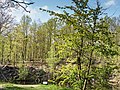
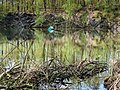
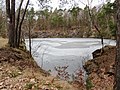
natural monument area in Belgern-Schildau Municipality, Saxony, Germany  | |||||
| Upload media | |||||
| Instance of |
| ||||
|---|---|---|---|---|---|
| Part of | |||||
| Location | Belgern-Schildau, Nordsachsen, Saxony, Germany | ||||
| Heritage designation |
| ||||
| Area |
| ||||
 | |||||
Media in category "Wittes Steinbruch Schildau"
The following 4 files are in this category, out of 4 total.
-
 Schildau Wittes Steinbruch-01.jpg 5,148 × 3,861; 12.35 MB
-
 Schildau Wittes Steinbruch-02.jpg 5,227 × 3,920; 12.4 MB
-
 Schildau Wittes Steinbruch-03.jpg 5,148 × 3,861; 11.28 MB
-
 Schildau Wittes Steinbruch.jpg 4,000 × 3,000; 1.46 MB


