Category:Withypool and Hawkridge
Jump to navigation
Jump to search
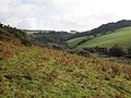
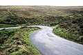
English: Withypool and Hawkridge is a civil parish in the West Somerset district, in the county of Somerset, England. The civil parish includes the villages of Withypool and Hawkridge and has a population around 230.
civil parish in West Somerset, Somerset, England | |||||
| Upload media | |||||
| Instance of | |||||
|---|---|---|---|---|---|
| Location | Somerset West and Taunton, Somerset, South West England, England | ||||
 | |||||
Subcategories
This category has the following 3 subcategories, out of 3 total.
H
W
- Withypool Stone Circle (4 F)
Media in category "Withypool and Hawkridge"
The following 200 files are in this category, out of 502 total.
(previous page) (next page)-
 A field by Ashway Hat Wood - geograph.org.uk - 3549984.jpg 1,500 × 1,000; 342 KB
-
 A field by Ashway Hat Wood - geograph.org.uk - 3549990.jpg 1,500 × 1,000; 256 KB
-
 Above Withypool - geograph.org.uk - 1987664.jpg 640 × 427; 230 KB
-
 Above Withypool - geograph.org.uk - 1987672.jpg 640 × 427; 229 KB
-
 Access road to Foxtwitchen - geograph.org.uk - 6400610.jpg 1,600 × 1,200; 766 KB
-
 Access road, Worth Farm - geograph.org.uk - 3875461.jpg 1,024 × 787; 159 KB
-
 Approach to Comer's Cross - geograph.org.uk - 2121148.jpg 640 × 480; 50 KB
-
 Approaching Landacre - geograph.org.uk - 3807531.jpg 1,024 × 768; 211 KB
-
 Autumn colours in the hedge - geograph.org.uk - 2121122.jpg 640 × 480; 130 KB
-
 B3223 on south side of Room Hill - geograph.org.uk - 5691385.jpg 1,600 × 1,067; 601 KB
-
 B3223, Room Hill Road - geograph.org.uk - 3574596.jpg 1,024 × 768; 152 KB
-

-
 Barle River Valley - geograph.org.uk - 967847.jpg 640 × 427; 111 KB
-
 Barle valley - geograph.org.uk - 1364630.jpg 640 × 480; 107 KB
-
 Barn at Landacre - geograph.org.uk - 1987694.jpg 640 × 427; 229 KB
-

-
 Bed of the River Barle, Somerset - geograph.org.uk - 4073004.jpg 5,440 × 3,672; 5.96 MB
-
 Beech trees and hedges, Woolpit Lane - geograph.org.uk - 3874861.jpg 1,024 × 768; 253 KB
-
 Beeches along the road - geograph.org.uk - 1623463.jpg 640 × 480; 225 KB
-

-

-
 Betony - geograph.org.uk - 4591651.jpg 1,024 × 768; 289 KB
-
 Billowing clouds, above Exmoor - geograph.org.uk - 4591807.jpg 1,024 × 768; 126 KB
-
 Boundary fence and gate, Porchester's Post - geograph.org.uk - 2650957.jpg 1,024 × 768; 207 KB
-
 Bridge at Westwater Farm - geograph.org.uk - 969024.jpg 640 × 427; 130 KB
-
 Bridge over the Litton Water - geograph.org.uk - 2120959.jpg 640 × 480; 128 KB
-
 Bridge over the West Water - geograph.org.uk - 2121053.jpg 640 × 480; 120 KB
-
 Bridleway down to River Barle - geograph.org.uk - 967805.jpg 640 × 427; 100 KB
-
 Bridleway from Tarr Post - geograph.org.uk - 968997.jpg 640 × 427; 83 KB
-
 Bridleway, near Porchester's Post - geograph.org.uk - 2653357.jpg 1,024 × 749; 247 KB
-
 Bridleway, on Humber's Ball - geograph.org.uk - 2653340.jpg 1,024 × 822; 228 KB
-
 Bridleway, to Porchester's Post - geograph.org.uk - 2653334.jpg 1,024 × 768; 293 KB
-
 Brightworthy Barrows - geograph.org.uk - 4591830.jpg 1,024 × 768; 212 KB
-
 Byway to Willingford - geograph.org.uk - 6119217.jpg 1,024 × 768; 222 KB
-
 Cairn on Withypool Hill - geograph.org.uk - 6120127.jpg 1,024 × 770; 222 KB
-
 Cattle grid on Landacre Lane - geograph.org.uk - 3807519.jpg 1,024 × 745; 238 KB
-
 Cattle grid on the road to Withypool - geograph.org.uk - 2121063.jpg 640 × 480; 54 KB
-
 Cattle grid on Worth Lane - geograph.org.uk - 3875471.jpg 1,024 × 739; 151 KB
-
 Cattle sheds, at Cloggs Farm - geograph.org.uk - 2651751.jpg 1,024 × 768; 186 KB
-
 Cloggs Farm yard - geograph.org.uk - 2651816.jpg 1,024 × 768; 192 KB
-
 Cloggs Farmhouse - geograph.org.uk - 2651870.jpg 1,024 × 768; 172 KB
-
 Colland Cross - geograph.org.uk - 3875915.jpg 1,024 × 768; 140 KB
-
 Combe Gate - geograph.org.uk - 969116.jpg 640 × 427; 78 KB
-
 Comer's Cross - geograph.org.uk - 5691397.jpg 1,600 × 1,201; 727 KB
-
 Comer's Gate cattle grid - geograph.org.uk - 5691400.jpg 1,600 × 1,200; 691 KB
-
 Concrete shed near Brightworthy - geograph.org.uk - 4591686.jpg 768 × 1,024; 246 KB
-
 Cottage on Kitridge Lane - geograph.org.uk - 3875451.jpg 1,024 × 768; 178 KB
-
 Dane's Brook Valley - geograph.org.uk - 2652646.jpg 1,024 × 768; 232 KB
-
 Ditch on Withypool Hill - geograph.org.uk - 6325510.jpg 1,600 × 1,067; 514 KB
-
 Driveway, Halsgrove Farm - geograph.org.uk - 3874383.jpg 1,024 × 769; 182 KB
-
 Exmoor , Hillside Woodland - geograph.org.uk - 2041837.jpg 4,288 × 2,848; 6.41 MB
-
 Exmoor , Lanacre - geograph.org.uk - 6185370.jpg 6,000 × 4,000; 7.2 MB
-
 Exmoor , Landacre Bridge ^ River Barle - geograph.org.uk - 6185352.jpg 6,000 × 4,000; 6.43 MB
-
 Exmoor , Landacre Bridge ^ River Barle - geograph.org.uk - 6185363.jpg 6,000 × 4,000; 6.45 MB
-
 Exmoor , Landacre Bridge ^ River Barle - geograph.org.uk - 6185372.jpg 4,000 × 6,000; 7.32 MB
-
 Exmoor , Moorland Scenery - geograph.org.uk - 6185357.jpg 6,000 × 4,000; 6.67 MB
-
 Exmoor , Moorland Scenery - geograph.org.uk - 6185359.jpg 6,000 × 4,000; 7.66 MB
-
 Exmoor , Moorland Scenery - geograph.org.uk - 6185361.jpg 6,000 × 4,000; 6.84 MB
-
 Exmoor , Moorland Scenery - geograph.org.uk - 6185364.jpg 6,000 × 4,000; 6.04 MB
-
 Exmoor , Moorland Scenery - geograph.org.uk - 6185365.jpg 6,000 × 4,000; 7.62 MB
-
 Exmoor , Moorland Scenery - geograph.org.uk - 6185366.jpg 6,000 × 4,000; 6.96 MB
-
 Exmoor , Moorland Scenery - geograph.org.uk - 6185368.jpg 6,000 × 4,000; 6.2 MB
-
 Exmoor , Moorland Scenery - geograph.org.uk - 6185371.jpg 6,000 × 4,000; 7.13 MB
-
 Exmoor , River Barle ^ Riverside Path - geograph.org.uk - 2039666.jpg 4,288 × 2,848; 6.15 MB
-
 Exmoor , Riverside Path - geograph.org.uk - 2039908.jpg 4,288 × 2,848; 6.27 MB
-
 Exmoor , Riverside Path - geograph.org.uk - 2040466.jpg 4,288 × 2,848; 6.3 MB
-
 Exmoor , Rocks on the Riverbank - geograph.org.uk - 2039699.jpg 4,288 × 2,848; 6.42 MB
-
 Exmoor , The River Barle - geograph.org.uk - 2039556.jpg 4,288 × 2,848; 6.25 MB
-
 Exmoor , The River Barle - geograph.org.uk - 2039570.jpg 4,288 × 2,848; 6.21 MB
-
 Exmoor , The River Barle - geograph.org.uk - 2039752.jpg 4,288 × 2,848; 6.37 MB
-
 Exmoor , The River Barle - geograph.org.uk - 2041326.jpg 4,288 × 2,848; 6.57 MB
-
 Exmoor , The River Barle - geograph.org.uk - 2041669.jpg 4,288 × 2,848; 6.26 MB
-
 Exmoor , The River Barle - geograph.org.uk - 2041697.jpg 4,288 × 2,848; 6.56 MB
-
 Exmoor , The River Barle - geograph.org.uk - 2041709.jpg 4,288 × 2,848; 6.3 MB
-
 Exmoor , The River Barle - geograph.org.uk - 2041757.jpg 4,288 × 2,848; 6.32 MB
-
 Exmoor , The River Barle - geograph.org.uk - 2041856.jpg 4,288 × 2,848; 6.67 MB
-
 Exmoor , The River Barle - geograph.org.uk - 2045310.jpg 4,288 × 2,848; 6.24 MB
-
 Exmoor , The River Barle - geograph.org.uk - 2045335.jpg 2,848 × 4,288; 6.38 MB
-
 Exmoor , The River Barle Riverside - geograph.org.uk - 2041272.jpg 4,288 × 2,848; 6.24 MB
-
 Exmoor , The River Barle ^ Riverside Path - geograph.org.uk - 2041866.jpg 4,288 × 2,848; 6.39 MB
-
 Exmoor , The River Barle ^ Tree Catcher - geograph.org.uk - 2039738.jpg 4,288 × 2,848; 6.34 MB
-
 Exmoor , West Water Stream - geograph.org.uk - 2045408.jpg 4,288 × 2,848; 6.33 MB
-
 Exmoor , Woodland - geograph.org.uk - 2045362.jpg 4,288 × 2,848; 6.37 MB
-
 Exmoor , Woodland ^ Riverside Path - geograph.org.uk - 2041881.jpg 4,288 × 2,848; 6.32 MB
-
 Exmoor ponies - geograph.org.uk - 3182365.jpg 640 × 427; 215 KB
-
 Exmoor ponies - geograph.org.uk - 3182383.jpg 640 × 427; 195 KB
-
 Exmoor ponies on Withypool Common - geograph.org.uk - 4135787.jpg 3,617 × 2,696; 4.84 MB
-
 Exmoor Ponies, near Landacre Gate - geograph.org.uk - 3807662.jpg 1,024 × 768; 167 KB
-
 Expanding Ham Wood - geograph.org.uk - 5061729.jpg 1,600 × 1,200; 737 KB
-
 Farmland near Worth - geograph.org.uk - 969077.jpg 640 × 427; 60 KB
-
 Farmland north of Withypool - geograph.org.uk - 3875440.jpg 1,024 × 768; 161 KB
-
 Fence and gate on Worth Hill - geograph.org.uk - 2651410.jpg 1,024 × 768; 211 KB
-
 Fields by Westover Farm - geograph.org.uk - 2121042.jpg 640 × 480; 68 KB
-
 Fields east of Withypool Hill - geograph.org.uk - 2121076.jpg 640 × 480; 97 KB
-
 Fingerpost at Worth - geograph.org.uk - 969036.jpg 640 × 427; 133 KB
-
 Footpath approaching Landacre Bridge - geograph.org.uk - 3182259.jpg 640 × 427; 207 KB
-
 Footpath to Landacre Bridge - geograph.org.uk - 3182253.jpg 640 × 427; 191 KB
-
 Footpath to Landacre Bridge - geograph.org.uk - 3366916.jpg 1,024 × 683; 326 KB
-
 Footpath west of Brightworthy - geograph.org.uk - 3182240.jpg 640 × 427; 197 KB
-
 Footpath west of Brightworthy - geograph.org.uk - 3182247.jpg 640 × 427; 206 KB
-
 Ford near Tudball's Splats - geograph.org.uk - 6119220.jpg 1,024 × 768; 219 KB
-
 Ford on River Barle - geograph.org.uk - 3574843.jpg 1,024 × 768; 284 KB
-
 Ford on River Barle - geograph.org.uk - 967820.jpg 640 × 427; 157 KB
-
 Ford on Westwater - geograph.org.uk - 3875483.jpg 1,024 × 768; 259 KB
-

-
 Gate into field on Clogg's Down - geograph.org.uk - 2120995.jpg 640 × 480; 91 KB
-
 Gate on the Two Moors Way - geograph.org.uk - 3182398.jpg 640 × 427; 157 KB
-
 Gateway near Brightworthy - geograph.org.uk - 3367079.jpg 1,024 × 683; 324 KB
-
 Gateway on Halscombe Allotment - geograph.org.uk - 6119226.jpg 1,024 × 768; 320 KB
-
 Gateway to footpath, on Old Barrow Down - geograph.org.uk - 2651697.jpg 1,024 × 768; 290 KB
-
 Grazing cattle on Room Hill - geograph.org.uk - 3574611.jpg 1,024 × 768; 134 KB
-
 Grazing on the moor - geograph.org.uk - 1987697.jpg 640 × 427; 238 KB
-
 Great Cleeve - geograph.org.uk - 3875710.jpg 1,024 × 768; 207 KB
-
 Halscombe Allotment - geograph.org.uk - 961067.jpg 640 × 427; 81 KB
-
 Halscombe Allotment - geograph.org.uk - 961071.jpg 640 × 427; 72 KB
-
 Hawkridge , Barn - geograph.org.uk - 6146272.jpg 6,000 × 4,000; 7.13 MB
-
 Hawkridge , Broad Lane - geograph.org.uk - 4211679.jpg 4,288 × 2,848; 5.5 MB
-
 Hawkridge , Broad Lane - geograph.org.uk - 4211689.jpg 4,288 × 2,848; 6.25 MB
-
 Hawkridge , Exmoor Scenery - geograph.org.uk - 4211682.jpg 4,288 × 2,848; 6.31 MB
-
 Hawkridge , Lane ^ Tree - geograph.org.uk - 4211690.jpg 2,848 × 4,288; 7.11 MB
-
 Hawkridge , St Giles Church - geograph.org.uk - 6146268.jpg 6,000 × 4,000; 6.61 MB
-
 Hawkridge , Village Hall - geograph.org.uk - 4211688.jpg 4,288 × 2,848; 6.36 MB
-
 Hawkridge Lane - geograph.org.uk - 3875498.jpg 1,024 × 768; 193 KB
-
 Hedge cutting above Withypool - geograph.org.uk - 3182208.jpg 640 × 427; 200 KB
-
 Hedge cutting above Withypool - geograph.org.uk - 3182210.jpg 427 × 640; 206 KB
-
 Hillside, below Cloggs Farm - geograph.org.uk - 2652719.jpg 1,024 × 768; 242 KB
-
 Hillway Farm - geograph.org.uk - 4591791.jpg 1,024 × 768; 173 KB
-
 Isolated cottage in the Barle Valley - geograph.org.uk - 3875714.jpg 1,024 × 768; 220 KB
-
 Isolated post box, on Landacre Lane - geograph.org.uk - 3807635.jpg 1,024 × 768; 175 KB
-
 Junction on the moor - geograph.org.uk - 3182391.jpg 640 × 427; 172 KB
-
 Kitridge Lane - geograph.org.uk - 3874869.jpg 1,024 × 768; 211 KB
-
 Knighton Combe - geograph.org.uk - 3808188.jpg 1,024 × 768; 194 KB
-
 Knighton Combe - geograph.org.uk - 4591866.jpg 1,024 × 768; 302 KB
-
 Landacre Gate - geograph.org.uk - 3807658.jpg 1,024 × 769; 148 KB
-
 Lone tree by the road to Weatherslade - geograph.org.uk - 5691378.jpg 1,600 × 1,281; 692 KB
-
 Looking down on Withypool - geograph.org.uk - 3574632.jpg 1,024 × 768; 155 KB
-
 Looking down the River Barle - geograph.org.uk - 3549959.jpg 1,500 × 1,000; 394 KB
-
 Looking down the River Barle - geograph.org.uk - 3549966.jpg 1,500 × 1,000; 405 KB
-
 Looking up the River Barle - geograph.org.uk - 3549961.jpg 1,500 × 1,000; 284 KB
-
 Looking up towards Cloggs Farm - geograph.org.uk - 2652627.jpg 1,024 × 768; 248 KB
-
 Marshclose Hill - geograph.org.uk - 3875707.jpg 1,024 × 787; 181 KB
-
 Meadow Brown butterfly feeds on Knapweed - geograph.org.uk - 4591650.jpg 1,024 × 768; 180 KB
-
 Minor road on Parsonage Down - geograph.org.uk - 3362780.jpg 1,024 × 766; 125 KB
-
 Minor road to North Molton - geograph.org.uk - 2649863.jpg 1,024 × 768; 165 KB
-
 Moorland, above the Barle Valley - geograph.org.uk - 3054634.jpg 1,024 × 768; 237 KB
-
 Near Brightworthy - geograph.org.uk - 3182239.jpg 640 × 427; 205 KB
-
 Newland - geograph.org.uk - 3182226.jpg 640 × 453; 222 KB
-
 Oakbeer Wood - geograph.org.uk - 3574775.jpg 1,024 × 768; 162 KB
-
 Old Barrow Down - geograph.org.uk - 2651534.jpg 1,024 × 768; 292 KB
-
 Old Barrow Down - geograph.org.uk - 969006.jpg 640 × 427; 72 KB
-

-
 Old hedgerow at Tudball's Splats - geograph.org.uk - 969101.jpg 640 × 427; 142 KB
-
 Ordnance Survey Cut Mark - geograph.org.uk - 5283325.jpg 640 × 428; 134 KB
-
 Ordnance Survey Cut Mark - geograph.org.uk - 5283327.jpg 360 × 640; 91 KB
-
 Ordnance Survey Cut Mark - geograph.org.uk - 5283328.jpg 393 × 640; 92 KB
-
 Outbuilding at Waterhouse Farm - geograph.org.uk - 4591645.jpg 1,024 × 768; 163 KB
-
 Parsonage Down - geograph.org.uk - 3187674.jpg 1,024 × 683; 160 KB
-
 Pastoral edge - geograph.org.uk - 1623456.jpg 640 × 480; 228 KB
-
 Path alongside the River Barle - geograph.org.uk - 3574759.jpg 1,024 × 768; 201 KB
-
 Path into the woodland east of Withypool - geograph.org.uk - 6400621.jpg 1,600 × 1,600; 1.24 MB
-
 Path through Uppington Plantation - geograph.org.uk - 3574741.jpg 1,024 × 768; 193 KB
-
 Path to Withycombe - geograph.org.uk - 4591887.jpg 640 × 480; 89 KB
-
 Path to Withypool - geograph.org.uk - 4591661.jpg 1,024 × 768; 146 KB
-

-
 Permissive path above Withypool - geograph.org.uk - 1987655.jpg 640 × 426; 204 KB
-
 Picnic, near Upper Willingford Bridge - geograph.org.uk - 2653317.jpg 1,024 × 768; 242 KB
-
 Pit near Old Barrow Plantation - geograph.org.uk - 2651654.jpg 1,024 × 768; 297 KB
-

-
 Porchester Post - geograph.org.uk - 6119222.jpg 1,024 × 768; 278 KB
-
 Portford Bridge - geograph.org.uk - 3358926.jpg 1,024 × 798; 161 KB
-
 Portford Bridge - geograph.org.uk - 961060.jpg 640 × 427; 105 KB
-
 Recently laid hedgerow, at Westwater Farm - geograph.org.uk - 3362785.jpg 1,024 × 768; 193 KB
-
 Red Admiral, on Old Barrow Down - geograph.org.uk - 2651520.jpg 1,024 × 768; 225 KB
-
 Reflections in the Barle, Somerset - geograph.org.uk - 4066141.jpg 800 × 664; 189 KB
-
 Reflections in the River Barle, Somerset - geograph.org.uk - 4066146.jpg 800 × 711; 213 KB
-
 River Barle - geograph.org.uk - 2697941.jpg 1,944 × 2,592; 2 MB
-
 River Barle - geograph.org.uk - 3182236.jpg 640 × 427; 182 KB
-
 River Barle - geograph.org.uk - 6326240.jpg 1,600 × 1,067; 636 KB
-
 River Barle at Landacre - geograph.org.uk - 648808.jpg 640 × 427; 77 KB
-
 River Barle below Sherdon Hutch - geograph.org.uk - 967962.jpg 640 × 427; 70 KB
-
 River Barle near Worth - geograph.org.uk - 967833.jpg 640 × 427; 155 KB
-
 River Barle, below South Barton Wood - geograph.org.uk - 3875718.jpg 1,024 × 780; 293 KB
-
 River Barle, near Landacre - geograph.org.uk - 3807545.jpg 1,024 × 768; 249 KB
-
 Road on Old Barrow Down - geograph.org.uk - 2120982.jpg 640 × 480; 88 KB
-
 Road over Clogg's Down - geograph.org.uk - 2121004.jpg 640 × 480; 82 KB
-
 Road to Batsom Farm and Cottage - geograph.org.uk - 3808203.jpg 1,024 × 768; 186 KB
-
 Road to Portford Bridge - geograph.org.uk - 961049.jpg 640 × 427; 76 KB
-
 Room Hill Road (B3223) - geograph.org.uk - 5691365.jpg 1,600 × 1,201; 727 KB
-
 Sharp bend in the River Barle - geograph.org.uk - 4591648.jpg 1,024 × 768; 290 KB
-
 Sherdon Hutch - geograph.org.uk - 967938.jpg 640 × 427; 129 KB
-
 Sparrow Lane - geograph.org.uk - 3874369.jpg 1,024 × 768; 224 KB
-
 Sparrow Lane - geograph.org.uk - 6400602.jpg 1,600 × 1,200; 1.01 MB
-
 Stepping Stones - geograph.org.uk - 3187636.jpg 1,024 × 683; 283 KB
-
 Stone outbuilding at Brightworthy - geograph.org.uk - 4591654.jpg 1,024 × 768; 190 KB
-
 Summit of Withypool Hill - geograph.org.uk - 6120122.jpg 1,024 × 768; 241 KB
-
 Tarr Post - geograph.org.uk - 3875491.jpg 1,024 × 768; 200 KB
-
 Tarr Steps (clapper bridge), Somerset - geograph.org.uk - 5657709.jpg 6,144 × 4,304; 3.35 MB
-
 Tarr Steps - geograph.org.uk - 4296161.jpg 640 × 436; 160 KB
-
 Tarr Steps - geograph.org.uk - 5354368.jpg 2,000 × 1,333; 2.65 MB
-
 Tarr Steps - geograph.org.uk - 5530937.jpg 2,399 × 1,599; 1.11 MB


_-_geograph.org.uk_-_5691365.jpg)


,_Somerset_-_geograph.org.uk_-_5657709.jpg)


