Category:Wisborough Green
Jump to navigation
Jump to search
village in West Sussex, England, UK  | |||||
| Upload media | |||||
| Instance of | |||||
|---|---|---|---|---|---|
| Location | Chichester, West Sussex, South East England, England | ||||
| Area |
| ||||
| official website | |||||
 | |||||
Subcategories
This category has the following 5 subcategories, out of 5 total.
P
W
Z
Media in category "Wisborough Green"
The following 200 files are in this category, out of 606 total.
(previous page) (next page)-
 A bin at Shurlands Farm - geograph.org.uk - 2506035.jpg 640 × 480; 161 KB
-
 A gentle flowing River Arun by the Wey-South Path - geograph.org.uk - 1829316.jpg 1,600 × 1,200; 676 KB
-
 A Rural Post Box - geograph.org.uk - 4515537.jpg 2,399 × 1,599; 785 KB
-
 A272 - geograph.org.uk - 5224188.jpg 640 × 375; 78 KB
-
 A272 crosses New Bridge - geograph.org.uk - 4060261.jpg 3,648 × 2,736; 2.27 MB
-
 A272 eastbound out of Wisborough Green - geograph.org.uk - 2350357.jpg 4,000 × 3,000; 3.35 MB
-
 A272 in Bowyer's Copse - geograph.org.uk - 6215341.jpg 1,600 × 1,198; 1.06 MB
-
 A272 junction with School Road - geograph.org.uk - 4060237.jpg 3,504 × 2,619; 1.5 MB
-
 A272 to Billingshurst - geograph.org.uk - 3181597.jpg 640 × 430; 100 KB
-
 A272, eastbound - geograph.org.uk - 5224193.jpg 640 × 353; 65 KB
-
 A272, eastbound - geograph.org.uk - 5224194.jpg 640 × 402; 58 KB
-
 A272, New Bridge - geograph.org.uk - 5224196.jpg 640 × 397; 81 KB
-
 A272, Wisborough Green - geograph.org.uk - 2203190.jpg 640 × 480; 61 KB
-
 A272, Wisborough Green - geograph.org.uk - 5224191.jpg 640 × 372; 64 KB
-
 A272, Wisborough Green - geograph.org.uk - 5224192.jpg 640 × 380; 74 KB
-
 Abandoned Range Rover by the Arun Canal - geograph.org.uk - 1829329.jpg 1,600 × 1,200; 829 KB
-
 After The Floods - geograph.org.uk - 3971616.jpg 3,072 × 2,048; 5.05 MB
-
 Alien gateway - geograph.org.uk - 1211290.jpg 640 × 480; 151 KB
-
 Alpaca Herd - geograph.org.uk - 778845.jpg 479 × 640; 92 KB
-
 An Arun Backwater - geograph.org.uk - 3971631.jpg 640 × 427; 100 KB
-
 Another sunset over Sussex - geograph.org.uk - 2822881.jpg 1,024 × 768; 133 KB
-
 Ansell’s Yard - geograph.org.uk - 5848610.jpg 1,024 × 626; 153 KB
-
 Approaching the Boxal Bridge - geograph.org.uk - 5848734.jpg 1,024 × 635; 232 KB
-

-
 Approaching Wisborough Green - geograph.org.uk - 5852973.jpg 1,024 × 632; 193 KB
-
 Arun journey - geograph.org.uk - 804383.jpg 637 × 425; 72 KB
-
 Arun journey - geograph.org.uk - 804391.jpg 637 × 425; 107 KB
-
 Arun journey - geograph.org.uk - 804393.jpg 637 × 425; 67 KB
-
 Arun journey - geograph.org.uk - 804396.jpg 637 × 425; 83 KB
-
 B2133 - geograph.org.uk - 28145.jpg 640 × 428; 156 KB
-
 B2133 south to Newpound Common - geograph.org.uk - 1894753.jpg 2,592 × 1,944; 2.07 MB
-
 Barn at Westland - geograph.org.uk - 2011561.jpg 640 × 426; 255 KB
-
 Barn in field - geograph.org.uk - 5514340.jpg 800 × 518; 133 KB
-

-
 Barn repair at Loves Farm - geograph.org.uk - 1829681.jpg 1,600 × 1,200; 502 KB
-

-
 Barns at Coldharbour Farm - geograph.org.uk - 2338703.jpg 800 × 600; 137 KB
-
 Barns at Coldharbour Farm - geograph.org.uk - 5849188.jpg 1,956 × 1,404; 1.56 MB
-
 Barns at Harsfold Farm - geograph.org.uk - 2350329.jpg 3,898 × 2,887; 2.84 MB
-
 Barns at Paplands Farm - geograph.org.uk - 2350594.jpg 4,000 × 3,000; 3.25 MB
-
 Barns on Crimbourne Lane - geograph.org.uk - 3089143.jpg 800 × 600; 137 KB
-
 Bat and Ball, Newpound Common - geograph.org.uk - 779344.jpg 640 × 479; 91 KB
-
 Bedham Lane north of Springs Farm - geograph.org.uk - 3228542.jpg 3,009 × 2,048; 1.24 MB
-
 Bend, A272 - geograph.org.uk - 5224184.jpg 640 × 429; 92 KB
-
 Between Copses - geograph.org.uk - 5848633.jpg 1,600 × 1,055; 491 KB
-
 Billingshurst Road (A272) in 1991 - geograph.org.uk - 2476998.jpg 826 × 554; 134 KB
-
 Billingshurst Road - geograph.org.uk - 5879607.jpg 1,920 × 1,280; 2.47 MB
-
 Billingshurst Road - geograph.org.uk - 5879609.jpg 1,826 × 1,118; 1.64 MB
-
 Bluebells, Quay Copse - geograph.org.uk - 3158519.jpg 640 × 430; 129 KB
-
 Bluebells, Three Corner Copse - geograph.org.uk - 3161975.jpg 640 × 430; 132 KB
-
 Boxal Bridge carrying Kirdford Road over Boxal Brook - geograph.org.uk - 2115089.jpg 2,592 × 1,944; 2.33 MB
-
 Bridge at Rowner Lock - geograph.org.uk - 5790246.jpg 1,024 × 768; 313 KB
-
 Bridge over tail of Rowner Lock - geograph.org.uk - 5790078.jpg 1,024 × 768; 335 KB
-

-
 Bridleway 774-1 meets Newpound Lane on a bend - geograph.org.uk - 2350428.jpg 4,000 × 3,000; 3.54 MB
-
 Bridleway 774-1 north to Newpound Lane - geograph.org.uk - 2350423.jpg 4,000 × 3,000; 3.44 MB
-

-

-
 Bridleway enters Smale Copse - geograph.org.uk - 4764925.jpg 800 × 600; 208 KB
-
 Bridleway junction - geograph.org.uk - 3161956.jpg 640 × 430; 117 KB
-
 Bridleway junction at Harsfold Hanger - geograph.org.uk - 3089113.jpg 800 × 600; 136 KB
-
 Bridleway leaves Smale Copse - geograph.org.uk - 4764927.jpg 600 × 800; 216 KB
-
 Bridleway towards Pallingham - geograph.org.uk - 2011573.jpg 640 × 427; 244 KB
-
 Brinkhurst Cottages at Malham - geograph.org.uk - 1831019.jpg 1,600 × 1,200; 406 KB
-
 Brinkhurst Cottages at Malham - geograph.org.uk - 1894708.jpg 1,600 × 1,200; 618 KB
-
 Broad verge, Durbans Road - geograph.org.uk - 2578972.jpg 640 × 480; 111 KB
-
 Brook Bridge - geograph.org.uk - 5852997.jpg 1,024 × 624; 218 KB
-

-
 Burchett’s Farm - geograph.org.uk - 5852649.jpg 1,024 × 658; 116 KB
-
 Bushes by the River Arun - geograph.org.uk - 3177930.jpg 640 × 430; 52 KB
-
 By the Wey South Path - geograph.org.uk - 3164887.jpg 640 × 430; 85 KB
-
 Camping site adjoining the Bat and Ball - geograph.org.uk - 2350454.jpg 4,000 × 3,000; 3.32 MB
-
 Canal Milestone on the Wey and Arun Canal - geograph.org.uk - 172345.jpg 640 × 439; 147 KB
-
 Canalside House, New Bridge - geograph.org.uk - 2150986.jpg 2,560 × 1,920; 1.61 MB
-

-
 Chalk pile at Burchett's Farm - geograph.org.uk - 2118984.jpg 2,592 × 1,944; 1.09 MB
-
 Chauf fur on duty near Pallingham Bridge - geograph.org.uk - 1824931.jpg 1,600 × 1,200; 547 KB
-
 Chinese Bridge over the River Arun at Haybarn - geograph.org.uk - 1893382.jpg 1,600 × 1,200; 418 KB
-
 Commemorative plaque to Arun Canal volunteer - geograph.org.uk - 1828237.jpg 1,600 × 1,200; 826 KB
-

-
 Coot's nest in small pool near Harsfold Manor - geograph.org.uk - 1892125.jpg 1,600 × 1,200; 595 KB
-
 Coppicing, Three Corner Copse - geograph.org.uk - 3161981.jpg 640 × 430; 148 KB
-
 Cottage at Bedham - geograph.org.uk - 2395859.jpg 800 × 600; 160 KB
-
 Cottage in the Bedham Hills - geograph.org.uk - 6381796.jpg 1,600 × 1,083; 825 KB
-
 Cottage, Horsebridge Hill - geograph.org.uk - 3162029.jpg 640 × 430; 87 KB
-
 Cottages alongside drive to Loves Farm - geograph.org.uk - 1829860.jpg 1,600 × 1,200; 557 KB
-

-
 Could do better on the footbridge design - geograph.org.uk - 2505774.jpg 640 × 480; 166 KB
-
 Countryside by the Wey South Path - geograph.org.uk - 3164877.jpg 640 × 430; 90 KB
-
 Course of Arun Navigation cut - geograph.org.uk - 2505475.jpg 640 × 480; 122 KB
-

-

-
 Course of the Wey and Arun Canal - geograph.org.uk - 3176425.jpg 640 × 430; 77 KB
-
 Course of the Wey and Arun Canal - geograph.org.uk - 3177759.jpg 640 × 430; 61 KB
-
 Cows by the Arun - geograph.org.uk - 2150979.jpg 2,560 × 1,920; 2.16 MB
-
 Cricket Ground - geograph.org.uk - 5848516.jpg 1,024 × 654; 137 KB
-
 Cricket match at Wisborough Green, West Sussex, England.jpg 640 × 480; 52 KB
-
 Cricket on the Village Green - geograph.org.uk - 5484842.jpg 5,472 × 3,648; 7.06 MB
-
 Cricket Pavilion at Wisborough Green - geograph.org.uk - 3574183.jpg 640 × 427; 90 KB
-
 Cricket pavilion on the village green - geograph.org.uk - 1915877.jpg 640 × 480; 108 KB
-
 Cricket pavilion Wisborough Green - geograph.org.uk - 1891877.jpg 1,600 × 1,200; 465 KB
-
 Cricket Pavilion, Village Green - geograph.org.uk - 778725.jpg 479 × 640; 99 KB
-
 Cricket pavilion, Wisborough Green - geograph.org.uk - 2505383.jpg 640 × 480; 120 KB
-
 Cricket pitch on Wisborough Green village green - geograph.org.uk - 1891885.jpg 1,600 × 1,200; 400 KB
-
 Crossing the National Park Boundary - geograph.org.uk - 5513999.jpg 800 × 464; 115 KB
-

-
 Dead tree by the Wey-South Path - geograph.org.uk - 1828394.jpg 1,600 × 1,200; 390 KB
-
 Disused cattle trough - geograph.org.uk - 258430.jpg 640 × 480; 128 KB
-
 Dovecote at Fishers Farm Park - geograph.org.uk - 4764941.jpg 800 × 600; 118 KB
-
 Drungewick from the air - geograph.org.uk - 5151110.jpg 1,846 × 1,112; 583 KB
-
 Duck and ducklings on Wisborough Green pond - geograph.org.uk - 1891979.jpg 1,600 × 1,200; 531 KB
-
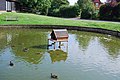 Duck house in Wisborough Green - geograph.org.uk - 1433625.jpg 640 × 428; 75 KB
-
 Duck pond by School Road Wisborough Green - geograph.org.uk - 1891966.jpg 1,600 × 1,200; 478 KB
-
 Duck pond, Wisborough Green - geograph.org.uk - 3574193.jpg 640 × 427; 99 KB
-
 Ducks on the River Arun near Guildenhurst Manor - geograph.org.uk - 1828360.jpg 1,600 × 1,200; 691 KB
-
 Durbans Road (formerly Loxwood Road) - geograph.org.uk - 1894768.jpg 1,600 × 1,200; 602 KB
-
 Durbans Road approaching Wisborough Green from the north - geograph.org.uk - 1891848.jpg 1,600 × 1,200; 693 KB
-
 Durbans Road at the junction of Vicarage Hill - geograph.org.uk - 4597517.jpg 2,560 × 1,920; 2.01 MB
-
 Durbans Road at Wisborough Green - geograph.org.uk - 5852987.jpg 1,024 × 668; 226 KB
-
 Durbans Road at Wisborough Green - geograph.org.uk - 5853009.jpg 1,024 × 674; 153 KB
-
 Durbans Road north of Wisborough Green - geograph.org.uk - 4600471.jpg 2,540 × 1,894; 1.24 MB
-

-
 Easterly of two ponds at Malham - geograph.org.uk - 1831000.jpg 1,600 × 1,200; 577 KB
-
 Electricity Pylon near Paplands Farm - geograph.org.uk - 779318.jpg 479 × 640; 110 KB
-

-
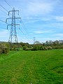 Electricity Pylons - geograph.org.uk - 779293.jpg 479 × 640; 88 KB
-
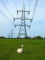 Electricity Pylons near Howfold Farm - geograph.org.uk - 778839.jpg 479 × 640; 89 KB
-

-
 Entering Wisborough Green, A272 - geograph.org.uk - 5224187.jpg 640 × 426; 90 KB
-

-
 Entrance to Honey Farm, near Wisborough Green - geograph.org.uk - 3348264.jpg 1,024 × 743; 239 KB
-
 Entrance to Malham Farms off the B2133 - geograph.org.uk - 1894741.jpg 1,600 × 1,200; 541 KB
-
 Factories, Newpound Common, West Sussex - geograph.org.uk - 3348261.jpg 1,600 × 1,247; 419 KB
-
 Fallen tree, alive and well, near Guildenhurst Bridge - geograph.org.uk - 1828385.jpg 1,600 × 1,200; 864 KB
-
 Farm Bridge - geograph.org.uk - 5852688.jpg 1,024 × 668; 199 KB
-
 Farm entrance on Fittleworth Road - geograph.org.uk - 5849193.jpg 2,048 × 1,536; 1.62 MB
-

-
 Farmland by the old canal - geograph.org.uk - 3177758.jpg 640 × 430; 39 KB
-
 Farmland by the River Arun - geograph.org.uk - 3176426.jpg 640 × 430; 52 KB
-
 Farmland near Pallingham - geograph.org.uk - 3158487.jpg 640 × 430; 43 KB
-
 Farmland off Pallingham Lane - geograph.org.uk - 3164919.jpg 640 × 430; 83 KB
-
 Fencing by driveway to Smale Farm - geograph.org.uk - 1829912.jpg 1,600 × 1,200; 494 KB
-
 Field by Billingshurst Road - geograph.org.uk - 5879612.jpg 1,920 × 1,280; 1.35 MB
-
 Field by Horsebridge Hill - geograph.org.uk - 3162014.jpg 640 × 430; 106 KB
-

-
 Field edge bridleway by Smale Hanger - geograph.org.uk - 4764923.jpg 800 × 600; 206 KB
-
 Field entrance - geograph.org.uk - 3158493.jpg 640 × 430; 88 KB
-
 Finger post at Wisborough Green - geograph.org.uk - 5372464.jpg 480 × 640; 120 KB
-
 Fishers Adventure Park Farm - geograph.org.uk - 2350432.jpg 4,000 × 3,000; 3.58 MB
-

-
 Fittleworth Road, Wisborough Green - geograph.org.uk - 2083490.jpg 640 × 406; 152 KB
-
 Flying over Wisborough Green - geograph.org.uk - 2202497.jpg 480 × 640; 73 KB
-
 Football pitch, Wisborough Green - geograph.org.uk - 3348269.jpg 800 × 458; 103 KB
-
 Footbridge north of Crimbourne Lane - geograph.org.uk - 3089151.jpg 600 × 800; 197 KB
-
 Footbridge over the River Arun - geograph.org.uk - 3171462.jpg 640 × 430; 65 KB
-
 Footbridge over tributary of the River Arun - geograph.org.uk - 1829068.jpg 1,600 × 1,200; 831 KB
-
 Footbridge spanning the River Arun - geograph.org.uk - 3818141.jpg 2,048 × 3,072; 3.66 MB
-
 Footbridge, River Arun - geograph.org.uk - 779165.jpg 479 × 640; 188 KB
-
 Footbridge, Wey South Path - geograph.org.uk - 3167611.jpg 640 × 430; 79 KB
-
 Footbridge, Wey South Path - geograph.org.uk - 3181445.jpg 640 × 430; 123 KB
-
 Footpath 2940 by Naldretts Copse - geograph.org.uk - 2578984.jpg 640 × 480; 113 KB
-

-

-
 Footpath crossing on Horsebridge Hill - geograph.org.uk - 2339640.jpg 800 × 600; 173 KB
-
 Footpath follows the line - geograph.org.uk - 5852914.jpg 1,024 × 673; 183 KB
-
 Footpath from Arundel Holt reaches road - geograph.org.uk - 2339722.jpg 800 × 600; 266 KB
-

-
 Footpath into Arundel Holt - geograph.org.uk - 3162020.jpg 640 × 430; 117 KB
-
 Footpath junction near Shipbourne Farm - geograph.org.uk - 1893446.jpg 1,600 × 1,200; 652 KB
-

-
 Footpath leaving the Kirdford Road - geograph.org.uk - 5848589.jpg 1,024 × 659; 211 KB
-
 Footpath near Champions Farm - geograph.org.uk - 779366.jpg 479 × 640; 197 KB
-
 Footpath near Sparr Farm - geograph.org.uk - 2250015.jpg 800 × 748; 282 KB
-
 Footpath off Horsebridge Hill - geograph.org.uk - 3162036.jpg 640 × 430; 104 KB
-
 Footpath off the Wey South Path - geograph.org.uk - 3164899.jpg 640 × 430; 66 KB
-
 Footpath past old lorries - geograph.org.uk - 5852884.jpg 1,024 × 667; 228 KB
-
 Footpath reaches Kirdford Road - geograph.org.uk - 2250029.jpg 600 × 800; 194 KB
-
 Footpath sign on road near Arundel Holt - geograph.org.uk - 2339719.jpg 800 × 600; 187 KB
-
 Footpath stile in Dunhurst Copse - geograph.org.uk - 2250059.jpg 800 × 600; 162 KB
-
 Footpath through Furzefield Rough - geograph.org.uk - 2115104.jpg 2,592 × 1,944; 2.55 MB
-
 Footpath to Shipbourne Cottages - geograph.org.uk - 1893434.jpg 1,600 × 1,200; 409 KB
-

-
 Four and a half miles to the River Arun - geograph.org.uk - 3435378.jpg 1,222 × 811; 384 KB
-
 Furnace Pond Cottages - geograph.org.uk - 3164911.jpg 640 × 463; 63 KB
-
 Furnace Pond Cottages - geograph.org.uk - 3164916.jpg 640 × 430; 69 KB
-
 Furnacepond Cottages - geograph.org.uk - 2011736.jpg 640 × 426; 191 KB
-
 Furnacepond Cottages - geograph.org.uk - 5513992.jpg 800 × 481; 121 KB
-
 Garden gate at Arundel Holt - geograph.org.uk - 3092237.jpg 800 × 481; 147 KB
-
 Gate into Farringtons Copse - geograph.org.uk - 2339764.jpg 800 × 600; 209 KB
-
 Gateway on Fittleworth Road - geograph.org.uk - 2338650.jpg 800 × 600; 150 KB
-
 Glebe Way, Wisborough Green - geograph.org.uk - 5877312.jpg 1,134 × 1,834; 1.37 MB
-
 Great Wood from the air - geograph.org.uk - 5951887.jpg 3,215 × 1,852; 1,014 KB
-
 Green and White - geograph.org.uk - 2150938.jpg 2,560 × 1,920; 1.86 MB
-
 Green Crop - geograph.org.uk - 5852675.jpg 1,600 × 1,056; 487 KB
-
 Green pond by the house at Arundel Holt - geograph.org.uk - 3092229.jpg 800 × 600; 195 KB
-
 Greenhouses at Wallabies Nursery - geograph.org.uk - 5848563.jpg 1,024 × 634; 133 KB
-
 Greenhouses near the Kirdford Road - geograph.org.uk - 5848580.jpg 1,024 × 654; 145 KB
-
 Guildenhurst Bridge - geograph.org.uk - 2151000.jpg 2,560 × 1,920; 2.21 MB
-
 Guildenhurst Bridge - geograph.org.uk - 3181453.jpg 640 × 430; 90 KB
-
 Guildenhurst Bridge - geograph.org.uk - 3181456.jpg 640 × 430; 58 KB


_in_1991_-_geograph.org.uk_-_2476998.jpg)


_-_geograph.org.uk_-_3177799.jpg)
_-_geograph.org.uk_-_3177803.jpg)


_-_geograph.org.uk_-_1894768.jpg)


