Category:Winteringham
Jump to navigation
Jump to search
English: Winteringham is a village in North Lincolnshire and on the south bank of the Humber Estuary, population 989 (census 2001).
village in United Kingdom  | |||||
| Upload media | |||||
| Instance of | |||||
|---|---|---|---|---|---|
| Location | North Lincolnshire, Lincolnshire, Yorkshire and the Humber, England | ||||
 | |||||
Subcategories
This category has the following 12 subcategories, out of 12 total.
Media in category "Winteringham"
The following 200 files are in this category, out of 509 total.
(previous page) (next page)-
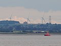 32A Float, Winterton and Wind Farm - geograph.org.uk - 1392909.jpg 640 × 480; 115 KB
-
 A farm track to Marsh Farm - geograph.org.uk - 2173213.jpg 800 × 600; 151 KB
-
 A junction of paths at Winteringham - geograph.org.uk - 4023596.jpg 1,600 × 1,064; 580 KB
-
 A quiet moment on the A1077 - geograph.org.uk - 5804455.jpg 640 × 536; 66 KB
-

-
 A walk to Winteringham ^56 - geograph.org.uk - 2008139.jpg 800 × 600; 274 KB
-
 A walk to Winteringham ^57 - geograph.org.uk - 2008146.jpg 800 × 600; 327 KB
-
 A walk to Winteringham ^58 - geograph.org.uk - 2008152.jpg 800 × 600; 249 KB
-
 A walk to Winteringham ^59 - geograph.org.uk - 2008188.jpg 800 × 600; 300 KB
-
 A walk to Winteringham ^60 - geograph.org.uk - 2008198.jpg 800 × 600; 301 KB
-
 A walk to Winteringham ^61 - geograph.org.uk - 2008204.jpg 800 × 600; 205 KB
-
 A walk to Winteringham ^62 - geograph.org.uk - 2008217.jpg 800 × 600; 260 KB
-
 A walk to Winteringham ^63 - geograph.org.uk - 2008229.jpg 800 × 600; 355 KB
-
 A walk to Winteringham ^64 - geograph.org.uk - 2008236.jpg 800 × 600; 271 KB
-
 A walk to Winteringham ^65 - geograph.org.uk - 2008245.jpg 800 × 600; 353 KB
-
 A walk to Winteringham ^66 - geograph.org.uk - 2008265.jpg 800 × 600; 125 KB
-
 A walk to Winteringham ^67 - geograph.org.uk - 2008274.jpg 800 × 600; 244 KB
-
 A walk to Winteringham ^68 - geograph.org.uk - 2008282.jpg 800 × 600; 324 KB
-
 A walk to Winteringham ^69 - geograph.org.uk - 2008289.jpg 800 × 600; 326 KB
-
 A walk to Winteringham ^70 - geograph.org.uk - 2008297.jpg 800 × 600; 268 KB
-
 A walk to Winteringham ^71 - geograph.org.uk - 2008302.jpg 800 × 600; 227 KB
-
 A walk to Winteringham ^72 - geograph.org.uk - 2008314.jpg 800 × 600; 235 KB
-
 A walk to Winteringham ^73 - geograph.org.uk - 2008320.jpg 800 × 600; 294 KB
-
 A walk to Winteringham ^74 - geograph.org.uk - 2008331.jpg 800 × 600; 269 KB
-
 A walk to Winteringham ^75 - geograph.org.uk - 2008338.jpg 800 × 600; 283 KB
-
 A walk to Winteringham ^76 - geograph.org.uk - 2008344.jpg 800 × 600; 322 KB
-
 A walk to Winteringham ^77 - geograph.org.uk - 2008352.jpg 800 × 600; 347 KB
-
 A walk to Winteringham ^78 - geograph.org.uk - 2008372.jpg 800 × 600; 319 KB
-
 A walk to Winteringham ^79 - geograph.org.uk - 2008379.jpg 800 × 600; 260 KB
-
 A walk to Winteringham ^80 - geograph.org.uk - 2008391.jpg 800 × 600; 303 KB
-
 A walk to Winteringham ^81 - geograph.org.uk - 2008401.jpg 800 × 600; 255 KB
-
 A walk to Winteringham ^82 - geograph.org.uk - 2008408.jpg 600 × 800; 306 KB
-

-
 A1077 Cockthorne Lane - geograph.org.uk - 4444838.jpg 1,024 × 673; 79 KB
-
 A1077 near Winteringham - geograph.org.uk - 4916178.jpg 640 × 452; 329 KB
-
 A1077 towards Scunthorpe - geograph.org.uk - 2516989.jpg 1,600 × 1,200; 467 KB
-
 A1077 towards Scunthorpe - geograph.org.uk - 2516998.jpg 1,600 × 1,200; 447 KB
-
 All Saint's Church, Winteringham - geograph.org.uk - 4023587.jpg 1,600 × 998; 630 KB
-
 All Saints Church, Winteringham - geograph.org.uk - 5332660.jpg 5,046 × 3,717; 5.52 MB
-
 All Saints Church, Winteringham - geograph.org.uk - 5675612.jpg 1,600 × 1,064; 998 KB
-

-
 An island no more - geograph.org.uk - 4338689.jpg 1,024 × 768; 126 KB
-
 Another view of Winteringham Haven - geograph.org.uk - 5335707.jpg 4,815 × 3,550; 4.54 MB
-
 Approaching Winteringham - geograph.org.uk - 99464.jpg 640 × 426; 104 KB
-
 Arable land west of Winteringham. - geograph.org.uk - 6235031.jpg 1,024 × 615; 136 KB
-
 At Winteringham Haven - geograph.org.uk - 5332647.jpg 3,781 × 4,917; 4.1 MB
-
 B1207 junction from Mere lane - geograph.org.uk - 3522485.jpg 640 × 509; 98 KB
-
 Bales near Ermine House, Winteringham - geograph.org.uk - 5104451.jpg 800 × 536; 151 KB
-
 Barn at Winteringham Grange - geograph.org.uk - 1534814.jpg 640 × 415; 277 KB
-
 Bend and Bench near Winteringham - geograph.org.uk - 2039423.jpg 640 × 480; 57 KB
-
 Between Winteringham and West Halton - geograph.org.uk - 1374362.jpg 640 × 480; 69 KB
-
 Beyond the Flood Bank - geograph.org.uk - 856993.jpg 640 × 480; 331 KB
-
 Big Warp, Winteringham foreshore - geograph.org.uk - 2828611.jpg 1,024 × 768; 187 KB
-

-
 Booth Nocking Lane - geograph.org.uk - 4871111.jpg 4,608 × 3,456; 4 MB
-
 Booth Nooking Lane, near Winteringham - geograph.org.uk - 4442106.jpg 640 × 480; 158 KB
-
 Bridge - geograph.org.uk - 10752.jpg 640 × 480; 60 KB
-
 Bridge over Winteringham Haven - geograph.org.uk - 99545.jpg 640 × 426; 124 KB
-
 Brough Roads, River Humber, on a falling tide - geograph.org.uk - 5613581.jpg 1,024 × 768; 104 KB
-

-
 By Booth Nooking Lane - geograph.org.uk - 5332655.jpg 5,010 × 3,679; 4.01 MB
-

-

-
 Cattle grazing on the Humber Bank - geograph.org.uk - 3988429.jpg 1,024 × 741; 168 KB
-
 Cattle grazing on the marsh - geograph.org.uk - 3988434.jpg 1,024 × 768; 163 KB
-
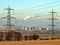
 Cement works lagoon, South Ferriby - geograph.org.uk - 4682897.jpg 640 × 470; 441 KB
-
 Cemented in the Middle - geograph.org.uk - 2163088.jpg 3,394 × 2,549; 1.94 MB
-
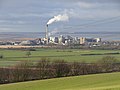 Cemex Cement Works - South Ferriby - geograph.org.uk - 2736636.jpg 1,280 × 960; 737 KB
-

-
 Cemex cement works, Ferriby Sluice from beyond the pond - geograph.org.uk - 5264217.jpg 3,109 × 1,623; 866 KB
-
 Cemex cement works, Ferriby Sluice from the east - geograph.org.uk - 5264222.jpg 3,996 × 1,948; 1.01 MB
-
 Cemex cement works, Ferriby Sluice from the south - geograph.org.uk - 5264219.jpg 4,908 × 2,451; 1.34 MB
-
 Cemex Plant, Ferriby Sluice - geograph.org.uk - 405079.jpg 640 × 355; 99 KB
-
 Cemex Plant, South Ferriby - geograph.org.uk - 4045445.jpg 1,600 × 1,064; 747 KB
-
 Chicken sheds seen from the Humber Bank - geograph.org.uk - 3988469.jpg 1,024 × 768; 196 KB
-
 Cliff Road, Winteringham - geograph.org.uk - 4916628.jpg 640 × 480; 504 KB
-
 Cliff Road, Winteringham - geograph.org.uk - 5210222.jpg 4,912 × 2,589; 1.42 MB
-
 Cliff Road, Winteringham, Lincolnshire - geograph.org.uk - 5502661.jpg 2,580 × 1,928; 3.31 MB
-
 Cliff View - geograph.org.uk - 5214429.jpg 800 × 600; 113 KB
-
 Cockthorne Lane (A1077) - geograph.org.uk - 3881910.jpg 1,024 × 768; 98 KB
-
 Coming into Winteringham - geograph.org.uk - 1968529.jpg 1,024 × 768; 133 KB
-
 Composition Lane - geograph.org.uk - 1973166.jpg 1,024 × 768; 172 KB
-
 Composition Lane - geograph.org.uk - 5804476.jpg 640 × 480; 56 KB
-

-
 Consecration Cross - geograph.org.uk - 4296961.jpg 1,024 × 683; 355 KB
-

-
 Containers on the way out to sea - geograph.org.uk - 416938.jpg 640 × 480; 63 KB
-
 Conveyor Belt - geograph.org.uk - 548670.jpg 425 × 640; 165 KB
-
 Cows at Marsh Farm - geograph.org.uk - 1968570.jpg 1,024 × 768; 140 KB
-
 Crop field off the A1077 - geograph.org.uk - 2517003.jpg 1,600 × 1,200; 586 KB
-
 Culvert on Rotten Sykes Lane - geograph.org.uk - 5675644.jpg 1,600 × 1,064; 1,018 KB
-
 Decaying building - geograph.org.uk - 1968604.jpg 1,024 × 768; 244 KB
-
 Disagreeing neighbours - geograph.org.uk - 1968615.jpg 1,024 × 768; 147 KB
-
 Dismantled Light Railway - geograph.org.uk - 2932009.jpg 3,264 × 2,448; 3.08 MB
-
 Distant cement works beside the Humber - geograph.org.uk - 6291589.jpg 3,648 × 1,744; 1.15 MB
-

-
 Drain and embankment by the Humber - geograph.org.uk - 4442109.jpg 640 × 480; 195 KB
-
 Drain at Rotten Sykes - geograph.org.uk - 5676100.jpg 1,600 × 1,074; 951 KB
-

-
 Eastfield Farm - geograph.org.uk - 2516996.jpg 1,600 × 1,200; 398 KB
-

-

-
-
 Ermine Street and Winteringham Grange - geograph.org.uk - 1392274.jpg 640 × 480; 204 KB
-
 Ermine Street near Winteringham - geograph.org.uk - 1366010.jpg 640 × 403; 75 KB
-
 Ermine Street, Winteringham - geograph.org.uk - 4916617.jpg 640 × 450; 461 KB
-
 Farm buildings east of Sandhills Farm - geograph.org.uk - 5308674.jpg 5,038 × 3,663; 4.12 MB
-
 Farm Cottage, West End, Winteringham - geograph.org.uk - 5674102.jpg 1,600 × 1,064; 614 KB
-
 Farm track off the A1077 - geograph.org.uk - 2516992.jpg 1,600 × 1,200; 602 KB
-
 Farm track off the A1077 - geograph.org.uk - 2517000.jpg 1,600 × 1,200; 521 KB
-

-
 Farmland near the Humber - geograph.org.uk - 2516994.jpg 1,600 × 1,200; 569 KB
-
 Farmland near the Humber - geograph.org.uk - 2517068.jpg 1,600 × 1,200; 409 KB
-
 Farmland near the Humber - geograph.org.uk - 2517071.jpg 1,600 × 1,200; 439 KB
-
 Farmland near the Humber - geograph.org.uk - 2517104.jpg 1,600 × 1,200; 371 KB
-
 Farmland near the Humber - geograph.org.uk - 2517114.jpg 1,600 × 1,200; 409 KB
-
 Farmland near Winteringham - geograph.org.uk - 2517050.jpg 1,600 × 1,200; 442 KB
-
 Farmland near Winteringham village - geograph.org.uk - 5104705.jpg 800 × 558; 102 KB
-
 Farmland south of Winteringham Grange - geograph.org.uk - 5104405.jpg 800 × 543; 158 KB
-
 Ferriby Sluice Boats - geograph.org.uk - 2620206.jpg 640 × 427; 60 KB
-

-
 Ferry Lane from West End, Winteringham - geograph.org.uk - 4023508.jpg 1,600 × 1,064; 658 KB
-
 Ferry Lane Winteringham - geograph.org.uk - 2931934.jpg 3,264 × 2,448; 1.52 MB
-
 Ferry Lane, Winteringham, Lincolnshire - geograph.org.uk - 5502675.jpg 2,592 × 1,944; 2.34 MB
-
 Ferry Lane, Winteringham, Lincolnshire - geograph.org.uk - 5502676.jpg 2,592 × 1,944; 2.28 MB
-
 Ferry Lane, Winteringham, Lincolnshire - geograph.org.uk - 5502677.jpg 1,906 × 1,646; 1.68 MB
-
 Ferry Lane, Winteringham, Lincolnshire - geograph.org.uk - 5502681.jpg 2,580 × 1,928; 2.61 MB
-
 Ferry Lane, Winteringham, Lincolnshire - geograph.org.uk - 5502687.jpg 2,592 × 1,944; 2.07 MB
-
 Ferry Lane, Winteringham, Lincolnshire - geograph.org.uk - 5502694.jpg 2,580 × 1,928; 2.46 MB
-
 Fingerpost on Rotten Sykes Lane, Winteringham - geograph.org.uk - 5675710.jpg 1,064 × 1,600; 656 KB
-
 Fingerpost on Rotten Sykes Lane, Winteringham - geograph.org.uk - 5675716.jpg 1,600 × 1,064; 368 KB
-
 Float 31, River Humber (geograph 3589569).jpg 1,024 × 768; 106 KB
-

-

-
 Footbridge at Rotten Sykes - geograph.org.uk - 5675887.jpg 1,600 × 1,133; 994 KB
-
 Footbridge at Rotten Sykes - geograph.org.uk - 5676097.jpg 1,600 × 1,064; 772 KB
-
 Footbridge near Rotten Sykes - geograph.org.uk - 5675882.jpg 1,600 × 1,064; 716 KB
-
 Footbridge over Halton Drain - geograph.org.uk - 5676166.jpg 1,600 × 1,064; 1.04 MB
-
 Footbridge over Haven Drain - geograph.org.uk - 1968549.jpg 1,024 × 768; 337 KB
-
 Footbridge over Haven Drain - geograph.org.uk - 4023688.jpg 1,600 × 1,064; 765 KB
-
 Footbridge over Haven Drain, Winteringham - geograph.org.uk - 5675619.jpg 1,600 × 1,064; 956 KB
-
 Footbridge to Rotten Sykes Lane - geograph.org.uk - 3031107.jpg 3,264 × 2,448; 1.82 MB
-
 Footpath at Rotten Sykes - geograph.org.uk - 5675885.jpg 1,600 × 1,064; 694 KB
-

-
 Footpath leading to Whitton - geograph.org.uk - 4123261.jpg 1,600 × 1,064; 618 KB
-
 Footpath on Meggitt Lane, Winteringham - geograph.org.uk - 5675110.jpg 1,600 × 1,064; 728 KB
-
 Footpath over Rotten Sykes - geograph.org.uk - 3031157.jpg 3,264 × 2,448; 1.73 MB
-

-
 Footpath through the wheat - geograph.org.uk - 1968556.jpg 1,024 × 768; 252 KB
-
 Footpath to Nowhere - geograph.org.uk - 3988425.jpg 1,024 × 768; 175 KB
-
 Footpath to West Halton - geograph.org.uk - 2931995.jpg 3,264 × 2,448; 2.11 MB
-
 Footpath to West Halton - geograph.org.uk - 4916809.jpg 480 × 640; 447 KB
-
 Footpath to Winteringham - geograph.org.uk - 10816.jpg 640 × 480; 74 KB
-
 Footpath to Winteringham church - geograph.org.uk - 1968537.jpg 1,024 × 768; 190 KB
-
 Footpath towards Ermine Street, Winteringham - geograph.org.uk - 2517058.jpg 1,600 × 1,200; 496 KB
-
 Footpath towards West Halton - geograph.org.uk - 2517049.jpg 1,600 × 1,200; 444 KB
-
 Former Georgian Postbox, West End, Winteringham - geograph.org.uk - 5674107.jpg 1,138 × 1,596; 681 KB
-
 Former tannery near Winteringham - geograph.org.uk - 4917744.jpg 640 × 480; 513 KB
-
 Former Wesleyan Chapel and school house, Winteringham - geograph.org.uk - 5210250.jpg 5,376 × 3,024; 2.33 MB
-
 Former Wesleyan Chapel dated 1801 - geograph.org.uk - 5674129.jpg 1,600 × 1,064; 595 KB
-
 Four more years of decay - geograph.org.uk - 3988412.jpg 1,024 × 768; 175 KB
-

-
 Gap in the reedbed - geograph.org.uk - 3988492.jpg 1,024 × 768; 130 KB
-
 Gate on the river bank - geograph.org.uk - 5103068.jpg 800 × 600; 154 KB
-
 Georgian Postbox, West End, Winteringham - geograph.org.uk - 5674135.jpg 1,600 × 1,064; 578 KB
-
 Grasses and Reeds by the Humber River - geograph.org.uk - 4871129.jpg 4,455 × 3,217; 3.17 MB
-

-
 Grey Day on the Humber - geograph.org.uk - 2059276.jpg 1,000 × 833; 418 KB
-
 Halton Drain footbridge - geograph.org.uk - 5804627.jpg 640 × 480; 95 KB
-
 Halton Drain near West Halton - geograph.org.uk - 5676162.jpg 1,600 × 1,064; 871 KB
-
 Halton Drain, near Winteringham - geograph.org.uk - 4442056.jpg 514 × 640; 170 KB
-
 Harrowing near Winteringham Grange - geograph.org.uk - 4916180.jpg 500 × 640; 463 KB
-
 Haven Drain toward Marsh Lane - geograph.org.uk - 2931981.jpg 3,264 × 2,448; 2.36 MB
-
 Haven Drain west of Winteringham - geograph.org.uk - 4023694.jpg 1,600 × 1,054; 723 KB
-
 Hewde Lane, Winteringham - geograph.org.uk - 2517054.jpg 1,600 × 1,200; 390 KB
-
 Hewde Lane, Winteringham - geograph.org.uk - 4195977.jpg 640 × 427; 50 KB
-
 Hewde Lane, Winteringham, Lincolnshire - geograph.org.uk - 5502732.jpg 2,580 × 1,928; 2.8 MB
-

-
 High Burgage, Winteringham, Lincolnshire - geograph.org.uk - 5502738.jpg 2,592 × 1,944; 1.84 MB
-
 High Burgage, Winteringham, Lincolnshire - geograph.org.uk - 5502740.jpg 2,592 × 1,944; 2.1 MB
-
 High Burgage, Winteringham, Lincolnshire - geograph.org.uk - 5502741.jpg 2,592 × 1,944; 2.24 MB
-
 High Burgage, Winteringham, Lincolnshire - geograph.org.uk - 5502745.jpg 2,592 × 1,944; 1.91 MB
-
 High Burgage, Winteringham, Lincolnshire - geograph.org.uk - 5502746.jpg 2,592 × 1,944; 2.09 MB
-
 High Burgage, Winteringham, Lincolnshire - geograph.org.uk - 5502748.jpg 2,592 × 1,944; 2.12 MB
-
 High Burgage, Winteringham, Lincolnshire - geograph.org.uk - 5502751.jpg 2,592 × 1,944; 2.18 MB
-
 Houses on West End, Winteringham - geograph.org.uk - 4023512.jpg 1,600 × 1,064; 668 KB
-
 Humber Bank - geograph.org.uk - 500728.jpg 556 × 640; 162 KB
-
 Humber Bank near Ferriby Sluice - geograph.org.uk - 1345421.jpg 640 × 571; 129 KB
-
 Humber Bank near Winteringham - geograph.org.uk - 5804492.jpg 640 × 480; 64 KB
-
 Humber Bank near Winteringham - geograph.org.uk - 5804496.jpg 640 × 480; 67 KB
-
 Humber Bank near Winteringham - geograph.org.uk - 5804507.jpg 640 × 480; 63 KB
-
 Humber flood bank - geograph.org.uk - 2517106.jpg 1,600 × 1,200; 385 KB
-
 Humber flood bank - geograph.org.uk - 2517108.jpg 1,600 × 1,200; 476 KB
-
 Humber flood bank near Winteringham - geograph.org.uk - 2517066.jpg 1,600 × 1,200; 343 KB
-
 Humber flood bank near Winteringham - geograph.org.uk - 2517070.jpg 1,600 × 1,200; 399 KB
-

-
 Humber Flood Prevention Bank - geograph.org.uk - 500641.jpg 640 × 426; 150 KB
-
 Humber Flood Prevention Bank - geograph.org.uk - 500715.jpg 640 × 460; 122 KB
-
 Humber floodbank. - geograph.org.uk - 4045215.jpg 640 × 352; 50 KB
-
 Humber foreshore near Winteringham Haven - geograph.org.uk - 5332652.jpg 5,028 × 3,815; 4.36 MB


_across_the_straw_bales_to_the_cement_works_pond_-_geograph.org.uk_-_4194317.jpg)


_-_geograph.org.uk_-_3881910.jpg)


.jpg)
_on_the_Whitton_to_Winteringham_Footpath_-_geograph.org.uk_-_2116040.jpg)
_on_the_Whitton_to_Winteringham_Footpath_-_geograph.org.uk_-_2116049.jpg)


_across_the_Humber_to_Read%27s_Island_-_geograph.org.uk_-_4194313.jpg)


