Category:Winter in Cumbria
Jump to navigation
Jump to search
Ceremonial counties of England: Bedfordshire · Berkshire · Buckinghamshire · Cambridgeshire · Cheshire · Cornwall · Cumbria · Derbyshire · Devon · Dorset · Durham · East Riding of Yorkshire · East Sussex · Essex · Gloucestershire · Greater London · Greater Manchester · Hampshire · Herefordshire · Hertfordshire · Isle of Wight · Kent · Lancashire · Leicestershire · Lincolnshire · Merseyside · Norfolk · North Yorkshire · Northamptonshire · Northumberland · Nottinghamshire · Oxfordshire · Rutland · Shropshire · Somerset · South Yorkshire · Staffordshire · Suffolk · Surrey · Tyne and Wear · Warwickshire · West Sussex · West Yorkshire · Wiltshire · Worcestershire
City-counties: Bristol ·
Former historic counties:
Other former counties:
City-counties: Bristol ·
Former historic counties:
Other former counties:
Subcategories
This category has the following 3 subcategories, out of 3 total.
Media in category "Winter in Cumbria"
The following 46 files are in this category, out of 46 total.
-
 A Frosty Sale Fell Track. - geograph.org.uk - 95439.jpg 640 × 439; 46 KB
-
 A66 at Stainmore - geograph.org.uk - 132784.jpg 640 × 425; 71 KB
-
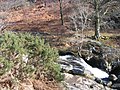 Above the falls, Aira Beck - geograph.org.uk - 1027416.jpg 640 × 480; 180 KB
-
 Aira Beck - geograph.org.uk - 1048364.jpg 640 × 480; 66 KB
-
 Aira Beck - geograph.org.uk - 1106613.jpg 427 × 640; 84 KB
-
 Arriving at Kentmere Pike - geograph.org.uk - 1106195.jpg 640 × 364; 55 KB
-
 Birk Beck at Greenholme - geograph.org.uk - 1139337.jpg 640 × 480; 120 KB
-
 Blakebeck - geograph.org.uk - 97158.jpg 640 × 427; 105 KB
-
 Bow Fell - geograph.org.uk - 1040994.jpg 640 × 385; 41 KB
-
 Bridge over Boredale Beck - geograph.org.uk - 1171960.jpg 640 × 480; 143 KB
-
 Brockle Beck - geograph.org.uk - 1706152.jpg 1,600 × 1,200; 1.05 MB
-
 Brockle Beck - geograph.org.uk - 1706153.jpg 1,200 × 1,600; 921 KB
-
 By Cat Gills - geograph.org.uk - 1609393.jpg 480 × 640; 65 KB
-
 Cascade of icicles - geograph.org.uk - 1158488.jpg 480 × 640; 121 KB
-
 Cascade of icicles - geograph.org.uk - 1158500.jpg 640 × 480; 143 KB
-
 Cast Iron Boundary Post - geograph.org.uk - 1718699.jpg 640 × 427; 291 KB
-
 Cleator Moor with Backdrop. - geograph.org.uk - 96724 (cropped).jpg 640 × 141; 22 KB
-
 Cleator Moor with Backdrop. - geograph.org.uk - 96724.jpg 640 × 360; 49 KB
-
 Closeup of icicles - geograph.org.uk - 1161009.jpg 640 × 480; 81 KB
-
 Descending to Black Brow in cloud - geograph.org.uk - 1612988.jpg 640 × 425; 151 KB
-
 Detail of Ice Sculpture - geograph.org.uk - 1101234.jpg 640 × 427; 76 KB
-
 Frozen Tarn, Kentmere Pike - geograph.org.uk - 680301.jpg 640 × 480; 93 KB
-
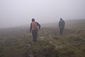
 Heading for the hills - geograph.org.uk - 1012501.jpg 640 × 421; 81 KB
-
 Icicles, Rest Dodd - geograph.org.uk - 1714178.jpg 640 × 480; 75 KB
-
 Kentmere church - geograph.org.uk - 1012547.jpg 640 × 422; 112 KB
-
 Lower slopes of Kentmere Pike - geograph.org.uk - 1724837.jpg 2,272 × 1,712; 927 KB
-
 Nethermost Cove in winter.jpg 3,585 × 1,619; 2.52 MB
-
 Nethermost Pike from Dollywaggon.jpg 1,024 × 426; 118 KB
-
 North ridge, Steel Fell - geograph.org.uk - 1609369.jpg 480 × 640; 52 KB
-
 Old sheepfold on Cumrew Fell - geograph.org.uk - 624882.jpg 640 × 480; 107 KB
-
 On Shipman Knotts - geograph.org.uk - 679761.jpg 640 × 480; 92 KB
-
 On Thornthwaite Crag - geograph.org.uk - 1724670.jpg 2,272 × 1,712; 976 KB
-
 On Woodland Fell - geograph.org.uk - 317493.jpg 640 × 480; 104 KB
-

-
 Shap Quarry Entrance. - geograph.org.uk - 88857.jpg 640 × 480; 110 KB
-
 Sheepfold, Thornthwaite Crag - geograph.org.uk - 110417.jpg 640 × 480; 80 KB
-
 Sleet Beck from Craiggyford Bridge - geograph.org.uk - 691205.jpg 640 × 480; 117 KB
-
 Summit Cairn, Kentmere Pike - geograph.org.uk - 680296.jpg 640 × 480; 98 KB
-
 Summit Cairn, Wool Knott - geograph.org.uk - 318430.jpg 640 × 480; 107 KB
-
 The south side of Kentmere Pike - geograph.org.uk - 1724835.jpg 2,272 × 1,712; 659 KB
-
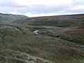
 Towards Harter Fell - geograph.org.uk - 1107520.jpg 640 × 342; 79 KB
-
 Trees by The Causeway - geograph.org.uk - 1098738.jpg 640 × 460; 107 KB
-
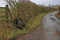
 View from Peggy's Bridge - geograph.org.uk - 107892.jpg 640 × 427; 80 KB
-
 Wall Above Angle Tarn - geograph.org.uk - 1715147.jpg 640 × 480; 88 KB
-
 Wall on Rest Dodd - geograph.org.uk - 1715133.jpg 480 × 640; 55 KB
-
 Winterwalk.jpg 400 × 333; 32 KB


.jpg)