Category:Winscombe and Sandford
Jump to navigation
Jump to search
English: Winscombe and Sandford is a civil parish in the North Somerset district, in the county of Somerset, England.
civil parish in Somerset, England  | |||||
| Upload media | |||||
| Instance of | |||||
|---|---|---|---|---|---|
| Location | North Somerset, Somerset, South West England, England | ||||
 | |||||
Subcategories
This category has the following 4 subcategories, out of 4 total.
S
- Shute Shelve Tunnel (10 F)
W
- Wavering Down (41 F)
Media in category "Winscombe and Sandford"
The following 199 files are in this category, out of 199 total.
-
 A benchmark on Winscombe Drove - geograph.org.uk - 5415407.jpg 1,600 × 1,200; 865 KB
-
 A bend in Bristol Road (A38) - geograph.org.uk - 4251777.jpg 640 × 480; 100 KB
-

-
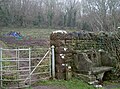
 A not-easy-to-find benchmark - geograph.org.uk - 5415404.jpg 1,600 × 1,200; 789 KB
-
 A railway shape - geograph.org.uk - 5263434.jpg 2,304 × 1,704; 1.74 MB
-
 A small stream in flood below Winterhead Farm - geograph.org.uk - 4801504.jpg 3,648 × 2,048; 2.79 MB
-
 A steep route from the church - geograph.org.uk - 5263183.jpg 2,304 × 1,704; 1.64 MB
-
 A371 nears Church Road junction, Winscombe - geograph.org.uk - 5814639.jpg 1,024 × 718; 163 KB
-
 A371 Sidcot Lane - geograph.org.uk - 5814650.jpg 1,024 × 768; 178 KB
-
 A38 Bridgwater Road at Texaco filling station - geograph.org.uk - 5814658.jpg 1,024 × 701; 124 KB
-

-
 Approaching Droveway Bridge - geograph.org.uk - 4939110.jpg 1,920 × 2,647; 1.9 MB
-
 Ash tree near The Hall - geograph.org.uk - 1888750.jpg 640 × 480; 74 KB
-
 Bank benchmark - geograph.org.uk - 5263482.jpg 2,304 × 1,704; 1.56 MB
-
 Barn, Sidcot Hill - geograph.org.uk - 3544031.jpg 2,288 × 1,712; 843 KB
-
 Barton Grange - geograph.org.uk - 5656050.jpg 1,024 × 768; 328 KB
-
 Benchmark on a gatepost - geograph.org.uk - 5415475.jpg 1,600 × 1,185; 896 KB
-
 Birchwood House - geograph.org.uk - 5657107.jpg 1,024 × 768; 225 KB
-
 Blessed be the giver - geograph.org.uk - 5263167.jpg 1,704 × 2,304; 1.79 MB
-
 Bracket fungus and deer skull - geograph.org.uk - 1013620.jpg 640 × 480; 109 KB
-
 Bracket fungus and woodpecker holes. - geograph.org.uk - 1013626.jpg 480 × 640; 124 KB
-
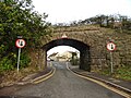 Bridge carrying former Yatton to Wells railway - geograph.org.uk - 5656745.jpg 1,024 × 768; 188 KB
-
 Bridge over Strawberry Line - geograph.org.uk - 1889336.jpg 480 × 640; 123 KB
-

-
 Bridgwater Road - geograph.org.uk - 4144044.jpg 3,533 × 2,256; 3.53 MB
-
 Bristol Road (A38) - geograph.org.uk - 4251771.jpg 640 × 480; 115 KB
-
 Car showroom, Sandford - geograph.org.uk - 5656868.jpg 1,024 × 774; 135 KB
-
 Car showrooms, Winscombe - geograph.org.uk - 5656751.jpg 1,024 × 776; 127 KB
-
 Caxton Library - geograph.org.uk - 5263419.jpg 2,304 × 1,704; 1.33 MB
-
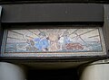 Caxton mosaic - geograph.org.uk - 5263424.jpg 2,304 × 1,704; 1.35 MB
-
 Cheddar Railway path - geograph.org.uk - 5552128.jpg 2,592 × 1,944; 1.48 MB
-
 Cheddar Railway path - geograph.org.uk - 5552130.jpg 2,592 × 1,944; 1.45 MB
-
 Cider orchard on Drove Way - geograph.org.uk - 5657149.jpg 1,024 × 768; 214 KB
-
 Cider Orchard Warning Notice - geograph.org.uk - 2630055.jpg 640 × 480; 101 KB
-

-
 Council chambers and community centre - geograph.org.uk - 5263224.jpg 2,304 × 1,704; 1.56 MB
-
 Crossroads in Sidcot - geograph.org.uk - 3045055.jpg 1,024 × 735; 193 KB
-
 Disused quarry, Sandford Batch - geograph.org.uk - 5656765.jpg 1,024 × 780; 267 KB
-
 Drove Way - geograph.org.uk - 5062935.jpg 1,920 × 1,280; 845 KB
-
 Droveway Farm - geograph.org.uk - 5657117.jpg 1,024 × 768; 136 KB
-
 Eastwell Lane - geograph.org.uk - 1889111.jpg 640 × 462; 131 KB
-
 Entrance to orchard, Drove Way - geograph.org.uk - 5062917.jpg 2,876 × 1,843; 1.15 MB
-
 Entrance, Sandford Station retirement village - geograph.org.uk - 5657094.jpg 1,024 × 768; 173 KB
-
 Entrance, Skanska Cement works - geograph.org.uk - 5656767.jpg 1,024 × 768; 192 KB
-
 Family outing - geograph.org.uk - 4727445.jpg 2,658 × 1,761; 2.49 MB
-
 Farmland towards The Avenue - geograph.org.uk - 3455948.jpg 640 × 480; 56 KB
-
 Field and barns by the A38 - geograph.org.uk - 5029231.jpg 3,048 × 1,679; 1.1 MB
-
-
 Field near Winscombe - geograph.org.uk - 1889097.jpg 640 × 480; 96 KB
-
 Fields near Sandford Batch - geograph.org.uk - 2628852.jpg 2,592 × 1,944; 1.52 MB
-
 Fields near Sandford Batch - geograph.org.uk - 2628881.jpg 2,592 × 1,944; 1.54 MB
-
 Former course of Cheddar Valley railway line - geograph.org.uk - 5062942.jpg 3,072 × 2,048; 1.2 MB
-
 Former Sandford and Banwell Railway Goods Shed - geograph.org.uk - 5657090.jpg 1,024 × 768; 137 KB
-
 Former Sandford and Banwell Railway Station - geograph.org.uk - 5657088.jpg 1,024 × 768; 137 KB
-
 Former Sandford and Banwell Railway Station - geograph.org.uk - 5657089.jpg 1,024 × 768; 152 KB
-
 From Winscombe Drove to Callow Drove - geograph.org.uk - 5415484.jpg 1,600 × 1,097; 679 KB
-
 Grazing meadow adjacent to Paddingham House - geograph.org.uk - 2419818.jpg 3,072 × 2,304; 4.02 MB
-
 Grazing pasture at the upper end of Winterhead Combe - geograph.org.uk - 4801497.jpg 3,648 × 2,048; 2.82 MB
-
 Great bloom - geograph.org.uk - 5263178.jpg 1,704 × 2,304; 1.53 MB
-
 Great tower - geograph.org.uk - 5263191.jpg 1,704 × 2,304; 2.03 MB
-
 Hale Combe - geograph.org.uk - 1888792.jpg 640 × 480; 121 KB
-
 Hale Combe - geograph.org.uk - 3544024.jpg 2,288 × 1,712; 838 KB
-
 Head Office, Thatchers Cider - geograph.org.uk - 5657084.jpg 1,024 × 774; 138 KB
-
 Hill Road, Sandford - geograph.org.uk - 5064000.jpg 1,920 × 2,743; 1.41 MB
-
 Hill Road, Sandford - geograph.org.uk - 5064005.jpg 1,920 × 1,280; 1,022 KB
-
 Hill Road, Sandford - geograph.org.uk - 5064009.jpg 2,048 × 3,072; 1.52 MB
-
 Hill Road, Sandford - geograph.org.uk - 5656777.jpg 1,024 × 772; 157 KB
-
 Houses on Church Road - geograph.org.uk - 5656743.jpg 1,024 × 758; 156 KB
-
 Individual orchid in Slader's Leigh LNR - geograph.org.uk - 4385032.jpg 2,112 × 2,816; 1.07 MB
-

-
 Junction with Church Road - geograph.org.uk - 5656741.jpg 1,024 × 775; 166 KB
-
 Knoll above Hale Farm - geograph.org.uk - 1888775.jpg 640 × 451; 117 KB
-
 Levels by Sandmead Rhyne - geograph.org.uk - 5062659.jpg 2,950 × 1,652; 1.12 MB
-
 Lime kiln at Sandford Quarry - geograph.org.uk - 6292695.jpg 1,280 × 960; 454 KB
-
 Lime kiln at Sandford Quarry - geograph.org.uk - 6292697.jpg 960 × 1,280; 514 KB
-
 Lime kilns at Sandford Quarry - geograph.org.uk - 6292694.jpg 1,280 × 960; 579 KB
-
 Looking North from the entrance to Max Mill Lane - geograph.org.uk - 3684391.jpg 1,824 × 1,368; 669 KB
-
 Low level lighting - geograph.org.uk - 5263463.jpg 1,704 × 2,304; 1.8 MB
-
 Lyncombe Lane - geograph.org.uk - 1194323.jpg 640 × 427; 81 KB
-
 Max House Farm - geograph.org.uk - 5656047.jpg 1,024 × 749; 160 KB
-
 Meanders on the Lox Yeo River - geograph.org.uk - 5656036.jpg 1,024 × 768; 305 KB
-
 Methodist church, Sandford - geograph.org.uk - 5656771.jpg 1,024 × 768; 199 KB
-
 Milestone- Bristol Turnpike - geograph.org.uk - 3022477.jpg 640 × 480; 116 KB
-
 Mill Leat feeding into the water mill at Max Mills Farm - geograph.org.uk - 3684396.jpg 1,824 × 1,368; 697 KB
-
 Nut Tree Farm - geograph.org.uk - 5657865.jpg 1,024 × 768; 282 KB
-
 Nye Farm - geograph.org.uk - 5657154.jpg 1,024 × 768; 240 KB
-
 Nye Road - geograph.org.uk - 5062939.jpg 1,920 × 1,280; 1.02 MB
-
 Nye Road - geograph.org.uk - 5063050.jpg 3,072 × 2,048; 1.14 MB
-
 Nye Road - geograph.org.uk - 5063068.jpg 3,062 × 1,901; 1.14 MB
-
 Nye Road, Sandford - geograph.org.uk - 5063081.jpg 3,072 × 2,048; 1.48 MB
-
 Nye Road, Sandford - geograph.org.uk - 5063092.jpg 1,920 × 1,280; 849 KB
-
 Nye Road, Sandford - geograph.org.uk - 5063186.jpg 2,853 × 1,840; 1.14 MB
-
 Nye Road, Sandford - geograph.org.uk - 5063228.jpg 2,304 × 1,585; 999 KB
-
 Oaks by Nye Road - geograph.org.uk - 5063054.jpg 2,964 × 2,016; 1.35 MB
-

-

-

-
 Old railway path - geograph.org.uk - 3022489.jpg 640 × 480; 125 KB
-
 On the A38 near Sidcot - geograph.org.uk - 4144053.jpg 4,000 × 2,664; 6.43 MB
-
 Orchard by Nye Road - geograph.org.uk - 5063076.jpg 2,976 × 1,780; 1.11 MB
-
 Orchard by the Strawberry Line - geograph.org.uk - 5062846.jpg 3,072 × 2,048; 1.29 MB
-
 Orchard by the Strawberry Line - geograph.org.uk - 5062860.jpg 1,920 × 1,140; 916 KB
-
 Orchard by the Strawberry Line - geograph.org.uk - 5062883.jpg 2,599 × 1,700; 865 KB
-
 Orchard, Sandford - geograph.org.uk - 5063982.jpg 3,072 × 2,048; 1.46 MB
-
 Orchid time in Slader's Leigh LNR - geograph.org.uk - 4385004.jpg 2,816 × 2,112; 1.02 MB
-
 Pasture at the lower end of Winterhead Combe - geograph.org.uk - 4801495.jpg 3,648 × 2,048; 2.09 MB
-
 Pasture land behind Paddingham House - geograph.org.uk - 2419022.jpg 3,072 × 2,304; 2.82 MB
-
 Power Line at Nye Farm - geograph.org.uk - 2630062.jpg 640 × 471; 63 KB
-
 Railing detail, former Winscombe station - geograph.org.uk - 5236018.jpg 800 × 450; 196 KB
-
 Railway Inn, Sandford - geograph.org.uk - 5657078.jpg 1,024 × 782; 158 KB
-
 Re-creation of station facade, Winscombe - geograph.org.uk - 5236013.jpg 800 × 450; 196 KB
-
 Recreation Ground - geograph.org.uk - 3022483.jpg 640 × 480; 70 KB
-
 Reservoirs from Droveway Bridge - geograph.org.uk - 5062931.jpg 3,052 × 1,769; 1.19 MB
-
 Reservoirs, east of Drove Way - geograph.org.uk - 5657132.jpg 1,024 × 768; 154 KB
-
 Roll of honour and service - geograph.org.uk - 5263209.jpg 1,704 × 2,304; 1.35 MB
-
 Rough Pasture Near Winscombe - geograph.org.uk - 2910358.jpg 2,592 × 1,944; 1.12 MB
-
 Runner on Strawberry Line - geograph.org.uk - 5062722.jpg 3,072 × 2,048; 1.46 MB
-
 Sales time - geograph.org.uk - 5263247.jpg 2,304 × 1,704; 1.26 MB
-
 Sandford Hill - geograph.org.uk - 2629874.jpg 640 × 480; 56 KB
-
 Sandford Levvy - geograph.org.uk - 3544053.jpg 1,712 × 2,288; 851 KB
-
 Sandmead Rhyne - geograph.org.uk - 5062544.jpg 3,072 × 2,048; 1.59 MB
-
 Scouts Hall - geograph.org.uk - 5263469.jpg 2,304 × 1,704; 1.67 MB
-
 Sculpture west of Winscombe - geograph.org.uk - 2628676.jpg 2,592 × 1,944; 2.14 MB
-
 Sedge near East Well - geograph.org.uk - 1889121.jpg 480 × 640; 71 KB
-
 Sedgemoor , Countryside Scenery - geograph.org.uk - 5346192.jpg 6,000 × 4,000; 6.32 MB
-
 Sedgemoor , Countryside Scenery - geograph.org.uk - 5346226.jpg 6,000 × 4,000; 7.31 MB
-
 Sedgemoor , Grassy Field ^ Gate - geograph.org.uk - 5346223.jpg 6,000 × 4,000; 5.99 MB
-
 Sedgemoor , Hill Farm - geograph.org.uk - 5346286.jpg 6,000 × 4,000; 6.52 MB
-
 Sedgemoor , Wavering Down - geograph.org.uk - 5346254.jpg 6,000 × 4,000; 6.3 MB
-
 Sedgemoor , West Mendip Way - geograph.org.uk - 5346185.jpg 6,000 × 4,000; 6.85 MB
-
 Sedgemoor , West Mendip Way - geograph.org.uk - 5346190.jpg 6,000 × 4,000; 7.02 MB
-
 Sedgemoor , West Mendip Way - geograph.org.uk - 5346206.jpg 6,000 × 4,000; 7.5 MB
-
 Sedgemoor , West Mendip Way - geograph.org.uk - 5346225.jpg 4,000 × 6,000; 5.61 MB
-
 Sedgemoor , Winscombe Scenery - geograph.org.uk - 5346266.jpg 6,000 × 4,000; 7.11 MB
-

-
 Sheep and horse grazing paddocks on the Sidcot Estate - geograph.org.uk - 2419858.jpg 3,072 × 2,304; 3.51 MB
-
 Sheep by Winscombe Drove - geograph.org.uk - 1888806.jpg 640 × 480; 73 KB
-
 Shops on Woodborough Road - geograph.org.uk - 5656748.jpg 1,024 × 768; 138 KB
-
 Shute Shelve Hill medieval estate boundary earthwork 01.jpg 4,000 × 3,000; 4.52 MB
-
 Shute Shelve Hill medieval estate boundary earthwork 02.jpg 4,000 × 3,000; 4.85 MB
-
 Sidcot Farmhouse.jpg 3,470 × 2,563; 1,008 KB
-
 Sidcot Hotel - geograph.org.uk - 6292688.jpg 1,280 × 918; 316 KB
-
 Sidcot Hotel - geograph.org.uk - 6292693.jpg 1,280 × 960; 356 KB
-
 Sidcot Quaker Meeting House - geograph.org.uk - 5230663.jpg 800 × 450; 84 KB
-
 Signpost, Sandford - geograph.org.uk - 5063183.jpg 1,920 × 1,173; 593 KB
-
 Signpost, Sandford - geograph.org.uk - 5063226.jpg 3,057 × 1,796; 1.02 MB
-
 Sloughpit Farm - geograph.org.uk - 5656760.jpg 1,024 × 780; 131 KB
-
 Snowdrops at Hill Farm - geograph.org.uk - 3865894.jpg 1,024 × 759; 304 KB
-
 Somerville Rd - geograph.org.uk - 2630042.jpg 640 × 480; 94 KB
-
 South Croft - geograph.org.uk - 5656763.jpg 1,024 × 768; 158 KB
-
 South Croft in Sandford Batch - geograph.org.uk - 3045066.jpg 1,024 × 768; 92 KB
-
 South Croft, Sandford Batch - geograph.org.uk - 6292698.jpg 1,280 × 960; 339 KB
-

-
 St James the Great Church Hall - geograph.org.uk - 5263459.jpg 2,304 × 1,704; 1.67 MB
-
 Strawberry Line - geograph.org.uk - 1193139.jpg 640 × 427; 126 KB
-
 Strawberry Line - geograph.org.uk - 1193153.jpg 640 × 427; 94 KB
-
 Strawberry Line - geograph.org.uk - 2554613.jpg 640 × 480; 138 KB
-
 Strawberry Line - geograph.org.uk - 5062687.jpg 3,072 × 2,048; 1.3 MB
-
 Strawberry Line - geograph.org.uk - 5172304.jpg 1,600 × 1,067; 749 KB
-
 Strawberry Line - geograph.org.uk - 5172741.jpg 1,600 × 1,067; 1.03 MB
-
 Strawberry Line approaching Droveway Bridge - geograph.org.uk - 5062798.jpg 3,072 × 2,048; 1.56 MB
-
 Strawberry Line approaching Droveway Bridge - geograph.org.uk - 5062895.jpg 1,920 × 1,280; 926 KB
-
 Strawberry Line at Sandmead Rhyne - geograph.org.uk - 5062676.jpg 3,072 × 2,048; 1.33 MB
-
 Strawberry Line at Sandmead Rhyne - geograph.org.uk - 5062701.jpg 3,056 × 2,005; 1.86 MB
-
 Strawberry Line from Drove Way - geograph.org.uk - 5062924.jpg 1,920 × 1,280; 1.06 MB
-
 Swans and cygnet on the rhyne beside Drove Way, near Nye - geograph.org.uk - 2139039.jpg 4,000 × 3,000; 3.16 MB
-
 Thatchers cider works - geograph.org.uk - 5657081.jpg 1,024 × 768; 179 KB
-
 The A38 to the south of Sidcot - geograph.org.uk - 3045045.jpg 1,024 × 1,024; 260 KB
-
 The Brewers Fayre restaurant at Sidcot - geograph.org.uk - 5804041.jpg 800 × 600; 168 KB
-
 The caterpillar has morphed - geograph.org.uk - 6292682.jpg 1,280 × 960; 442 KB
-
 The Cheddar Valley Railway - geograph.org.uk - 2628858.jpg 2,592 × 1,944; 1.63 MB
-
 The gates to St James the Great - geograph.org.uk - 5263172.jpg 1,704 × 2,304; 1.86 MB
-
 The gift of the Boys' brigade - geograph.org.uk - 5263443.jpg 2,304 × 1,704; 1.66 MB
-
 The old bank - geograph.org.uk - 5263477.jpg 2,304 × 1,704; 1.58 MB
-
 The Strawberry Line (railway trail) - geograph.org.uk - 3455933.jpg 640 × 480; 133 KB
-
 The Woodborough Inn - geograph.org.uk - 5656753.jpg 1,024 × 812; 177 KB
-
 Track by Strawberry Line - geograph.org.uk - 5062823.jpg 1,920 × 1,280; 1.1 MB
-
 Track by the Strawberry Line - geograph.org.uk - 5062836.jpg 1,920 × 1,280; 1,023 KB
-
 Track by the Strawberry Line - geograph.org.uk - 5062891.jpg 2,556 × 1,675; 1,009 KB
-
 Track downhill from Callow Drove - geograph.org.uk - 5230641.jpg 800 × 450; 200 KB
-
 Track south from Winscombe Drove - geograph.org.uk - 5230658.jpg 800 × 450; 129 KB
-
 Turning for Banwell - geograph.org.uk - 5657103.jpg 1,024 × 768; 221 KB
-
 View east along Winscombe Drove - geograph.org.uk - 5230646.jpg 800 × 450; 117 KB
-
 View from the Sidcot Hotel - geograph.org.uk - 6292690.jpg 1,280 × 866; 288 KB
-
 View from the Sidcot Hotel - geograph.org.uk - 6292691.jpg 1,280 × 960; 472 KB
-
 West from St James - geograph.org.uk - 5263199.jpg 1,704 × 2,304; 1.97 MB
-
 Wimblestone Rd - geograph.org.uk - 2630032.jpg 640 × 480; 113 KB
-
 Winscombe and Sandford - Rose Cottage - 20220926181314.png 4,032 × 3,024; 14.28 MB
-
 Winscombe Bowling Club - geograph.org.uk - 5263234.jpg 2,304 × 1,704; 1.19 MB
-
 Winscombe Bowling Club - geograph.org.uk - 5656756.jpg 1,024 × 755; 134 KB
-
 Winscombe Church tower - geograph.org.uk - 6292692.jpg 1,280 × 960; 384 KB
-
 Winscombe Club - geograph.org.uk - 5263245.jpg 2,304 × 1,704; 1.24 MB
-
 Winscombe Drove - geograph.org.uk - 1193202.jpg 640 × 427; 84 KB
-
 Winscombe orchard - geograph.org.uk - 5263202.jpg 2,304 × 1,704; 1.65 MB
-
 Winscombe post office - geograph.org.uk - 5263474.jpg 1,704 × 2,304; 1.6 MB
-
 Winscombe remembers - geograph.org.uk - 5263194.jpg 1,704 × 2,304; 1.81 MB
-
 Winterhead - geograph.org.uk - 2636864.jpg 2,592 × 1,944; 1.89 MB
-
 Wood near Sidcot - geograph.org.uk - 5230661.jpg 800 × 450; 170 KB
-
 Woodborough bridge - geograph.org.uk - 5263450.jpg 2,304 × 1,704; 1.53 MB

_-_geograph.org.uk_-_4251777.jpg)


_-_geograph.org.uk_-_3455937.jpg)

_-_geograph.org.uk_-_4251771.jpg)


_-_geograph.org.uk_-_4251735.jpg)


_-_geograph.org.uk_-_3455933.jpg)


