Category:Williton
Jump to navigation
Jump to search
English: Images relating to Williton, Somerset, England. For more information see the Wikipedia article Williton.
town and civil parish in Somerset, England, UK  | |||||
| Upload media | |||||
| Instance of | |||||
|---|---|---|---|---|---|
| Location | Somerset West and Taunton, Somerset, South West England, England | ||||
| official website | |||||
 | |||||
Subcategories
This category has the following 7 subcategories, out of 7 total.
Media in category "Williton"
The following 200 files are in this category, out of 329 total.
(previous page) (next page)-
 'Double-headed' train departs for Watchet - geograph.org.uk - 4191556.jpg 768 × 1,024; 140 KB
-

-
 'Royal Highland Fusilier' approaches Williton - geograph.org.uk - 5803920.jpg 1,024 × 765; 189 KB
-
 'Royal Tank Regiment' passes Williton - geograph.org.uk - 5803925.jpg 1,024 × 805; 259 KB
-
 'Sir Lamiel' arrives with a train from Minehead - geograph.org.uk - 2326730.jpg 1,024 × 768; 162 KB
-
 'Swindon' shed, Williton Works - geograph.org.uk - 3536443.jpg 1,024 × 768; 216 KB
-

-

-
 4160 arrives with a train from Minehead - geograph.org.uk - 3909473.jpg 1,024 × 768; 183 KB
-
 4160 arrives with a train from Minehead - geograph.org.uk - 4179950.jpg 1,024 × 768; 134 KB
-
 4612 departs with a train for Bishops Lydeard - geograph.org.uk - 6291805.jpg 1,024 × 790; 250 KB
-

-
 7828 Odney Manor at Williton - geograph.org.uk - 3684833.jpg 1,024 × 768; 195 KB
-
-
 A wheat-field beside the railway near Williton - geograph.org.uk - 6218293.jpg 1,024 × 768; 521 KB
-
 A358, Williton as dusk falls - geograph.org.uk - 1655067.jpg 640 × 430; 109 KB
-
 Accipiter nisus -Williton, West Somerset, England-8 (1).jpg 1,671 × 1,671; 949 KB
-
 Afternoon train from Minehead arrives at Wiliton - geograph.org.uk - 3406512.jpg 1,024 × 768; 189 KB
-
 Aller Farm - geograph.org.uk - 98810.jpg 640 × 480; 116 KB
-
 Aller Farm from the North East - geograph.org.uk - 98813.jpg 640 × 480; 147 KB
-

-
 Approaching Williton with a train for Minehead - geograph.org.uk - 6291802.jpg 1,024 × 723; 200 KB
-
 Arrival from Bishops Lydeard - geograph.org.uk - 6115799.jpg 1,024 × 757; 171 KB
-
 Arrival from Minehead - geograph.org.uk - 5370187.jpg 1,024 × 757; 175 KB
-

-
 Bakelite Museum, Williton - geograph.org.uk - 4148047.jpg 1,333 × 1,000; 1.45 MB
-
 Bean field, east of Williton, alongside the A39 - geograph.org.uk - 4094887.jpg 1,024 × 768; 145 KB
-
 Between trains at Williton - geograph.org.uk - 6218303.jpg 1,024 × 768; 339 KB
-
 Boarding the train at Williton - geograph.org.uk - 6218308.jpg 1,024 × 768; 410 KB
-

-
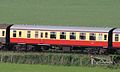 BR Mark 1 BSO 9227 repainted 2016.JPG 1,366 × 820; 411 KB
-
 BR Mark 1 SO (RMB) 4346 repainted 2016.JPG 1,366 × 820; 407 KB
-
 Brendon Hill foothills - geograph.org.uk - 1930939.jpg 640 × 424; 79 KB
-
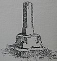
 Broken cross, Williton - geograph.org.uk - 1655124.jpg 640 × 430; 132 KB
-
 Car park, Tropiquaria - geograph.org.uk - 6248640.jpg 1,024 × 732; 173 KB
-
 Channel to Channel (509) - geograph.org.uk - 4470046.jpg 800 × 600; 120 KB
-
 Channel to Channel (510) - geograph.org.uk - 4470047.jpg 800 × 600; 175 KB
-
 Channel to Channel (511) - geograph.org.uk - 4470052.jpg 800 × 600; 204 KB
-
 Channel to Channel (512) - geograph.org.uk - 4470057.jpg 800 × 600; 207 KB
-
 Channel to Channel (513) - geograph.org.uk - 4470060.jpg 800 × 600; 152 KB
-
 Channel to Channel (514) - geograph.org.uk - 4470065.jpg 800 × 600; 127 KB
-
 Channel to Channel (515) - geograph.org.uk - 4470066.jpg 800 × 600; 199 KB
-
 Channel to Channel (516) - geograph.org.uk - 4470083.jpg 800 × 600; 94 KB
-
 Channel to Channel (517) - geograph.org.uk - 4470088.jpg 600 × 800; 116 KB
-
 Channel to Channel (518) - geograph.org.uk - 4470101.jpg 800 × 600; 231 KB
-
 Channel to Channel (519) - geograph.org.uk - 4470110.jpg 800 × 600; 80 KB
-
 Channel to Channel (521) - geograph.org.uk - 4470121.jpg 800 × 600; 100 KB
-
 Channel to Channel (522) - geograph.org.uk - 4470128.jpg 800 × 600; 140 KB
-
 Channel to Channel (523) - geograph.org.uk - 4470134.jpg 800 × 600; 144 KB
-
 Channel to Channel (524) - geograph.org.uk - 4470587.jpg 800 × 600; 167 KB
-
 Channel to Channel (525) - geograph.org.uk - 4470589.jpg 800 × 600; 128 KB
-
 Choose, Williton, Sampford Brett or Aller - geograph.org.uk - 98801.jpg 640 × 480; 156 KB
-
 Church Hall, Williton Methodist Church - geograph.org.uk - 1655095.jpg 640 × 430; 100 KB
-
 Class 16, D9526 on shed at Williton - geograph.org.uk - 6291808.jpg 1,024 × 723; 184 KB
-
 Cliff rock strata, St Audries Bay - geograph.org.uk - 3406184.jpg 1,024 × 768; 188 KB
-
 Cliffs, St Audries Bay - geograph.org.uk - 3406172.jpg 1,024 × 768; 234 KB
-
 Co-op store and road junction in Williton - geograph.org.uk - 5449609.jpg 5,366 × 3,370; 6.89 MB
-
 Coastal defences, Doniford beach - geograph.org.uk - 3406153.jpg 1,024 × 768; 220 KB
-

-
 Cottage and church, Williton - geograph.org.uk - 3414616.jpg 1,600 × 1,289; 465 KB
-
 Cottage at High Bridge, Williton - geograph.org.uk - 5803982.jpg 1,024 × 768; 219 KB
-
 Cottage on the edge of Williton - geograph.org.uk - 1655034.jpg 640 × 430; 103 KB
-
 Cottages in the Square, Williton - geograph.org.uk - 3437596.jpg 1,439 × 1,600; 368 KB
-
 Cottages, High Bridge, Williton - geograph.org.uk - 5803988.jpg 1,024 × 816; 192 KB
-
 Cross at Williton.jpg 1,584 × 1,693; 285 KB
-
 Curve (427089944).jpg 791 × 523; 528 KB
-
 D6566 at Williton works - geograph.org.uk - 5369026.jpg 1,024 × 768; 165 KB
-

-
 D821 Greyhound in the works at Williton - geograph.org.uk - 3909464.jpg 1,024 × 768; 144 KB
-
 Danesfield Comprehensive School, Williton - geograph.org.uk - 2148632.jpg 1,024 × 768; 152 KB
-
 Date stone, Lower Stream Farm - geograph.org.uk - 1904212.jpg 480 × 640; 141 KB
-
 Departure from Williton - geograph.org.uk - 2747232.jpg 4,000 × 3,000; 2.96 MB
-
 Diesel Multiple Unit, Doniford, Somerset - geograph.org.uk - 1987827.jpg 552 × 800; 121 KB
-
 Direction sign, Doniford, Somerset - geograph.org.uk - 3416081.jpg 1,600 × 1,124; 367 KB
-
 DMU Leaving Williton - geograph.org.uk - 5027847.jpg 640 × 415; 68 KB
-
 Doniford Bay Holiday Park - geograph.org.uk - 1118512.jpg 640 × 429; 48 KB
-
 Doniford Beach - geograph.org.uk - 2335302.jpg 3,144 × 2,250; 585 KB
-
 Doniford Beach - geograph.org.uk - 2611547.jpg 640 × 480; 77 KB
-
 Doniford Cross - geograph.org.uk - 4869416.jpg 640 × 480; 134 KB
-
 Doniford Farm - geograph.org.uk - 2486366.jpg 1,024 × 768; 196 KB
-
 Doniford Lane 821.jpg 1,824 × 1,368; 715 KB
-
 Doniford Lime kiln - geograph.org.uk - 1118522.jpg 640 × 425; 129 KB
-
 Doniford Road by Doniford Halt station - geograph.org.uk - 3638623.jpg 1,500 × 1,000; 221 KB
-
 Doniford Stream, east of Williton - geograph.org.uk - 4094903.jpg 1,024 × 768; 145 KB
-
 Doniford, in the valley of Doniford Stream - geograph.org.uk - 4094701.jpg 1,024 × 768; 130 KB
-
 Egrove Farm - geograph.org.uk - 4094736.jpg 1,024 × 768; 138 KB
-
 Egrove Farmhouse - geograph.org.uk - 2486374.jpg 1,024 × 768; 209 KB
-
 England Coast Path at The Swill, Doniford - geograph.org.uk - 6338543.jpg 5,184 × 2,920; 5.3 MB
-
 Entrance to Haven Holiday Park, Doniford Bay - geograph.org.uk - 3405217.jpg 1,024 × 768; 176 KB
-
 Entrance to Washford from east - geograph.org.uk - 3370275.jpg 1,024 × 768; 88 KB
-
 Entrance to Williton landfill site - geograph.org.uk - 3560262.jpg 1,024 × 768; 199 KB
-
 Eroding cliffs, St Audries Bay - geograph.org.uk - 3406161.jpg 1,024 × 768; 232 KB
-
 Extending the loop line at Williton - geograph.org.uk - 4804071.jpg 1,024 × 768; 258 KB
-
 Fair Cross - geograph.org.uk - 2284820.jpg 1,024 × 768; 125 KB
-
 Farmland in the valley of Doniford Stream - geograph.org.uk - 4094861.jpg 1,024 × 615; 121 KB
-
 Farmland west of Torweston Farm - geograph.org.uk - 4094937.jpg 1,024 × 768; 109 KB
-
 Farmland, east of Torre - geograph.org.uk - 3337352.jpg 1,024 × 803; 149 KB
-
 Field between the road and the railway, Doniford - geograph.org.uk - 4094692.jpg 1,024 × 768; 132 KB
-
 Field margin near Woodford - geograph.org.uk - 3337337.jpg 1,024 × 768; 176 KB
-
 Field of cattle, Doniford, Somerset - geograph.org.uk - 2016122.jpg 800 × 540; 98 KB
-
 Footpath near Williton - geograph.org.uk - 4869551.jpg 4,000 × 3,000; 3.97 MB
-
 Fore Street, Williton - geograph.org.uk - 2320058.jpg 1,024 × 768; 137 KB
-
 Former BBC building near Washford - geograph.org.uk - 5930685.jpg 4,966 × 3,725; 4.23 MB
-

-
 Former mill house at Orchard Mill - geograph.org.uk - 4944728.jpg 2,048 × 3,648; 1.57 MB
-
 Former workhouse, Williton - geograph.org.uk - 2326630.jpg 1,024 × 768; 151 KB
-
 Gliddons hardware store, Williton - geograph.org.uk - 2320068.jpg 1,024 × 768; 126 KB
-
 Grazing cattle alongside Doniford Stream - geograph.org.uk - 4094731.jpg 1,024 × 615; 112 KB
-

-
 Gulls on the beach, Doniford - geograph.org.uk - 2611559.jpg 640 × 480; 101 KB
-
 Gulls on the beach, Doniford - geograph.org.uk - 2611565.jpg 640 × 480; 73 KB
-
 Halwill Junction^ - geograph.org.uk - 3909527.jpg 1,024 × 768; 181 KB
-
 Haven Holidays - main indoor leisure building - geograph.org.uk - 3405246.jpg 1,024 × 768; 119 KB
-
 Helwell Bay, Watchet - geograph.org.uk - 6338540.jpg 5,184 × 2,920; 4.71 MB
-

-
 Hide, at the edge of Blackdown Wood - geograph.org.uk - 3337752.jpg 1,024 × 763; 274 KB
-
 Higher Stream farm - geograph.org.uk - 110088.jpg 609 × 425; 104 KB
-
 Higher Stream Farm - geograph.org.uk - 3336390.jpg 1,024 × 768; 212 KB
-
 House at Higher Stream - geograph.org.uk - 3337766.jpg 1,024 × 768; 192 KB
-
 Inside the old transmitter building at Tropiquaria - geograph.org.uk - 4151623.jpg 4,608 × 3,456; 4.46 MB
-
 Inside the railway works at Williton - geograph.org.uk - 5369047.jpg 1,024 × 768; 191 KB
-
 Inside Williton works - geograph.org.uk - 2326892.jpg 1,024 × 768; 176 KB
-
 Interesting rock formation at Helwell Bay - geograph.org.uk - 2486365.jpg 1,024 × 768; 229 KB
-
 Junction, on Burrow Rocks, near Willton - geograph.org.uk - 3456887.jpg 1,024 × 768; 213 KB
-
 Kentsford Farm - geograph.org.uk - 2455258.jpg 800 × 531; 127 KB
-
 Kentsford Farm - geograph.org.uk - 2505051.jpg 800 × 531; 96 KB
-
 Killick Way, Williton - geograph.org.uk - 1655149.jpg 640 × 430; 113 KB
-
 Limekiln at Doniford - geograph.org.uk - 2592553.jpg 2,592 × 1,944; 1.67 MB
-
 Local train heads for Stogumber - geograph.org.uk - 6291807.jpg 800 × 599; 93 KB
-
 Loco on the line at Williton station - geograph.org.uk - 4457754.jpg 800 × 600; 119 KB
-

-
 Long Street Gate tollhouse, Williton (geograph 6114532).jpg 640 × 521; 225 KB
-
 Long Street, Williton - geograph.org.uk - 3430788.jpg 800 × 539; 130 KB
-

-
 Looking for 'Nemo', Tropiquaria - geograph.org.uk - 6248653.jpg 1,024 × 768; 132 KB
-
 Looking to the hills east of Williton - May 2011 - panoramio.jpg 1,712 × 2,288; 718 KB
-
 Lower Stream Farm, Yarde - geograph.org.uk - 1904187.jpg 640 × 480; 148 KB
-
 Mill stream and sheep meadow at Orchard Mill - geograph.org.uk - 4944725.jpg 3,648 × 2,048; 2.57 MB
-
 Mill water system - geograph.org.uk - 2502485.jpg 800 × 531; 148 KB
-
 Minor road to Doniford - geograph.org.uk - 1216154.jpg 640 × 480; 66 KB
-
 Mud, sand and rock at Helwell Bay - geograph.org.uk - 4094659.jpg 1,024 × 614; 125 KB
-

-
-
 North Star at Williton - geograph.org.uk - 5027868.jpg 640 × 411; 59 KB
-
 Odney Manor, at Williton - geograph.org.uk - 3909496.jpg 1,024 × 768; 189 KB
-
 Offices, Somerset West and Taunton Council - geograph.org.uk - 6382235.jpg 1,024 × 768; 123 KB
-

-

-
 Ordnance Survey 1GL Bolt - geograph.org.uk - 4869411.jpg 640 × 498; 85 KB
-
 Ordnance Survey Cut Mark - geograph.org.uk - 4708177.jpg 480 × 640; 103 KB
-
 Otters at Tropiquaria - geograph.org.uk - 5930691.jpg 5,184 × 3,888; 6.76 MB
-
 Painting the fish and chip shop - geograph.org.uk - 2883381.jpg 1,280 × 856; 152 KB
-
 Papermill sluice at Kentsford Farm - geograph.org.uk - 1928753.jpg 640 × 424; 120 KB
-
 Passing trains at Williton - geograph.org.uk - 5369076.jpg 1,024 × 768; 174 KB
-
 Path to Doniford Beach halt - geograph.org.uk - 5489659.jpg 4,608 × 3,456; 4.12 MB
-
 Permissive path alongside Black Down Wood - geograph.org.uk - 99263.jpg 480 × 640; 126 KB
-
 Pirate-ship playground at Tropiquaria - geograph.org.uk - 5930687.jpg 5,184 × 3,888; 4.75 MB
-
 Pirate-ship playground at Tropiquaria - geograph.org.uk - 5930689.jpg 5,184 × 3,888; 4.64 MB
-
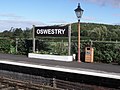 Platform 2, Oswestry Railway Station^ - geograph.org.uk - 3684848.jpg 1,024 × 768; 193 KB
-
 Platform, Williton Station - geograph.org.uk - 4094874.jpg 1,024 × 768; 126 KB
-
 Postbox, Yarde - geograph.org.uk - 1904196.jpg 480 × 640; 186 KB
-
-
 Quantocks from the air - geograph.org.uk - 5687727.jpg 3,444 × 1,987; 1.01 MB
-
 Raveningham Hall arrives at Williton - geograph.org.uk - 5762981.jpg 1,024 × 825; 248 KB
-
 Raveningham Hall at Williton - geograph.org.uk - 5027841.jpg 512 × 640; 110 KB
-
 Raveningham Hall at Williton loco shed - geograph.org.uk - 2628270.jpg 1,024 × 768; 181 KB
-
 Remains Of Market Cross, Williton.JPG 5,184 × 3,456; 11.14 MB
-
 Road Junction - geograph.org.uk - 67174.jpg 480 × 640; 47 KB
-
 Roadside Cross, Doniford. - geograph.org.uk - 870719.jpg 640 × 428; 136 KB
-
 Robert Street, Williton - geograph.org.uk - 3430786.jpg 1,600 × 1,274; 323 KB
-
 Robin Reliant, Bakelite Museum, Williton - geograph.org.uk - 3416069.jpg 1,600 × 1,180; 483 KB
-
 Rydon Hill from The Railway - geograph.org.uk - 2480993.jpg 3,892 × 2,232; 860 KB
-
 Seaweed on the beach, Doniford - geograph.org.uk - 2611558.jpg 640 × 480; 78 KB
-
 Sheep grazing above a grey sea - geograph.org.uk - 5910004.jpg 1,024 × 683; 115 KB
-
 Sheep near Williton - geograph.org.uk - 4869596.jpg 4,000 × 3,000; 4.37 MB
-
 Shell Petrol Station, Williton - geograph.org.uk - 1655142.jpg 640 × 501; 80 KB
-
 Shell service station, Williton - geograph.org.uk - 3430787.jpg 1,024 × 561; 118 KB
-
 Smithyard Cottage, on the B3190 near Washford - geograph.org.uk - 2164003.jpg 1,024 × 768; 180 KB
-
 Solicitors' offices, Williton - geograph.org.uk - 6382239.jpg 1,024 × 768; 152 KB
-
 Somerset And Dorset 7F 2-8-0 53808 Teddy bear Crossing .jpg 3,264 × 1,840; 2.74 MB
-
 Spar mini-market, Williton - geograph.org.uk - 3405981.jpg 640 × 350; 46 KB
-
 Stables, at Egrove Farm - geograph.org.uk - 2486370.jpg 1,024 × 768; 188 KB
-
 Stile on Aller Lane - geograph.org.uk - 1655020.jpg 640 × 430; 128 KB
-
 Stream on outskirts of Williton - geograph.org.uk - 3416075.jpg 1,600 × 1,200; 553 KB
-
 Sunnybank Caravan Park, Doniford - geograph.org.uk - 2798021.jpg 1,024 × 695; 176 KB
-
-

-
 The 'up' platform at Williton - geograph.org.uk - 6218311.jpg 1,024 × 768; 545 KB
-
 The 1230 from Minehead approaching Williton Station - geograph.org.uk - 4203646.jpg 3,589 × 2,393; 3.8 MB
-

-
 The 15.10 leaves Williton for Bishop's Lydeard - geograph.org.uk - 3623399.jpg 1,024 × 728; 181 KB
-
 The A39 at Williton - geograph.org.uk - 5059573.jpg 640 × 480; 70 KB
-
 The Bakelite Museum, Williton - geograph.org.uk - 3623327.jpg 1,024 × 768; 243 KB
-
 The coast, near Doniford - geograph.org.uk - 1216085.jpg 640 × 413; 48 KB
-
 The entrance to Doniford Bay Holiday Park - geograph.org.uk - 3570333.jpg 1,500 × 973; 146 KB
-
 The ford at Kentsford Farm - geograph.org.uk - 3407243.jpg 640 × 424; 72 KB
-
 The hills from Williton Station, May 2011 - panoramio.jpg 2,288 × 1,712; 817 KB
-

-
 The old School House, Williton - geograph.org.uk - 3623371.jpg 1,024 × 768; 179 KB
-
 The police station, Williton - geograph.org.uk - 2320386.jpg 640 × 480; 56 KB


.jpg)


_4346_repainted_2016.JPG)


_-_geograph.org.uk_-_4470046.jpg)
_-_geograph.org.uk_-_4470047.jpg)
_-_geograph.org.uk_-_4470052.jpg)
_-_geograph.org.uk_-_4470057.jpg)
_-_geograph.org.uk_-_4470060.jpg)
_-_geograph.org.uk_-_4470065.jpg)
_-_geograph.org.uk_-_4470066.jpg)
_-_geograph.org.uk_-_4470083.jpg)
_-_geograph.org.uk_-_4470088.jpg)
_-_geograph.org.uk_-_4470101.jpg)
_-_geograph.org.uk_-_4470110.jpg)
_-_geograph.org.uk_-_4470121.jpg)
_-_geograph.org.uk_-_4470128.jpg)
_-_geograph.org.uk_-_4470134.jpg)
_-_geograph.org.uk_-_4470587.jpg)
_-_geograph.org.uk_-_4470589.jpg)


.jpg)


.jpg)


