Category:Williams River
Jump to navigation
Jump to search
Deutsch: Der Williams River ist ein Fluss im Osten des australischen Bundesstaates New South Wales. Er entspringt am Barrington House im Barrington-Tops-Nationalpark und fließt nach Südosten und Süden, wo er genau westlich der Fitzgerald Bridge in Raymond Terrace auf den Hunter River trifft. Auf seinem Weg durchfließt er die Städte Salisbury, Bandon Grove, Fosterton, Dungog, Brookfield, Clarence Town und Seaham. (→Williams River (New South Wales))
English: The Williams River is a river that flows through Dungog, Clarence Town and Seaham in New South Wales, Australia. The river flows generally south east and south for about to its confluence with the Hunter River, just to the west of the Fitzgerald Bridge at Raymond Terrace. Previously it was known as Dooribang River. (→Williams River (New South Wales))
river in New South Wales, Australia  | |||||
| Upload media | |||||
| Instance of | |||||
|---|---|---|---|---|---|
| Location | New South Wales, AUS | ||||
| Length |
| ||||
| Mouth of the watercourse | |||||
| Tributary |
| ||||
 | |||||
Subcategories
This category has the following 3 subcategories, out of 3 total.
C
F
W
Media in category "Williams River"
The following 10 files are in this category, out of 10 total.
-
 Balickera Channel inlet.jpg 4,000 × 2,248; 2.54 MB
-
 Balickera Channel.jpg 2,248 × 4,000; 2.67 MB
-
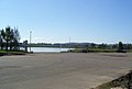 Raymond Terrace Boat ramp.jpg 1,024 × 689; 62 KB
-
 Raymond Terrace Fitzgerald Bridge 02.jpg 2,300 × 1,154; 237 KB
-
 Raymond Terrace twin rivers.jpg 2,300 × 1,250; 214 KB
-
 Waterfall on Williams River - panoramio.jpg 3,456 × 2,304; 3.69 MB
-
 Williams River - panoramio.jpg 2,496 × 1,047; 1.2 MB
-
 Williams River at Balickera Channel inlet.jpg 4,000 × 2,248; 2.48 MB
-
 Williams River Waterfall - panoramio.jpg 2,496 × 1,664; 1.92 MB
-
 WilliamsRiver.jpg 1,280 × 800; 620 KB


