Category:Wikivoyage maps of the Australian Capital Territory by SHB2000
Jump to navigation
Jump to search
States of Australia: New South Wales · Queensland · South Australia · Tasmania · Victoria ·
Internal territories of Australia: Australian Capital Territory ·
External territories of Australia: Cocos (Keeling) Islands · Heard Island and McDonald Islands ·
Internal territories of Australia: Australian Capital Territory ·
External territories of Australia: Cocos (Keeling) Islands · Heard Island and McDonald Islands ·
Media in category "Wikivoyage maps of the Australian Capital Territory by SHB2000"
The following 12 files are in this category, out of 12 total.
-
 Central Canberra static map.png 1,624 × 1,352; 717 KB
-
 Central Canberra static map.svg 750 × 625; 93 KB
-
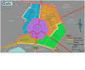
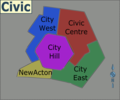
 Civic regions map.png 1,684 × 1,070; 943 KB
-
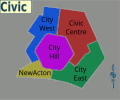
 Civic regions map.svg 750 × 625; 6.09 MB
-
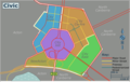
 Civic static map.png 1,148 × 956; 497 KB
-
 Civic static map.svg 750 × 625; 39 KB
-
 Gold Creek Village.png 1,899 × 1,582; 354 KB
-
 Gold Creek Village.svg 750 × 625; 4.3 MB
-
 Hall map.png 1,185 × 983; 361 KB
-
 Hall map.svg 750 × 625; 4.65 MB
-
 Parliamentary Triangle.png 1,899 × 1,553; 797 KB
-
 Parliamentary Triangle.svg 750 × 625; 4.19 MB


