Category:Wiesenttal zwischen Steinfeld und Treunitz
Jump to navigation
Jump to search
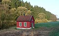
Deutsch: Das Wiesenttal zwischen Steinfeld und Treunitz ist mäandrierendes Bachsystem im Landkreis Bamberg, Oberfranken in Bayern. Es ist als Geotop (471R009) und geschützter Landschaftsbestandteil ausgewiesen.
valley in Stadelhofen, Germany  | |||||
| Upload media | |||||
| Instance of | |||||
|---|---|---|---|---|---|
| Location | Stadelhofen, Bamberg, Upper Franconia, Bavaria, Germany | ||||
| Width |
| ||||
| Length |
| ||||
| Area |
| ||||
| Elevation above sea level |
| ||||
| official website | |||||
 | |||||
Media in category "Wiesenttal zwischen Steinfeld und Treunitz"
The following 2 files are in this category, out of 2 total.
-
 Schuppen an der Wiesent.JPG 5,184 × 3,456; 7.9 MB
-
 Wiesenttal bei Steinfeld.jpg 2,610 × 1,584; 843 KB
