Category:Widmerpool
Jump to navigation
Jump to search
English: Widmerpool is a village and civil parish in Nottinghamshire , about 10 miles south of Nottingham. At the time of the 2001 census it had a population of 262 . Until the 1960s there had not been any building in the village for 100 years.
village in United Kingdom   | |||||
| Upload media | |||||
| Instance of | |||||
|---|---|---|---|---|---|
| Location | Rushcliffe, Nottinghamshire, East Midlands, England | ||||
 | |||||
Subcategories
This category has only the following subcategory.
Media in category "Widmerpool"
The following 179 files are in this category, out of 179 total.
-
 A46 approaching junction with A606 - geograph.org.uk - 4580821.jpg 2,256 × 1,496; 867 KB
-
 A46 from Leicester - geograph.org.uk - 5935455.jpg 640 × 430; 41 KB
-
 A46 heading north - geograph.org.uk - 4040293.jpg 640 × 480; 61 KB
-
 A46 heading south - geograph.org.uk - 3320422.jpg 2,256 × 1,504; 717 KB
-
 A46 Junction to Widmerpool and Kinoulton - geograph.org.uk - 120407.jpg 640 × 427; 115 KB
-

-
 A46 northbound in the evening - geograph.org.uk - 5935456.jpg 640 × 416; 40 KB
-
 A606 turning, A46 - geograph.org.uk - 2393455.jpg 640 × 386; 50 KB
-
 Autumn trees, Widmerpool - geograph.org.uk - 6311058.jpg 1,024 × 768; 392 KB
-
 Bench mark with bolt, New Inn Manor, Widmerpool - geograph.org.uk - 3825914.jpg 1,280 × 1,280; 311 KB
-
 Bench Mark, bridge at Widmerpool Station - geograph.org.uk - 3826813.jpg 1,280 × 960; 527 KB
-
 Bench mark, The Old School House, Widmerpool - geograph.org.uk - 3826828.jpg 1,280 × 1,018; 397 KB
-
 Blue plaque on Widmerpool Village sign - geograph.org.uk - 3828022.jpg 1,280 × 960; 254 KB
-
 Bridge Over A46(T) - geograph.org.uk - 102589.jpg 640 × 482; 43 KB
-
 Bus Shelter, Hickling Pastures - geograph.org.uk - 102598.jpg 640 × 482; 54 KB
-

-
 Church Lane, Widmerpool - geograph.org.uk - 6311071.jpg 1,024 × 768; 151 KB
-
 Church of St Peter and St Paul, Widmerpool - geograph.org.uk - 5900063.jpg 1,024 × 768; 186 KB
-
 Cottages on Field Lane - geograph.org.uk - 3828051.jpg 1,280 × 950; 257 KB
-
 Cottages on Old Melton Road - geograph.org.uk - 3828009.jpg 1,280 × 952; 307 KB
-
 Crop field off Thurlby Lane - geograph.org.uk - 4040274.jpg 640 × 480; 88 KB
-
 Crossroads, Wysall Lane, Widmerpool - geograph.org.uk - 4040251.jpg 640 × 480; 85 KB
-
 Crow Hill - geograph.org.uk - 3350008.jpg 640 × 421; 60 KB
-

-

-
 Enclosure of trees - geograph.org.uk - 3845996.jpg 640 × 427; 42 KB
-
 Entering Widmerpool - geograph.org.uk - 4040261.jpg 640 × 480; 73 KB
-
 Fairham Brook - geograph.org.uk - 1942925.jpg 640 × 480; 94 KB
-
 Fairham Brook, Widmerpool - geograph.org.uk - 3828030.jpg 1,280 × 960; 433 KB
-
 Farm track off Thurlby Lane - geograph.org.uk - 3828017.jpg 1,280 × 951; 375 KB
-
 Farmland and hedgerow - geograph.org.uk - 4040265.jpg 640 × 480; 82 KB
-
 Farmland near Widmerpool - geograph.org.uk - 4040244.jpg 640 × 480; 92 KB
-
 Field by Fairham Brook - geograph.org.uk - 3208149.jpg 640 × 466; 66 KB
-
 Field by Fields Farm - geograph.org.uk - 5925063.jpg 640 × 475; 56 KB
-
 Field edge and Roehoe Brook - geograph.org.uk - 6311079.jpg 1,024 × 768; 294 KB
-
 Field Lane, Widmerpool - geograph.org.uk - 3828054.jpg 1,280 × 960; 319 KB
-
 Field Lane, Widmerpool - geograph.org.uk - 3828056.jpg 1,280 × 960; 457 KB
-
 Field Lane, Widmerpool - geograph.org.uk - 5893795.jpg 1,024 × 768; 190 KB
-
 Field north of Widmerpool Hall - geograph.org.uk - 5900075.jpg 1,024 × 768; 157 KB
-
 Flint Hill - geograph.org.uk - 3350009.jpg 640 × 471; 67 KB
-
 Flint Hill - geograph.org.uk - 3350014.jpg 640 × 454; 82 KB
-
 Footbridge south of Stanton Lodge Farm - geograph.org.uk - 5892127.jpg 1,024 × 768; 415 KB
-
 Footpath on Crow Hill north of Widmerpool - geograph.org.uk - 5893793.jpg 1,024 × 768; 185 KB
-
 Footpath to a pylon north of Widmerpool - geograph.org.uk - 5893790.jpg 1,024 × 768; 176 KB
-
 Former railway station, Widmerpool - geograph.org.uk - 2770253.jpg 640 × 480; 65 KB
-
 Gardener's Cottage, Widmerpool - geograph.org.uk - 3826820.jpg 1,280 × 960; 348 KB
-

-
 Gated track to Guys Wood House - geograph.org.uk - 4040248.jpg 640 × 480; 107 KB
-
 Gates to Manor Farm, Widmerpool - geograph.org.uk - 6311065.jpg 1,024 × 768; 297 KB
-
 Grazing. Widmerpool - geograph.org.uk - 4040260.jpg 640 × 443; 47 KB
-
 Harrowed field near Widmerpool Station - geograph.org.uk - 6311074.jpg 1,024 × 768; 200 KB
-
 Hilltop with pine trees, Widmerpool - geograph.org.uk - 6311051.jpg 1,024 × 768; 206 KB
-
 Home Farm, Widmerpool - geograph.org.uk - 3828028.jpg 1,280 × 960; 336 KB
-
 Keyworth Road-Station Road junction - geograph.org.uk - 3350010.jpg 640 × 435; 84 KB
-
 Keyworth Rugby Football Club - geograph.org.uk - 3828048.jpg 1,280 × 960; 217 KB
-

-
 Letter box NG17 76 - geograph.org.uk - 3350033.jpg 640 × 412; 73 KB
-

-
 Main Street, Widmerpool - geograph.org.uk - 5893804.jpg 1,024 × 768; 196 KB
-
 Making a new gateway in the wall - geograph.org.uk - 3775374.jpg 640 × 427; 87 KB
-
 Manor Farmhouse, Widmerpool - geograph.org.uk - 3828027.jpg 1,280 × 960; 243 KB
-

-

-
 Mounting block at New Inn Manor, Widmerpool - geograph.org.uk - 3825919.jpg 1,280 × 960; 322 KB
-
 Near Widmerpool Hall - geograph.org.uk - 3828041.jpg 1,280 × 815; 259 KB
-
 New house on Wysall Lane, Widmerpool - geograph.org.uk - 3828043.jpg 1,280 × 960; 168 KB
-
 New Inn Manor House, Widmerpool - geograph.org.uk - 3828008.jpg 1,280 × 960; 271 KB
-
 North-bound slip road at Widmerpool roundabout - geograph.org.uk - 3825916.jpg 1,280 × 952; 278 KB
-
 Oilseed rape crop, Hill Farm - geograph.org.uk - 4040275.jpg 640 × 480; 50 KB
-
 Old Dalby railway test track - geograph.org.uk - 3323786.jpg 2,256 × 1,504; 1.52 MB
-
 Old Dalby test track (1) - geograph.org.uk - 1942959.jpg 640 × 480; 100 KB
-
 Old Dalby test track (2) - geograph.org.uk - 1942964.jpg 640 × 480; 97 KB
-
 Old Melton Road - geograph.org.uk - 3350036.jpg 640 × 451; 72 KB
-
 Old Melton Road at Widmerpool - geograph.org.uk - 3828011.jpg 1,280 × 960; 443 KB
-
 Old Melton Road-Melton Road junction - geograph.org.uk - 3350037.jpg 640 × 453; 40 KB
-
 Old waiting room, Widmerpool Station - geograph.org.uk - 3828015.jpg 1,280 × 960; 341 KB
-
 Pen Lane, towards Widmerpool - geograph.org.uk - 3322546.jpg 2,256 × 1,504; 880 KB
-
 Polite Notice - geograph.org.uk - 3350038.jpg 529 × 640; 72 KB
-
 Power lines crossing the road - geograph.org.uk - 2200394.jpg 1,024 × 768; 97 KB
-
 Power lines in Widmerpool Lane - geograph.org.uk - 3845857.jpg 640 × 427; 70 KB
-
 Railway bridge over A46 - geograph.org.uk - 4580823.jpg 2,256 × 1,496; 758 KB
-
 Railway heading north - geograph.org.uk - 4040286.jpg 640 × 480; 88 KB
-
 Red-barred gate - geograph.org.uk - 3870721.jpg 1,280 × 922; 472 KB
-
 Rimmers Wood - geograph.org.uk - 3828039.jpg 1,280 × 960; 357 KB
-
 Road Junction at Widmerpool - geograph.org.uk - 3320384.jpg 2,256 × 1,504; 1.03 MB
-
 Road Junction near Widmerpool - geograph.org.uk - 3320405.jpg 2,256 × 1,504; 1.1 MB
-

-

-
 Silverdale's golden bus - geograph.org.uk - 3845840.jpg 640 × 427; 96 KB
-
 Site of demolished Widmerpool Station building.jpg 4,640 × 2,140; 4.09 MB
-
 Smithy Farm, Widmerpool - geograph.org.uk - 3828058.jpg 1,280 × 942; 386 KB
-
 Stand of pines, Widmerpool - geograph.org.uk - 3828038.jpg 1,280 × 1,280; 383 KB
-
 Station Road - geograph.org.uk - 4040269.jpg 640 × 480; 71 KB
-
 Station Road - geograph.org.uk - 4040276.jpg 640 × 480; 67 KB
-
 Station Road bridge, Widmerpool - geograph.org.uk - 3826811.jpg 1,280 × 960; 346 KB
-

-

-
 Station Road towards Kinoulton - geograph.org.uk - 3350011.jpg 640 × 471; 58 KB
-
 Station Road towards Kinoulton - geograph.org.uk - 3350012.jpg 640 × 472; 68 KB
-
 Station Road towards Widmerpool - geograph.org.uk - 3350013.jpg 640 × 478; 59 KB
-
 Station Road, Widmerpool - geograph.org.uk - 1614769.jpg 640 × 479; 172 KB
-
 Station Road, Widmerpool - geograph.org.uk - 1614773.jpg 640 × 479; 105 KB
-
 Station Road, Widmerpool - geograph.org.uk - 3845991.jpg 640 × 427; 89 KB
-
 Station Road-Melton Road junction - geograph.org.uk - 3350019.jpg 640 × 425; 74 KB
-
 Stream crossing - geograph.org.uk - 1942921.jpg 640 × 480; 100 KB
-
 The A46 at Willoughby Fields - geograph.org.uk - 4907859.jpg 3,264 × 2,448; 2.02 MB
-
 The end of Station Road - geograph.org.uk - 1614770.jpg 640 × 479; 143 KB
-
 The field by Roehoe Brook - geograph.org.uk - 3845835.jpg 640 × 427; 68 KB
-
 The former New Inn Manor, Widmerpool - geograph.org.uk - 3825917.jpg 1,280 × 945; 268 KB
-
 The Old Melton Road - geograph.org.uk - 4040290.jpg 640 × 480; 81 KB
-
 The Old Rectory, Widmerpool - geograph.org.uk - 3826816.jpg 1,280 × 960; 249 KB
-
 The Old School House, Widmerpool - geograph.org.uk - 3826823.jpg 1,280 × 960; 243 KB
-
 The Pullman Inn - geograph.org.uk - 3323806.jpg 2,256 × 1,504; 1.07 MB
-
 The Pullman Inn - geograph.org.uk - 3350020.jpg 640 × 467; 77 KB
-
 The Pullman Inn - geograph.org.uk - 4040287.jpg 640 × 480; 48 KB
-
 The Pullman Inn - geograph.org.uk - 4521821.jpg 1,066 × 800; 210 KB
-
 The top of Church Lane, Widmerpool - geograph.org.uk - 3828025.jpg 1,280 × 955; 304 KB
-
 Thurlby Lane - geograph.org.uk - 3323774.jpg 2,256 × 1,504; 974 KB
-
 Thurlby Lane - geograph.org.uk - 3350016.jpg 640 × 485; 88 KB
-
 Thurlby Lane - geograph.org.uk - 4040271.jpg 640 × 480; 89 KB
-
 Thurlby Lane junction - geograph.org.uk - 3826830.jpg 1,280 × 960; 334 KB
-
 Thurlby Lane, Widmerpool - geograph.org.uk - 3826814.jpg 1,280 × 960; 291 KB
-
 Thurlby Lane-Station Road junction - geograph.org.uk - 3350017.jpg 640 × 405; 63 KB
-
 Towards Fairham Brook - geograph.org.uk - 3350018.jpg 640 × 425; 54 KB
-
 Track on south side of Wysall Road - geograph.org.uk - 6380408.jpg 640 × 489; 73 KB
-
 Track past Fields Farm - geograph.org.uk - 5925064.jpg 640 × 468; 68 KB
-
 Track tamping machine at Widmerpool - geograph.org.uk - 2863563.jpg 640 × 480; 106 KB
-
 Track to Manor Farm - geograph.org.uk - 3208150.jpg 640 × 493; 114 KB
-
 Track to Olde Willoughby Lodge - geograph.org.uk - 3320390.jpg 2,256 × 1,504; 1.28 MB
-
 Track towards A46 from Fields Farm - geograph.org.uk - 5925065.jpg 640 × 483; 69 KB
-
 Track towards Fields Farm - geograph.org.uk - 3320397.jpg 1,504 × 2,256; 964 KB
-
 Turn off to Keyworth and Stanton - geograph.org.uk - 3775355.jpg 640 × 427; 84 KB
-
 UK Widmerpool.jpg 859 × 1,597; 409 KB
-
 View towards Flint Hill - geograph.org.uk - 3826832.jpg 1,280 × 960; 288 KB
-
 Village House, Widmerpool - geograph.org.uk - 3826815.jpg 1,280 × 960; 216 KB
-
 Waring Waste disposal site on A46 - geograph.org.uk - 5935458.jpg 640 × 439; 34 KB
-
 Widmerpool from the air - geograph.org.uk - 2723129.jpg 480 × 640; 98 KB
-
 Widmerpool from the air - geograph.org.uk - 2723136.jpg 640 × 480; 92 KB
-
 Widmerpool Gardeners Cottage.JPG 3,872 × 2,592; 4.26 MB
-
 Widmerpool Grange - geograph.org.uk - 3828055.jpg 1,280 × 960; 470 KB
-
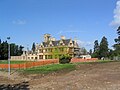 Widmerpool Hall - geograph.org.uk - 173922.jpg 640 × 480; 84 KB
-
 Widmerpool Lane - geograph.org.uk - 4040246.jpg 640 × 480; 90 KB
-

-
 Widmerpool station - geograph.org.uk - 1942954.jpg 640 × 480; 98 KB
-
 Widmerpool Village Sign - geograph.org.uk - 3828021.jpg 960 × 1,280; 574 KB
-
 Widmerpool Village Sign and Millennium seat - geograph.org.uk - 3828024.jpg 1,280 × 960; 421 KB
-
 Widmerpool Village Sign dedication plate - geograph.org.uk - 3828023.jpg 1,280 × 960; 317 KB
-
 Widmerpool, fingerpost and postbox - geograph.org.uk - 3828019.jpg 1,280 × 960; 278 KB
-
 Willoughby Road heading into Widmerpool - geograph.org.uk - 2200388.jpg 1,024 × 768; 206 KB
-
 Willoughby Road, Widmerpool - geograph.org.uk - 3828047.jpg 1,280 × 960; 381 KB
-
 Willoughby Road-Field Lane junction - geograph.org.uk - 3350007.jpg 640 × 451; 55 KB
-
 Willoughby-on-the-Wolds - geograph.org.uk - 4905392.jpg 3,264 × 2,448; 4.38 MB
-
 Willoughby-on-the-Wolds - geograph.org.uk - 4905439.jpg 3,264 × 2,448; 4.39 MB
-
 Wolds Lane, Keyworth - geograph.org.uk - 262125.jpg 640 × 427; 100 KB
-
 Woodland beside Melton Road - geograph.org.uk - 4040288.jpg 640 × 480; 79 KB
-
 Woodland by Old Melton Road - geograph.org.uk - 3350039.jpg 640 × 480; 95 KB
-
 Wysall Lane - geograph.org.uk - 4040255.jpg 640 × 480; 91 KB
-
 Wysall Lane - geograph.org.uk - 4040257.jpg 640 × 480; 77 KB
-
 Wysall Lane, Widmerpool - geograph.org.uk - 3826825.jpg 1,280 × 960; 396 KB
-
 Wysall Road - geograph.org.uk - 3870723.jpg 1,280 × 960; 350 KB
-
 Wysall Road towards Willoughby - geograph.org.uk - 3208151.jpg 640 × 472; 78 KB
-
 Wysall Road towards Wysall - geograph.org.uk - 3208152.jpg 640 × 473; 83 KB
-
 A46 Fosse Lodge Farm, Leicestershire - geograph.org.uk - 120222.jpg 640 × 480; 99 KB
-
 A46 Fosse Way - geograph.org.uk - 179243.jpg 640 × 480; 60 KB
-
 Farmland by Lings Lane - geograph.org.uk - 262116.jpg 640 × 480; 120 KB
-
 Field of wheat - geograph.org.uk - 191187.jpg 640 × 480; 76 KB
-
 Field Off Station Road - geograph.org.uk - 102583.jpg 640 × 482; 58 KB
-

-
 Junction, Station Road-Keyworth Road - geograph.org.uk - 102577.jpg 640 × 482; 56 KB
-
 Lings Lane, Keyworth - geograph.org.uk - 252920.jpg 640 × 480; 86 KB
-
 Lings Lane, Keyworth - geograph.org.uk - 262107.jpg 640 × 480; 109 KB
-
 Lings Lane, Keyworth - geograph.org.uk - 262113.jpg 640 × 427; 125 KB
-
 Lodge Farm - geograph.org.uk - 191188.jpg 640 × 476; 95 KB
-
 Off Lings Lane - geograph.org.uk - 262135.jpg 640 × 427; 96 KB
-
 Thurlby Lane - geograph.org.uk - 173925.jpg 640 × 480; 109 KB
-
 Track to Willoughby - geograph.org.uk - 191189.jpg 640 × 426; 65 KB
-
 Willoughby to Windmerpool road - geograph.org.uk - 173906.jpg 640 × 480; 62 KB
-
 Winter Aconite (Eranthis hyemalis) - geograph.org.uk - 699404.jpg 482 × 640; 71 KB
-
 Wysall Lane, Widmerpool - geograph.org.uk - 102574.jpg 640 × 482; 65 KB


_-_geograph.org.uk_-_102589.jpg)


,_approaching_roundabout_-_geograph.org.uk_-_4040291.jpg)


_-_geograph.org.uk_-_1942959.jpg)
_-_geograph.org.uk_-_1942964.jpg)


_-_geograph.org.uk_-_699404.jpg)
