Category:Wheaton Aston
Jump to navigation
Jump to search
English: Wheaton Aston is a village in Staffordshire, England about 9 miles south west of Stafford and 7 miles west of Cannock. It is located beside Bridge 19 of the Shropshire Union Canal.
Svenska: Wheaton Aston är en stad i Staffordshire i England, cirka 14 km sydväst om Stafford och 11 km väster om Cannock. Staden ligger vid kanalen Shropshire Union Canal. Stadens skola heter St. Mary's CE(C) First School och tar in cirka 100 barn per år.
village in Staffordshire, England  | |||||
| Upload media | |||||
| Instance of | |||||
|---|---|---|---|---|---|
| Location | Lapley, Stretton and Wheaton Aston, South Staffordshire, Staffordshire, West Midlands, England | ||||
 | |||||
Subcategories
This category has the following 3 subcategories, out of 3 total.
Media in category "Wheaton Aston"
The following 108 files are in this category, out of 108 total.
-
 21 resize.jpg 547 × 720; 122 KB
-
 Access to Bell Hurst Farm - geograph.org.uk - 847749.jpg 640 × 480; 97 KB
-
 Along the Roman Road - geograph.org.uk - 396101.jpg 600 × 450; 192 KB
-
 Another lane junction - geograph.org.uk - 832705.jpg 640 × 480; 65 KB
-
 Another narrow lane - geograph.org.uk - 847731.jpg 640 × 480; 136 KB
-
 Barn conversion at Woollaston Farm - geograph.org.uk - 396251.jpg 600 × 450; 245 KB
-
 Bellhurst Lane - geograph.org.uk - 382588.jpg 600 × 450; 186 KB
-
 Bridleway from Lapley - geograph.org.uk - 438829.jpg 600 × 450; 225 KB
-
 Bridleway near Woollaston Farm - geograph.org.uk - 390161.jpg 600 × 450; 334 KB
-
 Bridleway to Lapley - geograph.org.uk - 438919.jpg 450 × 600; 351 KB
-
 Bridleway to Longnor - geograph.org.uk - 384000.jpg 600 × 450; 185 KB
-
 Bridleway to Longnor Gorse Farm - geograph.org.uk - 396041.jpg 600 × 450; 253 KB
-
 Canal Milemarker north of Tavern Bridge, Wheaton Aston (geograph 6076456).jpg 1,135 × 1,730; 282 KB
-

-

-
 Church Farmhouse, Wheaton Aston.jpg 2,448 × 1,836; 1.6 MB
-
 Cyclists on the open road - geograph.org.uk - 390138.jpg 600 × 519; 240 KB
-

-
 Eaton Brook Farm - geograph.org.uk - 396312.jpg 600 × 450; 201 KB
-

-
 Farm track - geograph.org.uk - 384018.jpg 600 × 450; 180 KB
-
 Footpath and Farm - geograph.org.uk - 382138.jpg 640 × 480; 118 KB
-
 Footpath and Fog - geograph.org.uk - 381994.jpg 640 × 480; 77 KB
-
 From Ivetsey Bank to Bishops Wood - geograph.org.uk - 453954.jpg 640 × 480; 94 KB
-
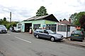 Garage and Shop, Wheaton Aston - geograph.org.uk - 2467245.jpg 640 × 428; 63 KB
-
 Grazing Land below Leasowes Farm - geograph.org.uk - 438907.jpg 597 × 345; 171 KB
-
 Grey House Farmhouse, Wheaton Aston.jpg 2,774 × 2,081; 1.61 MB
-

-
 Houses on Fentonhouse Lane, Wheaton Aston - geograph.org.uk - 2949564.jpg 1,142 × 857; 284 KB
-
 Ivory Cottage, Weaton Aston - geograph.org.uk - 2467230.jpg 640 × 428; 57 KB
-
 Lane junction near Wheaton Aston - geograph.org.uk - 2127737.jpg 640 × 480; 74 KB
-
 Lights track in shadow - geograph.org.uk - 438931.jpg 600 × 450; 268 KB
-

-
 Looking down from Wheaton Aston lock - geograph.org.uk - 187806.jpg 640 × 427; 87 KB
-
 Main Farmhouse, Wheaton Aston.jpg 800 × 600; 79 KB
-
 Main road to Wheaton Aston - geograph.org.uk - 382827.jpg 600 × 450; 167 KB
-
 Milepost at NGR SJ 866 118.jpg 800 × 785; 317 KB
-
 Misty Bridleway - geograph.org.uk - 382324.jpg 480 × 640; 112 KB
-
 Mixed crops - geograph.org.uk - 438926.jpg 600 × 455; 195 KB
-

-

-
 Newly planted field - geograph.org.uk - 440507.jpg 600 × 450; 225 KB
-
 Now look what you have done - geograph.org.uk - 440476.jpg 600 × 450; 255 KB
-
 Open Sided Barn - geograph.org.uk - 440489.jpg 600 × 450; 150 KB
-
 Opening up the silage clamp - geograph.org.uk - 396302.jpg 600 × 450; 231 KB
-
 Passage to India^ - geograph.org.uk - 382840.jpg 600 × 450; 220 KB
-
 Path and Sheep - geograph.org.uk - 382329.jpg 640 × 480; 95 KB
-
 Path to Lapley - geograph.org.uk - 622065.jpg 480 × 640; 63 KB
-
 Path to Wheaton - geograph.org.uk - 382326.jpg 640 × 480; 133 KB
-
-
 Quiet village street - geograph.org.uk - 385766.jpg 600 × 450; 171 KB
-
 Rusty Pits - geograph.org.uk - 396191.jpg 600 × 450; 245 KB
-
 Safely home - geograph.org.uk - 383234.jpg 600 × 450; 212 KB
-
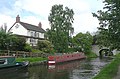
 Shropshire Union at Wheaton Aston - geograph.org.uk - 187803.jpg 640 × 427; 85 KB
-
 Shropshire Union Canal Aqueduct at SJ 850 140.jpg 800 × 511; 133 KB
-
 Shropshire Union Canal at Wheaton Aston - geograph.org.uk - 11096.jpg 413 × 628; 230 KB
-

-

-

-

-
 Shropshire Union Canal, nr Wheaton Aston - geograph.org.uk - 1565977.jpg 480 × 640; 164 KB
-

-
 St Mary's First School - geograph.org.uk - 454122.jpg 640 × 480; 169 KB
-
 Stretton Spoil Banks - geograph.org.uk - 438881.jpg 600 × 450; 356 KB
-
 The Coach and Horses - geograph.org.uk - 847744.jpg 640 × 480; 89 KB
-
 The Coach and Horses Pub, Wheaton Aston - geograph.org.uk - 1835723.jpg 2,048 × 1,536; 603 KB
-
 The Coach and Horses, Wheaton Aston - geograph.org.uk - 2467216.jpg 640 × 428; 81 KB
-
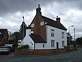
 The Hartley Arms Pub, Wheaton Aston - geograph.org.uk - 1835718.jpg 2,048 × 1,536; 622 KB
-
 The old schoolhouse - geograph.org.uk - 385749.jpg 600 × 450; 178 KB
-

-

-

-
 Turner's Garage at Wheaton Aston, Staffordshire - geograph.org.uk - 2804917.jpg 1,024 × 586; 332 KB
-
 Twin arch bridge over a brook - geograph.org.uk - 385839.jpg 600 × 450; 313 KB
-
 Tyres in the farmyard - geograph.org.uk - 396175.jpg 600 × 450; 319 KB
-
 Welcome to - you can read the rest^ - geograph.org.uk - 847738.jpg 640 × 480; 68 KB
-
 Welcome to Wheaton Aston - geograph.org.uk - 517735.jpg 640 × 428; 77 KB
-

-

-
 Wheaton Aston Lock, Staffordshire - geograph.org.uk - 1347375.jpg 640 × 462; 127 KB
-
 Wheaton Aston Lock, Staffordshire - geograph.org.uk - 1348552.jpg 640 × 435; 148 KB
-
 Wheaton Aston, Staffordshire morris dancers.jpg 600 × 450; 263 KB
-
 Whiston Brook - geograph.org.uk - 396012.jpg 600 × 450; 241 KB
-
 White Gate Farm - geograph.org.uk - 622080.jpg 480 × 640; 70 KB
-
 Whitehouse Farm - geograph.org.uk - 384007.jpg 600 × 450; 220 KB
-
 Working Narrow Boat Hadar moored at Wheaton Aston - geograph.org.uk - 3075556.jpg 4,608 × 3,456; 6.46 MB
-

-
 Away with the raggle taggle gypsies - geograph.org.uk - 440482.jpg 600 × 438; 280 KB
-
 Belvide Reservoir - geograph.org.uk - 622007.jpg 640 × 480; 66 KB
-
 Blue farmhouse - geograph.org.uk - 383478.jpg 600 × 450; 173 KB
-
 Brick cottage - geograph.org.uk - 383476.jpg 600 × 450; 187 KB
-
 Bridge over the Whiston Brook - geograph.org.uk - 390119.jpg 600 × 450; 195 KB
-
 Disused Barn at Woollaston Farm - geograph.org.uk - 396234.jpg 600 × 450; 225 KB
-
 Eaton Brook Farm - geograph.org.uk - 390203.jpg 600 × 450; 334 KB
-
 Full Barn - geograph.org.uk - 396084.jpg 600 × 450; 227 KB
-
 Zion Chapel - geograph.org.uk - 385774.jpg 600 × 450; 165 KB
-
 Ivy Villa - geograph.org.uk - 382594.jpg 600 × 450; 173 KB
-
 Longnor Gorse Farm - geograph.org.uk - 396029.jpg 600 × 450; 230 KB
-
 Mirror image - geograph.org.uk - 396150.jpg 600 × 450; 201 KB
-
 Old Barn in School Lane - geograph.org.uk - 385813.jpg 600 × 450; 208 KB
-
 Open sided barn - geograph.org.uk - 382584.jpg 600 × 450; 256 KB
-
 Sweet Turf - geograph.org.uk - 396056.jpg 600 × 450; 218 KB
-
 The village green - geograph.org.uk - 385718.jpg 600 × 450; 230 KB
-
 Tiny cottage - geograph.org.uk - 382849.jpg 600 × 450; 172 KB
-
 Tree near The Lights - geograph.org.uk - 622055.jpg 480 × 640; 99 KB
-
 Typical larger cottage - geograph.org.uk - 390221.jpg 600 × 450; 278 KB
-
 Westley House Livery - geograph.org.uk - 383211.jpg 600 × 450; 185 KB
-
 Woollaston Farm - geograph.org.uk - 396217.jpg 600 × 450; 179 KB


.jpg)


.jpg)
.jpg)


